| |
|---|---|
| Highway system | |

Several special routes of U.S. Route 31 exist. In order from south to north they are as follows.
| |
|---|---|
| Highway system | |
Several special routes of U.S. Route 31 exist. In order from south to north they are as follows.
| |
|---|---|
| Location | Pulaski–Nashville, Tennessee |
| Length | 76.94 mi (123.82 km) |
U.S. Route 31A (US 31A) is an alternate route of US 31 that exists between Pulaski and Nashville. It is located entirely in Middle Tennessee and except for the Lewisburg bypass, where it is concurrent with Tennessee State Route 106 (SR 106), it is entirely concurrent with unsigned SR 11.
| |
|---|---|
| Location | Lewisburg, Tennessee |
| Length | 2.7 mi (4.3 km) |
U.S. Route 31A Business (US 31A Business or US 31A Bus) is a Business route of U.S. Route 31A in Lewisburg, Tennessee, following US 31A’s original alignment through downtown. It is concurrent with unsigned State Route 11 (SR 11) for its entire length.
| |
|---|---|
| Location | Franklin, Tennessee |
U.S. Route 31 Truck (US 31 Truck) exists as truck route around the city of Franklin, Tennessee that is entirely concurrent with Tennessee State Route 397 (SR 397; Mack C Hatcher Parkway). At both of its termini, there are signs that show a US 31 Business through downtown Franklin, even though this is the mainline US 31 and this was actually done to draw traffic away from downtown Franklin.
| |
|---|---|
| Location | Hendersonville, Tennessee |
| Existed | 1981–present |
An unsigned portion consisting primarily of Tennessee State Route 386 is known as the U.S. Route 31E Bypass.
| |
|---|---|
| Location | Columbus–Seymour |
| Existed | 1939–1980s |
Former US 31A began at an interchange with US 31 where it traveled on Indianapolis Road and 11th Street. It followed State Road 46 on Brown Street (northbound) and Lindsay Street (southbound). South of Columbus, US 31A went through Jonesville, then passed through an interchange with Interstate 65, and terminated at US 50 in Seymour, Indiana. US 31A was deleted in Indiana in the 1980s, and State Road 11 was extended northward.
| |
|---|---|
| Location | Peru |
| Length | 5.2 mi [1] (8.4 km) |
| Existed | 1960s–present |
Business US 31 in Miami County is a business spur serving the city of Peru. It begins at US 31 south of Peru, and when it reaches downtown Peru, it turns east onto Bus. US 24 (Main Street), then it turns north onto Broadway. It ends at US 24 (Hoosier Heartland Highway).
Major intersections
The entire route is in Miami County.
| Location | mi [1] | km | Destinations | Notes | |
|---|---|---|---|---|---|
| Pipe Creek Township | 0.00 | 0.00 | Southern terminus; to be converted into interchange [2] | ||
| Wabash River | 2.0 | 3.2 | Kelly Avenue Bridge | ||
| Peru | 2.2 | 3.5 | Main Street west ( Bus. US 24 west) | Southern end of Bus. US 24 concurrency | |
| 3.7 | 6.0 | Northern end of Bus. US 24 concurrency | |||
| 5.2 | 8.4 | Hoosier Heartland Highway ( US 24 ) | Northern terminus; road continues as Mexico Road | ||
1.000 mi = 1.609 km; 1.000 km = 0.621 mi
| |||||
| |
|---|---|
| Location | Plymouth |
| Existed | 1963–1967 |
Alternate US 31 in Plymouth traveled along the Michigan Road, former US 31. It began at US 31 north of Plymouth, and terminated at US 31 south of Plymouth. It first appears on the 1964 Indiana State Highway Commission map (the previous edition shows a red line denoting a U.S. route but no marker) and last appears on the 1967–68 edition.
| |
|---|---|
| Location | South Bend |
| Length | 11.9 mi [3] (19.2 km) |
| Existed | 1980 [4] –present |
Business US 31 in South Bend follows the former US 31 north from the US 20/US 31/St. Joseph Valley Parkway interchange on the south side of the city, joining SR 933 south of downtown, then turns west along Cleveland Road just north of the Indiana Toll Road (Interstate 80/90) to return to US 31. The route had been planned to continue into Michigan along the former US 31 route which at the time carried US 33, but the Michigan Department of Transportation did not approve of the routing. [5] [6]
Major intersections
The entire route is in St. Joseph County.
| Location | mi [3] | km | Exit | Destinations | Notes |
|---|---|---|---|---|---|
| South Bend | 0.00 | 0.00 | Continuation beyond southern terminus | ||
| 0.2 | 0.32 | 246A | Exit numbers follow US 31; no northbound exit | ||
| 246B | Northbound entrance (via US 31) and southbound exit | ||||
| 3.0 | 4.8 | Southern end of SR 933 concurrency | |||
| Roseland | 6.2 | 10.0 | ITR exit 77 | ||
| 7.1 | 11.4 | SR 933 north | Northern end of SR 933 concurrency | ||
| South Bend | 11.9 | 19.2 | Interchange; northern terminus; road continues west as Brick Road | ||
1.000 mi = 1.609 km; 1.000 km = 0.621 mi
| |||||
There are five current, and three former, business routes for US 31 in Michigan. In addition, there was an alternate route in the state.
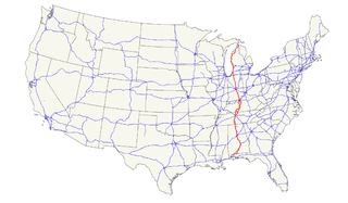
U.S. Route 31 or U.S. Highway 31 (US 31) is a major north–south U.S. highway connecting southern Alabama to northern Michigan. Its southern terminus is at an intersection with US 90/US 98 in Spanish Fort, Alabama. Its northern terminus is at an interchange with Interstate 75 (I-75) south of Mackinaw City, Michigan.

State Road 2 (SR 2) in the U.S. State of Indiana is an east–west route running from the Illinois border at Illinois Route 17 east to the outskirts of South Bend, Indiana, at the U.S. Route 20/U.S. Route 31 freeway, also known as the St. Joseph Valley Parkway. This is a distance of 80.98 miles (130.32 km).
U.S. Route 45E (US 45E) is a 61.23-mile-long (98.54 km) state highway in West Tennessee, connecting Jackson with South Fulton via Milan and Martin. For the majority of its length, it runs concurrently with unsigned State Route 43 (SR 43) for most of that highway’s length except for short segments at Martin and South Fulton, where it is cosigned with SR 216 and SR 215, respectively.
State Route 22 is a 172.8-mile long (278.1 km) south-to-north state highway in the western part of Tennessee, United States. It begins at the Mississippi state line in McNairy County, where the roadway continues as Mississippi Highway 2. It ends at the Kentucky state line in Lake County, when it crosses into the Kentucky Bend, a detached portion of Fulton County, Kentucky. The monument for the 1862 Battle of Island Number Ten in the American Civil War is located on SR 22, about 3 mi (4.8 km) north of Tiptonville.

State Road 933 (SR 933) is an Indiana State Road that runs between Elkhart and South Bend in US state of Indiana. The 16.83 miles (27.09 km) of SR 933 that lie within the state serve as a major conduit. None of the highway is listed on the National Highway System. Various sections are urban two-lane highway and urbanized four-lane divided highway. The highway passes through residential and commercial properties.
Several special routes of U.S. Route 1 exist, from Florida to Maine. In order from south to north, separated by type, these special routes are as follows.
U.S. Route 33 (US 33) is part of the United States Numbered Highway System that runs from Richmond, Virginia to Elkhart of the US state of Indiana. In Indiana, it is a state road that enters the state at the Ohio state line between Willshire, Ohio, and Pleasant Mills, Indiana. The 106.217 miles (170.940 km) of US 33 that lie within Indiana serve as a major conduit. All of the highway is listed on the National Highway System. Various sections are rural two-lane highway, urbanized four-lane divided expressway and the Lincoln Highway. The northernmost community along the highway is Elkhart. The highway ends at an interchange in southern Elkhart after serving the northeastern region of Indiana. US 33 passes through farm fields and urban areas.
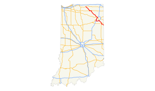
U.S. Route 31 (US 31) is a part of the United States Numbered Highway System that runs from Spanish Fort, Alabama, to Mackinaw City, Michigan. It enters the U.S. state of Indiana via the George Rogers Clark Memorial Bridge between Louisville, Kentucky, and Clarksville, Indiana. The 266.02 miles (428.12 km) of US 31 that lie within Indiana serve as a major conduit. Some of the highway is listed on the National Highway System. Various sections are rural two-lane highway and urbanized four- or six-lane divided expressway. The northernmost community along the highway is South Bend near the Michigan state line.
In Tennessee, U.S. Route 412 stretches for 181.93 miles (292.79 km) through the farmland of West Tennessee and the hills of Middle Tennessee, starting at the Missouri state line near Dyersburg and running to an interchange between I-65 and SR 99 in Columbia.
U.S. Route 431 in Tennessee totals an estimated 116 miles (187 km) through Lincoln, Marshall, Maury, Williamson, Davidson, and Robertson Counties in Middle Tennessee.
U.S. Route 31A is a 76.94-mile-long (123.82 km) alternate route of U.S. Route 31 that exists between Nashville and Pulaski, Tennessee. It is located entirely in Middle Tennessee and except for the Lewisburg bypass, where it is concurrent with SR 106, it is entirely concurrent with unsigned State Route 11.
A total of at least seven special routes of U.S. Route 301 exist and at least eleven have been deleted.
Several special routes of U.S. Route 41 exist. In order from south to north they are as follows.
Several special routes of U.S. Route 29 exist. In order from south to north they are as follows.
There are five business routes of Interstate 8.
Several special routes of U.S. Route 15 exist. In order from south to north they are as follows.
Several special routes of U.S. Route 25 exist. In order from south to north they are as follows.
Eighteen special routes of U.S. Route 58 currently exist in Virginia. In order from west to east they are as follows:
State Route 50 (SR 50) is a west–to–east highway in Middle Tennessee. The road begins near Only and ends in Altamont. The current length is 161.3 miles (259.6 km).
U.S. Route 231 in Tennessee runs north–south for 121.15 miles (194.97 km), entirely in Middle Tennessee, that starts south of Fayetteville at the Alabama state line, and ends north of Westmoreland at the Kentucky state line. For the majority of its length, between the Alabama state line and Trousdale County, it is concurrent with unsigned State Route 10.