Special routes of U.S. Route 54

Last updated

US 54.svg


Special routes of U.S. Route 54
Highway system

Several special routes of U.S. Route 54 exist, from Texas to Missouri. In order from southwest to northeast, separated by type, they are as follows.

Contents

Texas

El Paso business loop

Business plate.svg

US 54.svg

Business U.S. Highway 54

Location El Paso, Texas
Length12.5 mi [1]  (20.1 km)
Existed1990–present

New Mexico

Tucumcari business loop

Business plate.svg

US 54.svg

Business Loop US 54

Location Tucumcari, New Mexico
Length2.410 mi (3.879 km)

Kansas

El Dorado Truck Route

Truck plate.svg

US 54.svg

U.S. Highway 54 Truck

Location El Dorado, Kansas
Length0.327 mi [2]  (526 m)

U.S. Route 54 Truck (US 54 Truck.) is a truck route of US 54. The route starts at a junction with U.S. 54 heading west 1 block before heading north to rejoin with U.S. 54. The entire route is concurrent with U.S. 77 Truck. The route is commonly used as a bypass for downtown.

Missouri

Lake Ozark business loop

Business plate.svg

US 54.svg

U.S. Route 54 Business

Location Lake Ozark, Missouri
Length5.474 mi [3]  (8.810 km)
Existed1969–2021

MO-354.svg

Route 354

Location Lake Ozark, Missouri
Length5.474 mi (8.810 km)
Existed1968–1969

U.S. Route 54 Business (US 54 Bus.) was a business route of US 54. It followed due west via Missouri Route 242 and then due south via Osage Beach Parkway. Then, it traveled due west via Bagnell Dam Boulevard to get to downtown Lake Ozark. It then continued to travel north to reconnect to US 54. [4]

Before 1968, US 54 used to connect directly to Lake Ozark. [5] In 1968, a bypass was finished which caused US 54 to get rerouted. As a result, Missouri Route 354 briefly appeared on a former alignment of US 54. [6] In 1969, US 54 Business appeared, replacing Route 354 in the process. [7] The designation was removed in 2021. [8]

Major intersections

The entire route is in Lake Ozark.

Countymi [3] kmDestinationsNotes
Miller 0.0000.000US 54.svg US 54  Camdenton, Jefferson City
Begin plate.svg
MO-242.svg
Route 242 begins
Interchange; western end of Route 242 overlap
0.3240.521West plate.svg
MO-242.svg
Route 242 west Lake Ozark
Eastern end of Route 242 overlap
0.9171.476Old Highway 54Former US 54
Camden 2.9624.767To plate.svg
US 54.svg
To plate.svg
MO-supp-MM.svg
Horseshoe Bend Parkway to US 54  / Route MM
To plate.svg
MO-5.svg
To Route 5  Sunrise Beach (via toll bridge)
Miller 4.187–
4.635
6.738–
7.459
Bagnell Dam over Lake of the Ozarks
5.1908.352MO-supp-W.svg Route WRoundabout
5.3948.681US 54.svg US 54  Osage Beach, Eldon Roundabout interchange
1.000 mi = 1.609 km; 1.000 km = 0.621 mi

Eldon business loop

Business plate.svg

US 54.svg

U.S. Route 54 Business

Location Eldon, Missouri
Length5.838 mi [3]  (9.395 km)
Existed1975 [9] –present

U.S. Route 54 Business (US 54 Bus.) is a business route of US 54. It travels due northwest via Route 52 to connect to Eldon. It then travels due northeast to reconnect to US 54. [10]

Before 1975, US 54 used to run towards Eldon. [11] In 1975, US 54 bypassed Eldon which resulted in the creation of US 54 Business. [9]

Major intersections

The entire route is in Eldon, Miller County.

mi [3] kmDestinationsNotes
0.0000.000East plate.svg
US 54.svg
MO-52.svg US 54 east / Route 52  Lake of the Ozarks, Jefferson City
Interchange; western end of Route 52 overlap
3.0674.936West plate.svg
MO-52.svg
Route 52 west (4th Street)
Eastern end of Route 52 overlap
3.5995.792South plate.svg
MO-87.svg
Route 87 south (E. North Street)
Southern end of Route 87 overlap
4.2076.771North plate.svg
MO-87.svg
Route 87 north (Manor Drive)
Northern end of Route 87 overlap
5.8389.395US 54.svg US 54  Jefferson City Northbound exit and southbound entrance only
1.000 mi = 1.609 km; 1.000 km = 0.621 mi

Jefferson City alternate route

Alternate plate 1961.svg

US 54 (1961).svg

U.S. Route 54 Alternate

Location Jefferson City, Missouri
Length1 mi (1.6 km)
Existed1957–1964

Fulton business loop

Business plate.svg

US 54.svg

U.S. Route 54 Business

Location Fulton, Missouri
Length5.870 mi [3]  (9.447 km)
Existed1972 [12] –present

U.S. Route 54 Business (US 54 Bus.) is a business route of US 54. It travels due northeast to connect to downtown Fulton. It then travels due north via Market Street, St. Louis Avenue, and Bluff Street before reconnecting to US 54. [13]

Prior to 1972, US 54 used to run straight to Fulton. [14] Since 1972, US 54 bypassed Fulton. This resulted in the creation of US 54 Business. [12]

Mexico business loop

Business plate.svg

US 54.svg

U.S. Route 54 Business

Location Mexico, Missouri
Length6.223 mi [3]  (10.015 km)
Existed1990–present

In the 1990s, US 54 was rerouted to bypass Mexico.

Major intersections

The entire route is in Mexico, Audrain County.

mi [3] kmDestinationsNotes
0.0000.000US 54.svg US 54  Bowling Green, Jefferson City
Begin plate.svg
MO-15.svg
Begin plate.svg
MO-22.svg
Route 15 begins / Route 22 begins
Interchange; southern end of Route 15 and Route 22 overlap
3.3245.349North plate.svg
MO-15.svg
West plate.svg
MO-22.svg
Route 15 north / Route 22 west (Boulevard Street) / S. Clark Street Mexico
Northern end of Route 15 and 22 overlap
6.22310.015West plate.svg
US 54.svg
US 54 west Jefferson City
Road continues as US 54
1.000 mi = 1.609 km; 1.000 km = 0.621 mi

Bowling Green business loop

Business plate.svg

US 54.svg

U.S. Route 54 Business

Location Bowling Green, Missouri
Length2.967 mi [3]  (4.775 km)
Existed1985–present

A three-mile (4.8 km) business loop exists in Bowling Green, Missouri. It intersects with Business 61. It is also known as Old U.S. Route 54.

Louisiana business loop

Business plate.svg

US 54.svg

U.S. Route 54 Business

Location Louisiana, Missouri
Length3.375 mi [3]  (5.432 km)
Existed2003–present

A three-mile business loop exists in Louisiana, Missouri.

Kankakee business loop

Business plate.svg

US 54 (1961).svg

U.S. Route 54 Business

Location Kankakee, Illinois
Length6 mi (9.7 km)
Existed1959 [15] –1969 [16]

U.S. Route 54 Business (formerly U.S. Route 54 City) was a business route of US 54. Before 1959, US 54 ran through downtown Kankakee. [17] In 1959, US 54 was rerouted onto a bypass (now part of Interstate 57) which, as a result, created US 54 City. It followed north through Kankakee via US 45/52 and present-day IL 50. It was then changed into US 54 Business in 1960. [18] Originally, the freeway abruptly stopped at North Street which caused US 54 to travel west to its city route. [15] It remained like that until 1962 when a freeway connection between US 54 Business and North Avenue was made. [19] In 1969, US 54 supplanted its business route as the bypass was extended on both ends. [16] Three years later, in 1972, US 54 was significantly truncated, removing a section of US 54 between Griggsville and Chicago. [20]

Related Research Articles

<span class="mw-page-title-main">U.S. Route 54</span> Highway in the United States

U.S. Route 54 is an east–west United States Highway that runs northeast–southwest for 1,197 miles (1,926 km) from El Paso, Texas, to Griggsville, Illinois. The Union Pacific Railroad's Tucumcari Line runs parallel to US 54 from El Paso to Pratt, Kansas, which comprises about two-thirds of the route.

<span class="mw-page-title-main">U.S. Route 150</span> Highway in the Midwestern United States

U.S. Route 150 is a 571-mile (919 km) long northwest–southeast United States highway, signed as east–west. It runs from U.S. Route 6 outside of Moline, Illinois to U.S. Route 25 in Mount Vernon, Kentucky.

<span class="mw-page-title-main">Illinois Route 116</span> Highway in Illinois

Illinois Route 116 is a 176.07-mile-long (283.36 km) cross-state rural state highway that runs from U.S. Route 34 by Gladstone east to the intersection of US 45 and Old US 45, on the north side of Ashkum.

<span class="mw-page-title-main">Illinois Route 126</span>

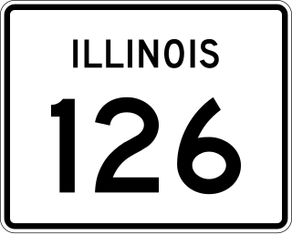
Illinois Route 126 (IL 126) is a 17.25-mile-long (27.76 km) east–west state highway in the northern part of the U.S. state of Illinois. It travels from IL 47 in Yorkville to Interstate 55 (I-55) between Plainfield and Bolingbrook.

<span class="mw-page-title-main">Illinois Route 76</span> Highway in Illinois

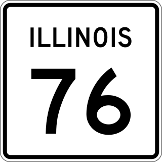
Illinois Route 76 is a north–south state highway in far north-central Illinois. It runs from the US 20 Bus. in Belvidere north to the Wisconsin State Line at State Trunk Highway 140. This is a distance of 15.77 miles (25.38 km).

<span class="mw-page-title-main">U.S. Route 150 in Illinois</span>

U.S. Route 150 in Illinois is a 267.47-mile-long (430.45 km) east–west highway that runs from US 6 near the Quad City International Airport in Moline to the Indiana state line near Vermilion. It closely parallels Interstate 74 (I-74) between Moline and Danville.

<span class="mw-page-title-main">U.S. Route 54 in Illinois</span>

U.S. Route 54 (US 54) in Illinois is a 23.9-mile-long (38.5 km) east–west highway that travels from the Champ Clark Bridge on the Missouri state line to I-72/US 36/IL 107 south of Griggsville. At its greatest extent, US 54 used to continue east to Springfield, then northeast to Onarga, and then north all the way to Downtown Chicago.

<span class="mw-page-title-main">U.S. Route 45 in Illinois</span>

U.S. Route 45 in the state of Illinois is a major north–south U.S. Highway that runs from the Brookport Bridge over the Ohio River at Brookport north through rural sections of eastern Illinois and then through the suburbs of Chicago to the Wisconsin state line east of Antioch. This is a distance of 428.99 miles (690.39 km). US 45 is the longest numbered route in Illinois.

<span class="mw-page-title-main">Special routes of U.S. Route 61</span> Highway system

Several special routes of U.S. Route 61 exist in the states of Louisiana, Mississippi, Missouri, and Iowa.

<span class="mw-page-title-main">Special routes of U.S. Route 40</span>

Several special routes of U.S. Route 40 exist. In order from west to east they are as follows.

<span class="mw-page-title-main">Special routes of U.S. Route 67</span>

Numerous special routes of U.S. Route 67, all business routes, exist. One other route, formerly an alternate route in western Illinois, has since been downgraded to state Route 267.

<span class="mw-page-title-main">Special routes of U.S. Route 30</span> Highway system

Several special routes of U.S. Route 30 exist. In order from west to east they are as follows.

<span class="mw-page-title-main">Special routes of U.S. Route 20</span>

Several special routes of U.S. Route 20 exist. In order from west to east they are as follows.

<span class="mw-page-title-main">Special routes of U.S. Route 14</span>

At least 14 special routes of U.S. Route 14 (US 14) have existed.

<span class="mw-page-title-main">U.S. Route 54 in Missouri</span> Section of U.S. Highway in Missouri

U.S. Route 54 in Missouri is a west-east highway that starts from the Kansas state line in Nevada to the Illinois state line in Louisiana.

<span class="mw-page-title-main">Special routes of U.S. Route 50</span>

Several special routes of U.S. Route 50 exist. In order from west to east they are as follows.

<span class="mw-page-title-main">Special routes of U.S. Route 12</span>

Several special routes of U.S. Route 12 (US 12) exist, from Washington to Michigan. In order from west to east, separated by state, they are as follows.

<span class="mw-page-title-main">Special routes of U.S. Route 24</span>

Several special routes of U.S. Route 24 (US 24) currently exist, while some are now decommissioned. These special routes include alternate, business and bypass routes that branch from U.S. Route 24.

<span class="mw-page-title-main">Illinois Route 65</span>

Illinois Route 65 was an east–west state highway in the Chicago metropolitan area. It traveled from U.S. Route 30 Business in Aurora to US 34 north of Naperville.

<span class="mw-page-title-main">U.S. Route 51 Business (Bloomington–Normal, Illinois)</span>

U.S. Route 51 Business is a business route of US 51 in Bloomington–Normal. It provides service to downtown Bloomington and downtown Normal.

References

  1. Google (December 28, 2022). "Overview map of US 54 Business (El Paso, TX)" (Map). Google Maps . Google. Retrieved December 28, 2022.
  2. Google (April 9, 2023). "Overview map of US 54 Truck (El Dorado, KS)" (Map). Google Maps . Google. Retrieved April 9, 2023.
  3. 1 2 3 4 5 6 7 8 9 Missouri Department of Transportation (June 18, 2021). MoDOT HPMAPS (Map). Missouri Department of Transportation. Retrieved June 18, 2021.
  4. Google (August 17, 2020). "Overview of US 54 BUS in Lake Ozark, MO" (Map). Google Maps . Google. Retrieved August 17, 2020.
  5. 1967 Missouri Highway Map (Map). Retrieved August 16, 2020.
  6. 1968 Missouri Highway Map (Map). Retrieved August 16, 2020.
  7. 1969 Missouri Highway Map (Map). Retrieved August 16, 2020.
  8. Special Committee on U.S. Route Numbering (November 2021). "2021 Annual Meeting Report to the Council on Highways and Streets" (PDF) (Report). Washington, DC: American Association of State Highway and Transportation Officials. Archived (PDF) from the original on May 13, 2022. Retrieved February 17, 2022.
  9. 1 2 1975 Missouri Highway Map (Map). Retrieved August 17, 2020.
  10. Google (August 17, 2020). "Overview of US 54 BUS in Eldon, MO" (Map). Google Maps . Google. Retrieved August 17, 2020.
  11. 1974 Missouri Highway Map (Map). Retrieved August 17, 2020.
  12. 1 2 1972 Missouri Highway Map (Map). Retrieved August 17, 2020.
  13. Google (August 17, 2020). "Overview of US 54 BUS in Fulton, MO" (Map). Google Maps . Google. Retrieved August 17, 2020.
  14. 1971 Missouri Highway Map (Map). Retrieved August 17, 2020.
  15. 1 2 Illinois Division of Highways; H.M. Gousha (1959). Illinois Official Highway Map (Map). [1:790,00]. Springfield: Illinois Division of Highways. Retrieved July 30, 2020 via Illinois Digital Archives.
  16. 1 2 Illinois Division of Highways; Rand McNally (1969). Illinois Official Highway Map (Map). [1:772,500]. Springfield: Illinois Division of Highways. Retrieved July 30, 2020 via Illinois Digital Archives.
  17. Illinois Division of Highways; H.M. Gousha (1958). Illinois Official Highway Map (Map). [1:805,000]. Springfield: Illinois Division of Highways. Retrieved July 30, 2020 via Illinois Digital Archives.
  18. Illinois Division of Highways; H.M. Gousha (1960). Illinois Official Highway Map (Map). [1:790,00]. Springfield: Illinois Division of Highways. Retrieved July 30, 2020 via Illinois Digital Archives.
  19. Illinois Division of Highways; H.M. Gousha (1962). Illinois Official Highway Map (Map). [1:790,00]. Springfield: Illinois Division of Highways. Retrieved July 30, 2020 via Illinois Digital Archives.
  20. Illinois Department of Transportation (1972). Illinois Official Highway Map (Map). [1:772,500]. Springfield: Illinois Department of Transportation. Retrieved July 30, 2020 via Illinois Digital Archives.