Special routes of U.S. Route 76

Last updated

US 76.svg

U.S. Route 76

Location
Country United States
Highway system

Several special routes of U.S. Route 76 exist. In order from west to east they are as follows.

Contents

Seneca business loop

Business plate.svg

US 76.svg

U.S. Highway 76 Business

Location Seneca, South Carolina
Existed1958–2000

U.S. Route 76 Business was established in 1958 as a renumbering of mainline US 76 through downtown Seneca, via North 1st Street. It was decommissioned in 2000, renumbered as part of SC 59 and SC 130. [1]

Laurens business loop

Business plate.svg

US 76.svg

U.S. Highway 76 Business

Location Laurens, South Carolina
Length3.910 mi [2]  (6.293 km)
Existed1979–present

U.S. Route 76 Business (US 76 Bus.) is a 3.910 mi (6.293 km) business route that is in Laurens. It was established in 1979 on the former route of mainline US 76 through downtown Laurens on Main Street after the highway was relocated to a bypass. [3] The entire route is two-lane. [4]

Newberry business loop

Business plate.svg

US 76.svg

U.S. Highway 76 Business

Location Newberry, South Carolina
Existed1952–2001

U.S. Route 76 Business was established in 1959 as a renumbering of mainline US 76 through downtown Newberry, via College Street, Main Street, Glenn Street, and Adelaide Street. It was decommissioned in 2001, all becoming secondary roads, with exception to northern part of College Street being part of SC 121. [5]

Columbia connector route

Connector plate.svg

US 76.svg

U.S. Highway 76 Connector

Location Columbia, South Carolina
Length4.440 mi [6] [7] [8]  (7.145 km)

U.S. Route 76 Connector (US 76 Conn.) is a 4.440 mi-long (7.145 km) connector route of US 76 that is an unsigned highway. It exists in three different segments and is located in the west-central part of Richland County and entirely within the city limits of Columbia in the U.S. state of South Carolina. It connects US 21/US 76/US 321 with US 76/US 378. The western segment is concurrent with SC 48 Truck and US 21 Conn. for its entire length. The central segment is known as Cross Hill Road for its entire length.

The western segment of US 76 Conn. is a 2.9 mi-long (4.7 km) highway that begins at an intersection with US 21/US 176/US 321 (Blossom Street/Huger Street). It travels to the east-northeast on Blossom Street. It crosses over some railroad tracks of CSX. It passes Greek Village, the fraternities and sororities of the University of South Carolina (USC). Right after passing the Carolina Coliseum, it intersects South Carolina Highway 48 (SC 48; Assembly Street). The highway passes the Carolina Community Garden at the Honors Residence Hall. Then, it passes the Thomas Cooper Library and then the Booker T. Washington Auditorium. It curves to the northeast and travels along the northwestern edge of Maxcy Gregg Park. This is southeast of the USC tennis courts at Blossom Street. The connector curves to the east and travels under a railroad bridge that carries railroad tracks of Norfolk Southern Railway. It curves to the southeast. At the intersection with Saluda Avenue, the highway turns left and travels to the northeast. One block later, at Devine Street, it turns right and travels to the east-northeast. At an intersection with Harden Street, it curves to the east-southeast and travels through a retail area before meeting its eastern terminus, an intersection with US 76/US 378 (Millwood Avenue/Devine Street). [9] [10]

The central segment of US 76 Conn. is a 0.4 mi-long (640 m) highway that begins at an intersection with SC 16 (Beltline Boulevard) southwest of Brennen Elementary School. It travels to the south-southeast and curves to the south-southwest. It curves back to the south-southeast and meets its eastern terminus, an intersection with US 76/US 378 (Devine Street) and the western terminus of SC 760 (Fort Jackson Boulevard). [11] [10]

The eastern segment of US 76 Conn. is a 1.1 mi-long (1.8 km) highway that begins at an intersection with SC 16 (Rosewood Drive/Beltline Boulevard) southwest of the eastern terminus of the central segment of the connector route. It travels east-southeast on Rosewood Drive and passes the Beltline Campus of Midlands Technical College. It curves to the east-northeast and crosses over Gills Creek. It curves to the northeast and intersects US 76/US 378 (Devine Street/Garners Ferry Road). Here, the connector becomes known as Wildcat Road. The highway curves to the east-northeast and meets its eastern terminus, an intersection with SC 760 (Fort Jackson Boulevard). [12] [10]

The entire route is in Columbia, Richland County.

mi [6] [7] [8] kmDestinationsNotes
0.0000.000US 21.svgUS 176.svgUS 321.svg US 21  / US 176  / US 321 (Blossom Street / Huger Street)Western end of US 21 Conn./SC 48 Truck concurrency; western terminus
0.5800.933South Carolina 48.svg SC 48 (Assembly Street)Eastern end of SC 48 Truck concurrency; eastern terminus of SC 48 Truck
2.9304.715US 76.svgUS 378.svg US 76 / US 378 (Millwood Avenue / Devine Street)Eastern end of US 21 Conn. concurrency; eastern terminus of western segment
Gap in route
0.0000.000South Carolina 16.svg SC 16 (Beltline Boulevard)Western terminus of central segment
0.4700.756US 76.svgUS 378.svgEast plate South Carolina.svg
South Carolina 760.svg
US 76 / US 378 (Devine Street) / SC 760 east (Fort Jackson Boulevard)
Eastern terminus of central segment
Gap in route
0.0000.000South Carolina 16.svg SC 16 (Rosewood Drive / Beltline Boulevard)Western terminus of eastern segment
0.5900.950US 76.svgUS 378.svg US 76 / US 378 (Devine Street / Garners Ferry Road) Sumter
1.0401.674South Carolina 760.svg SC 760 (Fort Jackson Boulevard) Ft. Jackson Eastern terminus of eastern segment
1.000 mi = 1.609 km; 1.000 km = 0.621 mi

Sumter business loop

Business plate.svg

US 76.svg

U.S. Highway 76 Business

Location Sumter, South Carolina
Length5.910 mi [13]  (9.511 km)
Existed1958–present

U.S. Route 76 Business (US 76 Bus.) is a 5.910 mi (9.511 km) business route that is entirely within the city limits of Sumter. It was established in 1958 as a renumbering of mainline US 76 through downtown Sumter, [14] via Liberty Street, Washington Street, and Broad Street. US 76 now uses Pike road instead of going through downtown Sumter.[ citation needed ] [15] The business route was originally co-signed with US 378 Business until that designation was deleted in 1973. [16]

Florence connector route

Connector plate.svg

US 76.svg

U.S. Highway 76 Connector

Location Florence, South Carolina
Length0.140 mi [17]  (225 m)

U.S. Route 76 Connector (US 76 Conn.) is a connector route that is essentially an eastward extension of Interstate 20 Business (I-20 Bus.) in the western part of Florence. It serves to connect I-20 Bus. with US 76. [18] It is an unsigned highway. [19]

Chadbourn–Whiteville business loop

Business plate.svg

US 76.svg

U.S. Highway 76 Business

Location ChadbournWhiteville, North Carolina
Length10.4 mi [20]  (16.7 km)
ExistedFebruary 1, 1976–present

U.S. Route 76 Business (US 76 Business) is a business route of US 76 running through Chadbourn and Whiteville. The highway runs for 10.4 mi (16.7 km) from US 76 north of Chadbourn to US 74 and US 76 northeast of Whiteville. [20] US 76 Business is completely concurrent with US 74 Business. It also shares concurrencies with both NC 130 and NC 410 along portions of its route. US 76 Business was established by North Carolina on February 1, 1976, when US 76 was rerouted along a new bypass north of both Chadbourn and Whiteville. [21] Its designation was then approved by the American Association of State Highway Officials in 1977. [22] Accordingly, the highway follows the original alignment of US 76 through Chadbourn and Whiteville. A roundabout intersection with US 701 Business surrounds the Columbus County Courthouse which is listed on the National Register of Historic Places. [20]

US 76 Business begins at an intersection with US 76, US 74 Business, NC 130, and NC 410 north of Chadbourn. From its terminus, US 76 Business travels south along Brown Street for 0.3 mi (480 m). At Strawberry Avenue, US 76 Business, US 74 Business, and NC 130 turn to follow the road to the southeast. NC 410 continues south along Brown Street toward downtown Chadbourn and Tabor City. US 76 Business between Brown Street and Elm Street is a four-lane undivided road. After intersecting Elm Street, the road narrows to a two-lane facility while following Strawberry Avenue in northern Chadbourn. Between Chadbourn and Whiteville, the highway is mostly rural. US 76 Business provides access to Southeastern Community College, located east of Chadbourn. The highway also intersects Union Valley Road and Midway Road, providing access to US 74 and US 76. US 76 Business enters Whiteville from the west, utilizing Washington Street. After Barbcrest Avenue, the road briefly widens to a four-lane undivided road, before narrowing to a three-lane road with two eastbound lanes and one westbound lane. The highway intersects US 701 (JK Powell Boulevard) west of downtown Whiteville. The intersection marks the eastern end of the NC 130 concurrency, as the highway follows US 701 to the south. In downtown Whiteville, US 76 Business intersects US 701 Business at a roundabout surrounding the Columbus County Courthouse. US 76 Business continues east along Jefferson Street, exiting the town limits. Shortly before its eastern terminus, the highway widens to a four-lane road and intersects NC 214. The highway continues for 0.1 mi (530 ft; 160 m) until reaching its eastern terminus at a US 74 and US 76. [20]

Major intersections

The entire route is in Columbus County.

Locationmi [20] kmDestinationsNotes
Chadbourn 0.00.0US 76.svgBusiness plate.svg
US 74.svg
NC 130.svgNC 410.svg US 76 / US 74 Bus.  / NC 130  / NC 410
Western terminus; western end of US 74 Bus. and NC 130 overlap; north end of NC 410 overlap
0.30.48South plate.svg
NC 410.svg
NC 410 south
South end of NC 410 overlap
Whiteville 7.311.7US 701.svgEast plate.svg
NC 130.svg
US 701  / NC 130 east
Eastern end of NC 130 overlap
7.612.2Business plate.svg
US 701.svg
US 701 Bus.
Roundabout
10.316.6East plate.svg
NC 214.svg
NC 214 east
Western terminus of NC 214
10.416.7US 74.svgUS 76.svg US 74  / US 76Eastern terminus; eastern end of US 74 Bus. overlap
1.000 mi = 1.609 km; 1.000 km = 0.621 mi

Chadbourn temporary route

Temporary plate.svg

US 76.svg

U.S. Highway 76 Temporary

Location Chadbourn
Length0.4 mi [23]  (640 m)
ExistedSeptember 1, 1975 [24] –February 1, 1976 [21]

U.S. Route 76 Temporary (US 76 Temporary) was a 0.4 mi-long (640 m) temporary route along Union Valley Road between US 74 and US 76 and US 74, US 76, and NC 130 (Chadbourn Highway). The western terminus of US 76 Temporary was at the US 74 and US 76 freeway which bypassed Chadbourn. The highway ran in a southwest–northeast direction along Union Valley Road. Its eastern terminus was located at US 74, US 76, and NC 130. This was the former alignment of US 74 and US 76 which connected Chadbourn and Whiteville. US 76 Temporary ran concurrently with US 74 Temporary along its entire route. [23] [ better source needed ]

US 76 Temporary was established on September 1, 1975, to link the newly constructed US 74 and US 76 freeway bypassing Chadbourn and the US 74 and US 76 alignment through Whiteville. [24] It lasted for six months while construction of a new freeway around Whiteville was being completed. Upon the completion of the freeway on February 1, 1976, US 76 Temporary was decommissioned. The former alignment of US 74 and US 76 through Chadbourn and Whiteville became US 74 Business and US 76 Business. [21]

Major intersections

The entire route was in Columbus County.

Locationmi [23] kmDestinationsNotes
Chadbourn 0.00.0West plate.svg
US 74.svg
West plate.svg
US 76.svg
US 74 west / US 76 west
Western terminus
0.40.64East plate.svg
US 74.svg
East plate.svg
US 76.svg
NC 130.svg US 74 east / US 76 east / NC 130
Eastern terminus
1.000 mi = 1.609 km; 1.000 km = 0.621 mi

Related Research Articles

<span class="mw-page-title-main">U.S. Route 76</span>

U.S. Route 76 is an east–west U.S. highway that travels for approximately 548 miles (882 km) from Chattanooga, Tennessee, to Wrightsville Beach, North Carolina.

<span class="mw-page-title-main">South Carolina Highway 9</span> Highway in South Carolina, USA

South Carolina Highway 9 (SC 9) is a 259.570-mile (418 km) major state highway in the U.S. state of South Carolina. The highway travels from Cherry Grove Beach to the North Carolina state line upstate. The highway is currently the longest state highway in South Carolina. It is signed as a north–south highway, even though it travels in an east–west direction.

<span class="mw-page-title-main">South Carolina Highway 6</span> State highway in South Carolina

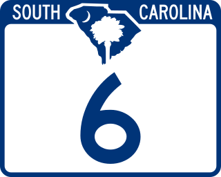
South Carolina Highway 6 (SC 6) is a 116.092-mile (186.832 km) state highway in the U.S. state of South Carolina. It extends from US 76 in Ballentine to US 52/SC 6 Truck in Moncks Corner. It uniquely links all three of the major hydropower projects in South Carolina: Lake Murray, Lake Marion, and Lake Moultrie.

<span class="mw-page-title-main">South Carolina Highway 34</span> Highway in South Carolina, US

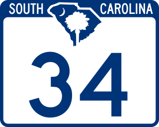
South Carolina Highway 34 (SC 34) is a 185.930-mile (299.225 km) primary state highway in the U.S. state of South Carolina. As one of the longer state highways, it traverses the state east-west from Greenwood to Dillon, connecting the cities of Newberry, Winnsboro, Camden, Bishopville and Darlington.

<span class="mw-page-title-main">South Carolina Highway 544</span>

South Carolina Highway 544 (SC 544) is a 13.710-mile (22.064 km) major four-lane state highway in Horry County, South Carolina. It connects the Surfside Beach and Conway areas. The highway is sometimes known as Dick Pond Road in the Socastee area.

<span class="mw-page-title-main">South Carolina Highway 90</span>

South Carolina Highway 90 (SC 90) is a 23.110-mile (37.192 km) state highway in Horry County, within the northeastern part of the U.S. state of South Carolina. It travels from Red Hill to Little River. It provides a direct connection from Conway to the northern Grand Strand in Little River.

<span class="mw-page-title-main">North Carolina Highway 130</span> State highway in North Carolina, US

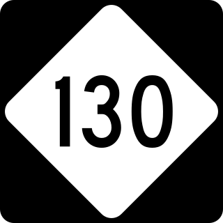
North Carolina Highway 130 (NC 130) is a primary state highway in the U.S. state of North Carolina. The highway serves the towns and rural communities in southern Robeson County, acts as a direct route between Whiteville and Shallotte through the Green Swamp, and provides access to Holden Beach.

<span class="mw-page-title-main">Special routes of U.S. Route 1</span> American highway system

Several special routes of U.S. Route 1 exist, from Florida to Maine. In order from south to north, separated by type, these special routes are as follows.

<span class="mw-page-title-main">Special routes of U.S. Route 17</span>

A total of at least twenty-three special routes of U.S. Route 17 have existed; two in Florida, five in South Carolina, fifteen in North Carolina, and six in Virginia.

<span class="mw-page-title-main">U.S. Route 76 in North Carolina</span> Section of highway in North Carolina

U.S. Highway 76 (US 76) is a U.S. Highway running from Chattanooga, Tennessee to Wrightsville Beach, North Carolina. In North Carolina the highway runs for 80.4 miles (129.4 km) in the southeastern region of the state. US 76 enters the state from South Carolina south of Fair Bluff in Columbus County. Travelling in an eastward direction, US 76 meets US 74 in Chadbourn. The two highways run concurrently for 50.4 miles (81.1 km) between Chadbourn and Wilmington. US 76 runs concurrently with US 17 along much of its Wilmington routing, until once again meeting US 74. US 76 and US 74 run concurrently for 1.4 miles (2.3 km) until reaching Wrightsville Beach. US 76 reaches its eastern terminus on the south side of Wrightsville Beach, at an intersection with Water Street.

<span class="mw-page-title-main">South Carolina Highway 125</span> State highway in South Carolina

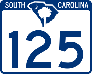
South Carolina Highway 125 (SC 125) is a 56.212-mile (90.464 km) primary state highway in the U.S. state of South Carolina. The highway serves as a direct route between Allendale and Augusta, Georgia, through the Savannah River Site (SRS); and an alternate to U.S. Route 278 (US 278).

<span class="mw-page-title-main">South Carolina Highway 385</span>

South Carolina Highway 385 (SC 385) is a 11.730-mile (18.878 km) primary state highway in the U.S. state of South Carolina. It connects the city of Bennettsville with northern Marlboro County.

<span class="mw-page-title-main">Special routes of U.S. Route 25</span> Routes in Georgia

Several special routes of U.S. Route 25 exist. In order from south to north they are as follows.

<span class="mw-page-title-main">Special routes of U.S. Route 21</span> Special routes or bypasses in the US

Several special routes of U.S. Route 21 exist. In order from south to north they are as follows.

<span class="mw-page-title-main">South Carolina Highway 19</span> State highway in South Carolina

South Carolina Highway 19 (SC 19) is a 28.750-mile (46.269 km) primary state highway in the U.S. state of South Carolina. It connects Aiken directly with the Savannah River Site and Edgefield via U.S. Route 25 (US 25).

<span class="mw-page-title-main">South Carolina Highway 23</span>

South Carolina Highway 23 (SC 23) is a 47.060-mile (75.736 km) primary state highway in the U.S. state of South Carolina. It serves to connect Edgefield and Batesburg-Leesville with Columbia via U.S. Route 1 (US 1).

<span class="mw-page-title-main">Special routes of U.S. Route 701</span>

Several special routes of U.S. Route 701 exist, from South Carolina to North Carolina. In order from south to north, separated by type, they are as follows.

<span class="mw-page-title-main">South Carolina Highway 105</span>

South Carolina Highway 105 (SC 105) is a 33.220-mile-long (53.462 km) state highway in the U.S. state of South Carolina. The highway connects rural areas of Union and Cherokee counties.

<span class="mw-page-title-main">South Carolina Highway 252</span> State highway in South Carolina

South Carolina Highway 252 (SC 252) is a 35.711-mile-long (57.471 km) state highway in the U.S. state of South Carolina. The highway connects the Anderson and Laurens areas with Honea Path and Ware Shoals. It has a unique feature in that it intersects U.S. Route 76 (US 76) three times along its length.

<span class="mw-page-title-main">South Carolina Highway 760</span>

South Carolina Highway 760 (SC 760) is a 1.182-mile-long (1.902 km) state highway in the U.S. state of South Carolina. The highway travels through eastern Columbia, and connects the main part of the city with Fort Jackson. It is known as Fort Jackson Boulevard for its entire length.

References

  1. "Mapmikey's South Carolina Highways Page" . Retrieved February 12, 2013.[ self-published source? ]
  2. "Highway Logmile Report". South Carolina Department of Transportation. Retrieved December 8, 2020.
  3. Google (February 12, 2013). "Overview map of US 76 Bus. (Laurens)" (Map). Google Maps. Google. Retrieved February 12, 2013.
  4. Special Committee on U.S. Route Numbering (May 19, 2001). "Report of the Special Committee on U.S. Route Numbering to the Standing Committee on Highways" (PDF) (Report). Washington, DC: American Association of State Highway and Transportation Officials. Archived from the original (PDF) on October 16, 2017. Retrieved July 13, 2013.
  5. 1 2 "Highway Logmile Report". South Carolina Department of Transportation. Retrieved December 8, 2020.
  6. 1 2 "Highway Logmile Report". South Carolina Department of Transportation. Retrieved December 8, 2020.
  7. 1 2 "Highway Logmile Report". South Carolina Department of Transportation. Retrieved December 8, 2020.
  8. Google (January 25, 2017). "Overview Map of Western Segment of US 76 Conn" (Map). Google Maps. Google. Retrieved January 25, 2017.
  9. 1 2 3 South Carolina Department of Transportation. Columbia City (PDF) (Map). South Carolina Department of Transportation. Retrieved January 25, 2017.[ full citation needed ]
  10. Google (January 25, 2017). "Overview Map of Central Segment of US 76 Conn" (Map). Google Maps. Google. Retrieved January 25, 2017.
  11. Google (January 25, 2017). "Overview Map of Eastern Segment of US 76 Conn" (Map). Google Maps. Google. Retrieved January 25, 2017.
  12. "Highway Logmile Report". South Carolina Department of Transportation. Retrieved December 8, 2020.
  13. Google (February 12, 2013). "Overview map of US 76 Bus. (Sumter)" (Map). Google Maps. Google. Retrieved February 12, 2013.
  14. U.S. Route Numbering Subcommittee (November 10, 1973). "U.S. Route Numbering Subcommittee Agenda Showing Action Taken by the Executive Committee" (PDF) (Report). Washington, DC: American Association of State Highway and Transportation Officials. p. 438. Retrieved September 30, 2022 via Wikimedia Commons.
  15. "Highway Logmile Report". South Carolina Department of Transportation. Retrieved December 8, 2020.
  16. Google (December 8, 2020). "Overview map of US 76 Conn. (Florence)" (Map). Google Maps. Google. Retrieved December 8, 2020.
  17. Florence Urban Area (PDF) (Map). South Carolina Department of Transportation. July 2020. p. Sheet 4. § D6. Retrieved December 8, 2020.
  18. 1 2 3 4 5 Google (December 7, 2020). "Special routes of U.S. Route 76" (Map). Google Maps. Google. Retrieved December 7, 2020.
  19. 1 2 3 "US and NC Route Changes" (PDF). North Carolina Department of Transportation. February 1, 1976. Retrieved December 10, 2020.
  20. Special Committee on U.S. Route Numbering (July 6, 1977). "Route Numbering Committee Agenda" (PDF) (Report). Washington, DC: American Association of State Highway and Transportation Officials. p. 482. Retrieved September 30, 2022 via Wikimedia Commons.
  21. 1 2 3 Google (December 10, 2020). "Special routes of U.S. Route 76" (Map). Google Maps. Google. Retrieved December 10, 2020.
  22. 1 2 "US and NC Route Changes" (PDF). North Carolina Department of Transportation. September 1, 1975. Retrieved December 10, 2020.