Special routes of U.S. Route 84

Last updated

US 84.svg

U.S. Route 84

Location
Country United States
Highway system

At least 13 special routes of U.S. Route 84 have existed.

Contents

Texas

Slaton business loop

Business plate.svg

US 84.svg

Business U.S. Highway 84-E

Location Slaton, Texas
Length3.933 mi [1]  (6.330 km)
Existed1990 [1] –present

Business U.S. Route 84-E (Bus. US 84-E) is a business route of US 84 that travels through Slaton. The highway is concurrent with FM 400 for most of its length.

The highway was previously designated as Loop 251 from 1965 to 1991. [2]

Junction list

The entire route is in Slaton, Lubbock County.

mi [3] kmDestinationsNotes
0.00.0West plate.svg
US 84.svg
US 84 west
Interchange; westbound exit and eastbound entrance
0.81.3North plate.svg
Texas FM 400.svg
Airport Sign.svg FM 400 north Plainview, Slaton Municipal Airport
West end of FM 400 overlap
2.54.0West plate.svg
Texas FM 41.svg
FM 41 west (West Division Street)
3.35.3To plate.svg
Texas FM 2150.svg
To FM 2150  / Borden Street
3.55.6US 84.svgSouth plate.svg
Texas FM 400.svg
US 84  / FM 400 south
Interchange; east end of FM 400 overlap
1.000 mi = 1.609 km; 1.000 km = 0.621 mi

Snyder business loop

Business plate.svg

US 84.svg

Business U.S. Highway 84-G

Location Snyder, Texas
Length7.751 mi [4]  (12.474 km)
Existed1990 [4] –present

Business U.S. Route 84-G (Bus. US 84-G) is a business route of US 84 that travels through the town of Snyder.

Bus. US 84-G begins at an interchange with US 84 / FM 1611 northwest of the town. The highway travels in a southeastern direction through rural farming areas before entering the Snyder city limits near an intersection with Huffman Avenue. In Snyder, Bus. US 84-G travels along Lubbock Highway through an industrial area of the town then begins an overlap with SH 208 near 13th Street. The two highways travel in a southern direction along College Avenue then turn east at US 180 / SH 350 at the town square, beginning an overlap with the former. Bus. US 84-G travels east along 25th Street with US 180 / SH 208, with the roadway turning southeast near Avenue H onto Coliseum Drive. The business route leaves the overlap with US 180 and SH 208 in southeastern Snyder and leaves the city limits before ending at an interchange with US 84.

The highway was previously designated as Loop 401 from 1964 to 1990. [5]

Major intersections

The entire route is in Terry County.

Locationmi [6] kmDestinationsNotes
0.00.0US 84.svgTexas FM 1611.svg US 84  / FM 1611 Interchange; western terminus
Snyder 5.28.4North plate.svg
Texas 208.svg
SH 208 north (College Avenue) / 13th Street Clairemont, Post
West end of SH 208 overlap
6.09.7West plate.svg
US 180.svg
West plate.svg
Texas 350.svg
US 180 west (25th Street) / SH 350 west (College Avenue)
West end of US 180 overlap
8.413.5West plate.svg
Texas FM 1605.svg
Hospital sign.svg FM 1605 west
Access to Cogdell Memorial Hospital
8.714.0East plate.svg
US 180.svg
US 180 east Lubbock, Roby, Post
East end of US 180 overlap
8.814.2South plate.svg
Texas 208.svg
SH 208 south Colorado City
East end of SH 208 overlap
10.516.9US 84.svg US 84 Interchange; eastern terminus
1.000 mi = 1.609 km; 1.000 km = 0.621 mi

Hermleigh business loop

Business plate.svg

US 84.svg

Business U.S. Highway 84-H

Location Hermleigh, Texas
Length3.035 mi [7]  (4.884 km)
Existed1990 [7] –present

Roscoe business loop

Business plate.svg

US 84.svg

Business U.S. Highway 84-J

Location Roscoe, Texas
Length2.24 mi [8]  (3.60 km)
Existed1990–present [8]

Business U.S. Highway 84-J (Bus. US 84-J) is a business route of US 84 in Roscoe, Texas that is 2.4 miles (3.9 km) long. [8] It starts at US 84 outside of Roscoe and starts heading towards the center of town. Near the center of town, it starts running concurrently with Farm to Market Road 608, and in the center of town, they intersect Business IH 20-L. The route then stops running concurrently with FM 608 and ends at US 84.

Major intersections

The entire route is in Nolan County.

Locationmi [8] [9] kmDestinationsNotes
0.00.0US 84.svg US 84 Western terminus
Roscoe 0.91.4North plate.svg
Texas FM 608.svg
FM 608 north
Western end of concurrency with FM 608
1.01.6West plate green.svg
Business Spur 20.svg
I-20 BS west (Broadway Street) Colorado City
Eastern terminus of I-20 Bus.
1.11.8South plate.svg
Texas FM 608.svg
FM 608 south (Main Street)
Eastern end of concurrency with FM 608
2.43.9US 84.svg US 84  Abilene Eastern terminus
1.000 mi = 1.609 km; 1.000 km = 0.621 mi

Teague business loop

Business plate.svg

US 84.svg

Business U.S. Highway 84-R

Location Teague, Texas
Length2.097 mi [10]  (3.375 km)
Existed1990 [10] –present

Mississippi

Natchez business loop

Business plate.svg

US 84.svg

U.S. Highway 84 Business

Location Natchez, Mississippi

Alabama

Enterprise business loop

Business plate.svg

US 84.svg

U.S. Route 84 Business

Location Enterprise, Alabama

Enterprise truck route

Truck plate.svg

US 84.svg

U.S. Route 84 Truck

Location Enterprise, Alabama

Dothan business loop

Business plate.svg

US 84.svg

U.S. Route 84 Business

Location Dothan, Alabama

Georgia

Bainbridge business loop

US 84 Business.svg

U.S. Highway 84 Business

Location Bainbridge, Georgia
Length2.8 mi [11]  (4.5 km)

U.S. Route 84 Business (US 84 Bus.) in Bainbridge follows the former routing of US 84/SR 38 through downtown, traveling west to east from both ends of the mainline route around the city. It is entirely concurrent with SR 38 Bus. The business route is known as Shotwell Street for its entire length.

US 84 Bus. and SR 38 Bus. begin at an interchange with US 27/US 84/SR 1/SR 38 in the central part of the city. At this interchange, the road continues as South Old Quincy Road, which is former SR 97 Conn. There is also Boat Basin Circle, which is the main entrance to Earle May Recreation Area. They travel to the east and cross over some railroad tracks of CSX. They intersect South Bruton Street, which leads to Cheney Griffin Park. At West Street, SR 97/SR 309 join the concurrency. One block later, at Broad Street, SR 97/SR 309 depart the concurrency, and US 27 Bus./SR 1 Bus. join. On the southeastern corner of the intersection with Monroe Street lies the Gilbert H. Gragg Library. At Scott Street, US 27 Bus./SR 1 Bus. leave the concurrency. Between North Thornatiska Drive and South Wheat Avenue, they pass Jones Wheat Elementary School. Between South Wheat Avenue and Gordon Avenue, they pass Memorial Hospital and Manor. Just to the east of Gordon Avenue, the highways curve to the east-southeast before meeting their eastern terminus, an intersection with US 84/SR 38 (Thomasville Road).

The entire route is in Bainbridge, Decatur County.

mi [11] kmDestinationsNotes
0.0–
0.3
0.0–
0.48
US 27.svgUS 84.svg US 27  / US 84 (SR 1 / SR 38) / South Old Quincy Road south / Boat Basin Circle west Colquitt, Donalsonville, Cairo, Havana, Tallahassee Western end of SR 38 Bus. concurrency; western terminus of US 84 Bus. and SR 38 Bus.; northern terminus of South Old Quincy Road; eastern terminus of Boat Basin Circle; interchange; South Old Quincy Road is former SR 97 Conn. south.
0.81.3South plate.svg
Georgia 97.svg
South plate.svg
Georgia 309.svg
SR 97 south / SR 309 south (West Street) Chattahoochee, Havana, Fla.
Western end of SR 97/SR 309 concurrency
0.81.3North plate.svg
US 27 Business.svg
North plate.svg
Georgia 97.svg
North plate.svg
Georgia 309.svg
US 27 Bus. north / SR 97 north / SR 309 north (SR 1 Bus. north / Broad Street)
Eastern end of SR 97/SR 309 concurrency; western end of US 27 Bus./SR 1 Bus. concurrency
1.32.1South plate.svg
US 27 Business.svg
US 27 Bus. south (SR 1 Bus. south / Scott Street) Attapulgus, Tallahassee
Eastern end of US 27 Bus./SR 1 Bus. concurrency
2.8–
2.8
4.5–
4.5
US 84.svgGeorgia 38 Business.svg US 84 (SR 38 / Thomasville Road) / SR 38 Bus.  Donalsonville, Cairo, Climax, Dothan, Ala., Quincy, Seminole State Park Eastern end of SR 38 Bus. concurrency; eastern terminus of US 84 Bus. and SR 38 Bus.
1.000 mi = 1.609 km; 1.000 km = 0.621 mi

Thomasville business loop

US 84 Business.svg

U.S. Highway 84 Business

Location Thomasville, Georgia
Length4.9 mi [12]  (7.9 km)
Northern terminus of US 84 Bus. north of Thomasville US84Bus NB end, Thomas County.jpg
Northern terminus of US 84 Bus. north of Thomasville
Eastern terminus of US 84 Bus. east of Thomasville US84Bus EB end, Thomas County.jpg
Eastern terminus of US 84 Bus. east of Thomasville

U.S. Route 84 Business (US 84 Bus. is a 4.9-mile-long (7.9 km) business route of US 84 that mostly exists within the city limits of Thomasville. It follows the former routing of US 84/SR 38 through the city. It is entirely concurrent with SR 38 Bus. and travels near the Lapham–Patterson House State Historic Site. Both ends of the highway are just outside of the city limits of Thomasville.

US 84 Bus. and SR 38 Bus. begin at an intersection with US 84/US 319/SR 35/SR 38 just north-northwest of the city limits. Here, the roadway continues as SR 3 Alternate (SR 3 Alt.). They travel to the south-southeast, with the local name of Old Albany Road, through rural areas, and enter the city. Just before intersecting the eastern terminus of Plantation Oak Drive, they begin a very gradual curve to a nearly due-south direction. The highway becomes increasingly more residential. Just before intersecting the western terminus of Meadow Street, they curve back to the south-southeast. They curve to the southeast and take on the North Boulevard name. North Boulevard splits off to the east, while US 84 Bus./SR 38 Bus. curve to the southeast, onto Madison Street. Between Crystal Street and Walcott Street, they travel on a bridge over some railroad tracks of CSX and Merrill Street. They then enter the main part of the city. An intersection with Calhoun Street leads to the Jack Hadley Black History Museum. On the western side of the intersection with Washington Street lies the Thomas County Judicial Center. They intersect Jackson Street, which is the former path of US 319 Bus./SR 35 Bus. The two highways turn left onto Smith Avenue and take it to the northeast. At the intersection with Broad Street, which is the former path of US 19 Bus., they curve to the east. Just east of Cherokee Street, they cross over some railroad tracks of CSX. At the northern terminus of Susie Way, they pass a complex that contains courts, magistrate, jail, police department, and sheriff's office. Between Susie Way and the southern terminus of Covington Avenue, they pass to the south of Cherokee Lake. Covington Avenue leads to the Thomasville Rose Garden.

The entire route is in Thomas County.

Locationmi [12] kmDestinationsNotes
0.00.0US 84.svgUS 319.svgGeorgia 35.svgGeorgia 38.svgGeorgia 3 Alternate.svgNorth plate.svg
Dixie Highway marker.svg
US 84  / US 319  / SR 35  / SR 38 (North Thomasville Bypass) / SR 3 Alt.  / Dixie Highway north to US 19  Cairo, Meigs, Cairo, Quitman
Western end of SR 38 Bus. and Dixie Highway Scenic Byway concurrency; western terminus of US 84 Bus. and SR 38 Bus.
Thomasville 2.64.2South plate.svg
Dixie Highway marker.svg
Dixie Highway south (Jackson Street)
Former US 319 Bus./SR 35 Bus.; eastern end of Dixie Highway Scenic Byway concurrency
2.84.5Broad StreetFormer US 19 Bus.
4.8–
4.9
7.7–
7.9
US 19.svgGeorgia 3.svgGeorgia 300.svgUS 84.svgGeorgia 38.svg US 19  / SR 3  / SR 300 (Georgia–Florida Parkway) / US 84  / SR 38 (Wiregrass Georgia Parkway) Monticello, Meigs, Cairo, Quitman, Boston Eastern end of SR 38 Bus. concurrency; eastern terminus of US 84 Bus. and SR 38 Bus.; interchange
1.000 mi = 1.609 km; 1.000 km = 0.621 mi

See also

Related Research Articles

<span class="mw-page-title-main">U.S. Route 43</span>

U.S. Route 43 (US 43) is a 410-mile-long (660 km) north–south United States Highway in the Southern states of Alabama and Tennessee. It travels from Prichard, Alabama, to Columbia, Tennessee. The highway's southern terminus is in Prichard, at an intersection with US 90, and its northern terminus is in Columbia at an intersection with US 31/US 412/US 412 Bus.

<span class="mw-page-title-main">U.S. Route 319</span> Highway in the United States

U.S. Route 319 is a spur of US 19. It runs for 303 miles (488 km) from US 98 at the foot of the John Gorrie Memorial Bridge across from downtown Apalachicola, Florida to US 1/SR 4 in Wadley, Georgia, through the Panhandle of Florida and the southern portion of Georgia.

<span class="mw-page-title-main">Georgia State Route 300</span> Highway in Georgia, United States

State Route 300, is a 107-mile-long (172 km) state highway in the southern part of the U.S. state of Georgia. Its southern terminus is at the Florida state line south-southeast of Thomasville, where the roadway continues as US 19/SR 57. This is also the southern terminus of SR 3, with which US 19 and SR 300 travel concurrently through the southern part of the state. Its northern terminus is at Interstate 75 (I-75) in Cordele.

<span class="mw-page-title-main">Georgia State Route 112</span> State highway in Georgia

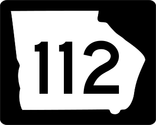
State Route 112 (SR 112) is a 189.84-mile-long (305.52 km) state highway that travels in a generally southwest-to-northeast orientation in the southwestern and central parts of the U.S. state of Georgia. It passes through portions of Grady, Mitchell, Worth, Turner, Wilcox, Pulaski, Bleckley, Twiggs, Wilkinson, and Baldwin counties, and connects the Cairo and Milledgeville areas of the state.

<span class="mw-page-title-main">Georgia State Route 7</span> State highway in Georgia

State Route 7 (SR 7) is a 216.0-mile-long (347.6 km) state highway that travels in a southeast-to-northwest orientation through portions of Lowndes, Cook, Tift, Turner, Crisp, Dooly, Houston, Peach, Crawford, Monroe, Lamar, Pike, and Spalding counties in the southern and central parts of the U.S. state of Georgia. The highway connects the Florida state line southeast of Lake Park to the Griffin area, via Valdosta, Tifton, Cordele, Perry, and Barnesville. The highway is concurrent with either US 41 or US 341 for its entire length, and closely parallels I-75 for much of its length.

<span class="mw-page-title-main">Georgia State Route 57</span> State highway in Georgia, United States

State Route 57 (SR 57) is a 178.5-mile-long (287.3 km) state highway that travels northwest-to-southeast through portions of Bibb, Jones, Twiggs, Wilkinson, Washington, Johnson, Emanuel, Candler, Tattnall, Long, and McIntosh counties in the central and southeastern parts of the U.S. state of Georgia. The route connects the eastern part of the Macon area to the Eulonia area, via Swainsboro.

<span class="mw-page-title-main">Special routes of U.S. Route 1</span> U.S. highway system

Several special routes of U.S. Route 1 (US 1) exist, from Florida to Maine. In order from south to north, separated by type, these special routes are as follows.

<span class="mw-page-title-main">Special routes of U.S. Route 87 in Texas</span>

The following special routes exist or existed parallel to U.S. Route 87 (US 87) in Texas, primarily along former alignments. They are varyingly designated by the Texas Department of Transportation (TxDOT) as business routes of US 87, state highway loops and spurs, and business loops of Interstate 27 (I-27).

<span class="mw-page-title-main">Special routes of U.S. Route 27</span>

There are at least 16 current and 19 former special routes of U.S. Route 27 (US 27), along with 10 current and six former special routes of State Route 1 (SR 1) in Georgia.

<span class="mw-page-title-main">Business routes of Interstate 35</span>

Interstate business routes are roads connecting a central or commercial district of a city or town with an Interstate bypass. These roads typically follow along local streets often along a former U.S. Route or state highway that had been replaced by an Interstate. Interstate business route reassurance markers are signed as either loops or spurs using a green shield shaped sign and numbered like the shield of the parent Interstate highway.

<span class="mw-page-title-main">Special routes of U.S. Route 67</span>

Numerous special routes of U.S. Route 67, all business routes, exist. One other route, formerly an alternate route in western Illinois, has since been downgraded to state Route 267.

<span class="mw-page-title-main">Business routes of Interstate 20 in Texas</span>

All of the business loops within Texas are maintained by the Texas Department of Transportation (TxDOT). Interstate 20 (I-20) has 15 business loops in the state, all located in western Texas. Along I-20, TxDOT identifies each business route as Business Interstate 20 followed by an alphabetic suffix. Along Texas Interstates, the alphabetic suffixes on business route names ascend eastward and northward. There are gaps in the alphabetic values to allow for future system expansion. The alphabetic naming suffixes are included as small letters on the bottom of route shields.

<span class="mw-page-title-main">Georgia State Route 122</span> State highway in Georgia

State Route 122 (SR 122) is a 98.2-mile-long (158.0 km) state highway that travels west-to-east through portions of Thomas, Brooks, Lowndes, Lanier, Clinch, and Ware counties in the southern part of the U.S. state of Georgia. The highway connects the cities of Thomasville and Waycross, via Lakeland.

<span class="mw-page-title-main">Special routes of U.S. Route 79</span>

A total of twelve special routes of U.S. Route 79 exist, divided between the states of Arkansas, Louisiana, Tennessee and Texas. Currently, they are all business routes, except for one bypass of Humboldt, Tennessee, and one bypass of Homer, Louisiana.

<span class="mw-page-title-main">Business routes of Interstate 75</span>

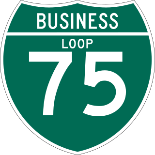
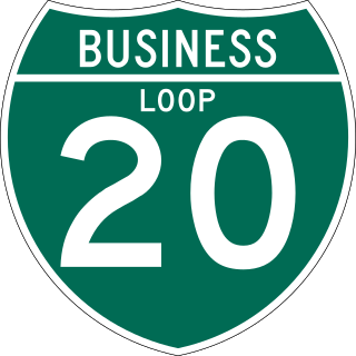
Business routes of Interstate 75 exist in three states. Georgia has three existing Interstate 75 (I-75) business routes and one other that was deleted. Ohio has three business routes for I-75. Nine other I-75 business routes also exist, or have existed, in Michigan, and a 10th has been proposed.

<span class="mw-page-title-main">Special routes of U.S. Route 80</span> Highway system

A total of ten special routes of U.S. Route 80 exist or did exist in the past.

<span class="mw-page-title-main">Georgia State Route 93</span> State highway in Georgia, United States

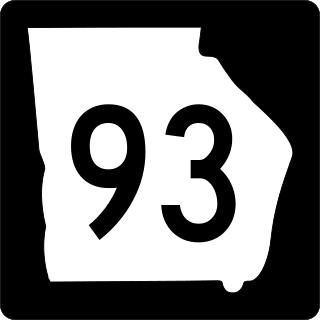
State Route 93 (SR 93) is a state highway in southwest part of the U.S. state of Georgia. The highway runs 60.9 miles (98.0 km) from Thomasville north to Pelham, northeast to Hinsonton, north to Lester, and west to Baconton.

<span class="mw-page-title-main">Georgia State Route 97</span> Highway in Georgia

State Route 97 (SR 97) is a 57.2-mile-long (92.1 km) southwest-to-northeast state highway in the southwestern part of the U.S. state of Georgia. The highway's southern terminus is at the Florida state line, southwest of Faceville, where the roadway continues as County Road 269A to US 90 in Florida. Its northern terminus is at SR 37 in Camilla. The highway connects Faceville with Camilla, via Bainbridge, Vada, and Hopeful.

<span class="mw-page-title-main">Business routes of Interstate 40</span> Highway system

Interstate business routes are roads connecting a central or commercial district of a city or town with an Interstate bypass. These roads typically follow along local streets often along a former U.S. Route or state highway that had been replaced by an Interstate. Interstate business route reassurance markers are signed as either loops or spurs using a green shield shaped and numbered like the shield of the parent Interstate highway.

References

  1. 1 2 Transportation Planning and Programming Division (n.d.). "Business U.S. Highway No. 84-E". Highway Designation Files. Texas Department of Transportation . Retrieved December 15, 2018.
  2. Transportation Planning and Programming Division (n.d.). "State Highway Loop No. 251". Highway Designation Files. Texas Department of Transportation . Retrieved October 11, 2021.
  3. Google (October 11, 2021). "Overview Map of Bus. US 84-E" (Map). Google Maps . Google. Retrieved October 11, 2021.
  4. 1 2 Transportation Planning and Programming Division (n.d.). "Business U.S. Highway No. 84-G". Highway Designation Files. Texas Department of Transportation . Retrieved December 15, 2018.
  5. Transportation Planning and Programming Division (n.d.). "State Highway Loop No. 401". Highway Designation Files. Texas Department of Transportation . Retrieved October 11, 2021.
  6. Google (December 15, 2018). "Overview Map of Bus. US 84-G" (Map). Google Maps . Google. Retrieved December 15, 2018.
  7. 1 2 Transportation Planning and Programming Division (n.d.). "Business U.S. Highway No. 84-H". Highway Designation Files. Texas Department of Transportation . Retrieved December 15, 2018.
  8. 1 2 3 4 Transportation Planning and Programming Division (n.d.). "Business U.S. Highway No. 84-J". Highway Designation Files. Texas Department of Transportation . Retrieved 1 March 2017.
  9. Google (1 March 2017). "U.S. 84 Bus. - Roscoe, Texas" (Map). Google Maps . Google. Retrieved 1 March 2017.
  10. 1 2 Transportation Planning and Programming Division (n.d.). "Business U.S. Highway No. 84-R". Highway Designation Files. Texas Department of Transportation . Retrieved December 15, 2018.
  11. 1 2 Google (September 5, 2019). "Overview map of US 84 Bus./SR 38 Bus" (Map). Google Maps . Google. Retrieved September 5, 2019.
  12. 1 2 Google (September 6, 2019). "Overview map of US 84 Bus./SR 38 Bus" (Map). Google Maps. Google. Retrieved September 6, 2019.