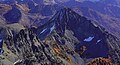
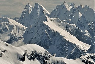
Elephant Butte is a remote 7,380-foot-elevation summit located in Whatcom County of Washington, United States. It is situated within North Cascades National Park and Stephen Mather Wilderness, and is part of the Picket Range, a subset of the North Cascades. Like many North Cascades peaks, Elephant Butte is more notable for its large, steep rise above local terrain than for its absolute elevation. Topographic relief is significant as the north aspect rises 5,200 feet above McMillan Creek in one mile, and the south aspect rises 5,000 feet above Stetattle Creek in two miles. Precipitation runoff from the mountain drains to the Skagit River via these two creeks. This geographical feature's name has been officially adopted by the United States Board on Geographic Names.

Buck Mountain is an 8,534-foot (2,601-metre) mountain summit in the Glacier Peak Wilderness of the North Cascades in Washington state. The mountain is located in Chelan County, in the Wenatchee National Forest. The nearest higher neighbor is Clark Mountain, 3.98 mi (6.41 km) to the southwest, and Brahma Peak is set 1.8 mi (2.9 km) to the south. Precipitation runoff from the mountain drains into Buck Creek, Chiwawa River, and Napeequa River, each a tributary of the Wenatchee River. The mountain's toponym was applied by Albert Hale Sylvester (1871-1944), pioneer surveyor, explorer, topographer, and forest supervisor in the Cascades.

Napeequa Peak is an 8,073-foot (2,461-metre) pyramidal mountain summit located in the Glacier Peak Wilderness of the North Cascades in Washington state. The mountain is situated on the crest of the Cascade Range, on the shared border of Snohomish County and Chelan County, also straddling the boundary between the Mount Baker-Snoqualmie National Forest and the Wenatchee National Forest. Its nearest neighbor is Cirque Mountain, 0.3 mi (0.48 km) to the north, and the nearest higher peak is Buck Mountain, 2.56 mi (4.12 km) to the east-southeast. Precipitation runoff from the peak drains east to the headwaters of Napeequa River; or west into the Suiattle River. The mountain's name is taken from the river's name, which was applied by Albert Hale Sylvester (1871-1944), a pioneer surveyor, explorer, topographer, and forest supervisor in the Cascades.
Mount Carru is an 8,595-foot (2,620-metre) mountain summit located in western Okanogan County in Washington state. It is the seventh-highest peak of the Okanogan Range, which is a sub-range of the North Cascades. The mountain is situated in the Pasayten Wilderness on land administered by the Okanogan–Wenatchee National Forest. The nearest higher peak is Mount Lago, 0.8 mile to the east, and Osceola Peak rises one mile (1.6 km) west. The mountain has a steep north face, but the south slope is covered in scree which allows a nontechnical climbing ascent. Precipitation runoff from Mount Carru drains north into Lease Creek which is a tributary of the Pasayten River, or south into Eureka Creek, which is part of the Methow River drainage basin.

Copper Peak is an 8,965-foot (2,733-metre) mountain summit located in the Entiat Mountains, a sub-range of the North Cascades, in Chelan County of Washington state. Copper Peak is situated 80 miles northeast of Seattle in the Glacier Peak Wilderness, on land managed by the Wenatchee National Forest. Copper Peak ranks 21st-highest on Washington's highest 100 peaks, and 19th on the "Bulger List." The nearest higher neighbor is Mount Fernow, 0.88 miles (1.42 km) to the south. Precipitation runoff from the mountain and meltwater from the glacier on the southeast slope drains into nearby Lake Chelan via Railroad Creek. The first ascent of the peak was made in August 1937 by Franklin Bennet, Edgar Courtwright, and Toivo Hagman. The peak's toponym refers to an abandoned copper mine that once operated at the northeast base of the peak.
Osceola Peak is an 8,587-foot (2,617-metre) mountain summit located in western Okanogan County in Washington state. The mountain's name was officially adopted in 1972. Osceola is the 10th highest peak of the Okanogan Range, which is a sub-range of the North Cascades. Osceola Peak ranks 50th on Washington's highest 100 peaks, and 48th on the "Bulger List". The mountain is situated in the Pasayten Wilderness, on land managed by the Okanogan–Wenatchee National Forest. The nearest higher peak is Mount Carru, 1 mile (1.6 km) to the east. The mountain has a steep north face, but the south slope is covered in scree which allows a nontechnical climbing ascent. Precipitation runoff from Osceola Peak drains north into tributaries of the Similkameen River, or south into Eureka Creek, which is part of the Methow River drainage basin.

The Temple is an 8,295-foot (2,528-metre) granite mountain summit located in Chelan County of Washington state. The Temple is part of The Enchantments, set within the Alpine Lakes Wilderness. The Temple belongs to the Stuart Range which is a subset of the Cascade Range. The nearest higher peak is Enchantment Peak, 1.55 miles (2.49 km) to the west, and the nearest town is Leavenworth, 8 miles (13 km) to the northeast. The mountain hosts many granite spires with names like The High Priest, The Boxtop, Flake Tower, Comet Spire, Razorback Spire, The Meteor, The Professor, Lighthouse Tower, Black Pyramid, and the most recognizable Prusik Peak. The highest point of the mountain is called Mt. Temple. Precipitation runoff from the mountain drains into Snow Creek which is a tributary of Icicle Creek.

Emerald Peak is an 8,422-foot-elevation (2,567-meter) mountain summit located in the Chelan Mountains, in Chelan County of Washington state.

Saska Peak is an 8,404 ft (2,560 m) mountain summit located in the Chelan Mountains, in Chelan County of Washington state. The mountain is situated in Glacier Peak Wilderness of the North Cascades, on land managed by Wenatchee National Forest. Saska Peak ranks as the third-highest peak in the Chelan Mountains, and 74th-highest summit in Washington state. Its nearest higher neighbor is Emerald Peak, 0.66 mi (1.06 km) to the east-northeast, and Cardinal Peak is positioned 1.52 mi (2.45 km) to the east-southeast. These three highest peaks of the Chelan Mountains enclose the head of North Fork Entiat River valley. Precipitation runoff from the peak drains into the Entiat River drainage basin. The mountain's name honors Shil-how-Saskt, Tribal chief of the Entiat people, and was applied by Albert Hale Sylvester (1871-1944), a pioneer surveyor, topographer, and forest supervisor who named thousands of geographic features in the Cascades. In the Columbia-Moses language (Salishan), this name means "Standing in the middle of the sky."

Mount Arriva is an 8,215 ft (2,500 m) elevation mountain summit located in the North Cascades in the U.S. state of Washington. It is situated in North Cascades National Park, on the shared border of Chelan County and Skagit County. Despite its position only 1.55 mi (2.49 km) southwest of Easy Pass, and 3.7 mi (6.0 km) west of the North Cascades Highway, it is not visible from either. Its nearest higher peak is Black Peak, 2.57 mi (4.14 km) to the southeast. Mount Arriva has a secondary summit, called East Peak, which was first climbed in August 1940 by Fred Beckey, Jim Crooks, and Ed Kennedy. The first ascent of the true summit was made July 6, 1966, by Joe and Joan Firey, John and Irene Meulemans.

Pinnacle Mountain is an 8,400-foot (2,560-metre) granitic multi-peak massif located in the Chelan Mountains, in Chelan County of Washington state. The mountain is situated in the Glacier Peak Wilderness of the North Cascades, on land managed by Wenatchee National Forest. Pinnacle Mountain ranks as the fourth-highest peak in the Chelan Mountains, and 77th-highest summit in Washington state. The nearest higher neighbor is Saska Peak, 1.9 mi (3.1 km) to the southeast, and Emerald Peak is positioned 2.25 mi (3.62 km) to the east-southeast. Precipitation runoff from the peak drains into the Entiat River and Chelan River drainage basins.
Martin Peak is an 8,509-foot (2,594-metre) mountain summit located in the North Cascades, in Chelan County of Washington state. Martin Peak is situated 80 miles northeast of Seattle, and 3 mi (4.8 km) northwest of Holden, in the Glacier Peak Wilderness, on land managed by the Wenatchee National Forest. Martin Peak ranks 57th on Washington's highest 100 peaks, and 54th on the "Bulger List". The nearest higher neighbor is Bonanza Peak, 2.35 miles (3.78 km) to the west, and Riddle Peak lies 3.7 miles (6.0 km) to the east-southeast. Precipitation runoff from the mountain and meltwater from the glacier in the east cirque drains into nearby Lake Chelan via Railroad Creek and Company Creek. Topographic relief is significant since the southern aspect of the mountain rises 4,900 feet above the Railroad Creek Valley in approximately two miles (3.2 km). The first ascent of the peak was made in July 1936 by Ida Zacher Darr.

Pasayten Peak is a 7,850-foot (2,390-metre) pyramidal-shaped mountain summit located in western Okanogan County in Washington state. It is part of the Okanogan Range which is a sub-range of the North Cascades. The mountain is situated in the Pasayten Wilderness, on land administered by the Okanogan–Wenatchee National Forest. The nearest higher neighbor is Wildcat Mountain, 3 miles (4.8 km) to the east-southeast, and Slate Peak is set 3.7 miles (6.0 km) to the south. Pasayten Peak is the high point of Gold Ridge, and precipitation runoff from this peak drains into the West and Middle Forks of Pasayten River.

Mount Berge is a 7,951-foot (2,423-metre) double-summit granitic mountain located in the Glacier Peak Wilderness of the North Cascades, in Chelan County of Washington state. The mountain is situated along the crest of the Cascade Range, on land managed by the Okanogan–Wenatchee National Forest. Its nearest higher neighbor is Napeequa Peak, 1.2 mi (1.9 km) to the west, and Buck Mountain is 1.7 mi (2.7 km) to the east-southeast. Berge is positioned on Chiwawa Ridge with Buck and Napeequa, and other notable peaks on this ridge include Fortress Mountain, Brahma Peak, Cirque Mountain, Helmet Butte, and Chiwawa Mountain. Precipitation runoff from Berge drains to the headwaters of Napeequa River; or east into tributaries of the Chiwawa River.

Ice Box is an 8,112-foot (2,473-metre) mountain summit located in the Entiat Mountains, a sub-range of the North Cascades, in Chelan County of Washington state. Ice Box ranks as ninth-highest in the Entiat Mountains, and 147th of Washington's highest 200 peaks. Its nearest higher neighbor is Mount Maude, 1.8 miles (2.9 km) to the north, Spectacle Buttes are set 1.9 miles (3.1 km) to the northeast, and Chilly Peak is 1.3 miles (2.1 km) to the southeast. Ice Box is situated 1.25 miles (2.01 km) south of Ice Lakes in the Okanogan-Wenatchee National Forest. Precipitation runoff from the mountain drains east into Ice Creek, or west into Box Creek. This peak is positioned between these two creeks, hence its name.

Chilly Peak is a 7,970-foot (2,429-metre) mountain summit located in the Entiat Mountains, a sub-range of the North Cascades, in Chelan County of Washington state. It ranks as 194th of Washington's highest 200 peaks. The nearest higher neighbor is Ice Box, 1.3 miles (2.1 km) to the northwest, and Spectacle Buttes are set 2.1 miles (3.4 km) to the north-northeast. Chilly Peak is situated 2.5 miles (4.0 km) south of Ice Lakes in the Okanogan–Wenatchee National Forest. Precipitation runoff from the mountain drains east into Ice Creek which is a tributary of the Entiat River, and west into Rock Creek, a tributary of the Chiwawa River.
Carne Mountain is a 7,080+ ft double-summit mountain located in the Entiat Mountains, a sub-range of the North Cascades, in Chelan County of Washington state. Carne Mountain is situated on the boundary of the Glacier Peak Wilderness, on land managed by the Okanogan–Wenatchee National Forest. Its nearest higher neighbor is Chilly Peak, 1.4 miles (2.3 km) to the northeast, and Ice Box is set 1.7 miles (2.7 km) to the north. Precipitation runoff from the mountain drains east into Rock Creek, or west into Phelps Creek, both tributaries of the Chiwawa River. This peak can be accessed via the 3.7-mile Carne Mountain Trail which gains 3,600 feet of elevation. The mountain once had a fire lookout building on its south peak. Views from the top include Bandit Peak, Brahma Peak, Buck Mountain, Fortress Mountain, Chiwawa Mountain, Mount Maude, Ice Box, and Chilly. This mountain was named by Albert Hale Sylvester for English clergyman W. Stanely Carnes. This feature is pronounced "karn".

Rhino Butte is a remote 6,914-foot-elevation summit located in Whatcom County of Washington, United States. It is situated within North Cascades National Park and Stephen Mather Wilderness, and is part of the Picket Range, a subset of the North Cascades. Like many North Cascades peaks, Rhino Butte is more notable for its large, steep rise above local terrain than for its absolute elevation. Topographic relief is significant as the north aspect rises 4,350 feet above McMillan Creek in one mile, and the south aspect rises 4,700 feet above Stetattle Creek in two miles. Precipitation runoff from the mountain drains to the Skagit River via these two creeks. The nearest higher neighbor is Elephant Butte, 1.27 mile to the east-northeast, with Hippo Butte (6,889 ft) between the two. A high alpine ridge connects Rhino to McMillan Spire, 1.7 mile to the west-southwest, and Azure Lake lies below this ridge. The first ascent of the summit was made October 15, 1978, by John Roper. This geographical feature's name has not yet been officially adopted by the United States Board on Geographic Names.
Mount Crowder is a remote 7,082-foot (2,159-metre) mountain summit in the Picket Range of the North Cascades, in Whatcom County of Washington state. Mount Crowder is situated in North Cascades National Park and Stephen Mather Wilderness. Neighbors include Mount Fury, 1.64 mi (2.64 km) to the northeast, and Twin Needles is set 2.3 mi (3.7 km) to the southeast. Precipitation runoff from this peak drains south into headwaters of Goodell Creek, and northwest into Picket Creek which is a tributary of the Baker River. Topographic relief is significant as the summit rises 4,300 feet above Goodell Creek in approximately one mile.
Mount Buckindy is a remote 7,320-foot-elevation (2,230-meter) mountain summit located in the North Cascades, in Skagit County of Washington state. It is the second-highest point of the Buckindy Range, or Buckindy Ridge. It is set in the Glacier Peak Wilderness on land managed by the Mount Baker-Snoqualmie National Forest. It is situated 20 miles east-northeast of Darrington, Washington, and 17 miles north-northwest of Glacier Peak which is one of the Cascade stratovolcanoes. Precipitation runoff from Mount Buckindy drains south to the Suiattle River via Buck Creek and Downey Creek, and north to the Cascade River via Kindy Creek. Topographic relief is significant as the summit rises 4,700 feet above Kindy Creek in less than two miles. The mountain's toponym is a portmanteau of Buck and Kindy Creeks, and has been officially adopted by the United States Board on Geographic Names.