Spiceland, Indiana

Last updated

Spiceland, Indiana
Classicarchtown.jpg
Spiceland Downtown
Henry County Indiana Incorporated and Unincorporated areas Spiceland Highlighted 1872008.svg
Location of Spiceland in Henry County, Indiana.
Coordinates: 39°50′35″N85°25′34″W / 39.84306°N 85.42611°W / 39.84306; -85.42611
Country United States
State Indiana
County Henry
Township Spiceland
Area
[1]
  Total1.46 sq mi (3.78 km2)
  Land1.46 sq mi (3.78 km2)
  Water0.00 sq mi (0.00 km2)
Elevation
[2]
1,066 ft (325 m)
Population
 (2020)
  Total958
  Density657.06/sq mi (253.70/km2)
Time zone UTC-5 (Eastern (EST))
  Summer (DST) UTC-4 (EDT)
ZIP code
47385
Area code 765
FIPS code 18-72008 [3]
GNIS feature ID2397672 [2]
Website http://www.spicelandtown.org

Spiceland is a town in Spiceland Township, Henry County, Indiana, United States. The population was 890 at the 2010 census.

Contents

Spiceland, Indiana Spiceland, Indiana.jpg
Spiceland, Indiana

History

Spiceland was platted in 1850. [4] The town was so named on account of spice bushes near the original town site. [5] It was primarily an agricultural area for spices.

In February 2001 James Parker and Robert Tulloch, wanted in the 2001 Dartmouth College murders in New Hampshire, were arrested at a truck stop here. They had hitchhiked with truckers to this point and been tracked down by police after a driver's casual announcement on his CB radio that the pair were traveling west.

Geography

Spiceland water tower Classicarchtower.jpg
Spiceland water tower

According to the 2010 census, Spiceland has a total area of 0.5 square miles (1.29 km2), all land. [6]

Demographics

Historical population
CensusPop.Note
1870 370
1880 52742.4%
1890 63720.9%
1900 590−7.4%
1910 6225.4%
1920 6321.6%
1930 72214.2%
1940 645−10.7%
1950 73914.6%
1960 86316.8%
1970 95710.9%
1980 940−1.8%
1990 757−19.5%
2000 8076.6%
2010 89010.3%
2020 9587.6%
U.S. Decennial Census [7]

2010 census

As of the census [8] of 2010, there were 890 people, 353 households, and 256 families living in the town. The population density was 1,780.0 inhabitants per square mile (687.3/km2). There were 389 housing units at an average density of 778.0 per square mile (300.4/km2). The racial makeup of the town was 98.5% White, 0.1% African American, 0.2% Asian, 0.7% from other races, and 0.4% from two or more races. Hispanic or Latino of any race were 0.7% of the population.

There were 353 households, of which 34.8% had children under the age of 18 living with them, 58.4% were married couples living together, 9.3% had a female householder with no husband present, 4.8% had a male householder with no wife present, and 27.5% were non-families. 24.9% of all households were made up of individuals, and 13.3% had someone living alone who was 65 years of age or older. The average household size was 2.52 and the average family size was 2.99.

The median age in the town was 39.5 years. 26.9% of residents were under the age of 18; 5.9% were between the ages of 18 and 24; 23.6% were from 25 to 44; 27.1% were from 45 to 64; and 16.5% were 65 years of age or older. The gender makeup of the town was 49.0% male and 51.0% female.

2000 census

As of the census [3] of 2000, there were 807 people, 327 households, and 240 families living in the town. The population density was 1,838.6 inhabitants per square mile (709.9/km2). There were 340 housing units at an average density of 774.6 per square mile (299.1/km2). The racial makeup of the town was 98.14% White, 0.12% African American, 0.25% Native American, 1.12% from other races, and 0.37% from two or more races. Hispanic or Latino of any race were 1.61% of the population.

There were 327 households, of which 30.3% had children under the age of 18 living with them, 64.2% were married couples living together, 7.6% had a female householder with no husband present, and 26.6% were non-families. 24.2% of all households were made up of individuals, and 12.2% had someone living alone who was 65 years of age or older. The average household size was 2.47 and the average family size was 2.92.

In the town, the population was spread out, with 25.0% under the age of 18, 7.7% from 18 to 24, 30.7% from 25 to 44, 23.9% from 45 to 64, and 12.6% who were 65 years of age or older. The median age was 36 years. For every 100 females, there were 93.1 males. For every 100 females age 18 and over, there were 88.5 males.

The median income for a household in the town was $45,875, and the median income for a family was $54,904. Males had a median income of $37,333 versus $28,393 for females. The per capita income for the town was $20,419. About 2.3% of families and 2.5% of the population were below the poverty line, including 3.1% of those under age 18 and 6.9% of those age 65 or over.

Spiceland Park. Classicarchpark.jpg
Spiceland Park.

Education

The town has a lending library, the Spiceland Town-Township Public Library. [9]

Related Research Articles

<span class="mw-page-title-main">Odon, Indiana</span> Town in Indiana, United States

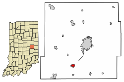
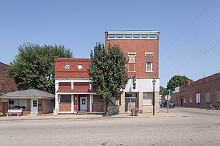
Odon is a town in Madison Township, Daviess County, Indiana, United States. The population was 1,354 at the 2010 census.

<span class="mw-page-title-main">Albany, Indiana</span> Town in Indiana, United States

Albany is a town in Delaware and Randolph counties in the U.S. state of Indiana, along the Mississinewa River. The population was 2,295 at the 2020 census. It is part of the Muncie, IN Metropolitan Statistical Area.

<span class="mw-page-title-main">Blountsville, Indiana</span> Town in Indiana, United States

Blountsville is a town in Stoney Creek Township, Henry County, Indiana, United States. The population was 98 at the 2020 census.

<span class="mw-page-title-main">Cadiz, Indiana</span> Town in Indiana, United States

Cadiz is a town in Harrison Township, Henry County, Indiana, United States. The population was 150 at the 2010 census.

<span class="mw-page-title-main">Dunreith, Indiana</span> Town in Indiana, United States

Dunreith is a town in Spiceland Township, Henry County, Indiana, United States. The population was 177 at the 2010 census.

<span class="mw-page-title-main">Greensboro, Indiana</span> Town in Indiana, United States

Greensboro is a town in Greensboro Township, Henry County, Indiana, United States. The population was 143 at the 2010 census. The town was a 'station' on the Underground Railroad and was recognized for its active abolitionists.

<span class="mw-page-title-main">Lewisville, Indiana</span> Town in Indiana, United States

Lewisville is a town in Franklin Township, Henry County, Indiana, United States. The population was 366 at the 2010 census.

<span class="mw-page-title-main">Middletown, Indiana</span> Town in Indiana, United States

Middletown is a town in northwest Henry County, Indiana, United States. The population was 2,322 at the 2010 census.

<span class="mw-page-title-main">Mooreland, Indiana</span> Town in Indiana, United States

Mooreland is a town in Blue River Township, Henry County, Indiana, United States. The population was 375 at the 2010 census.

<span class="mw-page-title-main">Mount Summit, Indiana</span> Town in Indiana, United States

Mount Summit is a town in Prairie Township, Henry County, Indiana, United States. The population was 352 at the 2010 census.

<span class="mw-page-title-main">New Castle, Indiana</span> City in Indiana, United States

New Castle is a city in Henry County, Indiana, 44 miles (71 km) east-northeast of Indianapolis, on the Big Blue River. The city is the county seat of Henry County. New Castle is home to New Castle Fieldhouse, the largest high school gymnasium in the world. The city is surrounded by agricultural land. In the past, it was a manufacturing center for the production of sheet iron and steel, automobiles, caskets, clothing, scales, bridges, pianos, furniture, handles, shovels, lathes, bricks, and flour. Starting in the early 20th century, it was known as the Rose City, at one point having 100 florists and numerous growers.

<span class="mw-page-title-main">Springport, Indiana</span> Town in Indiana, United States

Springport is a town in Prairie Township, Henry County, Indiana, United States. The population was 149 at the 2010 census.

<span class="mw-page-title-main">Straughn, Indiana</span> Town in Indiana, United States

Straughn is a town in Dudley Township, Henry County, Indiana, United States. The population was 222 at the 2010 census.

<span class="mw-page-title-main">Sulphur Springs, Indiana</span> Town in Indiana, United States

Sulphur Springs is a town in Jefferson Township, Henry County, Indiana, United States. As of the 2010 census, the town's population was 399.

<span class="mw-page-title-main">New Whiteland, Indiana</span> Town in Indiana, United States

New Whiteland is a town in Pleasant Township, Johnson County, Indiana, United States. The population was 5,550 at the 2020 census.

<span class="mw-page-title-main">Woodlawn Heights, Indiana</span> Town in Indiana, United States

Woodlawn Heights is a town in Anderson Township, Madison County, Indiana, United States. It is part of the Indianapolis–Carmel–Anderson metropolitan statistical area. The population was 91 at the 2020 census.

<span class="mw-page-title-main">Bethany, Indiana</span> Town in Indiana, United States

Bethany is a town in Clay Township, Morgan County, in the U.S. state of Indiana. The population was 95 at the 2020 census.

<span class="mw-page-title-main">Paragon, Indiana</span> Town in Indiana, United States

Paragon is a town in Ray Township, Morgan County, in the U.S. state of Indiana. The population was 556 at the 2020 census, down from 659 in 2010.

<span class="mw-page-title-main">Spurgeon, Indiana</span> Town in Indiana, United States

Spurgeon is a town in Monroe Township, Pike County, in the U.S. state of Indiana. The population was 207 at the 2010 census. It is part of the Jasper Micropolitan Statistical Area.

<span class="mw-page-title-main">Shadeland, Indiana</span> Town in Indiana, United States

Shadeland is a town in Union Township, Tippecanoe County, in the U.S. state of Indiana. The population was 1,610 at the 2010 census.

References

  1. "2020 U.S. Gazetteer Files". United States Census Bureau. Retrieved March 16, 2022.
  2. 1 2 U.S. Geological Survey Geographic Names Information System: Spiceland, Indiana
  3. 1 2 "U.S. Census website". United States Census Bureau . Retrieved January 31, 2008.
  4. Hazzard, George (1906). Hazzard's History of Henry County, Indiana, 1822-1906. G. Hazzard, author and publisher. p.  963.
  5. Baker, Ronald L. (October 1995). From Needmore to Prosperity: Hoosier Place Names in Folklore and History . Indiana University Press. p.  308. ISBN   978-0-253-32866-3. ...is for the abundance of spicebush growing in this area.
  6. "G001 - Geographic Identifiers - 2010 Census Summary File 1". United States Census Bureau. Archived from the original on February 13, 2020. Retrieved July 25, 2015.
  7. "Census of Population and Housing". Census.gov. Retrieved June 4, 2015.
  8. "U.S. Census website". United States Census Bureau . Retrieved December 11, 2012.
  9. "Indiana public library directory" (PDF). Indiana State Library. Retrieved March 7, 2018.