
The Delmarva Peninsula, or simply Delmarva, is a large peninsula and proposed state on the East Coast of the United States, occupied by the vast majority of the state of Delaware and parts of the Eastern Shore of Maryland and Eastern Shore of Virginia.
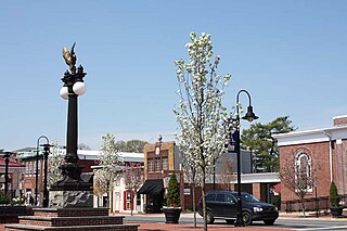
Middletown is a town in New Castle County, Delaware, United States. According to the 2021 Census, the population of the town is 24,164.

Odessa is a town in New Castle County, Delaware, United States. The population was 364 at the 2010 census. Founded as Cantwell's Bridge in the 18th century, the name was changed in the 19th century, after the Ukrainian port city of the same name. Today a significant part of the town is a historic district list on the National Register of Historic Places.

The Chesapeake & Delaware Canal is a 14-mile (22.5 km)-long, 450-foot (137.2 m)-wide and 35-foot (10.7 m)-deep ship canal that connects the Delaware River with the Chesapeake Bay in the states of Delaware and Maryland in the United States.

The Eastern Shore of Maryland is a part of the U.S. state of Maryland that lies mostly on the east side of the Chesapeake Bay. Nine counties are normally included in the region. The Eastern Shore is part of the larger Delmarva Peninsula that Maryland shares with Delaware and Virginia.
Christiana Hundred is an unincorporated subdivision of New Castle County, Delaware. Hundreds were once used as a basis for representation in the Delaware General Assembly, and while their names still appear on all real estate transactions, they presently have no meaningful use or purpose except as a geographical point of reference.
Blackbird Hundred is an unincorporated subdivision of New Castle County, Delaware. Hundreds were once used as a basis for representation in the Delaware General Assembly, and while their names still appear on all real estate transactions, they now have no purpose except as a geographical point of reference.
Appoquinimink Hundred is an unincorporated subdivision of New Castle County, Delaware. Hundreds were once used as a basis for representation in the Delaware General Assembly, and while their names still appear on all real estate transactions, they presently have no meaningful use or purpose except as a geographical point of reference.
Pencader Hundred is an unincorporated subdivision of New Castle County, Delaware. Hundreds were once used as a basis for representation in the Delaware General Assembly, and while their names still appear on all real estate transactions, they presently have no meaningful use or purpose except as a geographical point of reference. It is named after Pencader, Carmarthenshire, Wales.
Red Lion Hundred is an unincorporated subdivision of New Castle County, Delaware. Hundreds were once used as a basis for representation in the Delaware General Assembly, and while their names still appear on all real estate transactions, they presently have no meaningful use or purpose except as a geographical point of reference.
Wilmington Hundred is an unincorporated subdivision of New Castle County, Delaware. Hundreds were once used as a basis for representation in the Delaware General Assembly, and while their names still appear on all real estate transactions, they presently have no meaningful use or purpose except as a geographical point of reference.
White Clay Creek Hundred is an unincorporated subdivision of New Castle County, Delaware. Hundreds were once used as a basis for representation in the Delaware General Assembly, and while their names still appear on all real estate transactions, they presently have no meaningful use or purpose except as a geographical point of reference.

Delaware Route 896 (DE 896) is a state highway located in New Castle County, Delaware. The route runs from U.S. Route 13 (US 13) in Boyds Corner north to the Maryland border northwest of Newark, where the road becomes unsigned Maryland Route 896 (MD 896) briefly before heading into Pennsylvania as Pennsylvania Route 896 (PA 896). The route heads west from US 13 before turning north along with DE 71 in Mount Pleasant, crossing the Chesapeake & Delaware Canal on the Summit Bridge. After the bridge, DE 71 splits off to the east and the road continues to Glasgow, where it comes to an intersection with US 40. DE 896 continues north and interchange with Interstate 95 (I-95) before reaching Newark, where it bypasses the University of Delaware to the west by following DE 4, Elkton Road, and South Main Street. DE 896 comes to downtown Newark and continues northwest to the Maryland border. DE 896 has a business route, DE 896 Business, that passes through Glasgow, and had an alternate alignment south of Glasgow called DE 896 Alternate.

U.S. Route 301 (US 301) in the state of Maryland is a major highway that runs 122.85 miles (197.71 km) from the Governor Harry W. Nice Memorial Bridge over the Potomac River into Virginia northeast to Delaware. It passes through three of Maryland's four main regions: Southern Maryland, the Baltimore-Washington Metropolitan Area, and the Eastern Shore. US 301 serves mainly as a bypass of Baltimore and Washington, D.C. from Virginia to Delaware.

Delaware Route 9 (DE 9) is a 57.83-mile (93.07 km) state highway that runs from DE 1 near Dover Air Force Base in Kent County north to DE 2 in the city of Wilmington in New Castle County. DE 9 is a designated scenic highway known as the Delaware Bayshore Byway south of New Castle, running through mostly rural areas to the west of the Delaware Bay and the Delaware River as a two-lane undivided road. Between New Castle and Wilmington, DE 9 is a four-lane road that runs through urban and suburban areas. DE 9 passes through several cities and towns including Little Creek, Leipsic, Port Penn, Delaware City, and New Castle. DE 9 has an auxiliary route, DE 9A, that provides access to the Port of Wilmington. In addition, it has a truck route, DE 9 Truck, located to the south of New Castle.
U.S. Route 301 (US 301) is a US Highway running from Sarasota, Florida, north to Biddles Corner, Delaware. In the state of Delaware, the route runs 11.9 mi (19.2 km) across New Castle County from the Maryland state line southwest of Middletown northeast to its northern terminus at the Delaware Route 1 (DE 1) freeway in Biddles Corner, just south of the Senator William V. Roth Jr. Bridge that carries DE 1 over the Chesapeake & Delaware Canal in St. Georges. US 301 in Delaware is a controlled-access toll road that is designated as the First Responders Memorial Highway. The freeway has interchanges with DE 299 west of Middletown, DE 71 north of Middletown, and Jamison Corner Road, and uses all-electronic tolling, with tolls paid by E-ZPass or toll-by-plate. A mainline toll gantry is located north of the Maryland state line while there are ramp tolls on the southbound exits and northbound entrances at the three interchanges.

Delaware Route 15 (DE 15) is a state highway in the U.S. state of Delaware. The route runs from DE 14 west of Milford in Kent County north to DE 71/DE 896 in Summit Bridge, New Castle County, just south of the Summit Bridge over the Chesapeake & Delaware Canal. DE 15 winds a path through many rural sections of Delaware, turning along many different roads. Most of the route, with the exception of the southern part of the route from Milford to Canterbury, runs to the west of U.S. Route 13 (US 13). DE 15 serves several cities and towns, including Wyoming, Dover, Clayton, and Middletown. The route intersects DE 12 near Felton, US 13 in Canterbury, DE 10 near Camden, DE 8 in Dover, DE 42 in Seven Hickories, DE 300 and DE 6 in the Clayton area, DE 299 in Middletown, and DE 286 near Summit Bridge.

Delaware Route 71 (DE 71) is a state highway in New Castle County, Delaware. The route runs from U.S. Route 13 (US 13) south of Townsend north to another intersection with US 13 in Tybouts Corner, traveling to the west of US 13 by way of Townsend, Middletown, and the Summit Bridge. The route runs concurrent with DE 896 from Mount Pleasant to just north of the Summit Bridge.

U.S. Route 13 (US 13) is a U.S. highway running from Fayetteville, North Carolina, north to Morrisville, Pennsylvania. In the U.S. state of Delaware, the route runs for 103.33 mi (166.29 km). It traverses the entire north–south length of the state from the Maryland state line in Delmar, Sussex County, north to the Pennsylvania state line in Claymont, New Castle County. US 13 connects many important cities and towns in Delaware, including Seaford, Dover, and Wilmington. The entire length of US 13 in Delaware is a multilane divided highway with the exceptions of the segment through Wilmington and parts of the route in Claymont. Between the Maryland state line and Dover, US 13 serves as one of the main north–south routes across the Delmarva Peninsula. From Dover north to Tybouts Corner, the route is followed by the controlled-access Delaware Route 1 (DE 1) toll road, which crosses the route multiple times and has multiple interchanges with it. US 13 bypasses downtown Wilmington to the east before it heads northeast of the city parallel to Interstate 495 (I-495) and the Delaware River to Claymont. US 13 is the longest numbered highway in the state of Delaware.
Delaware Bicycle Route 1 is a bicycle route that runs the north-south length of the U.S. state of Delaware, from the Maryland border in Fenwick Island, Sussex County north to the Pennsylvania border near Montchanin, New Castle County. The route passes through many Delaware scenes, including beaches, farmland, state parks, and towns. The route is the first of many signed bike routes planned in the state.
