St. Marks, Florida

Last updated

St. Marks, Florida
San Marcos
St Marks FL city hall01.jpg
St. Marks City Hall
Wakulla County Florida Incorporated and Unincorporated areas St. Marks Highlighted.svg
Location in Wakulla County and the state of Florida
Coordinates: 30°9′33″N84°12′26″W / 30.15917°N 84.20722°W / 30.15917; -84.20722
Country Flag of the United States.svg  United States
State Flag of Florida.svg  Florida
County   Wakulla
Incorporated 1963 [1]
Government
  Type Commissioner-Manager
   Mayor Paul Sheddan
   Commissioners John Gunter,
Steve Remke,
Paula Bell, and
Sharon Rudd
   City Manager and
City Clerk
Zoe Mansfield
   City Attorney William C. Garner
Area
[2]
  Total1.97 sq mi (5.09 km2)
  Land1.96 sq mi (5.07 km2)
  Water0.01 sq mi (0.02 km2)
Elevation
10 ft (3 m)
Population
 (2020)
  Total274
  Density139.87/sq mi (54.01/km2)
Time zone UTC-5 (Eastern (EST))
  Summer (DST) UTC-4 (EDT)
FIPS code 12-62825 [3]
GNIS feature ID0290282 [4]
Website www.cityofstmarks.com

St. Marks is a city in Wakulla County, Florida, United States. It is part of the Tallahassee, Florida Metropolitan Statistical Area. St. Marks is located on the Florida Panhandle in North Florida, along the Gulf of Mexico. The population at the 2020 census was 274, down from 293 at the 2010 census.

Contents

Geography

The approximate coordinates for the City of St. Marks is located at 30°09′33″N84°12′26″W / 30.159244°N 84.207152°W / 30.159244; -84.207152 . [5]

St. Marks United States Post Office StMarksFlPostoffice.JPG
St. Marks United States Post Office

According to the United States Census Bureau, the city has a total area of 1.9 square miles (4.9 km2), of which 1.9 square miles (4.9 km2) is land and 0.52% is water.

Climate

The climate in this area is characterized by hot, humid summers and generally mild winters. According to the Köppen climate classification, St. Marks has a humid subtropical climate zone (Cfa).

History

Posey's Bar, before it was torn down in 2010. St Marks Poseys Oyster Bar02.jpg
Posey's Bar, before it was torn down in 2010.

Originally known as San Marcos de Apalache and centered on a Spanish fort, this town was founded by the Spanish in the 17th century in what was then Spanish Florida. There was a trading post of Panton, Leslie & Company in the late 18th century. A long time has passed since St. Marks last had appreciable importance, but this place on Apalachee Bay in Florida's Big Bend is a very old and historic Gulf port. Fortifications built here by the Spanish in the 17th century, and rebuilt several times, provided the venue for force of arms repeatedly up through the American Civil War.

In the best-known incident, Andrew Jackson, in his incursion into Spanish Florida in 1818, executed British nationals Robert Chrystie Ambrister and Alexander George Arbuthnot at the old fort, as well as the Muscogee ("Creek") religious leader called Francis the Prophet. This nearly embroiled the United States in international strife. San Marcos de Apalache Historic State Park interprets the site of the old fort.

Today's St. Marks evidently has its roots in American commercial activity that took hold beneath the walls of the fort upon acquisition of Spanish Florida by the U.S. in 1821—before the settlement moved slightly up the St. Marks River to the present position. Various articles in publications like Florida Historical Quarterly relate how the fort site later held a government "naval" hospital to meet yellow fever emergencies in the merchant marine.[ citation needed ] And just afterward Confederate batteries were established on the site in the Civil War. Their earthworks remain and are interpreted in the historic state park. But the site also exhibits old Spanish stonework, and not far away (though inaccessible), just down St. Marks River are shallow Spanish quarries where this limestone was evidently obtained in the 1730s.

Limestone quarried here by the Spanish helped to make the St. Marks Light lighthouse, constructed about 1830 by the U.S. government[ citation needed ]. The lighthouse stands, after a couple of reconstructions, at the mouth of the river six miles from town and accessible by road. The lighthouse is, like San Marcos de Apalache, on the National Register of Historic Places.

St. Marks was a seaport for all of Middle Florida and lower Georgia during this early period. Ellen Call Long, on her way to Tallahassee, described the port about 1830 as "a quaint little village, amphibious-like, consisting of a few dwelling houses, stores, etc., mostly built on stilts or piles, as if ready to launch when wind or tide prevailed." [6]

A railroad often cited as Florida's first [7] connected the port of St. Marks with the territorial capital, Tallahassee, some 20 miles inland. The line, the Tallahassee Railroad, was constructed about 1836, and until the Civil War it served in the export of Middle Florida's cotton through St. Marks.

The capacity of the St. Marks port was limited, and it was surpassed in the 19th century by the larger port of Apalachicola, served by the Thomasville, Tallahassee and Gulf Railroad via Carrabelle, Florida.

The city was officially incorporated as a municipality in 1963. [1]

The now-abandoned rail line serves as Tallahassee-St. Marks Historic Railroad State Trail, a paved 16 miles (26 km) bicycle and equestrian trail terminating at the St. Marks waterfront.

On July 10, 2005, the section of the coast was damaged by the big storm surge associated with Hurricane Dennis, severely flooded the town, causing major damage to local businesses and homes. As on other occasions in its history, St. Marks was flooded badly with saltwater.

Demographics

Historical population
CensusPop.Note
1850 189
1930 217
1970 366
1980 286−21.9%
1990 3077.3%
2000 272−11.4%
2010 2937.7%
2020 274−6.5%
U.S. Decennial Census [8]

St. Marks first appeared in the 1850 U.S. census with a total population of 189. [9]

2010 and 2020 census

St. Marks racial composition
(Hispanics excluded from racial categories)
(NH = Non-Hispanic)
RacePop 2010 [10] Pop 2020 [11] % 2010% 2020
White (NH)28424296.93%88.32%
Black or African American (NH)541.71%1.46%
Native American or Alaska Native (NH)100.34%0.00%
Asian (NH)130.34%1.09%
Pacific Islander or Native Hawaiian (NH)000.00%0.00%
Some other race (NH)010.00%0.36%
Two or more races/Multiracial (NH)2170.68%6.20%
Hispanic or Latino (any race)070.00%2.55%
Total293274

As of the 2020 United States census, there were 274 people, 167 households, and 140 families residing in the city. [12]

As of the 2010 United States census, there were 293 people, 124 households, and 66 families residing in the city. [13]

2000 census

As of the census [3] of 2000, there were 272 people, 137 households, and 79 families residing in the city. The population density was 141.0 inhabitants per square mile (54.4/km2). There were 168 housing units at an average density of 87.1 per square mile (33.6/km2). The racial makeup of the city was 93.75% White, 2.57% African American, 0.74% Native American, 0.37% Asian, 1.10% from other races, and 1.47% from two or more races. Hispanic or Latino of any race were 0.37% of the population.

In 2000, there were 137 households, out of which 16.1% had children under the age of 18 living with them, 43.1% were married couples living together, 9.5% had a female householder with no husband present, and 42.3% were non-families. 36.5% of all households were made up of individuals, and 8.8% had someone living alone who was 65 years of age or older. The average household size was 1.99 and the average family size was 2.56.

In 2000, in the city, the population was spread out, with 15.8% under the age of 18, 7.4% from 18 to 24, 27.6% from 25 to 44, 31.6% from 45 to 64, and 17.6% who were 65 years of age or older. The median age was 44 years. For every 100 females, there were 104.5 males. For every 100 females age 18 and over, there were 110.1 males.

The median income for a household in the city was $25,156, and the median income for a family was $36,250. Males had a median income of $25,234 versus $21,458 for females. The per capita income for the city was $14,994. About 19.1% of families and 19.5% of the population were below the poverty line, including 27.3% of those under the age of eighteen and 6.7% of those 65 or over.

See also

Related Research Articles

<span class="mw-page-title-main">Crystal River, Florida</span> City in Florida, United States

Crystal River is a city in Citrus County, Florida, United States. The population was 3,396 in the 2020 census. The city was incorporated in 1903 and is the self-professed "Home of the Manatee". Crystal River Preserve State Park is located nearby, and Crystal River Archaeological State Park is located in the city's northwest side.

<span class="mw-page-title-main">Gadsden County, Florida</span> County in Florida, United States

Gadsden County is a county located in the panhandle of the U.S. state of Florida. As of the 2020 census, the population was 43,826. Its county seat is Quincy. Gadsden County is included in the Tallahassee, FL Metropolitan Statistical Area. Gadsden County is the only majority African-American county in Florida.

<span class="mw-page-title-main">Jefferson County, Florida</span> County in Florida, United States

Jefferson County is a county located in the Big Bend region in the northern part of the U.S. state of Florida. As of the 2020 census, the population was 14,510. Its county seat is Monticello.

<span class="mw-page-title-main">Leon County, Florida</span> County in Florida, United States

Leon County is a county in the Panhandle of the U.S. state of Florida. It was named after the Spanish explorer Juan Ponce de León. As of the 2020 census, the population was 292,198.

<span class="mw-page-title-main">St. Lucie County, Florida</span> County in Florida, United States

St. Lucie County is located in the southeastern portion of the U.S. state of Florida. As of the 2020 census, the population was 329,226. The county's seat is Fort Pierce, while the largest city is Port St. Lucie, making up 62% of the county's population. St. Lucie County is the principal county of the Port St. Lucie, FL Metropolitan Statistical Area.

<span class="mw-page-title-main">Wakulla County, Florida</span> County in Florida, United States

Wakulla County is a county located in the Big Bend region in the northern portion of the U.S. state of Florida. As of the 2020 census, the population was 33,764. Its county seat is Crawfordville.

<span class="mw-page-title-main">Micanopy, Florida</span> Town in the state of Florida, United States

Micanopy is a town in Alachua County, Florida, United States, located south of Gainesville. It is part of the Gainesville, Florida Metropolitan Statistical Area. The population as of the 2020 census was 648, up from 600 at the 2010 census.

<span class="mw-page-title-main">Panama City, Florida</span> City in the United States

153rd Cavalry Regiment

<span class="mw-page-title-main">Marco Island, Florida</span> City in Florida, United States

Marco Island is a city and barrier island in Collier County, Florida, 20 miles (32 km) south of Naples on the Gulf Coast of the United States. It is the largest barrier island in Southwest Florida's Ten Thousand Islands area, which extends southerly to Cape Sable. Marco Island is home to an affluent beach community with resort amenities.

<span class="mw-page-title-main">Apalachicola, Florida</span> City in Florida, United States of America

Apalachicola is a city and the county seat of Franklin County, Florida, United States, on the shore of Apalachicola Bay, an inlet of the Gulf of Mexico. The population was 2,341 at the 2020 census.

<span class="mw-page-title-main">Carrabelle, Florida</span> City in Florida, United States

Carrabelle is a city in Franklin County along Florida's Panhandle, United States. It is located east of Apalachicola at the mouth of the Carrabelle River on the Gulf of Mexico. The population was 2,606 as of the 2020 census.

<span class="mw-page-title-main">Havana, Florida</span> Town in the state of Florida, United States

Havana is a town in Gadsden County, Florida, United States, and a suburb of Tallahassee. The population was 1,753 at the 2020 census, almost even from 1,754 at the 2010 census. It is part of the Tallahassee, Florida Metropolitan Statistical Area. The town was named after Havana, Cuba, located about 530 miles (850 km) to the south.

<span class="mw-page-title-main">Estero, Florida</span> Village in Florida, United States

Estero is an incorporated village in Lee County, Florida, United States, located directly beside the first aquatic nature preserve established in Florida: The Estero Bay Aquatic Preserve, otherwise referred to as Estero Bay Preserve State Park which is within Estero Bay, Florida. At the time of the 2010 census, Estero was an unincorporated community and census-designated place, but incorporated as a village on the last calendar date of 2014. It is part of the Cape Coral-Fort Myers, Florida Metropolitan Statistical Area. As of the 2020 census, the population was 36,939.

<span class="mw-page-title-main">Fernandina Beach, Florida</span> City in Florida, United States

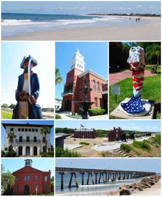
Fernandina Beach is a city in northeastern Florida and the county seat of Nassau County, Florida, United States. It is the northernmost city on Florida's Atlantic coast, situated on Amelia Island, and is one of the principal municipalities comprising Greater Jacksonville. The area was first inhabited by the Timucuan Indian people. Known as the "Isle of 8 Flags", Amelia Island has had the flags of the following nations flown over it: France, Spain, Great Britain, Spain (again), the Republic of East Florida (1812), the Republic of the Floridas (1817), Mexico, the Confederate States of America, and the United States.

<span class="mw-page-title-main">Coleman, Florida</span> City in Florida, United States

Coleman is a city in Sumter County, Florida, United States. The population was 642 at the 2020 census.

<span class="mw-page-title-main">Sopchoppy, Florida</span> City in Florida, United States

Sopchoppy is a city in Wakulla County, Florida, United States. The City of Sopchoppy is located on the Florida Panhandle in North Florida, with Ochlockonee River State Park located nearby. It is part of the Tallahassee, Florida Metropolitan Statistical Area. The population was 426 at the 2020 census, down from 457 at the 2010 census.

<span class="mw-page-title-main">San Marcos de Apalache Historic State Park</span> Archaeological site in Florida, United States

San Marcos de Apalache Historic State Park is a Florida State Park in Wakulla County, Florida organized around the historic site of a Spanish colonial fort, which was used by succeeding nations that controlled the area. The Spanish first built wooden buildings and a stockade in the late 17th and early 18th centuries here, which were destroyed by a hurricane.

<span class="mw-page-title-main">Forgotten Coast</span> Region in Florida

The Forgotten Coast refers to a largely undeveloped and sparsely populated coastline in the panhandle of the US state of Florida. The trademarked term was first used in 1992, but the Forgotten Coast's exact extent is not agreed upon.

<span class="mw-page-title-main">Tallahassee metropolitan area</span> Metropolitan area in the United States

The Tallahassee Metropolitan Statistical area is the metropolitan area centered on Tallahassee, Florida.

<span class="mw-page-title-main">Big Bend (Florida)</span> Region of the state Florida, United States

The Big Bend of Florida, United States, is an informally named geographic region of North Florida where the Florida Panhandle transitions to the Florida Peninsula south and east of Tallahassee. The region is known for its vast woodlands and marshlands and its low population density relative to much of the state. The area is home to the largest single spring in the United States, the Alapaha Rise, and the longest surveyed underwater cave in the United States, the 32-mile (51 km) Wakulla-Leon Sinks cave system.

References

  1. 1 2 "FLORIDA CITIES BY INCORPORATION YEAR WITH INCORPORATION & DISSOLUTION INFO" (PDF). www.flcities.com.
  2. "2020 U.S. Gazetteer Files". United States Census Bureau. Retrieved December 2, 2021.
  3. 1 2 "U.S. Census website". United States Census Bureau . Retrieved January 31, 2008.
  4. "US Board on Geographic Names". United States Geological Survey. October 25, 2007. Retrieved January 31, 2008.
  5. "US Gazetteer files: 2010, 2000, and 1990". United States Census Bureau. February 12, 2011. Retrieved April 23, 2011.
  6. Smith, Julia Floyd (2017). Slavery and plantation growth in Antebellum Florida, 1821-1860 (PDF). University of Florida Press.
  7. Turner, Gregg (2003). A Short History of Florida Railroads. Charleston, SC: Arcadia Publishing. pp. 7–8. ISBN   978-0738524214.
  8. "Census of Population and Housing". Census.gov. Retrieved June 4, 2015.
  9. "1850 Census of Population: Florida" (PDF). Retrieved February 24, 2023.
  10. "P2 HISPANIC OR LATINO, AND NOT HISPANIC OR LATINO BY RACE - 2010: DEC Redistricting Data (PL 94-171) - St. Marks city, Florida". United States Census Bureau .
  11. "P2 HISPANIC OR LATINO, AND NOT HISPANIC OR LATINO BY RACE - 2020: DEC Redistricting Data (PL 94-171) - St. Marks city, Florida". United States Census Bureau .
  12. "S1101 HOUSEHOLDS AND FAMILIES - 2020: St. Marks city, Florida". United States Census Bureau .
  13. "S1101 HOUSEHOLDS AND FAMILIES - 2010: St. Marks city, Florida". United States Census Bureau .