
U.S. Route 206 is a 130.23-mile-long (209.58 km) north–south United States highway in New Jersey and Pennsylvania, United States. Only about a half a mile of its length is in Pennsylvania; the Milford–Montague Toll Bridge carries it over the Delaware River into New Jersey, where it connects to the remainder of the route. Its southern terminus is at an intersection with US 30 and Route 54 in Hammonton. The highway's northern terminus is at an intersection with US 209 near Milford, Pennsylvania; some sources and signs show an overlap with US 209 to end at its parent route US 6. For much of its length, US 206 is a rural two-lane undivided road that passes through the Pine Barrens, agricultural areas, and the Appalachian Mountains of northwestern New Jersey, with some urban and suburban areas. The route connects several cities and towns, including Bordentown, Trenton, Princeton, Somerville, Roxbury, Netcong, and Newton. The road is known as the Disabled American Veterans Highway for much of its length.

Route 439 is a short state highway in the communities of Elizabeth, Union and Hillside in Union County, New Jersey. The highway is known as the Bayway, North Avenue and Elmora Avenue from the Goethals Bridge and Interstate 278 (I-278) and does a half-loop around Elizabeth, with the designation terminating at an intersection with Route 27 in Elizabeth. The highway originated as part of Route 28 south of the current intersection with Route 28 and Route S24 north of that intersection to Route 82. The current designation of Route 439 was assigned in the 1953 renumbering.

The Overseas Highway is a 113-mile (181.9 km) highway carrying U.S. Route 1 (US 1) through the Florida Keys to Key West. Large parts of it were built on the former right-of-way of the Overseas Railroad, the Key West Extension of the Florida East Coast Railway. Completed in 1912, the Overseas Railroad was heavily damaged and partially destroyed in the 1935 Labor Day hurricane. The Florida East Coast Railway was financially unable to rebuild the destroyed sections, so the roadbed and remaining bridges were sold to the state of Florida for $640,000.
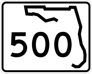
State Road 500 is a state highway running through Florida as a mostly unsigned route under several U.S. Highways. From Chiefland to Williston it is U.S. Highway 27 Alternate. From Williston to Ocala, it is US 27. From Ocala to Holopaw, it is US 441. From Kissimmee to Indialantic it is US 192.
The Pinellas Bayway System is a series of bridges on two state roads in Pinellas County, Florida. It is a toll road complex maintained and operated by the Florida Department of Transportation. It also is compatible with the SunPass ETC system currently in use on all other FDOT-owned toll roads. The Pinellas Bayway consists of:
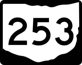
State Route 253 (SR 253) is a very short east–west state highway in the southern part of the U.S. state of Ohio. With an overall length of just 0.56 miles (0.90 km), the majority of SR 253 is a part of the Jesse Stuart Memorial Bridge, which crosses over the Ohio River near Franklin Furnace, Ohio. The western terminus of SR 253 is at about the midspan of the bridge, where it crosses the Kentucky State Line and becomes Kentucky Route 10 (KY 10). The eastern terminus of the highway is at a diamond interchange with U.S. Route 52 (US 52) near the eastern landing of the Ohio River crossing. The current SR 253 was established in the late 1980s. However, an earlier version of the highway existed in the Medina vicinity from the early 1920s until the late 1950s.
Glenelg Highway is a rural highway in south-eastern Australia, linking Mount Gambier with Ballarat. Most of the highway is located within the Western part of the state of Victoria, though a short, 15 km stretch from the South Australia/Victoria state border near Ardno to Glenburnie is located in South Australia. Some maps identify the South Australian stretch as Casterton Road. Major towns along its route include Casterton, Coleraine and Hamilton.

In the US state of Georgia, Interstate 20 (I-20) travels from the Alabama state line to the Savannah River, which is the South Carolina state line. The highway enters the state near Tallapoosa. It travels through the Atlanta metropolitan area and exits the state in Augusta. The highway also travels through the cities of Bremen, Douglasville, Conyers, Covington, and Madison. I-20 has the unsigned state highway designation of State Route 402 (SR 402).
Several special routes of U.S. Route 1 (US 1) exist, from Florida to Maine. In order from south to north, separated by type, these special routes are as follows.
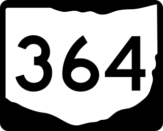
State Route 364 (SR 364) is a north–south state route in Ohio. It starts from SR 705 near Yorkshire. The route moves north across several counties, then northeast against the side of the Grand Lake. SR 364 then travels west along a concurrency with SR 703, and ends at SR 29 near St. Marys. The route was designated in 1934, from SR 219 to SR 29. It was extended southwards to SR 705 in 1936 and completely paved by 1940. SR 364 was also extended in 1973 to the new alignment of SR 29.

U.S. Route 278 (US 278) in the U.S. state of Georgia is an east–west United States Highway traversing the north-central portion of the state. The highway travels from the Alabama state line near Esom Hill to the South Carolina state line where it crosses the Savannah River in the Augusta metropolitan area.

U.S. Highway 76 (US 76) is a U.S. Highway running from Chattanooga, Tennessee to Wrightsville Beach, North Carolina. In North Carolina the highway runs for 80.4 miles (129.4 km) in the southeastern region of the state. US 76 enters the state from South Carolina south of Fair Bluff in Columbus County. Travelling in an eastward direction, US 76 meets US 74 in Chadbourn. The two highways run concurrently for 50.4 miles (81.1 km) between Chadbourn and Wilmington. US 76 runs concurrently with US 17 along much of its Wilmington routing, until once again meeting US 74. US 76 and US 74 run concurrently for 1.4 miles (2.3 km) until reaching Wrightsville Beach. US 76 reaches its eastern terminus on the south side of Wrightsville Beach, at an intersection with Water Street.

Route 167 is a short, 0.77-mile-long (1.24 km) state highway in Atlantic and Burlington counties in New Jersey. The route is one of the few discontinuous state highways in New Jersey, split by wetlands, the Garden State Parkway and the Mullica River. Although the alignment is registered by the New Jersey Department of Transportation as 2.76 miles (4.44 km) highway, the amount of roadway is considerably shorter. The route begins at an intersection with U.S. Route 9 (US 9) in Port Republic, where it continues along Old New York Road to an end of roadway at the Parkway embankment. Across the Mullica River, Route 167 continues at a gate for wetlands, heading northward to an intersection with US 9 in Bass River Township.

A total of at least three special routes of U.S. Route 9 (US 9) exist and at least seven have been deleted.

A total of at least seven special routes of U.S. Route 301 exist and at least eleven have been deleted.

Terminology related to road transport—the transport of passengers or goods on paved routes between places—is diverse, with variation between dialects of English. There may also be regional differences within a single country, and some terms differ based on the side of the road traffic drives on. This glossary is an alphabetical listing of road transport terms.
At least 15 special routes of U.S. Route 78 have existed and at least seven have been deleted.
 "The Road From London to the Lands End" from Ogilby's Britannia (1675)

