Stump Cross Caverns is a limestone cave system between Wharfedale and Nidderdale in North Yorkshire, England.

Stump Cross Caverns is a limestone cave system between Wharfedale and Nidderdale in North Yorkshire, England.
The caverns at Stump Cross lie beneath Greenhow Hill, 1,275 feet (389 m) above sea level. Their name was taken from Stump Cross, which in ancient times marked the limit of Knaresborough Forest. [1] The area above the caves consists largely of moorland, the nearest towns being Pateley Bridge and Grassington. One mile of the caves have been open to the public for many years, although the entire system is much more extensive than the show caves, extending more than 4 miles (6 km). It has not yet been fully explored. [2]
The system is in a region of limestone extending from Wharfedale to Greenhow and the Craven Fault. [1] Lead has been mined in the region since the era of the Roman empire. [3]
The caves are thought to have been formed around 500,000 years ago, [3] although the process by which they were created began during a much earlier period in which the region was covered by ocean. [4] They were discovered in January 1860 by William and Mark Newbould, [5] who were amongst a group of miners prospecting for lead veins in the Yorkshire Dales. [1] Some sources have given the date of their discovery as 1858. [6] By 1867 1,100 yards (1,000 m) of the caves had been explored. [7]
In 1922 the caves were explored more thoroughly by Christopher Long, a student at Caius College, Cambridge. His discoveries included stalactites in a range of colours, suggesting that they were impregnated with iron and lead. [8] Long claimed that he had also discovered an underground lake, but is said to have sealed its entrance when the caves' owners refused to allow him a share of the revenue generated by tourism to the site. [2]
The caverns were sold in 1926 to Septimus Wray, the owner of the Heysham Head Pleasure Gardens, for £400. He installed his son-in-law, Harry Deane Hornby, to run them on his behalf. Wray's grandson, George Gill, later took over the running of the caves, and installed electric lighting and started to promote the caves as a tourist attraction. The caves remained in his family until 2003. [2] [ failed verification ] Stump Cross developed into a tourist destination in the decades that followed, gaining an information centre, gift shop and a two-bedroomed cottage for the owners. [3]
In 1963 Geoffrey Workman spent 105 days in the caves, a world record, as part of a study on the effects of isolation on the body. [9]
The caves gained Site of Special Scientific Interest designation, and the Reindeer Cave was opened to the public in 2000, forty-five years after it was first discovered. In 2001 the caves were affected by the cleanup of nearby farms during the foot-and-mouth crisis. [10] By 2003 over 60,000 people visited the caves every year. In the same year they were put on the market by then-owner Gordon Hanley, a son of George Gill's second wife, for £675,000. [3]
Ownership of the site passed to the Bowerman family, who also part-own the Richmond Brewery Company, which in 2008 released an ale named after Stump Cross. [11]
Several fossils have been discovered in the Stump Cross system. The initial discoverers of the caves found four near-complete reindeer fossils and a smaller skeleton believed to be that of an unborn reindeer. These have since been privately restored. [1] Christoper Long's 1922 exploration revealed more prehistoric reindeer bones, and also those of wolverines. [2] The wolverine bones are now on display at the site's visitor centre. Bison remains have also been found. [4]

The River Wharfe is a river in Yorkshire, England originating within the Yorkshire Dales National Park. For much of its middle course it is the county boundary between West Yorkshire and North Yorkshire. Its valley is known as Wharfedale.

The Yorkshire Dales are an upland area of the Pennines in England. Most of the area is in the county of North Yorkshire, but it extends into Cumbria and a small part of Lancashire. It was historically entirely within Yorkshire. The majority of the Dales are part of the Yorkshire Dales National Park, created in 1954. The exception is the area around Nidderdale, which forms the separate Nidderdale Area of Outstanding Natural Beauty.

Craven was a non-metropolitan district in the west of North Yorkshire, centred on the market town of Skipton.

Settle is a market town and civil parish in the Craven district of North Yorkshire, England. Historically in the West Riding of Yorkshire, the town had a population of 2,421 in the 2001 census, increasing to 2,564 at the 2011 census.

Grassington is a village and civil parish in North Yorkshire, England. The population of the parish at the 2011 Census was 1,126. Historically part of the West Riding of Yorkshire, and now in the lieutenancy area of North Yorkshire, the village is situated in Wharfedale, about 8 miles (10 km) north-west from Bolton Abbey, and is surrounded by limestone scenery. Nearby villages include Linton, Threshfield, Hebden, Conistone and Kilnsey.

Clapham is a village in the civil parish of Clapham cum Newby in the Craven district of North Yorkshire, England. It was previously in the West Riding of Yorkshire. It lies within the Yorkshire Dales National Park, 6 miles (10 km) north-west of Settle, and just off the A65 road.
Greenhow is a village in North Yorkshire, England, often referred to as Greenhow Hill. The term how derives from the Old Norse word haugr meaning a hill and a mound, so Greenhow literally means 'Green's hill or mound'.

Appletreewick is a village and civil parish in the Craven district of North Yorkshire, England, 6.5 miles (10.5 km) north-east of Skipton, 7 miles (11 km) from Skipton railway station and 16 miles (25.7 km) from Leeds Bradford International Airport.

Conistone is a small village in the Craven district of North Yorkshire, England. It lies 3 miles (5 km) north of Grassington, 3 miles (5 km) south of Kettlewell and 12 miles (19 km) north of Skipton beside the River Wharfe, in Upper Wharfedale.

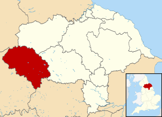
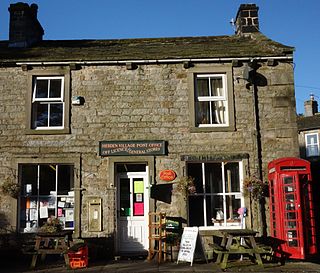
Hebden is a village and civil parish in the Craven District of North Yorkshire, England, and one of four villages in the ecclesiastical parish of Linton. It lies near Grimwith Reservoir and Grassington, in Wharfedale in the Yorkshire Dales National Park. In 2011 it had a population of 246.

The River Washburn is a river in Yorkshire, England. It originates high in the Yorkshire Dales and ends where it meets the River Wharfe. It lies within the Nidderdale Area of Outstanding Natural Beauty.

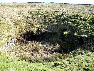
Mossdale Caverns is a cave system in the Yorkshire Dales, England. It is about 5 kilometres (3.1 mi) north of Grassington, and east of Conistone, where Mossdale Beck sinks at the base of Mossdale Scar. It lies at an altitude of 425 metres (1,394 ft) on the eastern flank of Wharfedale, and extends south-east beneath Grassington Moor.

Littondale is a dale in the Craven district of the non-metropolitan county of North Yorkshire, England. It comprises the main settlements of Hawkswick, Arncliffe, Litton, Foxup and Halton Gill, and farmhouses that date from the 17th century. The main waterway in the dale is the River Skirfare which is fed by many small gills and becks.

Recreational caving in the United Kingdom dates back to the mid-19th century. The four major caving areas of the United Kingdom are North Yorkshire, South Wales, Derbyshire, and the Mendips. Minor areas include Devon, North Wales, and the Scottish Highlands.

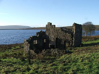
Grimwith Reservoir is located in the Yorkshire Dales in North Yorkshire, England. It was originally built by the Bradford Corporation as one of eleven reservoirs in the Yorkshire Dales to supply fresh water to Bradford. It is the largest reservoir owned by Yorkshire Water in terms of water storage. It is near the villages of Appletreewick, Burnsall, Hartlington, Hebden, and Skyreholme.

Langcliffe Pot is a cave system on the slopes of Great Whernside in Upper Wharfedale, about 3 kilometres (1.9 mi) SSE of Kettlewell in North Yorkshire. It is part of the Black Keld Site of Special Scientific Interest where the "underground drainage system which feeds the stream resurgence at Black Keld is one of the largest and deepest in Britain, although only a small proportion of its cave passages are accessible at present." Mossdale Caverns is also part of the Black Keld SSSI. Although a considerable length of passage has been explored in Langcliffe Pot, the current end is over 170 metres (560 ft) above the resurgence, and over 4 kilometres (2.5 mi) in distance. A trip to the far end has been described as "one of the most serious undertakings in British caving".

Trollers Gill is a limestone gill or gorge in North Yorkshire, England, close to the village of Skyreholme and 4.7 miles (7.5 km) south-east of Grassington in the Yorkshire Dales. The gorge, which is 0.5 miles (0.8 km) in length, is also known as Trollerdale.
The Upper Wharfedale Fell Rescue Association is based in Grassington in the Yorkshire Dales of northern England, and provides help to people and animals in difficulty in the caves and on the fells around Wharfedale, Nidderdale, Littondale and Mid-Airedale. Although it is staffed by approximately 80 volunteers and funded by donations, it is integrated into the emergency services and is called out by the police when there is an appropriate incident. The Upper Wharfedale Fell Rescue Association was founded in 1948, and is the third oldest such team in the UK.

Wharfedale Brewery is a brewery situated in Ilkley in Wharfedale, West Yorkshire, England, on the edge of the Yorkshire Dales National Park. Two, now defunct, breweries in Yorkshire have previously used the Wharfedale name; first in Wetherby in the 1756 and again in Grassington in 2003. The name was resurrected for a third time, further down the River Wharfe, in 2012 by a group of 16 real ale enthusiasts, many of whom are former chairmen of Ilkley & District Round Table.