| Sunshine Mountain | |
|---|---|
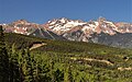
 Northeast aspect | |
| Highest point | |
| Elevation | 12,930 ft (3,940 m) [1] |
| Prominence | 810 ft (250 m) [1] |
| Parent peak | Lizard Head (13,119 ft) [2] |
| Isolation | 1.79 mi (2.88 km) [2] |
| Coordinates | 37°51′30″N107°56′03″W / 37.8583385°N 107.9342234°W [3] |
| Geography | |
 Sunshine Mountain Location in Colorado  Sunshine Mountain Sunshine Mountain (the United States) | |
| Location | San Miguel County Colorado, US |
| Parent range | Rocky Mountains San Juan Mountains |
| Topo map | USGS Mount Wilson |
| Geology | |
| Rock age | Tertiary |
| Climbing | |
| Easiest route | class 2 [2] East ridge |
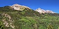
Sunshine Mountain is a 12,930-foot-elevation (3,940-meter) mountain summit located in San Miguel County, in Colorado, United States. [3] It is situated nine miles southwest of the community of Telluride, in the Lizard Head Wilderness, on land managed by Uncompahgre National Forest. It is part of the San Juan Mountains which is a subset of the Rocky Mountains. Sunshine Mountain is situated 24 miles west of the Continental Divide, 2.75 miles east of Wilson Peak, and 1.8 mile northeast of Lizard Head, the nearest higher neighbor. [1] Topographic relief is significant as the west aspect rises 2,700 feet (820 meters) above Bilk Creek in approximately one mile. The mountain is composed of rock of the San Juan Formation overlaying Telluride Conglomerate, in turn overlaying Mancos Shale. [4] The mountain's name, which has been officially adopted by the United States Board on Geographic Names, was in use before 1899 when Henry Gannett published it in A Dictionary of Altitudes in the United States. [5]