Terrain

Last updated
Present-day Earth altimetry and bathymetry. Data from the National Geophysical Data Center's TerrainBase Digital Terrain Model. AYool topography 15min.png
Present-day Earth altimetry and bathymetry. Data from the National Geophysical Data Center's TerrainBase Digital Terrain Model.
Relief map of Sierra Nevada, Spain Maps-for-free Sierra Nevada.png
Relief map of Sierra Nevada, Spain
A shaded and colored image (i.e. terrain is enhanced) of varied terrain from the Shuttle Radar Topography Mission. This shows elevation model of New Zealand's Alpine Fault running about 500 km (300 mi) long. The escarpment is flanked by a vast chain of hills between the fault and the mountains of New Zealand's Southern Alps. Northeast is towards the top. Alpine Fault SRTM (vertical).jpg
A shaded and colored image (i.e. terrain is enhanced) of varied terrain from the Shuttle Radar Topography Mission. This shows elevation model of New Zealand's Alpine Fault running about 500 km (300 mi) long. The escarpment is flanked by a vast chain of hills between the fault and the mountains of New Zealand's Southern Alps. Northeast is towards the top.

Terrain or relief (also topographical relief) involves the vertical and horizontal dimensions of land surface. The term bathymetry is used to describe underwater relief, while hypsometry studies terrain relative to sea level. The Latin word terra (the root of terrain) means "earth."

Contents

In physical geography, terrain is the lay of the land. This is usually expressed in terms of the elevation, slope, and orientation of terrain features. Terrain affects surface water flow and distribution. Over a large area, it can affect weather and climate patterns.

Importance

The understanding of terrain is critical for many reasons:

Relief

Relief (or local relief) refers specifically to the quantitative measurement of vertical elevation change in a landscape. It is the difference between maximum and minimum elevations within a given area, usually of limited extent. [5] A relief can be described qualitatively, such as a "low relief" or "high relief" plain or upland. The relief of a landscape can change with the size of the area over which it is measured, making the definition of the scale over which it is measured very important. Because it is related to the slope of surfaces within the area of interest and to the gradient of any streams present, the relief of a landscape is a useful metric in the study of the Earth's surface. Relief energy, which may be defined inter alia as "the maximum height range in a regular grid", [6] is essentially an indication of the ruggedness or relative height of the terrain.

Geomorphology

Geomorphology is in large part the study of the formation of terrain or topography. Terrain is formed by concurrent processes operating on the underlying geological structures over geological time:

Tectonic processes such as orogenies and uplifts cause land to be elevated, whereas erosional and weathering processes wear the land away by smoothing and reducing topographic features. [7] The relationship of erosion and tectonics rarely (if ever) reaches equilibrium. [8] [9] [10] These processes are also codependent, however the full range of their interactions is still a topic of debate. [11] [12] [13]

Land surface parameters are quantitative measures of various morphometric properties of a surface. The most common examples are used to derive slope or aspect of a terrain or curvatures at each location. These measures can also be used to derive hydrological parameters that reflect flow/erosion processes. Climatic parameters are based on the modelling of solar radiation or air flow.

Land surface objects, or landforms, are definite physical objects (lines, points, areas) that differ from the surrounding objects. The most typical examples airlines of watersheds, stream patterns, ridges, break-lines, pools or borders of specific landforms.

Digital terrain model

3D rendering of a DEM of Tithonium Chasma on Mars Mtm-05277e 3d.png
3D rendering of a DEM of Tithonium Chasma on Mars

A digital elevation model (DEM) or digital surface model (DSM) is a 3D computer graphics representation of elevation data to represent terrain or overlaying objects, commonly of a planet, moon, or asteroid. A "global DEM" refers to a discrete global grid. DEMs are used often in geographic information systems (GIS), and are the most common basis for digitally produced relief maps. A digital terrain model (DTM) represents specifically the ground surface while DEM and DSM may represent tree top canopy or building roofs.

While a DSM may be useful for landscape modeling, city modeling and visualization applications, a DTM is often required for flood or drainage modeling, land-use studies, [14] geological applications, and other applications, [15] and in planetary science.

See also

Related Research Articles

<span class="mw-page-title-main">Erosion</span> Natural processes that remove soil and rock

Erosion is the action of surface processes that removes soil, rock, or dissolved material from one location on the Earth's crust and then transports it to another location where it is deposited. Erosion is distinct from weathering which involves no movement. Removal of rock or soil as clastic sediment is referred to as physical or mechanical erosion; this contrasts with chemical erosion, where soil or rock material is removed from an area by dissolution. Eroded sediment or solutes may be transported just a few millimetres, or for thousands of kilometres.

<span class="mw-page-title-main">Geomorphology</span> Scientific study of landforms

Geomorphology is the scientific study of the origin and evolution of topographic and bathymetric features created by physical, chemical or biological processes operating at or near Earth's surface. Geomorphologists seek to understand why landscapes look the way they do, to understand landform and terrain history and dynamics and to predict changes through a combination of field observations, physical experiments and numerical modeling. Geomorphologists work within disciplines such as physical geography, geology, geodesy, engineering geology, archaeology, climatology, and geotechnical engineering. This broad base of interests contributes to many research styles and interests within the field.

<span class="mw-page-title-main">Peneplain</span> Low-relief plain formed by protracted erosion

In geomorphology and geology, a peneplain is a low-relief plain formed by protracted erosion. This is the definition in the broadest of terms, albeit with frequency the usage of peneplain is meant to imply the representation of a near-final stage of fluvial erosion during times of extended tectonic stability. Peneplains are sometimes associated with the cycle of erosion theory of William Morris Davis, but Davis and other workers have also used the term in a purely descriptive manner without any theory or particular genesis attached.

<span class="mw-page-title-main">Inselberg</span> Isolated, steep rock hill on relatively flat terrain

An inselberg or monadnock is an isolated rock hill, knob, ridge, or small mountain that rises abruptly from a gently sloping or virtually level surrounding plain. In Southern Africa a similar formation of granite is known as a koppie, an Afrikaans word from the Dutch diminutive word kopje. If the inselberg is dome-shaped and formed from granite or gneiss, it can also be called a bornhardt, though not all bornhardts are inselbergs. An inselberg results when a body of rock resistant to erosion, such as granite, occurring within a body of softer rocks, is exposed by differential erosion and lowering of the surrounding landscape.

<span class="mw-page-title-main">Landform</span> Feature of the solid surface of a planetary body

A landform is a natural or anthropogenic land feature on the solid surface of the Earth or other planetary body. Landforms together make up a given terrain, and their arrangement in the landscape is known as topography. Landforms include hills, mountains, canyons, and valleys, as well as shoreline features such as bays, peninsulas, and seas, including submerged features such as mid-ocean ridges, volcanoes, and the great ocean basins.

Landforms are categorized by characteristic physical attributes such as their creating process, shape, elevation, slope, orientation, rock exposure, and soil type.

<span class="mw-page-title-main">Ridge</span> Long, narrow, elevated landform

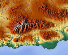
A ridge is a long, narrow, elevated geomorphologic landform, structural feature, or combination of both separated from the surrounding terrain by steep sides. The sides of a ridge slope away from a narrow top, the crest or ridgecrest, with the terrain dropping down on either side. The crest, if narrow, is also called a ridgeline. Limitations on the dimensions of a ridge are lacking. Its height above the surrounding terrain can vary from less than a meter to hundreds of meters. A ridge can be either depositional, erosional, tectonic, or combination of these in origin and can consist of either bedrock, loose sediment, lava, or ice depending on its origin. A ridge can occur as either an isolated, independent feature or part of a larger geomorphological and/or structural feature. Frequently, a ridge can be further subdivided into smaller geomorphic or structural elements.

<span class="mw-page-title-main">Glacial landform</span> Landform created by the action of glaciers

Glacial landforms are landforms created by the action of glaciers. Most of today's glacial landforms were created by the movement of large ice sheets during the Quaternary glaciations. Some areas, like Fennoscandia and the southern Andes, have extensive occurrences of glacial landforms; other areas, such as the Sahara, display rare and very old fossil glacial landforms.

<span class="mw-page-title-main">Hypsometry</span> Measurement of the elevation and depth of features on Earths surface relative to mean sea level.

Hypsometry is the measurement of the elevation and depth of features of the Earth's surface relative to mean sea level.

The geographic cycle, or cycle of erosion, is an idealized model that explains the development of relief in landscapes. The model starts with the erosion that follows uplift of land above a base level and ends, if conditions allow, in the formation of a peneplain. Landscapes that show evidence of more than one cycle of erosion are termed "polycyclical". The cycle of erosion and some of its associated concepts have, despite their popularity, been a subject of much criticism.

<span class="mw-page-title-main">Knickpoint</span> Point on a streams profile where a sudden change in stream gradient occurs

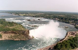
In geomorphology, a knickpoint or nickpoint is part of a river or channel where there is a sharp change in channel slope, such as a waterfall or lake. Knickpoints reflect different conditions and processes on the river, often caused by previous erosion due to glaciation or variance in lithology. In the cycle of erosion model, knickpoints advance one cycle upstream, or inland, replacing an older cycle. A knickpoint that occurs at the head of a channel is called a headcut. Headcuts resulting in headward erosion are hallmarks of unstable expanding drainage features such as actively eroding gullies.

Geomorphometry, or geomorphometrics, is the science and practice of measuring the characteristics of terrain, the shape of the surface of the Earth, and the effects of this surface form on human and natural geography. It gathers various mathematical, statistical and image processing techniques that can be used to quantify morphological, hydrological, ecological and other aspects of a land surface. Common synonyms for geomorphometry are geomorphological analysis, terrain morphometry, terrain analysis, and land surface analysis. Geomorphometrics is the discipline based on the computational measures of the geometry, topography and shape of the Earth's horizons, and their temporal change. This is a major component of geographic information systems (GIS) and other software tools for spatial analysis.

<span class="mw-page-title-main">Décollement</span> Geological feature

Décollement is a gliding plane between two rock masses, also known as a basal detachment fault. Décollements are a deformational structure, resulting in independent styles of deformation in the rocks above and below the fault. They are associated with both compressional settings and extensional settings.

In geology, lake capture is the process of capture of the waters collected in a lake by a neighbor river basin.

<span class="mw-page-title-main">Erosion and tectonics</span> Interactions between erosion and tectonics and their implications

The interaction between erosion and tectonics has been a topic of debate since the early 1990s. While the tectonic effects on surface processes such as erosion have long been recognized, the opposite has only recently been addressed. The primary questions surrounding this topic are what types of interactions exist between erosion and tectonics and what are the implications of these interactions. While this is still a matter of debate, one thing is clear, Earth's landscape is a product of two factors: tectonics, which can create topography and maintain relief through surface and rock uplift, and climate, which mediates the erosional processes that wear away upland areas over time. The interaction of these processes can form, modify, or destroy geomorphic features on Earth's surface.

<span class="mw-page-title-main">Pediment (geology)</span> Very gently sloping inclined bedrock surface

A pediment, also known as a concave slope or waning slope, is a very gently sloping (0.5°-7°) inclined bedrock surface. It is typically a concave surface sloping down from the base of a steeper retreating desert cliff, escarpment, or surrounding a monadnock or inselberg, but may persist after the higher terrain has eroded away.

<span class="mw-page-title-main">Drainage system (geomorphology)</span> Patterns formed by streams, rivers, and lakes in a drainage system

In geomorphology, drainage systems, also known as river systems, are the patterns formed by the streams, rivers, and lakes in a particular drainage basin. They are governed by the topography of land, whether a particular region is dominated by hard or soft rocks, and the gradient of the land. Geomorphologists and hydrologists often view streams as part of drainage basins. This is the topographic region from which a stream receives runoff, throughflow, and its saturated equivalent, groundwater flow. The number, size, and shape of the drainage basins varies and the larger and more detailed the topographic map, the more information is available.

<span class="mw-page-title-main">Avulsion (river)</span> Rapid abandonment of a river channel and formation of a new channel

In sedimentary geology and fluvial geomorphology, avulsion is the rapid abandonment of a river channel and the formation of a new river channel. Avulsions occur as a result of channel slopes that are much less steep than the slope that the river could travel if it took a new course.

In geology, the term exhumation refers to the process by which a parcel of rock, approaches Earth's surface.

<span class="mw-page-title-main">River incision</span>

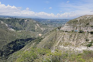
River incision is the narrow erosion caused by a river or stream that is far from its base level. River incision is common after tectonic uplift of the landscape. Incision by multiple rivers result in a dissected landscape, for example a dissected plateau. River incision is the natural process by which a river cuts downward into its bed, deepening the active channel. Though it is a natural process, it can be accelerated rapidly by human factors including land use changes such as timber harvest, mining, agriculture, and road and dam construction. The rate of incision is a function of basal shear-stress. Shear stress is increased by factors such as sediment in the water, which increase its density. Shear stress is proportional to water mass, gravity, and WSS:

References

  1. Dwevedi, Alka; Kumar, Promod; Kumar, Pravita; Kumar, Yogendra; Sharma, Yogesh K.; Kayastha, Arvind M. (January 1, 2017). Grumezescu, Alexandru Mihai (ed.). "15 - Soil sensors: detailed insight into research updates, significance, and future prospects". New Pesticides and Soil Sensors . Academic Press: 561–594. doi:10.1016/B978-0-12-804299-1.00016-3. ISBN   978-0-12-804299-1 . Retrieved October 11, 2022.
  2. Baker, N.T.; Capel, P.D. (2011). "Environmental factors that influence the location of crop agriculture in the conterminous United States". U.S. Geological Survey Scientific Investigations Report 2011–5108. U.S. Geological Survey. p. 72.
  3. Brush, L. M. (1961). Drainage basins, channels, and flow characteristics of selected streams in central Pennsylvania (PDF). U.S. Department of the Interior, GEOLOGICAL SURVEY. Washington D.C.: U.S. Geological Survey. pp. 1–44. Retrieved October 29, 2017.
  4. "Joint Publication 1-02" (PDF). Department of Defense Dictionary of Military and Associated Terms. * "compartmentation ... [involves] areas bounded on at least two sides by terrain features such as woods..."
    * "culture — A feature of the terrain that has been constructed by man. Included are such items as roads, buildings, and canals; boundary lines; and, in a broad sense, all names and legends on a map."
    * "key terrain — Any locality, or area, the seizure or retention of which affords a marked advantage to either combatant."
    * "terrain intelligence — Intelligence on the military significance of natural and manmade characteristics of an area."
  5. Summerfield, M.A. (1991). Global Geomorphology. Pearson. p. 537. ISBN   9780582301566.
  6. Bollig, Michael; Bubenzer, Olaf, eds. (2009). African Landscapes: Interdisciplinary Approaches. Cologne: Springer. p. 48. ISBN   9780387786827 via Google Books.
  7. Strak, V.; Dominguez, S.; Petit, C.; Meyer, B.; Loget, N. (2011). "Interaction between normal fault slip and erosion on relief evolution; insights from experimental modelling" (PDF). Tectonophysics . 513 (1–4): 1–19. Bibcode:2011Tectp.513....1S. doi:10.1016/j.tecto.2011.10.005.
  8. Gasparini, N.; Bras, R.; Whipple, K. (2006). "Numerical modeling of non–steady-state river profile evolution using a sediment-flux-dependent incision model. Special Paper". Geological Society of America . 398: 127–141. doi:10.1130/2006.2398(08).
  9. Roe, G.; Stolar, D.; Willett, S. (2006). "Response of a steady-state critical wedge orogen to changes in climate and tectonic forcing. Special Paper". Geological Society of America . 398: 227–239. doi:10.1130/2005.2398(13).
  10. Stolar, D.; Willett, S.; Roe, G. (2006). "Climatic and tectonic forcing of a critical orogen. Special Paper". Geological Society of America . 398: 241–250. doi:10.1130/2006.2398(14).
  11. Wobus, C.; Whipple, K.; Kirby, E.; Snyder, N.; Johnson, J.; Spyropolou, K.; Sheehan, D. (2006). "Tectonics from topography: Procedures, promise, and pitfalls. Special Paper". Geological Society of America . 398: 55–74. doi:10.1130/2006.2398(04).
  12. Hoth et al. (2006) , pp. 201–225; Bonnet, Malavieille & Mosar (2007); King, Herman & Guralnik (2016) , pp. 800–804
  13. University of Cologne (23 August 2016). "New insights into the relationship between erosion and tectonics in the Himalayas". ScienceDaily .
  14. I. Balenovic, H. Marjanovic, D. Vuletic, etc. Quality assessment of high density digital surface model over different land cover classes. PERIODICUM BIOLOGORUM. VOL. 117, No 4, 459–470, 2015.
  15. "Appendix A – Glossary and Acronyms" (PDF). Severn Tidal Tributaries Catchment Flood Management Plan – Scoping Stage. UK: Environment Agency. Archived from the original (PDF) on 2007-07-10.

Bibliography

Further reading

Wiktionary-logo-en-v2.svg The dictionary definition of terrain at Wiktionary