
Ransom Township is a civil township of Hillsdale County in the U.S. state of Michigan. The population was 932 at the 2010 census.
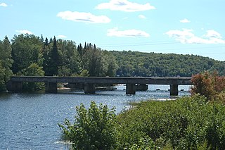
Trunk Line Bridge No. 1, also known as Peshekee River Bridge, is a bridge adjacent to US Highway 41/M-28 (US 41/M-28). It was the first of many trunkline bridges designed by the Michigan State Highway Department. It was built in 1914, and listed on the National Register of Historic Places in 1999.

The Chicago Drive Bridge, also known as the Business Route M-21–Plaster Creek Bridge, is a bridge in Wyoming, Michigan, carrying Business Spur I-196 over Plaster Creek. It was listed on the National Register of Historic Places in 1999.

The Division Avenue–Plaster Creek Bridge was a historic bridge in Grand Rapids, Michigan, carrying Division Avenue over Plaster Creek. It was listed on the National Register of Historic Places in 1999. The bridge was demolished and replaced in 2007.

The US 41–Fanny Hooe Creek Bridge is a highway bridge located on US Highway 41 (US 41) over the Fanny Hooe Creek about one mile east of Copper Harbor, adjacent to Fort Wilkins State Park, in Grant Township, Michigan. It was listed on the National Register of Historic Places in 1999.
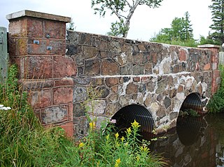
The M-26–Cedar Creek Culvert is a short highway bridge located on M-26 over Cedar Creek in Eagle Harbor Township, Michigan. The Keweenaw County Road Commission built the bridge in 1930; they also built the M-26–Silver River Culvert and the US 41–Fanny Hooe Creek Bridge around the same time. The M-26–Cedar Creek Culvert was listed on the National Register of Historic Places in 1999.

The Jefferson Avenue–Huron River and Harbin Drive–Silver Creek Canal Bridges are two separate bridges, sharing a continuous railing, that were jointly listed on the National Register of Historic Places on February 10, 2000.
The Old M-95–Michigamme River Bridge is a bridge located on Old M-95 as it passes over the Michigamme River in Republic Township, Michigan. It was listed on the National Register of Historic Places in 1999.
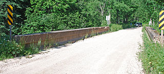
The King Road–Whitefish River Bridge is a bridge located on King Road over the Whitefish River in Limestone Township, Michigan. It was listed on the National Register of Historic Places in 1999.

The Mackinac Trail–Carp River Bridge is a bridge located on H-63 over the Carp River in St. Ignace Township, Michigan. It is the oldest bridge in Mackinac County, and was listed on the National Register of Historic Places in 1999.

The Old US 41–Backwater Creek Bridge is a bridge located on an abandoned section of US Highway 41 (US 41) over Backwater Creek in Baraga Township, Michigan. It was listed on the National Register of Historic Places in 1999.
The Mansfield Road–Michigamme River Bridge was a bridge located on Mansfield Road over the Michigamme River in Mansfield Township, Michigan. It was listed on the National Register of Historic Places in 1999.

The North Watervliet Road–Paw Paw Lake Outlet Bridge, also known as Trunk Line Bridge No. 57, was an arch bridge in Watervliet Township, Michigan, that carried North Watervliet Road over the outlet of Paw Paw Lake into the Paw Paw River. It is listed on the National Register of Historic Places. The bridge was demolished and replaced about 2008.
The Second Street–Gun River Bridge was a bridge in Martin Township, Michigan, USA. It was demolished in 2012. The bridge was significant as a rare example of a bridge with a plaque stating that it had been built as a result of Michigan's Covert Act. It was also one of the few remaining examples of a camelback highway bridge in Michigan.
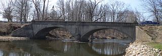
The 12 Mile Road–Kalamazoo River Bridge, also known as State Reward Bridge No. 53, is a filled-spandrel concrete arch bridge in Ceresco, Michigan, that carries 12 Mile Road over the Kalamazoo River. Built in 1920, it is listed on the National Register of Historic Places.

The 23 Mile Road–Kalamazoo River Bridge is a curved-chord through-girder bridge in Marengo Township, Michigan, that carries 23 Mile Road over the Kalamazoo River. Built in 1922, it is listed on the National Register of Historic Places.
The Ocqueoc Falls Highway–Ocqueoc River Bridge is a highway bridge located on the Ocqueoc Falls Highway over Ocqueoc River in Ocqueoc Township, Michigan. It was listed on the National Register of Historic Places in 1999. It is significant as a well-preserved early example of concrete arch bridges constructed by the Michigan State Highway Department.

Bridge No. 3589 in Silver Creek Township, Minnesota is a reinforced concrete arch bridge carrying Minnesota State Highway 61 over the Stewart River just north of Two Harbors, Minnesota. The bridge was built in 1924, originally with a 70 feet (21 m) span and a width of 19 feet (5.8 m). It was widened to 39 feet (12 m) in 1939 because of increasing traffic loads. The bridge was listed on the National Register of Historic Places in 1998.
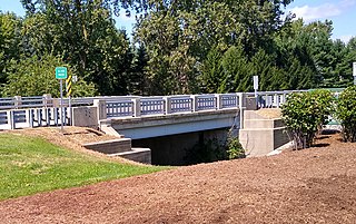
The Murray D. Van Wagoner Memorial Bridge is a bridge carrying M-156 over Silver Creek in Morenci, Michigan. It was listed on the National Register of Historic Places in 2000.
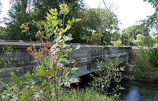
The M-50–Sandstone Creek Bridge, also known as th Tompkins Bridge, is a road bridge carrying M-50 over Sandstone Creek in Tompkins Township, Michigan. It was listed on the National Register of Historic Places in 2000.


