
New Haven County is a county in the south central part of the U.S. state of Connecticut. As of the 2020 census, the population was 864,835, making it the third-most populous county in Connecticut. Two of the state's top 5 largest cities, New Haven (3rd) and Waterbury (5th), are part of New Haven County.

Branford is a shoreline town located on Long Island Sound in New Haven County, Connecticut, United States, about 6 miles (10 km) east of downtown New Haven. The town is part of the South Central Connecticut Planning Region. Branford borders East Haven to the west, Guilford to the east, and North Branford to the north. The population was 28,273 in the 2020 census.
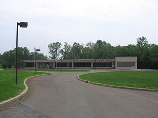
North Branford is a town in New Haven County, Connecticut, United States. The town is part of the South Central Connecticut Planning Region. The population was 13,544 at the 2020 census. The town is primarily known for agriculture and for other points of interest including Lake Gaillard and Northford Ice Pavilion. Wallingford, Durham, and North Haven border it to the north- East Haven to the west, Guilford to the east, and Branford to the south.

Clarksville is a town in northern Coös County, New Hampshire, United States. The population was 294 at the 2020 census. It is part of the Berlin, NH–VT Micropolitan Statistical Area.

New City is a hamlet and census-designated place in the town of Clarkstown, Rockland County, New York, United States, part of the New York Metropolitan Area. An affluent suburb of New York City, the hamlet is located 18 miles (29 km) north of the city at its closest point, Riverdale, Bronx. Within Rockland County, New City is located north of Bardonia, northeast of Nanuet, east of New Square and New Hempstead, south of Garnerville and the village of Haverstraw, and west of Congers. New City's population was 35,101 at the 2020 census, making it the 14th most populous CDP/hamlet in the state of New York.

East Haven is a town in New Haven County, Connecticut, in the United States. As of the 2020 census, the town population was 27,923. The town is located 3 miles (5 km) east of New Haven, and is part of the South Central Connecticut Planning Region. East Haven is 35 miles (56 km) from Hartford, 82 miles (132 km) from New York City, 99 miles (159 km) from Providence, Rhode Island, and 140 miles (230 km) from Boston.

Ridgefield is a town in Fairfield County, Connecticut, United States. Situated in the foothills of the Berkshire Mountains, Ridgefield has a population of 25,033 as of the 2020 census. The town is part of the Western Connecticut Planning Region. The town center, which was formerly a borough, is defined by the U.S. Census Bureau as a census-designated place. The town was settled then quickly incorporated by 1709.
Independence Pass, originally known as Hunter Pass, is a high mountain pass in central Colorado, United States. It is at elevation 12,095 ft (3,687 m) on the Continental Divide in the Sawatch Range of the Rocky Mountains. The pass is midway between Aspen and Twin Lakes, on the border between Pitkin and Lake counties.

Interstate 95 (I-95) is the main north–south Interstate Highway on the East Coast of the United States, running in a general east–west compass direction for 111.57 miles (179.55 km) in Connecticut, from the New York state line to the Rhode Island state line. I-95 from Greenwich to East Lyme is part of the Connecticut Turnpike, during which it passes through the major cities of Stamford, Bridgeport, and New Haven. After leaving the turnpike in East Lyme, I-95 is known as the Jewish War Veterans Memorial Highway and passes through New London, Groton, and Mystic, before exiting the state through North Stonington at the Rhode Island border.

Cannondale is a census-designated place (CDP) within the town of Wilton in Fairfield County, Connecticut. It had a population of 141 at the 2010 census. The neighborhood consists of many old homes on large, almost rural lots now largely wooded. The English first settled the land in the 17th century. At the center of Cannondale is Cannon Crossing, a small shopping village of boutiques and restaurants made up of 19th-century buildings restored by actress June Havoc in the late 1970s on the east side of Cannondale Railroad Station. Both are part of Cannondale Historic District, which encompasses the central part of Cannondale and most of its significant historical buildings.

The Metacomet Ridge, Metacomet Ridge Mountains, or Metacomet Range of southern New England is a narrow and steep fault-block mountain ridge known for its extensive cliff faces, scenic vistas, microclimate ecosystems, and rare or endangered plants. The ridge is an important recreation resource located within 10 miles (16 km) of more than 1.5 million people, offering four long-distance hiking trails and over a dozen parks and recreation areas, including several historic sites. It has been the focus of ongoing conservation efforts because of its natural, historic, and recreational value, involving municipal, state, and national agencies and nearly two dozen non-profit organizations.

Totoket Mountain, with a high point of (est.) 720 ft (220 m) above sea level, is a traprock massif with several distinct summits, located 7 mi (11 km) northeast of New Haven, Connecticut. It is part of the Metacomet Ridge that extends from the Long Island Sound near New Haven, north through the Connecticut River Valley of Massachusetts to the Vermont border. Totoket Mountain is known for its 500 ft-high (150 m) scenic cliffs, microclimate ecosystems, rare plant communities, and for Lake Gaillard, a 2.5 mi-wide (4.0 km) public reservoir nearly enclosed by the mountain. The north ridge of Totoket Mountain is traversed by the 50 mi (80 km) Mattabesett Trail and a significant network of shorter trails. The name "Totoket Mountain" applies to both the entire mountain and to a subordinate northwestern peak.

Saltonstall Mountain, also known as Saltonstall Ridge, with a high point of (est.) 320 feet (98 m) above sea level, is a traprock mountain ridge located 3 miles (5 km) east of New Haven, Connecticut and 1.75 miles (2.8 km) north of Long Island Sound. It is part of the Metacomet Ridge that extends from Long Island Sound near New Haven, Connecticut, north through the Connecticut River Valley of Massachusetts to the Vermont border. Saltonstall Mountain is known for its 100 foot (30 m) scenic cliff faces and sharp ridgeline, unique microclimate ecosystems, rare plant communities, and for Lake Saltonstall, a 3 miles (5 km) long by 0.3 miles (400 m) wide municipal reservoir nearly enclosed by the mountain. Saltonstall Mountain is traversed by a number of hiking trails managed by the South Central Connecticut Regional Water Authority (SCCRWA) and Branford Land Trust.
Beacon Hill, (est.) 130 feet (40 m) above sea level, is a traprock outcrop located 1.2 miles (1.9 km) southeast of New Haven, Connecticut overlooking the mouth of the Farm River 1.2 miles north of Long Island Sound. It is the southernmost notable summit of the Metacomet Ridge which extends from Long Island Sound near New Haven, Connecticut, north through the Connecticut River Valley of Massachusetts to nearly the Vermont border. Beacon Hill is known for its scenic ledges overlooking a surrounding salt marsh and the greater Sound and for its unique microclimate ecosystems and rare plant communities. Beacon Hill is traversed by several trails, most notably the 28-mile (45 km) Branford Trail. The Shoreline Trolley Museum runs trolley service to the base of the hill.

U.S. Route 93 is a north–south U.S. Highway in the U.S. state of Idaho.

Balsam Lake Mountain is one of the Catskill Mountains, located in the Town of Hardenburgh, New York, United States. It is the westernmost of the range's 35 High Peaks. Its exact height has not been determined, but the highest contour line on topographic maps, 3,720 feet (1,130 m), is usually given as its elevation.

Brace Mountain is the peak of a ridge in the southern Taconic Mountains, near the tripoint of the U.S. states of New York, Connecticut and Massachusetts. Its 2,311-foot (704 m) main summit is located in New York; it is the highest point in that state's Dutchess County.

The Branford Point Historic District is a historic district in Branford, Connecticut. It was listed on the National Register of Historic Places in 1988. It includes a significant portion of the Branford Point neighborhood, generally considered to be the area along the west side of the Branford Harbor to the Amtrak railroad tracks. It is bounded on the west by the Short Beach neighborhood, on the north by Branford Center, and on the east by the Branford River. Harbor Street, Maple Avenue, and Stannard Avenue are the main thoroughfares of the neighborhood. In the 2000 Census, Branford Point was included by the U.S. Census Bureau in the Branford Center census-designated place.

Moose Mountain is an 8-mile (13 km)-long ridge located in the eastern part of the town of Hanover in Grafton County, New Hampshire. The mountain is flanked to the north by Holts Ledge, at 2,110 feet (640 m), and to the south by Shaker Mountain, at 1,690 feet (520 m). It is traversed by the Appalachian Trail, a 2,170-mile (3,490 km) National Scenic Trail from Georgia to Maine. Moose Mountain is outside the White Mountain National Forest, but the trail runs through a narrow corridor along the ridge which is administered by the U.S. Forest Service. The trail can be accessed from the south along Three Mile Road in Hanover, and from the north along Goose Pond Road in Lyme, New Hampshire.
Lake Gaillard in North Branford, Connecticut, began during the 1920s, when the New Haven Water Company started buying land in North Branford from the area of Totoket Mountain to what is now known as Sea Hill Road, with the intention of building a reservoir. "The regional water authority currently owns 34.9% of the land within North Branford, most of these holdings surrounds Lake Gaillard, the largest reservoir within the Regional Water Authority’s water supply."