
New Haven County is a county in the south central part of the U.S. state of Connecticut. As of the 2020 census, the population was 864,835, making it the third-most populous county in Connecticut. Two of the state's top 5 largest cities, New Haven (3rd) and Waterbury (5th), are part of New Haven County.

New Hartford is a town in Litchfield County, Connecticut, United States. The population was 6,658 at the 2020 census. The town is part of the Northwest Hills Planning Region. The town center is defined by the U.S. Census Bureau as the New Hartford Center census-designated place (CDP). The town is mainly a rural community consisting of farms, homes, and parks. Brodie Park and Ski Sundown are located in New Hartford.

Woodbury is a town in Litchfield County, Connecticut, United States. The town is part of the Naugatuck Valley Planning Region. The population was 9,723 at the 2020 census. The town center, comprising the adjacent villages of Woodbury and North Woodbury, is designated by the U.S. Census Bureau as the Woodbury Center census-designated place (CDP). Woodbury was founded in 1673.
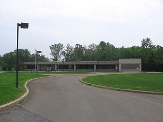
North Branford is a town in New Haven County, Connecticut, United States. The town is part of the South Central Connecticut Planning Region. The population was 13,544 at the 2020 census. The town is primarily known for agriculture and for other points of interest including Lake Gaillard and Northford Ice Pavilion. Wallingford, Durham, and North Haven border it to the north- East Haven to the west, Guilford to the east, and Branford to the south.
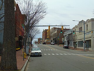
Wallingford is a town in New Haven County, Connecticut, United States, centrally located between New Haven and Hartford, and Boston and New York City. The town is part of the South Central Connecticut Planning Region. The population was 44,396 at the 2020 census. The community was named after Wallingford, in England.
Willimantic is a census-designated place located in the town of Windham in Windham County, Connecticut, United States. It is a former city and borough, and is currently organized as one of two tax districts within the Town of Windham. Willimantic is part of the Southeastern Connecticut Planning Region. Known as "Thread City" for the American Thread Company's mills along the Willimantic River, it was a center of the textile industry in the 19th century. Originally incorporated as a city in 1893, it entered a period of decline after the Second World War, culminating in the mill's closure and the city's reabsorption into the town of Windham in the 1980s. Heroin use, present since the 1960s, became a major public health problem in the early 2000s, declining somewhat by the 2010s. Though the city was a major rail hub, an Interstate Highway has never passed within ten miles, despite early plans to connect it.

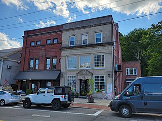
Branford Center is a neighborhood and census-designated place (CDP) in the town of Branford, Connecticut, United States. The CDP encompasses the traditional town center area and the area known as Branford Point. The population of the CDP was 5,819 at the 2010 census.
Linwood is a census-designated place (CDP) in Delaware County, Pennsylvania, United States. The population was 3,281 at the 2010 census.

East Haven is a town in New Haven County, Connecticut, in the United States. As of the 2020 census, the town population was 27,923. The town is located 3 miles (5 km) east of New Haven, and is part of the South Central Connecticut Planning Region. East Haven is 35 miles (56 km) from Hartford, 82 miles (132 km) from New York City, 99 miles (159 km) from Providence, Rhode Island, and 140 miles (230 km) from Boston.
Clinton is a census-designated place (CDP) comprising the primary village in the town of Clinton, Middlesex County, Connecticut, United States. It is in the southwest corner of the town, bordered to the west, across the Hammonasset River, by the town of Madison in New Haven County, to the north by Interstate 95, and to the south by Clinton Harbor, an inlet of Long Island Sound. As of the 2020 census, the CDP had a population of 3,441, out of 13,185 in the entire town of Clinton.
East Hampton is a census-designated place (CDP) comprising the primary village and adjacent residential and rural land in the town of East Hampton, Middlesex County, Connecticut, United States. It is in the central and eastern portions of the town, bordered to the north by the East Hampton community of Lake Pocotopaug and to the east by the town of Colchester in New London County and the town of Marlborough in Hartford County. As of the 2020 census, the East Hampton CDP had a population of 2,960, out of 12,717 in the entire town of East Hampton.

North Haven is a town in New Haven County, Connecticut on the outskirts of New Haven, Connecticut. The town is part of the South Central Connecticut Planning Region. As of the 2020 census, it had a population of 24,253.

Greater New Haven is the metropolitan area whose extent includes those towns in the U.S. state of Connecticut that share an economic, social, political, and historical focus on the city of New Haven. It occupies the south-central portion of the state, in a radius around New Haven.

Riverton is an unincorporated village and census-designated place (CDP) in the town of Barkhamsted, Litchfield County, Connecticut, United States. It is in the northwest corner of the town, bordered to the north by the town of Hartland in Hartford County. The village sits at the confluence of the Still River with the West Branch of the Farmington River.

Greene is an unincorporated village and census-designated place in the western part of the town of Coventry, Rhode Island, United States. As of the 2010 census it had a population of 888. It is 2 miles (3 km) east of the Connecticut border and the same distance north of West Greenwich. The name derives from Nathanael Greene, a Rhode Island-born general in the American Revolution.

The Episcopal Diocese of Connecticut is a diocese of the Episcopal Church in the United States of America, encompassing the entire state of Connecticut. It is one of the nine original dioceses of the Episcopal Church and one of seven New England dioceses that make up Province 1.

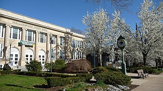
Wallingford Center is a census-designated place (CDP) comprising the primary community in the town of Wallingford, New Haven County, Connecticut, United States. It is in the central and southern parts of the town, bordered to the west by the Wilbur Cross Parkway, to the east by Interstate 91, and to the south by the town of North Haven. To the north the CDP extends to New Rock Hill Road, Durham Road, Christian Street, North Elm Street, Maplewood Avenue, and up North Main Street as far as Yale Avenue, where it crosses the Wilbur Cross Parkway. U.S. Route 5 is the main north–south road through the community. To the north is the neighborhood of Yalesville.

Route 139 is a state highway in southern Connecticut running from Branford to North Branford.

Aquasco is an unincorporated area and census-designated place in southeastern Prince George's County, Maryland, United States, surrounding the town of Eagle Harbor and bordering Charles County. As of the 2020 census, the CDP had a population of 913. Aquasco was home to the Aquasco Speedway.

Peter Anthony Rosazza is an American prelate of the Roman Catholic Church. He served as an auxiliary bishop of the Archdiocese of Hartford from 1978 to 2010.


