
Azua is a province which is collectively one of the thirty-two provinces of the Dominican Republic. It is divided into 10 municipalities and its capital city is Azua de Compostela. It is bordered by the provinces of La Vega to the north-east, San José de Ocoa and Peravia to the east, Barahona and Baoruco to the west and San Juan to the north-west. To the south, Azua has a significant coastline of the Caribbean Sea. Azua is known for its diverse geography and climate, with the southern part of the province having an arid climate that is not the typical tropical-like that is found in other parts of the Caribbean.
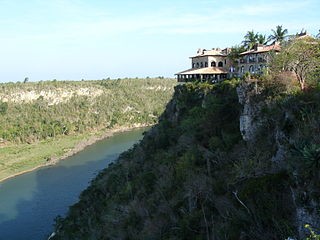
La Romana is a province of the Dominican Republic. The capital is also named La Romana, and is the third-largest city in the country. La Romana was elevated to the category of province in 1944. File:Catalina Island, La Romana, Dominican Republic. A cruise liner in coast waters of Catalina Isl, approaching the rocky shore. .jpg La Romana is also home to Casa de Campo, one of the world's largest resorts and top golfing destinations, including the Teeth of the Dog golf course. Many international and local artists perform at "Altos de Chavón", an artistic community and university.

Peravia is a province in the southern region of the Dominican Republic. Before January 1, 2002 it was included in what is the new San José de Ocoa province, and published statistics and maps generally relate it to the old, larger, Peravia.

Santiago Rodríguez is a province in the northwest region of the Dominican Republic. It was split from Monte Cristi in 1948. The Santiago Rodríguez province has the Monte Cristi and Valverde provinces to the north, the Santiago province to the east, the San Juan and Elías Piña provinces to the south and the Dajabón province to the west.

Jarabacoa is a town located in the central region of the Dominican Republic. It is the second largest municipality in La Vega Province.
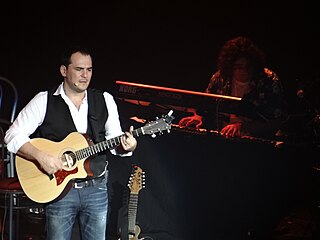
Ismael Serrano is a singer-songwriter and guitarist from Spain, popular in Spain and Latin America, known for his often political lyrics and eclectic musical influences. During his creative career he has been influenced by other Spanish singer-songwriters such as Joaquín Sabina, Joan Manuel Serrat and the Cuban Silvio Rodríguez amongst others. His music also shows influences from renowned poets such as Luis García Montero and Mario Benedetti.
Carlos Alzugaray Treto is a Cuban diplomat and educator.
General elections were held in Guatemala on 1 March 1970. No candidate received over 50% of the vote in the presidential election, resulting in Carlos Manuel Arana Osorio being elected by Congress on 21 March by a vote of 37 to 17. The National Liberation Movement–Institutional Democratic Party alliance also won the Congressional elections. Voter turnout was 54% in the presidential election and 53% in the Congressional elections.

Barrio Playa, also known as Playa de Ponce, Ponce Playa, or La Playa, is one of the thirty-one barrios that comprise the municipality of Ponce, Puerto Rico. Along with Bucaná, Canas, Vayas, and Capitanejo, Playa is one of the municipality's five coastal barrios. Barrio Playa also incorporates several islands, the largest of which is Caja de Muertos. It was founded in 1831.

The Sierra de las Quijadas National Park is a national park located in the northwestern part of the Argentine province of San Luis. It was established on December 10, 1991, to protect the natural features, representative of the Semiarid Chaco and the High Monte ecoregions.

Bucaná is one of the 31 barrios of the municipality of Ponce, Puerto Rico. Together with Canas, Playa, Vayas, and Capitanejo, Bucaná is one of the municipality's five coastal barrios. The name of this barrio is of native Indian origin. It was founded in 1831.
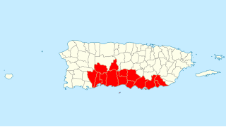
Porta Caribe is a tourism region in southern Puerto Rico. It was established in 2003 by the Puerto Rico Tourism Company, an agency of the Government of Puerto Rico. When created in 2003 it consisted of 14 municipalities in the south central zone. With the creation of the neighboring Porta Cordillera zone in July 2012, the municipalities of Adjuntas and Jayuya were transferred to the newly created Porta Cordillera zone and Porta Caribe became a 12-municipality tourism region. The name Porta Caribe translates to "Doorway to the Caribbean." Its executive director is Maritza W. Ruiz Cabán.

José Florencio Fernández Santillán is a political science professor and researcher at Monterrey Institute of Technology and Higher Education, Mexico City. He and his work appear in academic and popular media in Mexico.
Hilda María Herzer was an Argentine sociologist, environmentalist and professor. She was a researcher with FLACSO, and visiting professor at Universidad Nacional del Litoral.
Emilio Luis Sempris Ceballos is a Panamanian politician and sustainability advocate. He served as Panama's minister of environment from 2017 to 2019. He also served as director general of the Water Center for the Humid Tropics of Latin America and the Caribbean (CATHALAC) between 2002 and 2012. In 2021, he was appointed as Distinguished Advisor of the Integrity Council for the Voluntary Carbon Market (ICVCM).
Nature Reserve of Puerto Rico is a title and special designation given by the upper house of the Legislative Assembly of Puerto Rico to specific natural areas or features throughout the territory. All nature reserves in Puerto Rico are protected by Puerto Rico Law #150, first approved on August 8, 1988, better known as the Puerto Rico Natural Heritage Program Act that seeks to protect the natural resources of the island for the purpose of natural preservation and tourism. These are managed by different agencies within the Puerto Rico Department of Natural and Environmental Resources, public-private partnerships such as the Conservation Trust of Puerto Rico and its management unit Para la naturaleza, and other grassroots and community institutions and programs.
