
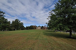
The New Haven Green is a 16-acre (65,000 m2) privately owned park and recreation area located in the downtown district of the city of New Haven, Connecticut, United States. It comprises the central square of the nine-square settlement plan of the original Puritan colonists in New Haven, and was designed and surveyed by colonist John Brockett. Today the Green is bordered by the modern paved roads of College, Chapel, Church, and Elm streets. Temple Street bisects the Green into upper (northwest) and lower (southeast) halves.

The Canterbury Center Historic District is a historic district in Canterbury, Connecticut. The district is centered on the town green, located at the junction of Route 169 and Route 14. It has been the town center since 1705, and includes a fine assortment of 18th and early 19th-century architecture. It was listed on the National Register of Historic Places (NRHP) in 1998.
The Woodstock Hill Historic District is a historic district encompassing the historic village center of Woodstock, Connecticut. It is centered on the Woodstock Green, extending south from there toward the junction of Connecticut Route 169 and Plaine Hill Road. Major buildings in the district include the 1821 Congregational Church, the buildings of Woodstock Academy, and Roseland Cottage, a National Historic Landmark that is one of the nation's finest Gothic Revival summer houses. The district was listed on the National Register of Historic Places in 1999.

The Clinton Village Historic District encompasses the historic portion of the town center of Clinton, Connecticut. It is roughly linear and extends along East Main Street from the Indian River in the west to Old Post Road in the east. The area represents a well-preserved mid-19th century town center, with architecture dating from the late 17th to mid-20th centuries. The district was listed on the National Register of Historic Places in 1994.

The South Britain Historic District encompasses the core of the unincorporated village of South Britain in Southbury, Connecticut, United States. The village arose in the 18th century as an industrial center serving the surrounding agricultural community, powered by the Pomperaug River, and rivalled the town center of Southbury in importance. The district was listed on the National Register of Historic Places in 1987.

Stafford Hollow, also known as Stafford, Stafford Village, or Furnace Hollow, is a village in the town of Stafford, in Tolland County, Connecticut, located at the junction of Route 19 and Route 319. Stafford Hollow was the town center of Stafford during the 18th and 19th centuries, before the growth of the village of Stafford Springs.

The Milton Center Historic District encompasses the historic 19th-century village center of Milton in the northwestern part of the town of Litchfield, Connecticut. Basically linear, it stretches from Milton Cemetery in the west to the junction of Milton and Shearshop Roads in the east, including houses, churches, schools, and the remains of industrial sites. The district was listed on the National Register of Historic Places in 1986.

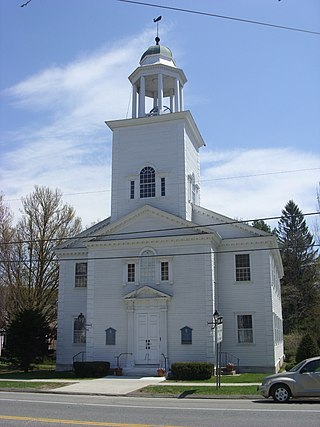
Norwichtown is a historic neighborhood in the city of Norwich, Connecticut. It is generally the area immediately north of the Yantic River between I-395 and Route 169.

Bolton Green Historic District is a historic district that includes the town green, Bolton Green, of the town of Bolton, Connecticut. The green and the surrounding buildings were listed on the National Register of Historic Places in 2001. The district encompasses 9 buildings, 1 site, 4 structures, and 2 objects that contribute to the historical significance of the area. The district extends east about 500 yards (460 m) from the green along Bolton Center Road. The oldest existing buildings around the Green are the former tavern and the Bolton General Store. The most prominent building around the Green is the Bolton Congregational Church, a Greek Revival structure built in 1818 with a truncated box-spire. Other structures around the green are a house facing the green on the east side built in the 1840s, and a new ranch house that was built on the former site of an 1870s house that was destroyed by fire. Other properties in the district includes the Brick Tavern, the site of Bolton's first post office, the town hall, the Tuthill residence, and the Bolton Heritage Farm.

Willington Common Historic District is a historic district that includes the town green, Willington Common, of the town of Willington, Connecticut. The common and the surrounding buildings were listed on the National Register of Historic Places in 1990.

The Tolland Green Historic District is a historic district that includes the town green, Tolland Green, of Tolland, Connecticut.

Wolcott Green Historic District a historic district in the New England town of Wolcott, Connecticut. The district encompasses the town green and the surrounding buildings. The green is located in the town center of Wolcott along Center Road. It has a triangular shape and is surrounded by several houses, a church and the town hall. The other streets bounding the green are Bound Line Road and Kenea Avenue.

Fort Golgotha and the Old Burial Hill Cemetery is the site of an historic cemetery, officially known as the "Old Burying Ground", and the location of a former Revolutionary War-era fort, known as Fort Golgotha, at Main Street and Nassau Road in Huntington, New York. It is located in the Old Town Green Historic District and Old Town Hall Historic District.
The Andover Center Historic District encompasses the historic town center of Andover, Connecticut. Centered on the junction of Hebron Road with Center Street and Cider Mill Road, the district includes houses dating to the town's early history, civic buildings including a library and former town hall, and the town's first cemetery. The district was listed on the National Register of Historic Places in 2003.

Ellington Center Historic District is an 80-acre (32 ha) historic district in the town of Ellington, Connecticut that was listed on the National Register of Historic Places in 1990.
The Somers Historic District encompasses the historic civic and social center of the town of Somers, Connecticut. It stretches along Main Street, with extensions along Springfield Road and Battle Street, and includes a significant number of vernacular Federal and Greek Revival houses. It includes the town's early churches, as well as important civic buildings, including the town hall and library. The district was listed on the National Register of Historic Places in 1982.

Hebron Center Historic District encompasses most of the historic village center of Hebron, Connecticut. Centered on the junction of Connecticut Routes 66 and 85, it has served as the rural community's civic center since its incorporation in 1708. The district was listed on the National Register of Historic Places in 1993.

The Stockbridge Common Historic District encompasses the central portion of a rural 19th-century village center in Stockbridge, Vermont. Including the town common as well as a few buildings and an adjacent cemetery, it is a well-preserved example of a village bypassed by economic development during the 19th century industrial period. It was listed on the National Register of Historic Places in 1990.
The Wheelock Common Historic District encompasses the traditional town center of the small northeastern Vermont community of Wheelock. Located at the junction of Vermont Route 122 and Sutton Road, it includes the town common, town hall, and cemetery. The district was listed on the National Register of Historic Places in 2007.
The Salisbury Center Historic District encompasses the historic town center and main commercial district of Salisbury, Connecticut. Established in 1741, it has served in that role since, and now reflects a typical 19th-century small town center. It extends along Main Street, between its junctions with Library Street and Under Mountain Road. The district was listed on the National Register of Historic Places in 1997.


