Urban areas of New Zealand

Last updated

Urban areas correspond to the more densely populated areas of New Zealand:
.mw-parser-output .legend{page-break-inside:avoid;break-inside:avoid-column}.mw-parser-output .legend-color{display:inline-block;min-width:1.25em;height:1.25em;line-height:1.25;margin:1px 0;text-align:center;border:1px solid black;background-color:transparent;color:black}.mw-parser-output .legend-text{}
100 people per square km and above
250 people per square km and above
500 people per square km and above
750 people per square km and above
1000 people per square km and above
2000 people per square km and above
3000 people per square km and above
4000 people per square km and above NewZealandPopulationDensity.png
Urban areas correspond to the more densely populated areas of New Zealand:
  100 people per square km and above
  250 people per square km and above
  500 people per square km and above
  750 people per square km and above
  1000 people per square km and above
  2000 people per square km and above
  3000 people per square km and above
  4000 people per square km and above

Statistics New Zealand defines urban areas of New Zealand for statistical purposes (they have no administrative or legal basis). [1] The urban areas comprise cities, towns and other conurbations (an aggregation of urban settlements) of a thousand people or more. In combination, the urban areas of the country constitute New Zealand's urban population. [1] As of June 2023, the urban population made up 90.8% of New Zealand's total population.

Contents

The current standard for urban areas is the Statistical Standard for Geographic Areas 2018 (SSGA18), which replaced the New Zealand Standard Areas Classification 1992 (NZSAC92) in 2018. [2]

There are four classes of urban area under SSGA18:

Each urban area consists of one or more level-2 statistical areas (SA2s). Urban areas under SSGA18 do not cross territorial authority boundaries, with one exception (Richmond, which lies in the Tasman District but includes the Daelyn SA2 area from neighbouring Nelson City).

Statistics New Zealand also defines rural settlements with a population of 200 to 999 people or at least 40 dwellings. [3] [4] While these do not fit the standard international definition of an urban population, they serve to distinguish between true rural dwellers and those in rural settlements or towns. There are 402 rural settlements which combined have a population of 157,400 (3.0% of the total population).

In 2023, Stats NZ updated the 2018 standard for geographical areas with the new NZ Statistical standard for geographic areas 2023. While similar, the new standard has added a new geographical area (SA3), has upgraded Wanaka to a medium urban area, seven rural settlements to small urban areas and has created thirteen new rural settlements. [5] [6]
Statistical Standard for Geographic Areas 2018

The following shows the urban areas as classified under SSGA18 (adjusted according to SSGA23 update). [7] [8]

Major urban areas

Large urban areas

Medium urban areas

Small urban areas

Rural settlements

North Island

South Island

Offshore islands

New Zealand Standard Areas Classification 1992

Under the New Zealand Standard Areas Classification 1992 (NZSAC92), there are three classes of urban area: [9] [3]

Main urban areas

The population figures shown are Statistics New Zealand's resident population estimates at June 2018. [10] For rankings in various criteria see the ranked list of New Zealand urban areas by population. Four main urban areas are subdivided into urban zones. The following cities are listed by location from north to south.

North Island

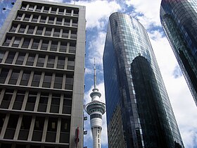
Skycrapers in Auckland's central business district Auckland skyline.jpg
Skycrapers in Auckland's central business district
Wellington city centre Wellington downtown.jpg
Wellington city centre
  • Whangārei (58,700): from Hikurangi to Portland.
  • Auckland (1,570,100) is divided into four urban zones:
  • Hamilton (241,200) is divided into three urban zones:
    • Hamilton Urban Zone (203,100): all of Hamilton City and neighbouring parts of Waikato and Waipa districts including Ngāruawāhia, Taupiri and Ōhaupō
    • Cambridge Urban Zone (20,600): includes Leamington
    • Te Awamutu Urban Zone (17,500): includes Kihikihi
  • Tauranga (141,600): Omokoroa to Papamoa Beach; and Mount Maunganui to Tauriko and Pyes Pa
  • Rotorua (59,500): Ngongotahā to Owhata
  • Gisborne (37,200): Makaraka to Okitu
  • Napier-Hastings (134,500) is a conurbation of two urban zones:
  • New Plymouth (58,300): Oakura to Bell Block
  • Wanganui (40,900): Westmere to Marybank
  • Palmerston North (86,600): Including Longburn, Kairanga and Stony Creek, but excluding Ashhurst and rural areas in the Tararua foothills
  • Kāpiti (42,700): Pekapeka to Paekākāriki
  • Wellington (418,500) is divided into four urban zones:
    • Upper Hutt (41,200): Te Marua to Pinehaven
    • Lower Hutt (105,200): includes Wainuiomata, Petone and the eastern bays, excludes farmland adjacent to Wainuiomata
    • Porirua (56,700): all of Porirua City except Paekākāriki Hill and Mana Island; includes Pukerua Bay and Pauatahanui
    • Wellington City (215,400): from Linden south, includes Horokiwi but excludes Mākara and Ohariu

South Island

Secondary urban areas

The population figures shown are Statistics New Zealand's resident population estimates at the June 2018. [10] The following towns are listed by location from north to south.

North Island

  • Pukekohe (31,400): From Paerata to Tuakau. Excludes Bombay.
  • Whakatāne (19,750): From Coastlands to Ōhope and south to Poroporo.
  • Tokoroa (14,050): From Tokoroa to Kinleith.
  • Taupō (24,700): From Wairakei to Taupō Airport.
  • Hāwera (12,150): From Normanby to Mokoia.
  • Feilding (16,850): From Halcombe to Aorangi.
  • Levin (21,200): From Waitarere Beach to Ohau.
  • Masterton (22,200): From Opaki to Waingawa.

South Island

  • Greymouth (9,700): From Runanga to Southbeach and Camerons.
  • Rangiora (18,300): From the Ashley River to Flaxton
  • Ashburton (20,200): From Fairton to Winslow and Argyle Park.
  • Timaru (29,100): From Washdyke to Scarborough and west to Gleniti.
  • Queenstown (15,850): From Fernhill and Kelvin Heights to Frankton
  • Oamaru (13,950): From Pukeuri to Weston and Holmes Hill.

Minor urban areas

North Island

South Island

Changes to classification

1992

Original classification

1996

No change

2001
2006
2013

Related Research Articles

<span class="mw-page-title-main">Kaipara District</span> Territorial authority district in Northland, New Zealand

Kaipara District is a territorial authority district in the Northland Region of New Zealand.

Edgecumbe is a town in the Bay of Plenty Region of the North Island of New Zealand, 15 kilometres (9.3 mi) to the west of Whakatāne and 8 kilometres (5.0 mi) south of the Bay's coast.

Postcodes in New Zealand consist of four digits, the first two of which specify the area, the third the type of delivery, and the last the specific lobby, RD number, or suburb. The present postcode system was introduced in New Zealand in June 2006, which, unlike the previous system, applies to all items of mail with effect from June 2008. In October 2008, New Zealand Post launched a 'remember your postcode' campaign, offering a $10,000 prize for remembering a postcode.

<span class="mw-page-title-main">Hauraki District</span> Territorial authority district in Waikato Region, New Zealand

Hauraki District is a territorial authority within the Hauraki region of New Zealand. The seat of the council is at Paeroa.

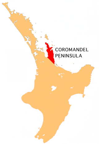
<span class="mw-page-title-main">Coromandel Peninsula</span> Peninsula in New Zealand

The Coromandel Peninsula on the North Island of New Zealand extends 85 kilometres (53 mi) north from the western end of the Bay of Plenty, forming a natural barrier protecting the Hauraki Gulf and the Firth of Thames in the west from the Pacific Ocean to the east. It is 40 kilometres (25 mi) wide at its broadest point. Almost its entire population lives on the narrow coastal strips fronting the Hauraki Gulf and the Bay of Plenty. In clear weather the peninsula is clearly visible from Auckland, the country's biggest city, which lies on the far shore of the Hauraki Gulf, 55 kilometres (34 mi) to the west. The peninsula is part of the Thames-Coromandel District and the Waikato Region.

<span class="mw-page-title-main">Waihi Beach</span> Town in the Bay of Plenty, New Zealand

Waihi Beach is a coastal town at the western end of the Bay of Plenty in New Zealand's North Island. It lies 10 kilometres to the east of the town of Waihi, at the foot of the Coromandel Peninsula. The main beach is 10 kilometres long. The town had a permanent population of 2,780 as of June 2023.

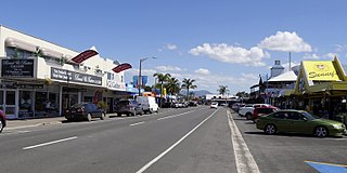
<span class="mw-page-title-main">Whitianga</span> Town in Waikato, New Zealand

Whitianga is a town on the Coromandel Peninsula, in the Waikato region of New Zealand's North Island. The town is located on Mercury Bay, on the northeastern coast of the peninsula. The town has a permanent population of 6,440 as of June 2023, making it the second-largest town on the Coromandel Peninsula behind Thames.

<span class="mw-page-title-main">Karekare, New Zealand</span> Place in Auckland Region, New Zealand

Karekare is a small coastal settlement in West Auckland, New Zealand, sandwiched between the Waitākere Ranges and a large black sand surf beach.

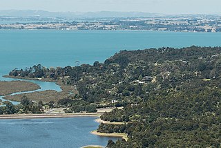
<span class="mw-page-title-main">Whiritoa</span> Settlement in Waikato, New Zealand

Whiritoa is a small beach town on the Coromandel Peninsula, New Zealand between Whangamatā and Waihi Beach. It has a permanent population in the low hundreds, which swells to over a thousand during the New Year holiday period.

<span class="mw-page-title-main">Parau</span> Coastal settlement in West Auckland, New Zealand

Parau is a locality of West Auckland in the Auckland Region. It is under the local governance of the Waitākere Ranges Local Board within the Auckland Council. It is a coastal community close to Titirangi village. Parau is made up of Huia Road, one other looping street called Rauhuia Crescent and two cul de sacs, Staley Road and Shirley Road. It also consists of a safe clean beach called Armour Bay where locals can partake in tennis, and swimming in the Manukau Harbour which laps the beach.

<span class="mw-page-title-main">Kaiwaka</span> Place in Northland Region, New Zealand

Kaiwaka, known as "the little town of lights", is a settlement in Northland, New Zealand. The Kaiwaka River runs from the east through the area and joins with the Wairau River to form the Otamatea River, which drains into the Kaipara Harbour. State Highway 1 passes through Kaiwaka. Wellsford is 20 kilometres (12 mi) south, Brynderwyn is 8 kilometres (5.0 mi) north, and Whangārei, the closest city, is 60 kilometres (37 mi) to the north. The Mangawhai Heads are 18 kilometres (11 mi) northeast of Kaiwaka.

<span class="mw-page-title-main">Mangawhai</span> Place in Northland Region, New Zealand

Mangawhai is a township at the south-west extent of the Mangawhai Harbour, or Mangawhai Estuary, in Northland, New Zealand. The adjacent township of Mangawhai Heads is 5 km north-east, on the lower part of the harbour. Kaiwaka is 13 km south-west, and Waipu is 20 km north-west of Mangawhai Heads.

Mangawhai Heads is a township in Northland, New Zealand. Waipu is 21 kilometres northwest, and Mangawhai is 5 kilometres southwest. Mangawhai Heads is on the north shore of the Mangawhai Harbour.

The Bay of Plenty Times is the regional daily paper for the Bay of Plenty area, including Tauranga, in the North Island of New Zealand.

<span class="mw-page-title-main">Shelly Beach, New Zealand</span> Place in Auckland Region, New Zealand

Shelly Beach, officially known as Aotea / Shelly Beach, is a settlement and beach located on the eastern side of Te Korowai-o-Te-Tonga Peninsula and the southwest side of Kaipara Harbour, North Auckland. In 2018, a seawall and five groynes were constructed to fight erosion.

<span class="mw-page-title-main">Langs Beach</span> Place in Northland Region, New Zealand

Langs Beach is a locality on the shore of Bream Bay in the Whangarei District and Northland Region of New Zealand. It is about 5 km southeast of Waipu Cove and 10 km northwest of Mangawhai Heads.

<span class="mw-page-title-main">Plummers Point</span> Rural settlement in the Bay of Plenty, New Zealand

Plummers Point is a rural settlement in the Western Bay of Plenty District and Bay of Plenty Region of New Zealand's North Island. It is on a headland on the southern side of Tauranga Harbour, opposite Motuhoa Island, and between Mangawhai Bay and Te Puna Estuary. The East Coast Main Trunk forms its southern boundary.

References

  1. 1 2 "Urban area". Statistics New Zealand. Retrieved 17 January 2020.
  2. Statistical Standard for Geographic Areas 2018 (PDF). Statistics New Zealand. 2017. ISBN   978-1-98-852841-0 . Retrieved 23 July 2021.
  3. 1 2 "Geographic definitions". Statistics New Zealand. Retrieved 8 August 2017.
  4. "Defining urban and rural New Zealand". Statistics New Zealand. Retrieved 8 August 2017.
  5. "Statistical standard for geographic areas 2023" (PDF). Stats NZ. Retrieved 23 February 2023.
  6. "Urban Rural 2023". Stats NZ. Retrieved 23 February 2023.
  7. "Ariā SNZ". aria.stats.govt.nz.
  8. "Urban Rural 2023". Stats NZ. Retrieved 23 February 2023.
  9. "Subnational Population Estimates Geographic Areas". Statistics New Zealand. Retrieved 8 August 2017.
  10. 1 2 "Subnational Population Estimates: At 30 June 2019". Statistics New Zealand. 22 October 2019. Retrieved 11 January 2020. For urban areas, "Subnational population estimates (UA, AU), by age and sex, at 30 June 1996, 2001, 2006–18 (2017 boundaries)". Statistics New Zealand. 23 October 2018. Retrieved 23 October 2018.