U.S. Route 89 is a north–south United States Numbered Highway with two sections, and one former section. The southern section runs for 848 miles (1,365 km) from Flagstaff, Arizona, to the southern entrance of Yellowstone National Park. The northern section runs for 404 miles (650 km) from the northern entrance of Yellowstone National Park in Montana, ending at the Canadian border. Unnumbered roads through Yellowstone connect the two sections. Before 1992, US 89 was a Canada–Mexico, border-to-border highway that ended at Nogales, Arizona, on its southern end.

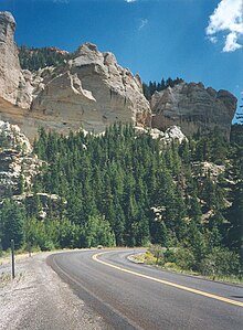
State Route 12 or Scenic Byway 12 (SR-12), also known as "Highway 12 — A Journey Through Time Scenic Byway", is a 123-mile-long (198 km) state highway designated an All-American Road located in Garfield County and Wayne County, Utah, United States.
The State Scenic Highway System in the U.S. state of California is a list of highways, mainly state highways, that have been designated by the California Department of Transportation (Caltrans) as scenic highways. They are marked by the state flower, a California poppy, inside either a rectangle for state-maintained highways or a pentagon for county highways.

State Route 157, also known as Kyle Canyon Road, is a U.S. state highway in Clark County, Nevada. The highway connects the Las Vegas area to the recreational areas of Mount Charleston in the Spring Mountains.
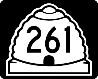
State Route 261 is a state highway located entirely within south-central San Juan County, Utah. It runs 34 miles (55 km) north, from the junction of U.S. Route 163, to the junction with State Route 95, just east of Natural Bridges National Monument.
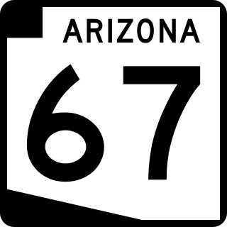
State Route 67 is a 43.4 mi (69.8 km) long, north–south state highway in northern Arizona. Also called the Kaibab Plateau – North Rim Parkway, SR 67 is the sole road that links U.S. Route 89A at Jacob Lake to the North Rim of Grand Canyon National Park. Along the route, the road heads through the national park as well as Kaibab National Forest and traverses extensive coniferous forests. The section inside the national park is maintained by the National Park Service (NPS), whereas the section north of the entrance, completely within Kaibab National Forest, is owned by the Arizona Department of Transportation (ADOT). The road was built in the late 1920s and improved through the 1930s. In 1941, the road received its number, and was given its designation as the parkway in the 1980s. The parkway has received designations as a National Forest Scenic Byway as well as a National Scenic Byway.
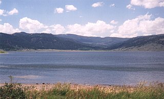
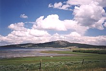
Panguitch Lake was originally a large natural lake that has now been expanded by the creation of a 24-foot (7 m) dam to become a reservoir with a maximum surface area of 1,248 acres (5 km2). The lake, which drains into the Sevier River is located on the Markagunt Plateau, between Panguitch, Utah and Cedar Breaks National Monument. The lake is located in the Dixie National Forest in a high tourist use area near three national parks and one national monument.
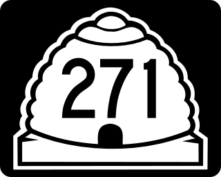
State Route 271 (SR-271) is a state highway within Iron County in the southwestern portion of the US state of Utah that connects Parowan and SR-274 to Paragonah and I-15. The route spans 5.65 miles (9.09 km) south–north and roughly parallels I-15. State Route 271 was designated in 1978.

State Route 279 is a state highway in the U.S. state of Utah. The highway was constructed in 1962–1963 to service the Cane Creek potash mine and processing plant southwest of Moab. The highway was named one of the most beautiful highways opened to traffic in 1963. The entire length of SR-279 has been designated the Potash – Lower Colorado River Scenic Byway by the Utah State Legislature, however is known locally as Potash Road.
U.S. Route 89 in the U.S. state of Utah is a north-south United States Highway spanning more than 502 miles (807.891 km) through the central part of the state, making it the longest road in Utah. Between Provo and Brigham City, US-89 serves as a local road, paralleling Interstate 15, but the portions from Arizona north to Provo and Brigham City northeast to Wyoming serve separate corridors. The former provides access to several national parks and Arizona, and the latter connects I-15 with Logan, the state's only Metropolitan Statistical Area not on the Interstate.

The Dinosaur Diamond is a 486-mile (782 km) scenic and historic byway loop through the dinosaur fossil laden Uinta Basin of the U.S. states of Utah and Colorado. The byway comprises the following two National Scenic Byways:

State Route 92 (SR-92), also known in various portions as the Timpanogos Highway, and Alpine Loop Scenic Highway is a scenic state highway in Utah County, Utah that runs from I-15/US-89 in Lehi to US-189 in Provo Canyon. The route is 27.296 miles (43.929 km) long and is the only road with access to Sundance Ski Resort and the Aspen Grove Family Camp and Conference Center.

State Route 14 (SR-14) is a state highway in southern Utah, running for 40.995 miles (65.975 km) in Iron and Kane Counties from Cedar City to Long Valley Junction. The highway has been designated the Markagaunt High Plateau Scenic Byway as part of the Utah Scenic Byways program.

State Route 18 (SR-18) is a state highway in southern Utah, running for 51.005 miles (82.085 km) in Washington and Iron Counties from St. George to Beryl Junction. It forms part of the Legacy Loop Highway from St. George to Parowan. The highway closely follows the route of the Old Spanish Trail through Dixie National Forest.

Lund Highway is a road connecting Cedar City to the ghost town of Lund in Iron County, Utah. Although it is classified as a minor collector, it was once an important connection between the Union Pacific Railroad at Lund and the national parks of southern Utah and northern Arizona.

State Route 148 (SR-148) is a state highway in the U.S. state of Utah. The entire highway has been designated the Cedar Breaks Scenic Byway as part of the Utah Scenic Byways and National Forest Scenic Byway programs.

State Route 153 (SR-153) is a state highway in the U.S. state of Utah. Just over half of the western portion of the highway has been designated the Beaver Canyon Scenic Byway as part of the Utah Scenic Byways and National Forest Scenic Byways programs.
The Trail of the Ancients is a collection of National Scenic Byways located in the U.S. Four Corners states of Utah, Colorado, New Mexico, and Arizona. These byways comprise: