Mount Wynne is a 13,179-foot-elevation (4,017-meter) mountain summit located one mile west of the crest of the Sierra Nevada mountain range, in Fresno County of northern California, United States. It is situated in eastern Kings Canyon National Park, 31 miles (50 km) northwest of the town of Lone Pine, 0.4 miles immediately east of Pinchot Pass, and 0.66 miles (1.06 km) south of Mount Pinchot, which is the nearest higher neighbor. Mt. Wynne ranks as the 116th highest summit in California. Topographic relief is significant as the south aspect rises nearly 2,000 feet above the surrounding terrain in approximately one mile. The approach to this remote peak is made via the John Muir Trail. The first ascent of the summit was made in 1935 by a Sierra Club party.

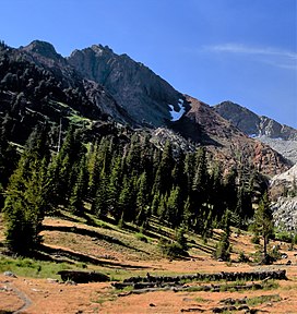
Picture Puzzle, also known as Picture Puzzle Peak, is a 13,297-foot-elevation mountain summit located one mile east of the crest of the Sierra Nevada mountain range in Inyo County of northern California, United States. It is situated in the Palisades area of the John Muir Wilderness, on land managed by Inyo National Forest. It is approximately 14.5 miles (23.3 km) west of the community of Big Pine, one mile north of Bishop Pass, 0.8 miles (1.3 km) northwest of Aperture Peak, 1.2 miles (1.9 km) north-northwest of Mount Agassiz, and 1.1 miles (1.8 km) south-southwest of parent Cloudripper. Picture Puzzle ranks as the 90th-highest summit in California, and the third-highest peak of the Inconsolable Range.

Fin Dome is an 11,673-foot-elevation (3,558-meter) granite summit located 1.5 mile west of the crest of the Sierra Nevada mountain range, in the southeast corner of Fresno County, in northern California. It is situated in the Rae Lakes area of Kings Canyon National Park, approximately 15.5 miles (24.9 km) west of the community of Independence. Nearby peaks include Black Mountain 1.9 miles (3.1 km) to the east, and Mount Rixford 2.1 miles (3.4 km) to the south-southeast. Topographic relief is significant as the east aspect rises 1,135 feet above Rae Lakes in one-quarter mile. The John Muir Trail passes to the east of this landmark, providing an approach. This geographical feature was named by Bolton Brown in 1899 when he explored the lake basin in its vicinity, because it resembled the fin of a sea serpent. The first ascent of the summit was made in 1910 by James Rennie, one of the foremost mountaineers of the Sierra Club.

Mount Hitchcock is a 13,186-foot-elevation (4,019-meter) mountain summit located west of the crest of the Sierra Nevada mountain range in Tulare County, California. It is situated in Sequoia National Park, and is two miles (3.2 km) south-southwest of Mount Whitney, 1.3 miles (2.1 km) southwest of Mount Muir, and 1.1 miles (1.8 km) west of Trail Crest. Topographic relief is significant as it rises approximately 1,500 feet above Hitchcock Lakes in less than one-half mile. Mt. Hitchcock ranks as the 112th highest summit in California.

Mount Chamberlin is a 13,169-foot-elevation (4,014-meter) mountain summit located west of the crest of the Sierra Nevada mountain range in Tulare County, California. It is situated in Sequoia National Park, and is 3.2 miles (5.1 km) south-southwest of Mount Whitney, 1.5 miles (2.4 km) south of Mount Hitchcock, and 3.5 miles west of Mount Corcoran. Topographic relief is significant as it rises approximately 1,830 feet above Crabtree Lakes in one-half mile. Mt. Chamberlin ranks as the 119th highest summit in California. This mountain's name was officially adopted in 1940 by the U.S. Board on Geographic Names to honor American geologist Thomas Chrowder Chamberlin (1843–1928). The first ascent of the summit was made by Sierra Club member J. H. Czock, date unknown.
Mount Newcomb is a 13,422-foot-elevation (4,091-meter) mountain summit located just west of the crest of the Sierra Nevada mountain range in Tulare County, California. It is situated in Sequoia National Park, and is 2.8 miles (4.5 km) south of Mount Whitney, 1.1 miles (1.8 km) northeast of Mount Chamberlin, and 3.5 miles west of Mount Corcoran. Mt. Newcomb ranks as the 70th highest summit in California. Topographic relief is significant as it rises 2,083 feet above the second Crabtree Lake in approximately one mile. This mountain's name was officially adopted in 1940 by the U.S. Board on Geographic Names to honor American astronomer Simon Newcomb (1835–1909). The first ascent of the summit was made August 22, 1936, by Max Eckenburg and Bob Rumohr.

Mount Powell is a 13,364-foot-elevation mountain summit located on the crest of the Sierra Nevada mountain range in California, United States. It is situated on the shared boundary of Kings Canyon National Park with John Muir Wilderness, and along the common border of Fresno County with Inyo County. It is also 19 miles (31 km) west of the community of Big Pine, and 1.17 miles (1.88 km) west of Mount Thompson, which is the nearest higher neighbor. Mount Powell ranks as the 81st highest peak in California, and the 10th highest of the Evolution Region of the Sierra Nevada. The west summit is unofficially known as "Point John." Two other peaks on the mountain are informally called "Point Wesley" (13,356 ft) in the middle, and "Point Powell" (13,360+ ft) one-half mile to the east.

Mount Bago is an 11,870-foot-elevation (3,620-meter) mountain summit located west of the crest of the Sierra Nevada mountain range, in the southeast corner of Fresno County, in northern California. It is situated in Kings Canyon National Park, 14 miles (23 km) west of the community of Independence, 2.3 miles west of the Kearsarge Pinnacles, and 2.4 miles southwest of Mount Rixford. Topographic relief is significant as the south aspect rises 3,675 feet above Junction Meadow in one mile. The John Muir Trail passes to the northeast of this remote geographical feature. The first ascent of the summit was made July 11, 1896, by Joseph Nisbet LeConte and Wilson S. Gould.

State Peak is a remote 12,620-foot-elevation (3,850-meter) mountain summit located in Kings Canyon National Park, in Fresno County of northern California, United States. It is situated on Cirque Crest which is west of the crest of the Sierra Nevada mountain range, 3.03 miles (4.88 km) west of Arrow Peak, and 2.13 miles (3.43 km) southwest of Marion Peak, the nearest higher neighbor. Topographic relief is significant as the west aspect rises 2,100 feet above State Lakes in 1.5 mile, and the southeast aspect rises 4,000 feet above South Fork Kings River in 1.5 mile.
Mount Lamarck is a 13,417-foot-elevation (4,090-meter) mountain summit located on the crest of the Sierra Nevada mountain range in northern California, United States. It is situated on the shared boundary of Kings Canyon National Park with John Muir Wilderness, and along the common border of Fresno County with Inyo County. It is 20 miles (32 km) southwest of the community of Bishop, and 1.9 miles (3.1 km) north of Mount Darwin. Subsidiary peak Mount Lamarck North (13,464 feet ranks as the 67th highest summit in California, and the sixth highest in the Evolution Region. Topographic relief is significant as the east aspect rises 4,290 feet above Lake Sabrina in three miles, and the west aspect rises 3,600 feet above Evolution Valley in three miles.

Mount Eisen is a 12,185-foot-elevation (3,714-meter) double summit mountain located on the Great Western Divide of the Sierra Nevada mountain range, in Tulare County of northern California. It is situated in Sequoia National Park, 1.6 miles (2.6 km) south of Lippincott Mountain. Mount Eisen ranks as the 380th highest summit in California. Topographic relief is significant as the south aspect rises 3,500 feet above Pinto Lake in one mile. The summit can be reached from the southeast ridge via a long class 2 hike from Black Rock Pass.

Highland Peak is a prominent 10,936-foot-elevation (3,333-meter) mountain summit located in the Sierra Nevada mountain range, in Alpine County of northern California, United States. It is situated 3.5 miles east of Ebbetts Pass in the Carson-Iceberg Wilderness, on land managed by Humboldt–Toiyabe National Forest. Although it ranks as the 680th-highest summit in California, it ranks 36th-highest of those with at least 500 meters of topographic prominence. Also, there is no higher peak than Highland Peak to the north within the Sierra Nevada. Highland Peak has a subsidiary South Peak, with one-half mile separation between summits. The Pacific Crest Trail traverses the western foot of this mountain, providing an approach option. Precipitation runoff from this mountain drains into tributaries of the East Fork Carson River.. Topographic relief is significant as the summit rises over 2,900 feet above Noble Canyon in 1.6 mile (2.6 km).

Goat Mountain is a 12,207-foot-elevation (3,721-meter) mountain summit located in Kings Canyon National Park, in Fresno County of northern California, United States. It is situated on Monarch Divide which is west of the crest of the Sierra Nevada mountain range. Topographic relief is significant as the southeast aspect rises 5,600 feet above Paradise Valley in 2.5 miles. This feature was so named because mountain sheep, erroneously called goats, were once seen on the slopes. The name was already in use when the first ascent of the summit was made in 1896 by Joseph Nisbet LeConte and party. This mountain's name has been officially adopted by the United States Board on Geographic Names.

The Sphinx is a 9,143-foot-elevation (2,787-meter) double summit granitic pillar located west of the crest of the Sierra Nevada mountain range, in Kings Canyon National Park, in Fresno County of northern California. This landmark is situated at the northern end of the Great Western Divide, two miles southeast of Kanawyers, five miles northwest of North Guard, and immediately south of the confluence of Bubbs Creek and South Fork Kings River. Topographic relief is significant as the north aspect rises 4,000 feet above the canyon in one mile. This geographical feature was named in 1891 by John Muir. This feature's name has been officially adopted by the United States Board on Geographic Names. The Sphinx formation is the further north and slightly lower of the two peaks, and was the first rock climb done in the Kings Canyon region. The first ascent of the summit was made July 26, 1940, by Art Argiewicz and Bob Jacobs. The North Buttress was first climbed October 18, 1970, by Fred Beckey, Greg Donaldson, and Walt Vennum.

Mount Genevra is a remote 13,054-foot-elevation (3,979-meter) mountain summit located on the Kings–Kern Divide of the Sierra Nevada mountain range, in Tulare County of northern California. It is situated on the shared boundary of Kings Canyon National Park with Sequoia National Park, 3.5 miles (5.6 km) southeast of Mount Brewer, and 0.86 miles (1.38 km) east of Mount Jordan, which is the nearest higher neighbor. Topographic relief is significant as the north aspect rises 3,025 feet above Lake Reflection in 1.5 mile. Mount Genevra ranks as the 138th highest summit in California, and the eighth highest peak on the Kings–Kern Divide.

Kettle Peak is a mountain with a summit elevation of 11,010 feet (3,356 m) located in the Sierra Nevada mountain range, in Mono County of northern California, United States. The summit is set in the Hoover Wilderness on land managed by Humboldt–Toiyabe National Forest, and is less than one-half mile outside the boundary of Yosemite National Park. The peak is situated approximately three miles southwest of Twin Lakes, three miles south of Victoria Peak, 2.9 miles northeast of Crown Point, and 3.1 miles northwest of Matterhorn Peak. Topographic relief is significant as the west aspect rises over 2,600 feet above Robinson Creek in one mile.

Pilot Knob is a 12,245-foot-elevation (3,732 meter) mountain summit located in Fresno County in the Sierra Nevada mountain range in northern California, United States. It is situated at the intersection of Piute Canyon and French Canyon, in the John Muir Wilderness, on land managed by Sierra National Forest. It is set 2.5 miles (4.0 km) south of Merriam Peak and three miles north of the Matthes Glaciers. Pilot Knob is the 360th-highest peak in California, and topographic relief is significant as the west aspect rises 2,800 feet above Hutchinson Meadow in approximately one mile. This mountain was likely named by the USGS during the 1907–09 survey for the Mt. Goddard Quadrangle, and the toponym has been officially adopted by the U.S. Board on Geographic Names.

Picket Guard Peak is a 12,302-foot-elevation (3,750 meter) mountain summit located west of the crest of the Sierra Nevada mountain range in Tulare County, California. It is situated in Sequoia National Park, two miles southwest of Kern Point, 3.4 miles (5.5 km) north of Mount Kaweah, and three miles east of the junction of Kaweah Peaks Ridge with Great Western Divide. Picket Guard Peak ranks as the 345th-highest summit in California, and topographic relief is significant as the summit rises 4,265 feet above Kern Canyon in approximately three miles.
Kern Point is a 12,763-foot-elevation (3,890 meter) mountain summit located west of the crest of the Sierra Nevada mountain range in Tulare County, California. It is situated in Sequoia National Park, two miles northeast of Picket Guard Peak, and seven miles east of Mount Whitney. Kern Point ranks as the 220th-highest summit in California, and topographic relief is significant as the summit rises over 4,700 feet above Kern River in two miles. Kern Point is the southernmost peak on Kern Ridge, and precipitation runoff from this mountain drains to the Kern River. The river was named by John C. Frémont for Edward Kern, the artist and topographer of Frémont's third expedition in 1845. The Kern Point toponym was officially adopted in 1928 by the U.S. Board on Geographic Names.

Aperture Peak is a 13,265-foot-elevation mountain summit located in Inyo County, California, United States.