Wasatch and Uinta montane forests

Last updated
Wasatch and Uinta montane forests
Kings Peak with Henry's Fork Basin.jpg
Coniferous forest with Kings Peak in the background, Uinta Mountains
Wasatch and Uinta Montane Forests map.svg
Ecology
Realm Nearctic
Biome Temperate coniferous forest
Borders
Bird species190 [1]
Mammal species91 [1]
Geography
Area41,500 km2 (16,000 sq mi)
CountryUnited States
States
Climate type Cold semi-arid (BSk)
Conservation
Habitat loss2.45% [1]
Protected68.9% [1]

The Wasatch and Uinta montane forest is a temperate coniferous forest ecoregion in the Wasatch Range and Uinta Mountains of the western Rocky Mountains system, in the Western United States.

Contents

Setting

This ecoregion is located almost entirely within the state of Utah, with a very small portion stretching north into southwestern Wyoming and southeastern Idaho. This ecoregion covers the driest ranges of the Rocky Mountains, in the rain shadow of the Sierra Nevada to the west.

Flora

The dominant vegetation type of this ecoregion is coniferous forest, composed mainly of ponderosa pine ( Pinus ponderosa ), Rocky Mountain Douglas-fir (Pseudotsuga menziesii subsp. glauca), subalpine fir ( Abies lasiocarpa ), Engelmann spruce ( Picea engelmanni ) and trembling aspen ( Populus tremuloides ), with limited populations of limber pine ( Pinus flexilis ). This ecoregion is unique from other Rocky Mountain ecoregions in that large areas are dominated by Gambel oak ( Quercus gambelii ) and Bigtooth maple (Acer grandidentatum).

Fauna

Mammals include mule deer (Odocoileus hemonius), elk (Cervus canadensis), moose (Alces alces), bighorn sheep (Ovis canadensis), mountain goat (Oreamnos americanus), black bear (Ursus americanus) cougar (Puma concolor), and wolverine (Gulo gulo)

Brown bear and gray wolf, are also native to these forests, and much of the rest of Utah, but have been extirpated due to hunting, with brown bears having not been found in Utah since roughly 1922, when the last grizzly bear Old Ephraim was shot and killed. [2] Gray wolves have begun to return to Utah, primarily in the far northeastern reaches of state, where it borders Wyoming and Idaho. Both bears and wolves have been under threat, due primarily to the livestock industry which is an obstacle currently preventing their return. [3]

Threats and preservation

The majority of this ecoregion has been greatly affected by livestock grazing, logging, mining, and recreational uses such as downhill skiing, and as a result, its conservation status is "critical/endangered". Very few areas are protected, and the largest area that is protected, the High Uintas Wilderness in northeastern Utah, mainly protects areas in the high alpine zone, with the more diverse montane and subalpine zones being almost entirely unprotected. The main threats to this ecoregion's integrity are motorised recreation, widespread livestock grazing and downhill skiing. This region has also been severely effected by mountain pine beetle outbreaks in the last decades, killing large swathes of forest.

See also

Related Research Articles

<span class="mw-page-title-main">Uinta Mountains</span> Mountain range in northeastern Utah and northwestern Colorado in the United States

The Uinta Mountains are an east-west trending chain of mountains in northeastern Utah extending a short distance into northwest Colorado and slightly into southwestern Wyoming in the United States. As a subrange of the Rocky Mountains, they are unusual for being the highest range in the contiguous United States running east to west, and lie approximately 100 miles (160 km) east of Salt Lake City. The range has peaks ranging from 11,000 to 13,528 feet, with the highest point being Kings Peak, also the highest point in Utah. The Mirror Lake Highway crosses the western half of the Uintas on its way to Wyoming. Utah State Route 44 crosses the east end of the Uintas between Vernal and Manila.

<span class="mw-page-title-main">British Columbia mainland coastal forests</span> Temperate coniferous forest ecoregion in British Columbia, Canada and Washington, United States

British Columbia mainland coastal forests is a temperate coniferous forest ecoregion the Pacific coast of North America, as defined by the World Wildlife Fund (WWF) categorization system.

<span class="mw-page-title-main">New England–Acadian forests</span> Temperate broadleaf and mixed forest ecoregion of Canada and the United States

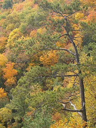
The New England-Acadian forests are a temperate broadleaf and mixed forest ecoregion in North America that includes a variety of habitats on the hills, mountains and plateaus of New England and New York State in the Northeastern United States, and Quebec and the Maritime Provinces of Eastern Canada.

<span class="mw-page-title-main">Klamath Mountains (ecoregion)</span> Temperate coniferous forests ecoregion in northern California and southwestern Oregon

The Klamath Mountains ecoregion of Oregon and California lies inland and north of the Coast Range ecoregion, extending from the Umpqua River in the north to the Sacramento Valley in the south. It encompasses the highly dissected ridges, foothills, and valleys of the Klamath and Siskiyou Mountains. It corresponds to the Level III ecoregion designated by the Environmental Protection Agency and to the Klamath-Siskiyou forests ecoregion designated by the World Wide Fund for Nature.

<span class="mw-page-title-main">Cascade Mountains leeward forests</span> Temperate coniferous forest ecoregion in British Columbia, Canada and Washington, United States

The Cascade Mountains leeward forests are a temperate coniferous forest ecoregion of North America, as defined by the World Wildlife Fund (WWF) categorization system.

<span class="mw-page-title-main">Eastern forest–boreal transition</span> Temperate broadleaf and mixed forest ecoregion in Canada and the United States

The eastern forest–boreal transition is a temperate broadleaf and mixed forests ecoregion of North America, mostly in eastern Canada. It is a transitional zone or region between the predominantly coniferous Boreal Forest and the mostly deciduous broadleaf forest region further south.

<span class="mw-page-title-main">Eastern Great Lakes lowland forests</span> Temperate broadleaf and mixed forest ecoregion of Canada and the United States

The Eastern Great Lakes lowland forests is a temperate broadleaf and mixed forest ecoregion of North America, as defined by the World Wildlife Fund. It lies mostly in south and eastern Ontario and Quebec in Canada, and Upstate New York and Vermont in the United States.

<span class="mw-page-title-main">Alberta Mountain forests</span> Temperate coniferous forests ecoregion of Alberta and British Columbia, Canada

The Alberta Mountain forests are a temperate coniferous forests ecoregion of Western Canada, as defined by the World Wildlife Fund (WWF) categorization system.

<span class="mw-page-title-main">Alberta–British Columbia foothills forests</span> Temperate coniferous forests ecoregion of Alberta and British Columbia, Canada

The Alberta–British Columbia foothills forests are a temperate coniferous forests ecoregion of Western Canada, as defined by the World Wildlife Fund (WWF) categorization system. This ecoregion borders Canada's taiga and contains a mix of subarctic forest and temperate forest species as a result. This makes the region an ecotone region, or a region that acts as a buffer between two other biomes.

<span class="mw-page-title-main">Ecology of the Rocky Mountains</span> Ecology of the Rocky Mountain range in North America

The ecology of the Rocky Mountains is diverse due to the effects of a variety of environmental factors. The Rocky Mountains are the major mountain range in western North America, running from the far north of British Columbia in Canada to New Mexico in the southwestern United States, climbing from the Great Plains at or below 1,800 feet (550 m) to peaks of over 14,000 feet (4,300 m). Temperature and rainfall varies greatly also and thus the Rockies are home to a mixture of habitats including the alpine, subalpine and boreal habitats of the Northern Rocky Mountains in British Columbia and Alberta, the coniferous forests of Montana and Idaho, the wetlands and prairie where the Rockies meet the plains, a different mix of conifers on the Yellowstone Plateau in Wyoming, the montane forests of Utah, and in the high Rockies of Colorado and New Mexico, and finally the alpine tundra of the highest elevations.

<span class="mw-page-title-main">Yukon Interior dry forests</span> Taiga ecoregion of British Columbia and Yukon, Canada

The Yukon Interior dry forests is a taiga ecoregion of Canada.

<span class="mw-page-title-main">South Central Rockies forests</span> Temperate coniferous forests ecoregion of the United States

The South Central Rockies forests is a temperate coniferous forest ecoregion of the United States located mainly in Wyoming, Idaho, and Montana. It has a considerably drier climate than the North Central Rockies forest.

<span class="mw-page-title-main">Wyoming Basin shrub steppe</span> Xeric shrubland ecoregion of the western United States

The Wyoming Basin shrub steppe ecoregion, within the deserts and xeric shrublands biome, is a shrub steppe in the northwestern United States.

<span class="mw-page-title-main">Colorado Rockies forests</span> Temperate coniferous forests ecoregion of the United States

The Colorado Rockies forests is a temperate coniferous forest ecoregion of the United States.

<span class="mw-page-title-main">North Central Rockies forests</span> Temperate coniferous forest ecoregion in Canada and the United States

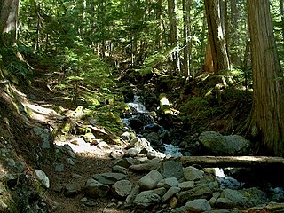
The North Central Rockies forests is a temperate coniferous forest ecoregion of Canada and the United States. This region overlaps in large part with the North American inland temperate rainforest and gets more rain on average than the South Central Rockies forests and is notable for containing the only inland populations of many species from the Pacific coast.

<span class="mw-page-title-main">Mammals of Rocky Mountain National Park</span>

There are 67 native species of mammals in Rocky Mountain National Park, a 265,461 acres (107,428 ha) park in Colorado. Species are listed by common name, scientific name, habitat, and abundance. Species which are extirpated, or locally extinct, are marked with an EX.

<span class="mw-page-title-main">Ogilvie–MacKenzie alpine tundra</span> Tundra ecoregion of Canada and the United States

The Ogilvie–MacKenzie alpine tundra ecoregion covers the mountainous middle of the Yukon Territory in Canada, with extensions into the Northwest Territories. The vegetation is alpine and subalpine open forest of stunted spruce, fir and pine. The area is rugged but sections appear to have been unglaciated in the late Pleistocene and there are therefore relic species in the region. The area is remote and supports large, sustainable predator-prey systems.

References

  1. 1 2 3 4 Hoekstra, J. M.; Molnar, J. L.; Jennings, M.; Revenga, C.; Spalding, M. D.; Boucher, T. M.; Robertson, J. C.; Heibel, T. J.; Ellison, K. (2010). Molnar, J. L. (ed.). The Atlas of Global Conservation: Changes, Challenges, and Opportunities to Make a Difference . University of California Press. ISBN   978-0-520-26256-0.
  2. "Grizzly Bear Archives".
  3. "Rare Gray Wolf Found in Utah Targeted by State Trappers".