
Roane County is a county of the U.S. state of Tennessee. As of the 2010 census, the population was 54,181. Its county seat is Kingston.
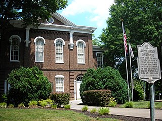
Loudon County is a county in the U.S. state of Tennessee. It is located in the central part of East Tennessee. As of the 2010 census, the population was 48,556. Its county seat is Loudon.

Spring City is a town in Rhea County, Tennessee, United States. The population was 2,025 at the 2000 census and 1,981 at the 2010 census. The town is located along Watts Bar Lake, and Watts Bar Dam and the Watts Bar Nuclear Generating Station are nearby.
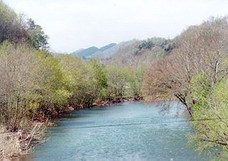
The Clinch River rises near Tazewell, Virginia, and flows southwest for more than 300 miles (480 km) through the Great Appalachian Valley, gathering various tributaries, including the Powell River, before joining the Tennessee River in Kingston, Tennessee.

Norris Dam is a hydroelectric and flood control structure located on the Clinch River in Anderson County and Campbell County, Tennessee, United States. Its construction in the mid-1930s was the first major project for the Tennessee Valley Authority, which had been created in 1933 to bring economic development to the region and control the rampant flooding that had long plagued the Tennessee Valley. The dam was named in honor of Nebraska Senator George Norris (1861–1944), a longtime supporter of government-owned power in general, and supporter of TVA in particular. The project infrastructure was listed on the National Register of Historic Places in 2016.

Tuskegee was an Overhill Cherokee town located along the lower Little Tennessee River in what is now Monroe County, Tennessee, United States. The town developed in the late 1750s alongside Fort Loudoun, and was inhabited until the late 1770s. It was forcibly evacuated and probably burned during the Cherokee–American wars.
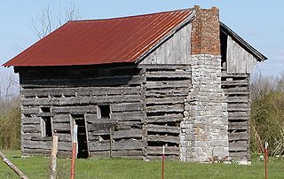
Ten Mile is an unincorporated community in northern Meigs and southeastern Roane counties in the U.S. state of Tennessee.

Watts Bar Dam is a hydroelectric dam on the Tennessee River in Meigs and Rhea counties in Tennessee, United States. The dam is one of nine dams on the main Tennessee River channel operated by the Tennessee Valley Authority, which built the dam in the early 1940s to provide flood control and electricity and to help create a continuous navigable channel along the entire length of the river. The dam is the technical boundary between the 39,090-acre (15,820 ha) Watts Bar Lake— which it impounds— and Chickamauga Lake, which stretches from the dam's tailwaters southward to Chattanooga.

Fort Loudoun Dam is a hydroelectric dam on the Tennessee River in Loudon County, Tennessee, in the southeastern United States. The dam is operated by the Tennessee Valley Authority (TVA), which built the dam in the early 1940s as part of a unified plan to provide electricity and flood control in the Tennessee Valley and create a continuous 652-mile (1,049 km) navigable river channel from Knoxville, Tennessee to Paducah, Kentucky. It is the uppermost of nine TVA dams on the Tennessee River.

Melton Hill Dam is a hydroelectric dam on the Clinch River just south of Oak Ridge, Tennessee, United States. The dam is operated by the Tennessee Valley Authority, which built the dam in the early 1960s to extend the Tennessee Valley's continuous navigation channel up the Clinch as far as Clinton and to increase TVA's overall power-generating capacity. The dam impounds the 5,470-acre (2,210 ha) Melton Hill Lake, and is the only TVA tributary dam serviced by a navigation lock. The dam and associated infrastructure were listed on the National Register of Historic Places in 2017.

Kingston Fossil Plant, commonly known as Kingston Steam Plant, is a 1.4-gigawatt coal-fired power plant located in Roane County, just outside Kingston, Tennessee on the shore of Watts Bar Lake. It is operated by the Tennessee Valley Authority. The plant is known for the Kingston Fossil Plant fly ash spill which occurred in December 2008.
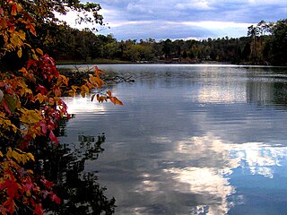
Big Ridge State Park is a state park in Union County, Tennessee, in the southeastern United States. The park consists of 3,687 acres (14.92 km2) on the southern shore of the Norris Reservoir, an impoundment of the Clinch River created by the completion of Norris Dam in 1936. Much of the park's recreational focus is on Big Ridge Lake, a 45-acre (0.18 km2) sub-impoundment of Norris near the center of the park.

The Kingston Fossil Plant coal fly ash slurry spill was an environmental and industrial disaster that occurred on Monday December 22, 2008, when a dike ruptured at a coal ash pond at the Tennessee Valley Authority's Kingston Fossil Plant in Roane County, Tennessee, releasing 1.1 billion US gallons of coal fly ash slurry. The coal-fired power plant, located across the Clinch River from the city of Kingston, used a series of ponds to store and dewater the fly ash, a byproduct of coal combustion. The spill released a slurry of fly ash and water, which traveled across the Emory River and its Swan Pond embayment, onto the opposite shore, covering up to 300 acres (1.2 km2) of the surrounding land. The spill damaged multiple homes and flowed into nearby waterways including the Emory River and Clinch River, both tributaries of the Tennessee River. It was the largest industrial spill in United States history.
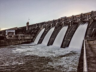
Cherokee Dam is a hydroelectric dam located on the Holston River in Grainger County and Jefferson County, Tennessee, in the southeastern United States. The dam is operated and maintained by the Tennessee Valley Authority, which built the dam in the early 1940s to help meet urgent demands for energy at the outbreak of World War II. Cherokee Dam is 175 feet (53 m) high and impounds the 28,780-acre (11,650 ha) Cherokee Lake. It has a generating capacity of 135,200 kilowatts. The dam was named for the Cherokee, a Native American tribe that controlled much of East Tennessee when the first European settlers arrived in the mid-18th century.

Rhea Springs was a community once located along the Piney River in Rhea County, Tennessee, in the southeastern United States. Originally established in the 19th century as a health resort, the community was inundated when the completion of Watts Bar Dam by the Tennessee Valley Authority flooded the lower Piney Valley in 1942.
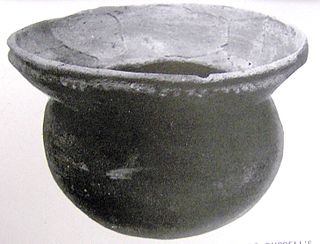
Bussell Island, formerly Lenoir Island, is an island located at the mouth of the Little Tennessee River, at its confluence with the Tennessee River in Loudon County, near the U.S. city of Lenoir City, Tennessee. The island was inhabited by various Native American cultures for thousands of years before the arrival of early European explorers. The Tellico Dam and a recreational area occupy part of the island. Part of the island was added in 1978 to the National Register of Historic Places for its archaeological potential.
Unitia is an Unincorporated community of Loudon County, Tennessee. Historically it was a crossroads village, the site of a post office, and a stop on the Underground Railroad. The historical center of the community was flooded in the 1940s by the filling of the reservoir behind Fort Loudoun Dam.
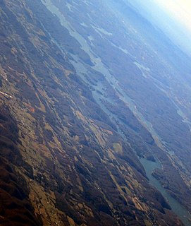
Norris Lake, also known as Norris Reservoir, is a reservoir that is located in Tennessee, United States. The lake was created by the Norris Dam at the Cove Creek Site on the Clinch River in 1936 by the Tennessee Valley Authority (TVA) for flood control, water storage, and hydroelectric power. Norris Dam and its reservoir were the first major project taken on by the TVA. The lake, the dam, and the town of Norris, Tennessee are named for George W. Norris, who was a U.S. Senator from Nebraska and who wrote the legislation that created the TVA.


