Related Research Articles

Fishers Island is an island located in Southold, New York at the eastern end of Long Island Sound, 2 miles (3 km) off the southeastern coast of Connecticut across Fishers Island Sound. Approximately 9 miles (14 km) long and 1 mile (1.6 km) wide, it is approximately 11 miles (18 km) from the tip of Long Island at Orient Point, 2 miles (3 km) each from Napatree Point at the southwestern tip of Rhode Island and Groton Long Point in Connecticut, and approximately 7 miles (11 km) southeast of New London, Connecticut. It is accessible from New London by plane and regular ferry service.
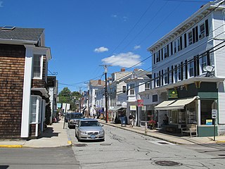
The town of Stonington is located in New London County, Connecticut in the state's southeastern corner. It includes the borough of Stonington, the villages of Pawcatuck, Lords Point, and Wequetequock, and the eastern halves of the villages of Mystic and Old Mystic. The population of the town was 18,545 at the 2010 census.

The Pawcatuck River is a river in the US states of Rhode Island and Connecticut flowing approximately 34 miles (55 km). There are eight dams along the river's length. USS Pawcatuck was named after the river.

The Mystic River is a 3.4-mile-long (5.5 km) estuary in the southeast corner of the U.S. state of Connecticut. Its main tributary is Whitford Brook. It empties into Fishers Island Sound, dividing the village of Mystic, Connecticut between the towns of Groton and Stonington. Much of the river is tidal. The Mystic River was the location of three large shipbuilding firms during the 19th-century, and it is now the home of the Mystic Seaport maritime museum. The name Mystic is derived from the Pequot term "missi-tuk", describing a large river whose waters are driven into waves by tides or wind, according to the Mystic River Historical Society.

Mason's Island is an inhabited island at the mouth of the Mystic River, in Stonington, Connecticut. The island was named after Major John Mason who was granted the island in recognition for his military services in the 1637 Pequot War in nearby Mystic. This island remained in the Mason family for over 250 years, from 1651 to 1913. Since then the Allyn family have been stewards of it, and most of the island is owned by the Mason's Island Company and regulated by property deeds under the Mason's Island Property Owners Association. The Mason's Island Marina and the Mystic River Marina are located on the north end of the island. Mason's Island is connected to the mainland by a causeway.
Ram Island is a small 20-acre (81,000 m2) island off the coast of Mystic, Connecticut. It is located in the Town of Stonington, approximately 1 mile (1.6 km) offshore, between Mystic and Fishers Island. Once called Mystic Island, it was formerly the site of an exclusive Victorian era hotel resort at which steamships from Boston and New York City stopped twice a day. At the height of its popularity, the hotel played host to a world lightweight bare-knuckle boxing championship. By the 1920s, the hotel had fallen into disrepair and was completely destroyed in the New England Hurricane of 1938. A motel was later built that catered to transient boaters.
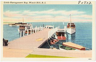
Little Narragansett Bay is an inlet of the Atlantic Ocean and an estuary of the Pawcatuck River on the Rhode Island-Connecticut state line. It is sheltered by a curving peninsula, known as Napatree Point.
The Green Fall River is a river in the U.S. states of Connecticut and Rhode Island. It flows approximately 13 km (8 mi).
The Ashaway River is a river in the U.S. states of Rhode Island and Connecticut. It flows approximately 4 km (2 mi). There are three dams along the river's length.
Plax is the name of a manufacturing factory that was located in Stonington, Connecticut. It began operations in Stonington in 1957, and was later purchased by the Monsanto Chemical Company. It specialized in the manufacturing of plastic bottles. The General Manager was Benedict U. Feole, formerly of New Britain, Connecticut and Westerly, Rhode Island.

Lords Point is a small private village on the Atlantic Coast in the town of Stonington, Connecticut, established in 1909. Lords Point has over 200 houses and summer cottages, with an average summer population of 800 people.
Mumford Cove is a private association in Southeastern Connecticut located adjacent to Groton Long Point, bordered by Noank Connecticut's Haley's Farm nature preserve, Palmer's Cove, and Fisher's Island Sound. It is a part of the town of Groton, Connecticut. The neighborhood was first developed in the late 1960s, and a number of the original ranch, raised-ranch, and colonial homes remain. More recently, new construction and high home values have made Mumford Cove a desirable location in the Mystic/Groton area. Homes for sale in 2006 ranged in price from about $500,000 to $2.5 million, while the average home in Groton sells for about $220,000.
Ziegler's Cove is a sheltered haven located on the north shore of Long Island Sound at Darien, Connecticut. Its coordinates are 41.05112°N 73.47128°W The cove is protected to the south by Hay Island, to the west by Coon Point and Long Neck Point and Great Island to the north. There are also two islands within the cove, Neds Island and smaller, rockier Pine Island. The shoreline of the cove is a mixture of steep granite bluffs, marsh, and coarse sand beaches. The shoreline is privately owned. There is no public access to the shore.
Wheeler High School is a small public high school located on Norwich-Westerly Road in North Stonington, Connecticut. It is part of the North Stonington School District.

Florence is a western rig dragger located at Mystic Seaport in Mystic, Connecticut, United States. Florence was built in 1926 by Franklin G. Post along the Mystic River and was used as a dragger in Long Island Sound. In 1982 Florence was acquired by Mystic Seaport and completely restored to her original configuration. Florence is the only working dragger in a museum collection. Florence is now used to carry students to collect marine biology specimens from Fishers Island Sound.
William Chesebrough (c.1594–1667) was a farmer and trader in the colonies of Massachusetts and Connecticut. He was one of the four co-founders of Stonington, Connecticut, along with Thomas Stanton, Thomas Miner, and Walter Palmer.
Sandy Point Island is a 35-acre island in Little Narragansett Bay, lying mostly in Westerly, Rhode Island and partly in Stonington, Connecticut. Once an extension of Napatree Point, Sandy Point is now a mile-long island that serves as an important nature preserve and recreation site. Sandy Point is the westernmost piece of land in the state of Rhode Island.
Elihu Island is a private island off the coast of Stonington, Connecticut. It is located in Wequetequock Cove, just southwest of Goat Island and northeast of the western tip of Sandy Point Island. It has been variously known as Ledward or Ledward's Island, Elihu's or Elihue's Island, Elihu Chesebrough's Island, and Freeman's Island.
Goat Island is part of Stonington, Connecticut in Wequetequock Cove. It is just northeast of Elihu Island, and is also close to the coast along the Northeast Corridor. Sandy Point Island is nearby southwest along Little Narragansett Bay.
The Shunock River is a river belonging to Connecticut state in the United States of America. It is an eastward flowing river that joins the Pawcatuck River. According to a 1978 study, the lower Shunock River valley had a good potential for sustainable exploitation of its ground water reserves.
References
- ↑ "Saltwater Farm, Stonington, Connecticut" . Retrieved June 23, 2012.
Coordinates: 41°20′36″N71°52′56″W / 41.34333°N 71.88222°W
| | This Connecticut state location article is a stub. You can help Wikipedia by expanding it. |