Westbury Interchange

Last updated

Westbury Interchange
MeadowbrookPkwyNorthEnd-NorthernPkwyEW (31061520965).jpg
Signage for the Northern State Parkway at the interchange, on the ramp from the northbound Meadowbrook Parkway
Westbury Interchange
Location
Westbury and Carle Place
Coordinates 40°45′18.1″N73°37′01.3″W / 40.755028°N 73.617028°W / 40.755028; -73.617028
Roads at
junction
Construction
Type Semi-directional T interchange
Constructed1956
Reconstructed1968, 1988–1991, 2022–2023
Maintained by NYSDOT

The Westbury Interchange is a highway interchange located in Carle Place and the Incorporated Village of Westbury in the Town of North Hempstead, in Nassau County, Long Island, New York, United States.

Contents

Description

The interchange's ramp to the westbound Northern State Parkway. Meadowbrook State Parkway - New York - 6819249181.jpg
The interchange's ramp to the westbound Northern State Parkway.
A diagram of the Westbury Interchange. Westbury Interchange Diagram, Carle Place & Westbury, Long Island, NY.jpg
A diagram of the Westbury Interchange.

The interchange is a semi-directional T interchange, connecting two major, controlled-access parkways: the Meadowbrook State Parkway and the Northern State Parkway; it also connects the two parkways to two major surface arterial routes: Jericho Turnpike (NY 25) and Glen Cove Road (CR 1). [1] [2] [3]

The interchange consists of three levels: Glen Cove Road and Jericho Turnpike are at ground level, the ramps connecting the Northern & Meadowbrook State Parkways are on the middle level, and the Northern State Parkway is on the top level. [1] [2] [3] Ramps also connect the parkways to Glen Cove Road and Jericho Turnpike. [1] [2] [3]

The majority of the interchange is within the Incorporated Village of Westbury, while the extreme southern portions are within the hamlet and CDP of Carle Place. [4] [5]

History

The interchange was constructed between the Meadowbrook and Northern State Parkways in 1956, when the Meadowbrook Parkway was extended north to the Northern State Parkway. [1] It underwent a reconfiguration in 1968. [1] [6] In the late 1980s, the interchange was again reconfigured, with the goal of improving the connectivity between the two parkways. [1] [7] The controversial project was completed in 1991. [7]

In 2022, it was announced that another modernization project would be undertaken. The $3.8 million project would mitigate bottlenecks on Glen Cove Road and Jericho Turnpike. [8] [9] One such feature added as part of this project was a raised median barrier on Glen Cove Road to prevent illegal turns from being made. [8] [10] [9] Construction was underway by December of that year, continuing into 2023. [9] [10] The project was completed in late December 2023. [11]

1980s reconstruction controversy

Approaching the interchange from the northbound Meadowbrook Parkway. Meadowbrook at Northern State.jpg
Approaching the interchange from the northbound Meadowbrook Parkway.

A major reconstruction project was carried out in the late 1980s, costing $61 million (1989 USD). [1] [12] Although it was previously redesigned in 1968, it was still the site of about 180 accidents per year—over six times the statewide average for accident frequency. The junction was to be rebuilt with three lanes in each direction for the Northern State Parkway in the middle of exit 31A, a direct ramp between the westbound Northern State Parkway and the southbound Meadowbrook, connections from Glen Cove Road to both parkways, and the relocation of exit and entrance ramps within the interchange. Construction began in May 1988, and the project was expected to be completed on October 31, 1991. It was proceeding on schedule until the Village of Westbury filed a suit against NYSDOT in February 1989. The lawsuit claimed that NYSDOT did not follow proper environmental guidelines while designing the project because their environmental impact report failed to consider the impacts of a nearby future widening project on the Northern State Parkway. This widening project, considered a second phase of the interchange reconstruction, had no intended date of construction. [13] [14]

The Appellate Division of the New York State Supreme Court ruled that NYSDOT had to provide a new environmental report by May 12, 1989 [15] or face having the reconstruction shut down. The order by the court reversed a decision by the New York State Supreme Court that determined that a revised report was unnecessary. Residents of Westbury claimed that the project would bring noise concerns to the village, along with a spillover of diverted traffic to local roads. Concerns were also stated by then-mayor Ernest Strada about Westbury's water supply and potential impacts from the project. NYSDOT claimed that no disruption would be caused by the project, but Strada insisted there were still concerns. Strada also stated that the village had no interest in shutting down the project; rather, they wanted to ensure that their community would be protected from any disruptions caused by the reconstruction. [13] On April 24, NYSDOT announced they had appealed the stoppage of work on the interchange, which had been suspended pending a ruling by the Court of Appeals, the highest court in the state. [15]

On December 19, 1989, the Court of Appeals announced their decision on the case of Village of Westbury v. Department of Transportation of the State of New York, et al., ruling in favor of Westbury. In its decision, the court stated NYSDOT should have issued a joint report for the interchange and widening projects because both projects improved the flow of traffic on the Northern State Parkway and thus were related. The ruling made by the previous court was affirmed, and NYSDOT was advised to consider the environmental impacts of projects on other nearby projects in the future. [3] While the village of Westbury was praising Ernest Strada for taking on the state, residents of the hamlet of Carle Place felt they were being taken hostage by his actions and that the stoppage of work was hurting their community more than Westbury. Editorials in Newsday also called the mayor "parochial and overzealous". [5]

While Carle Place was complaining about the inability to access their section of town, a January 1990 article in The New York Times mentioned that the Court's decision put Westbury alone against the state, then-Governor Mario Cuomo and regional planners, who were worried about the safety of the roughly 140,000 drivers who used the interchange daily. Local business leaders claimed that Westbury was being selfish in opposing inconvenient construction. Even after the ruling, Strada continued to claim that they wanted to be informed on the impacts of a nearby widening project on the Northern State. NYSDOT officials worried that this would add more bureaucratic levels to getting approval for local road projects and that it could set the project back three years. Officials also went out of their way to call this a simple "not in my backyard" case. NYSDOT continued to claim that the projects were separate, and filed three years apart, despite the court's ruling that they were similar projects. Cuomo, worried about the safety of drivers, invited Strada to come to Albany to meet with NYSDOT Commissioner Franklin White and State Senator Norman J. Levy to make an agreement. [14] Strada, however, felt that in order to compromise, they would have to continue the original "violation" of not giving a report. [16]

Westbury and NYSDOT came to a deal allowing construction to resume in February 1990, with lane changes and other modifications being made by the end of the month. [17] This truce, made by Governor Cuomo, allowed work to resume at a normal pace, with nearly 200 workers doing daily work on the project by April 1990. The speed of progress on the reconstruction put the project back on track to meet the original October 1991 deadline. Mayor Strada, however, stated that he thought NYSDOT would not advance any work that would "need to be ripped up". [18] The interchange reconstruction project was ultimately completed in 1991 as expected. [7]

See also

Related Research Articles

<span class="mw-page-title-main">East Hills, New York</span> Village in New York, United States

East Hills is a village in Nassau County, on the North Shore of Long Island, in New York, United States. It is considered part of the Greater Roslyn area, which is anchored by the Incorporated Village of Roslyn. The population was 6,955 at the 2010 census.

<span class="mw-page-title-main">Interstate 495 (New York)</span> Interstate Highway in New York

Interstate 495 (I-495), commonly known as the Long Island Expressway (LIE), is an auxiliary Interstate Highway in the US state of New York. It is jointly maintained by the New York State Department of Transportation (NYSDOT), the New York City Department of Transportation (NYCDOT), MTA Bridges and Tunnels (TBTA), and the Port Authority of New York and New Jersey (PANYNJ).

<span class="mw-page-title-main">New York State Route 878</span> Highway on Long Island in New York, US

New York State Route 878 (NY 878) is an east-west expressway on Long Island and in New York City. The route exists in two sections, which both form the Nassau Expressway. NY 878's western terminus is the Belt Parkway and Conduit Avenue (NY 27) in Ozone Park, within southern Queens. Its southern terminus is immediately before the Village of Atlantic Beach, at the Atlantic Beach Bridge in Lawrence, within southwestern Nassau County. NY 878 is discontinuous between Farmers Boulevard in Queens and the town of Inwood in Nassau County. The two sections are connected to each other by Rockaway Boulevard and Rockaway Turnpike.

<span class="mw-page-title-main">New York State Route 25A</span> Queens-Calverton highway on Long Island

New York State Route 25A (NY 25A) is a state highway on Long Island in New York, United States. It serves as the main east–west route for most of the North Shore of Long Island, running for 73 miles (117 km) from Interstate 495 (I-495) at the Queens–Midtown Tunnel in the New York City borough of Queens to NY 25 in Calverton, Suffolk County. The highway is a northern alternate route of NY 25, which follows a more inland routing along Jericho Turnpike.

<span class="mw-page-title-main">Meadowbrook State Parkway</span> Highway in New York

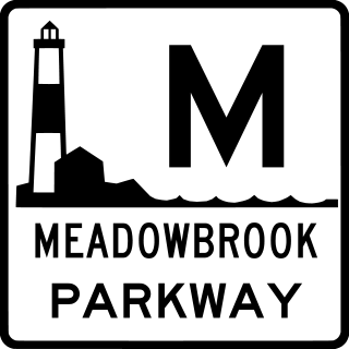
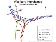
The Meadowbrook State Parkway is a 12.52-mile (20.15 km) parkway in Nassau County, New York, in the United States. Its southern terminus is at a full cloverleaf interchange with the Bay and Ocean parkways in Jones Beach State Park. The parkway heads north, crossing South Oyster Bay and intersecting Loop Parkway before crossing onto the mainland and connecting to the Southern State Parkway in North Merrick. It continues north to the hamlet of Carle Place, where the Meadowbrook Parkway ends at exit 31A of the Northern State Parkway. The Meadowbrook Parkway is designated New York State Route 908E (NY 908E), an unsigned reference route. Most of the road is limited to non-commercial traffic, like most parkways in the state of New York; however, the portion south of Merrick Road is open to commercial traffic.

<span class="mw-page-title-main">Loop Parkway</span> A 2.65-mile (4.26 km) parkway in Nassau County, New York, in the United States

The Loop Parkway is a 2.65-mile (4.26 km) parkway in Nassau County, New York, in the United States. It serves the barrier islands south of Long Island itself, beginning on Long Beach Barrier Island at an intersection with Lido Boulevard in Point Lookout. From here, it heads generally east–west across Alder and Meadow islands to an interchange with the Meadowbrook State Parkway on Jones Island, a part of Jones Beach State Park located just north of Jones Beach Island. The islands served by the Loop Parkway are separated by narrow channels of water, all of which connect to Jones Inlet. The parkway is maintained by the New York State Department of Transportation (NYSDOT) and inventoried by the department as New York State Route 908C (NY 908C), an unsigned reference route.

<span class="mw-page-title-main">Wantagh State Parkway</span> Highway in Nassau County, New York

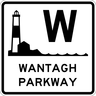
The Wantagh State Parkway is a 13.33-mile (21 km) long parkway on Long Island, New York, in the United States. It links the Ocean Parkway in Jones Beach State Park with the Northern State Parkway in Westbury. The parkway is located approximately 30 miles (48 km) east of Manhattan and 14 miles (23 km) east of the Nassau–Queens border.

<span class="mw-page-title-main">Northern State Parkway</span> Highway in New York

The Northern State Parkway is a 28.88-mile-long (46.48 km) parkway on Long Island in the U.S. state of New York. The western terminus is at the Queens–Nassau County line, where the parkway continues westward into New York City as the Grand Central Parkway. The eastern terminus is at New York State Route 347 (NY 347) and NY 454 in Hauppauge. The parkway is designated New York State Route 908G (NY 908G), an unsigned reference route. As its name implies, the parkway services communities along the northern half of the island.

<span class="mw-page-title-main">New York State Route 25B</span> State highway on Long Island in New York, US

New York State Route 25B (NY 25B) is a 7.25-mile (11.67 km) east–west state highway located on Long Island in New York, United States. The western terminus of the route is at an intersection with NY 25 in Queens. The eastern terminus is at an interchange with NY 25 in Westbury, Nassau County. NY 25B is named Hillside Avenue for its entire length, except for a 0.69-mile (1.11 km) portion in the village of East Williston, where it is called East Williston Avenue and owned & maintained by Nassau County as the unsigned County Route 85.

<span class="mw-page-title-main">Sagtikos State Parkway</span> Limited-access parkway in Suffolk County

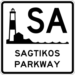
The Sagtikos State Parkway is a 5.14-mile (8.27 km) north–south parkway in Suffolk County on Long Island, New York, in the United States. It begins at an interchange with the Southern State and Heckscher Parkways in the hamlet of West Islip and goes north to a large cloverleaf interchange with the Northern State Parkway in the town of Smithtown, where the Sagtikos ends and the road becomes the Sunken Meadow State Parkway. The parkway comprises the southern half of New York State Route 908K (NY 908K), an unsigned reference route, with the Sunken Meadow State Parkway forming the northern portion. Commercial vehicles are prohibited from using the Sagtikos State Parkway, a restriction that applies to most parkways in the state.

<span class="mw-page-title-main">New York State Route 107</span> State highway in Nassau County, New York, US

New York State Route 107 (NY 107) is a 17.07-mile (27.47 km) state highway in Nassau County, New York, in the United States. The route begins at an intersection with Merrick Road in Massapequa, serving several communities in the town of Oyster Bay before entering the city of Glen Cove and terminating at an intersection with Pulaski Street. From here, the right-of-way continues west for a short distance as Pratt Boulevard (CR 243) to Brewster Street and Glen Cove Avenue. Route 107 is the only State Highway on Long Island to enter a city other than New York City. The route connects with several major parkways and expressways and has a concurrency with NY 106 through Hicksville and Jericho Gardens; the route is historically known as the Massapequa Glen Cove Highway.

<span class="mw-page-title-main">New York State Route 347</span> State highway in Suffolk County, New York, US

New York State Route 347 (NY 347) is an east–west expressway located in Suffolk County, New York, in the United States. It connects the Northern State Parkway in Hauppauge to NY 25A in Mount Sinai. The route serves as a southern bypass of Smithtown and as a direct link between Nesconset and Port Jefferson. Along the way, NY 347 intersects NY 25 in Nesconset and Nicolls Road in Lake Grove. The westernmost 2 miles (3.2 km) of NY 347 is concurrent with NY 454 while the portion northeast of NY 25 parallels NY 25A, which follows a more northerly alignment through the town of Brookhaven than NY 347.

<span class="mw-page-title-main">New York State Route 110</span> State highway in Suffolk County, New York, US

New York State Route 110 (NY 110) is a major north–south state highway along the western border of Suffolk County, New York. It runs between the village of Amityville in the town of Babylon and Halesite in the town of Huntington. NY 110 comes close to the Nassau County line several times in the town of Babylon, which is only surpassed by NY 108 in distance to the county line for a state highway.

<span class="mw-page-title-main">Kew Gardens Interchange</span> Highway interchange in Kew Gardens, Queens, New York

The Kew Gardens Interchange is a complex interchange in Kew Gardens, in the center of the New York City borough of Queens serving nearly 600,000 vehicles daily.

Glen Cove Road is a major, 11.7-mile-long (18.8 km) north–south thoroughfare running through north-central Nassau County on Long Island, New York, in the United States.

<span class="mw-page-title-main">New York State Route 135</span> State highway in Nassau County, New York, US

New York State Route 135 (NY 135) is a 10.8-mile (17.4 km) state highway in eastern Nassau County, New York, in the United States. The route is a freeway that connects Seaford with Syosset. The highway runs from Merrick Road in Seaford to NY 25 in Syosset. In between, NY 135 passes through Bethpage and Plainview and serves Bethpage State Park. The highway is ceremoniously designated as the Ralph J. Marino Expressway; however, it is more commonly known as the Seaford–Oyster Bay Expressway.

The Freeport–Roslyn Expressway was a proposed north–south controlled-access highway, that would have run between Freeport and East Hills – in the vicinity of Roslyn – in Nassau County, on Long Island, in the State of New York.

References

  1. 1 2 3 4 5 6 7 "Compact NYSDOT Highway Record Plans: Beginning 1900". New York State Department of Transportation. Retrieved November 23, 2023.
  2. 1 2 3 Google (November 27, 2023). "Westbury Interchange" (Map). Google Maps . Google. Retrieved November 27, 2023.
  3. 1 2 3 4 In The Matter of Village of Westbury, Respondent v. Department of Transportation of the State of New York, et. al, Appellants(Court of Appeals for the State of New YorkDecember 19, 1989), Text .
  4. "Long Island Index: Interactive Map". www.longislandindexmaps.org. Retrieved November 27, 2023.
  5. 1 2 Fan, Maureen (January 15, 1990). "A View from Westbury, A Roar Heard Over Interchange". Newsday. New York City. Retrieved December 23, 2012.
  6. Morris, Tom (January 13, 1976). "Coming Up: A Standstill Decade: The Island depends on state funds for big projects-- and the state won't be spending much TRANSPORTATION". Newsday . p. 6 via ProQuest.
  7. 1 2 3 Annual Report (Report). New York State Department of Transportation. 1991. p. 42.
  8. 1 2 Gralla, Joan (November 28, 2022). "Key parkway interchange in Westbury area to be revamped, state officials say". Newsday. Retrieved November 27, 2023.
  9. 1 2 3 Costello, Alex (November 29, 2022). "Major Road Improvement Project Starts In Westbury". MSN. Retrieved November 28, 2023.
  10. 1 2 "State Department of Transportation Announces Start of $3.8 Million Project to Upgrade Northern State Parkway Interchange with Jericho Turnpike And Glen Cove Road" (Press release). New York State Department of Transportation. November 28, 2022. Retrieved November 27, 2023.
  11. "Busy Nassau interchange near Westbury gets $3.8M upgrade". Newsday. December 26, 2023. Retrieved December 31, 2023.
  12. Winzelberg, David (July 30, 1989). "New Plan For Parkway Roils Westbury". The New York Times . pp. 11LI1. Retrieved November 27, 2023.
  13. 1 2 Saslow, Linda (February 19, 1989). "Woodbury Suit Threatens Highway Interchange Work". The New York Times. p. LI8. Retrieved December 23, 2012.
  14. 1 2 Rizzo, Frank (October 11, 2019). "When The Mayor Took On The Governor–And Won". Nassau Ilustrated. Retrieved November 27, 2023.
  15. 1 2 Abrams, Arnold (April 25, 1989). "Order Halting Road Project Is Thwarted". Newsday. New York City. p. 30.
  16. Lyall, Sarah (January 5, 1990). "Court Detours Effort to Repair an L.I. Parkway Junction". The New York Times. Retrieved December 23, 2012.
  17. Morris, Tom (February 6, 1990). "Parkway Project Restarts Slowly". Newsday. p. 23. Retrieved December 23, 2012.
  18. Fan, Maureen (April 26, 1990). "Parkways Work Back Up to Speed Interchange now termed safer". Newsday. Retrieved December 23, 2012.