Fair Haven is a neighborhood in the eastern part of the city of New Haven, Connecticut, between the Mill and Quinnipiac rivers. The northeast section of the neighborhood is also known as Chatham Square.

Westville is a neighborhood of the city of New Haven, Connecticut. It is consistently ranked as one of the best neighborhoods to live in New Haven due to its high home values, low crime rates, walkable streets, proximity to downtown, and local amenities.

City Point is an area in what is now The Hill neighborhood of the city of New Haven, Connecticut, located in the southwestern portion of the city. The City Point area was, when settled and through the 18th century, a relatively narrow peninsula extending south into New Haven Harbor, located where the West River empties into the harbor. Areas adjacent to the original peninsula have since been filled in, broadening its shoulders, and Interstate 95 has cut across it. The Oyster Point Historic District is a 26-acre (11 ha) historic district encompassing an area of relatively old buildings in City Point south of I-95.

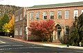
Edgewood Historic District is a historic district located in the west-central portion of New Haven, Connecticut. It was listed on the National Register of Historic Places in 1986. A predominantly residential area roughly bisected by Edgewood Avenue, a broad boulevard which features a large central esplanade and forms the principal east-west artery through the heart of the district. The area includes 232 contributing buildings, 4 other contributing structures, and 1 contributing object. Most of these were built between about 1888 and 1900, and represent the city's first neighborhood planned under the tenets of the City Beautiful movement. They are generally either Queen Anne or Colonial Revival in style, and are set on larger lots.

The Masonic Hall of Hiram Masonic Lodge No. 7 is a historic Gothic revival building on South 2nd Avenue in Franklin, Tennessee. Constructed in 1823, it is the oldest public building in Franklin. It is nationally significant as the site of negotiations leading to the Treaty of Franklin, the first Indian removal treaty agreed after passage of the 1830 Indian Removal Act. It was declared a National Historic Landmark in 1973. It continues to serve the local Masonic lodge.

The Colchester Village Historic District encompasses most of the historic village center of Colchester, Connecticut. It is located at the junction of Route 16, Route 85, and Norwich Avenue. Roughly, the district extends to the northwest along Broadway Street as far as Jaffe Terrace; east along Norwich Avenue to just short of Pleasant Street; south along South Main Street to just north of Hall Hill Road; west along Linwood Avenue to just east of Kmick Lane. The historic district was listed on the National Register of Historic Places (NRHP) in 1994.

The Whitney Avenue Historic District is a historic district in the East Rock neighborhood of New Haven, Connecticut. It is a 203-acre (82 ha) district which included 1,084 contributing buildings when it was listed on the National Register of Historic Places in 1989.

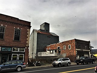
The Winchester Repeating Arms Company Historic District is a historic district in New Haven, Connecticut that was listed on the National Register of Historic Places in 1988. It includes 867 properties, which "include 858 major structures and 131 notable outbuildings." Of these structures, 876 are buildings deemed to contribute to the historical and/or architectural significance of the area, and most of these are residential. However the center of the district is "dominated" by the 75-acre (30 ha) tract of the former Winchester Repeating Arms Company, which contains industrial buildings.

This is a list of National Register of Historic Places listings in New Haven, Connecticut.

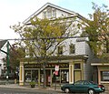
The Dwight Street Historic District is an irregularly shaped 135-acre (55 ha) historic district in New Haven, Connecticut. The district is located immediately west of the center of Downtown New Haven and is generally bounded by Elm Street on the north, Park Street on the east, North Frontage Road on the south, and Sherman Avenue on the west. It contains one of the city's highest concentrations of well-preserved 19th and early 20th-century residential architecture, much of which was developed for the working classes in the city's factories. It was listed on the National Register of Historic Places in 1983. The historic district includes most of the Dwight neighborhood and several blocks of the northeast corner of the West River neighborhood.
The city of New Haven, Connecticut has many distinct neighborhoods. In addition to Downtown, centered on the central business district and the Green, are the following neighborhoods: the west central neighborhoods of Dixwell and Dwight; the southern neighborhoods of The Hill, historic water-front City Point, and the harborside district of Long Wharf; the western neighborhoods of Edgewood, West River, Westville, Amity, and West Rock; East Rock, Cedar Hill, Prospect Hill, and Newhallville in the northern side of town; the east central neighborhoods of Mill River and Wooster Square, an Italian-American neighborhood; Fair Haven, an immigrant community located between the Mill and Quinnipiac rivers; Quinnipiac Meadows and Fair Haven Heights across the Quinnipiac River; and facing the eastern side of the harbor, The Annex and East Shore.

The Greenwich Avenue Historic District is a historic district representing the commercial and civic historical development of the downtown area of the town of Greenwich, Connecticut. The district was listed on the National Register of Historic Places on August 31, 1989. Included in the district is the Greenwich Municipal Center Historic District, which was listed on the National Register the year before for the classical revival style municipal buildings in the core of Downtown. Most of the commercial buildings in the district fall into three broad styles, reflecting the period in which they were built: Italianate, Georgian Revival, and Commercial style. The district is linear and runs north–south along the entire length of Greenwich Avenue, the main thoroughfare of Downtown Greenwich, between U.S. Route 1 and the New Haven Line railroad tracks.
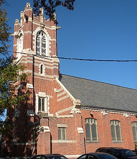
St. Luke's Episcopal Church is a historic church at 111-113 Whalley Avenue in New Haven, Connecticut. Built in 1905 for a congregation founded in 1844, it is a good example of late Gothic Revival architecture, and is further notable as the second church in the city established as an African-American congregation. It was listed on the National Register of Historic Places in 2003.

Quinnipiac River Historic District is a 313-acre (127 ha) historic district straddling the Quinnipiac River in the Fair Haven and Fair Haven Heights neighborhoods of New Haven, Connecticut. It encompasses most of the historic maritime village of Fair Haven, with a history dating back to the 18th century. It was listed on the National Register of Historic Places in 1984. At that time it included 524 contributing buildings, an inland wetland at the mouth of Hemingway Creek on the northeast corner of the district, and the Grand Avenue Swing Bridge over the Quinnipiac River connecting Fair Haven with Fair Haven Heights at the center of the district.

Leoni W. Robinson was a leading architect in New Haven, Connecticut.

Casselton Commercial Historic District is a 9.3-acre (3.8 ha) historic district in Casselton, North Dakota that was listed on the National Register of Historic Places in 1982.

The Ardmore Historic Commercial District, in Ardmore, Oklahoma, is a 19 acres (7.7 ha) historic district which was listed on the National Register of Historic Places in 1983.

The Foley Downtown Historic District, in Foley, Alabama, is a historic district which was listed on the National Register of Historic Places in 2005.
The Harrison Commercial Historic District, in Harrison, Idaho, is a historic district which was listed on the National Register of Historic Places in 1996. The listing included six contributing buildings.