Related Research Articles
Greene County is a county in Virginia in the eastern United States. As of the 2010 census, the population was 18,403. Its county seat is Stanardsville.

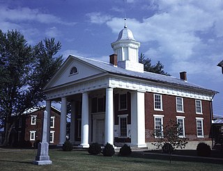
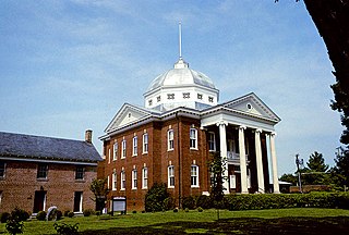
Page County is located in the Commonwealth of Virginia. As of the 2010 census, the population was 24,042. Its county seat is Luray. Page County was formed in 1831 from Shenandoah and Rockingham counties and was named for John Page, Governor of Virginia from 1802 to 1805.

Madison County is a county located in the Commonwealth of Virginia. As of the 2010 census, the population was 13,308. Its county seat is Madison.
Louisa County is a county located in the Commonwealth of Virginia. As of the 2010 census, the population was 33,153. The county seat is Louisa.

Buckingham County is a rural United States county located in the Commonwealth of Virginia, and containing the geographic center of the state. Buckingham County is part of the Piedmont region of Virginia, and the county seat is Buckingham.

Jefferson County is a county located in the U.S. state of Georgia. As of the 2010 census, the population was 16,930. The county seat is Louisville. The county was created on February 20, 1796, and named for Thomas Jefferson, the main author of the Declaration of Independence who became the third president of the United States.

Burke is an unincorporated section of Fairfax County, Virginia, United States traditionally defined as the area served by the Burke post office. Burke includes two census-designated places: The Burke CDP, population 41,055 in 2010 and the Burke Centre CDP, population 17,326.

Hybla Valley is a census-designated place (CDP) in Fairfax County, Virginia, United States, south of Alexandria. The population was 15,801 at the 2010 census, down from 16,721 in 2000 due to a reduction in area, resulting from some of the eastward neighborhoods including much of Hollin Hills being moved to the Fort Hunt CDP.

Newington is a census-designated place (CDP) in Fairfax County, Virginia, United States. The population was 12,943 at the 2010 census. The 2010 census showed a significant decrease after half the population was split off to the newly created Newington Forest CDP.

The Washington and Old Dominion Railroad Regional Park is a linear regional park in Northern Virginia. The park's primary feature is the Washington and Old Dominion Railroad Trail, an asphalt-surfaced paved rail trail that runs through densely populated urban and suburban communities as well as through rural areas. Most of the trail travels on top of the rail bed of the former Washington and Old Dominion Railroad, which closed in 1968.

Sandy Gulch is a small community in Calaveras County, California, just southwest of West Point on State Route 26. It lies at an elevation of 2592 feet above sea level and is located at 38°22′49″N120°31′58″W. The community is in ZIP code 95248 and area code 209.
Conran is an unincorporated community in eastern New Madrid County, Missouri, United States. It is located approximately ten miles southwest of New Madrid on U.S. Route 61.

William Randolph Barbee was an American sculptor recognized for creating idealized, sentimental classical figures. Barbee's most notable works were the marble sculptures entitled Coquette and Fisher Girl.
The Empire City Historic Landmark is a California Historic Landmark in honor of the pioneer John C. Marvin who from 1850, settled on the south bank of the Tuolumne River and called the town "Empire City". Empire City was the head of navigation for small steamboats that could ascend the Tuolumne River carrying passengers and supplies. It was the shipping point for the large grain crops grown in the area. At its height, the town had three stores, a three-story hotel, two boarding houses, a blacksmith shop, a church, and a school house. Empire City was voted as the county seat of Stanislaus County from October 1854 to December 1855. The town was destroyed by flood waters during the Great Flood of 1862. A new railroad town was built 40 years later 1 mile north of the old town site, taking the name Empire.
Nancy Wrights Corner is an unincorporated community in Caroline County, in the U.S. state of Virginia. It is located along US 1 and VSR 605, west of Woodford. The community was one of the sites of the Battle of North Anna.
Catherine Furnace is an unincorporated community in Page County, in the U.S. state of Virginia. The earned its name from the blast furnace of the same name, built in 1846, by the Forrer family.
Fairview, Page County is an unincorporated community in Page County, in the U.S. state of Virginia. In this community, there is a local general store, with a butchery, jams, honey, and interesting snacks. It is near Luray, Virginia also.
Jollett is an unincorporated community in Page County, in the U.S. state of Virginia. It is not as much of a town per se, but it has a number of houses in the area. It is mainly characterized by the fact it is surrounded on all sides by the Blue Ridge Mountains and it having only small valleys.
Salem, Page County is an unincorporated community in Page County, in the U.S. state of Virginia.
Buck Mountain is a summit in the Free Union area of Albemarle County, Virginia. Its elevation is 1,358 feet and 414 meters. It was named for the abundance of deer in the area. Buck Mountain is bounded by 776, 667 and 601, and 671 roads, as well as Buck Mountain Creek.
References
- U.S. Geological Survey Geographic Names Information System: White House, Page County, Virginia
- "White House Bridge" Marker at the Historical Markers Database
- "White House" Marker at the Historical Markers Database
Municipalities and communities of Page County, Virginia, United States | ||
|---|---|---|
| Towns |  | |
| Unincorporated communities |
| |
Coordinates: 38°38′48″N78°31′58″W / 38.64667°N 78.53278°W
| | This Page County, Virginia state location article is a stub. You can help Wikipedia by expanding it. |