Alamo is a town in Crockett County, Tennessee, United States. Its population was 2,461 at the time of the 2010 U.S. Census. Alamo, located in the central part of West Tennessee, is the county seat of Crockett County.

Gainesboro is a town in Jackson County, Tennessee, United States. The population was 920 at the 2020 census. It is the county seat of Jackson County.

Loudon is a city in and the county seat of Loudon County, Tennessee, United States. Its population was 6,001 at the 2020 census. It is included in the Knoxville, Tennessee Metropolitan Statistical Area. The city is located in East Tennessee, southwest of Knoxville, on the Tennessee River. Fort Loudoun, the colonial era fort for which the city was named, is located several miles to the south in Monroe County.

Decatur is a town in Meigs County, Tennessee, United States. The population was 1,563 at the 2020 census. It is the county seat of Meigs County.

Martin is a city in Weakley County, Tennessee, United States. The population was 10,825 according to the 2020 census. The city is the home of the University of Tennessee at Martin.
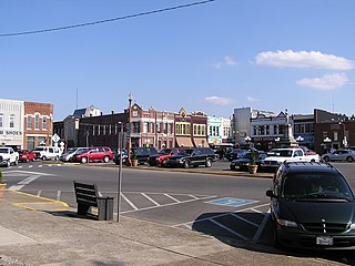
Lebanon is the county seat of Wilson County, Tennessee, United States. The population was 38,431 at the 2020 census. Lebanon is located in Middle Tennessee, approximately 25 miles (40 km) east of downtown Nashville. Lebanon is part of the Nashville Metropolitan Statistical Area.

Sweetwater is a city in Monroe and McMinn counties in the U.S. state of Tennessee, and the most populous city in Monroe County. As of the 2020 census, its population was 6,312. Sweetwater is the home of the Craighead Caverns which contains the Lost Sea, the United States' largest underground lake. In 2022, TravelMag named Sweetwater one of Tennessee’s Ten Most Charming Cities.

Harrogate is the largest city in Claiborne County, Tennessee, United States. It is adjacent to Cumberland Gap National Historical Park.

Petros is an unincorporated community and census-designated place (CDP) in Morgan County, Tennessee, United States, located on State Route 116. Its population was 583 as of the 2010 Census. Petros has its own post office, with the ZIP code 37845.
Delano is an unincorporated community in Polk County, Tennessee, United States. It is located near the junction of U.S. Route 411, Tennessee State Route 30 and Tennessee State Route 163 4.3 miles (6.9 km) south-southwest of Etowah. Delano has a post office with ZIP code 37325, which opened on August 14, 1909.
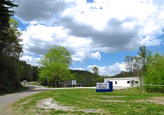
Farner is an unincorporated community in Polk County, Tennessee, United States. Farner is located in a mountainous area along Tennessee State Route 68 near the North Carolina border, 9 miles (14 km) north-northeast of Ducktown. Farner has a post office with ZIP code 37333. The Hiwassee River and Apalachia Dam are located just to the north.
Lavinia is an unincorporated community in Carroll County, Tennessee, United States. In 1822, Lavinia was organized as a community. In 1950, Lavinia School was destroyed by a fire.
Yuma is an unincorporated community in Carroll County, Tennessee, United States. It is located along Tennessee State Route 424 about 3.5 miles (5.6 km) southeast of Clarksburg. Yuma has a post office, with Zip code 38390.
Darden is an unincorporated community and census-designated place (CDP) in Henderson County, Tennessee, United States. As of the 2010 census, its population was 399. The ZIP code is 38328.

Christiana is an unincorporated community and census-designated place in Rutherford County, Tennessee, United States. It has a post office, with ZIP code 37037. Christiana Middle School is located in the community. Both U.S. Route 231 and Tennessee State Route 269 pass through the community.
Hickman is an unincorporated community in Smith County, Tennessee, United States. Its ZIP code is 38567.

Flintville is an unincorporated community in Lincoln County, Tennessee, United States. As of the 2010 census, its population was 627. Flintville is located approximately 10.5 miles (16.9 km) southeast of Fayetteville along Tennessee State Route 275 highway.

Pocahontas is an unincorporated community and census-designated place (CDP) in Hardeman and McNairy counties, Tennessee, United States. It is eighty-three miles southeast of Memphis.
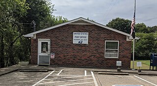
Dellrose is an unincorporated community in Lincoln County, Tennessee, United States. It has a post office, with ZIP code 38453. It is located along Tennessee State Route 273 between Elkton and Fayetteville.

Pelham is an unincorporated community and census-designated place (CDP) in Grundy County, Tennessee, United States. As of the 2010 census, its population was 403. Pelham is located at the junction of U.S. Route 41, State Route 2, and State Route 50 near the base of the Cumberland Plateau, 5.35 miles (8.61 km) north-northwest of Monteagle. Pelham has a post office with ZIP code 37366, which opened on April 4, 1832.