East Hills is a village in Nassau County, on the North Shore of Long Island, in New York, United States. It is considered part of the Greater Roslyn area, which is anchored by the Incorporated Village of Roslyn. The population was 6,955 at the 2010 census.

Flower Hill is a village in Nassau County, on the North Shore of Long Island, in New York, United States. The eastern half is considered part of the Greater Roslyn area, which is anchored by the Incorporated Village of Roslyn. Western and northern parts are more closely associated with Manhasset and Port Washington. The population was 4,794 at the time of the 2020 census.

Greenvale is a hamlet and census-designated place (CDP) in the towns of North Hempstead and Oyster Bay in Nassau County, on the North Shore of Long Island, in New York, United States. It is considered part of the Greater Roslyn area, which is anchored by the Incorporated Village of Roslyn. The population was 1,069 at the time of the 2020 census.

Roslyn is a village in the Town of North Hempstead in Nassau County, on the North Shore of Long Island, in New York, United States. It is the Greater Roslyn area's anchor community. The population was 2,988 at the 2020 census.
Roslyn Estates is a village in the Town of North Hempstead in Nassau County, on the North Shore of Long Island, in New York, United States. It is considered part of the Greater Roslyn area, which is anchored by the Incorporated Village of Roslyn. The population was 1,318 at the 2020 census.

Roslyn Harbor is a village in Nassau County, on the North Shore of Long Island, in New York, United States. It is considered part of the Greater Roslyn area, which is anchored by the Incorporated Village of Roslyn. The population was 1,051 at the 2010 census.

Roslyn Heights is a hamlet and census-designated place (CDP) in the Town of North Hempstead in Nassau County, on the North Shore of Long Island, in New York, United States. It is considered part of the Greater Roslyn area, which is anchored by the Incorporated Village of Roslyn. The population was 6,747 at the time of the 2020 census.

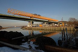
The Goethals Bridge is the name of a pair of cable-stayed bridge spans connecting Elizabeth, New Jersey, to Staten Island, New York, in the United States. The spans cross a strait known as Arthur Kill, and replaced a cantilever bridge span built in 1928. The bridge is operated by the Port Authority of New York and New Jersey.
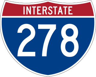
Interstate 278 (I-278) is an auxiliary Interstate Highway in New Jersey and New York in the United States. The road runs 35.62 miles (57.32 km) from US Route 1/9 (US 1/9) in Linden, New Jersey, northeast to the Bruckner Interchange in the New York City borough of the Bronx. The majority of I-278 is in New York City, where it serves as a partial beltway and passes through all five of the city's boroughs. I-278 follows several freeways, including the Union Freeway in Union County, New Jersey; the Staten Island Expressway (SIE) across Staten Island; the Gowanus Expressway in southern Brooklyn; the Brooklyn–Queens Expressway (BQE) across northern Brooklyn and Queens; a small part of the Grand Central Parkway in Queens; and a part of the Bruckner Expressway in the Bronx. I-278 also crosses multiple bridges, including the Goethals, Verrazzano-Narrows, Kosciuszko, and Robert F. Kennedy bridges.

Interstate 495 (I-495), commonly known as the Long Island Expressway (LIE), is an auxiliary Interstate Highway in the US state of New York. It is jointly maintained by the New York State Department of Transportation (NYSDOT), the New York City Department of Transportation (NYCDOT), MTA Bridges and Tunnels (TBTA), and the Port Authority of New York and New Jersey (PANYNJ).
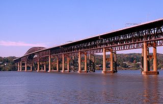
The Hamilton Fish Newburgh–Beacon Bridge is a continuous truss toll bridge that spans the Hudson River in New York State. The bridge carries Interstate 84 (I-84) and New York State Route 52 (NY 52) between Newburgh and Beacon and consists of two separate spans. The original northern span, which now carries westbound traffic, was opened on November 2, 1963, as a two-lane bridge. A second span, completed in 1980, now carries all eastbound traffic. Still often referred to by its original name, the Newburgh–Beacon Bridge, in 1997 the bridge was rededicated in honor of Hamilton Fish III, a 12-term member of the U.S. House of Representatives, and his son and namesake Hamilton Fish IV, a 13-term member of the House.

New York State Route 25A (NY 25A) is a state highway on Long Island in New York, United States. It serves as the main east–west route for most of the North Shore of Long Island, running for 73 miles (117 km) from Interstate 495 (I-495) at the Queens–Midtown Tunnel in the New York City borough of Queens to NY 25 in Calverton, Suffolk County. The highway is a northern alternate route of NY 25, which follows a more inland routing along Jericho Turnpike.

New York State Route 27 (NY 27) is a 120.58-mile (194.05 km) long state highway that runs east–west from Interstate 278 (I-278) in the New York City borough of Brooklyn to Montauk Point State Park on Long Island, New York. Its two most prominent components are Sunrise Highway and Montauk Highway, the latter of which includes the Montauk Point State Parkway. NY 27 acts as the primary east–west highway on southern Long Island east of the interchange with the Heckscher State Parkway in Islip Terrace. The entire route in Suffolk, Nassau, and Queens counties were designated by the New York State Senate as the POW/MIA Memorial Highway. The highway gives access to every town on the South Shore. NY 27 is the easternmost state route in the state of New York.

The Southern State Parkway is a 25.53-mile (41.09 km) parkway on Long Island, New York, in the United States. The parkway begins at an interchange with the Belt and Cross Island Parkways in Elmont, in Nassau County, and travels east to an interchange with the Sagtikos State Parkway in West Islip, Suffolk County, where it becomes the Heckscher State Parkway. The Southern State Parkway comprises the western portion of unsigned New York State Route 908M (NY 908M), with the Heckscher Parkway occupying the eastern section.

The George Clinton Kingston–Rhinecliff Bridge is a continuous under-deck truss toll bridge that carries NY 199 across the Hudson River in New York State north of the City of Kingston and the hamlet of Rhinecliff. It was opened to traffic on February 2, 1957, as a two-lane bridge, although it was not actually complete. The formal opening was May 11, 1957. The original cost was $17.5 million.
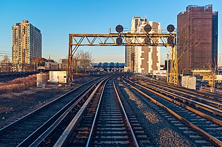
The Main Line is a rail line owned and operated by the Long Island Rail Road in the U.S. state of New York. It begins as a two-track line at the Long Island City station in Long Island City, Queens, and runs along the middle of Long Island about 95 miles (153 km) to the Greenport station in Greenport, Suffolk County. A mile east of the Long Island City station, the four tracks of the East River Tunnels join the two tracks from Long Island City; most Main Line trains use these tunnels rather than running to or from Long Island City.
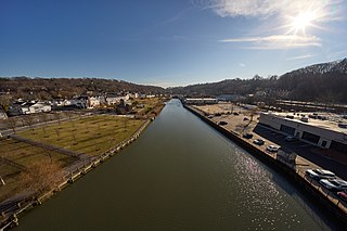
Hempstead Harbor is a bay hugging the northern coast of Long Island, New York. Located off of the Long Island Sound, it forms the northernmost portion of the political border between the Nassau County towns of Oyster Bay on the east and North Hempstead on the west, as well as the western border of the city of Glen Cove.

The Webster Avenue Bridge is a road bridge over the Long Island Rail Road's Port Washington Branch between the Long Island villages of Plandome Heights and Flower Hill.

Strathmore is an unincorporated, Levitt & Sons-developed hamlet in the Town of North Hempstead in Nassau County, on the North Shore of Long Island, in New York, United States, within the census-designated place (CDP) of Manhasset.