Sacramento is the capital city of the U.S. state of California and the county seat of Sacramento County. Located at the confluence of the Sacramento and American Rivers in Northern California's Sacramento Valley, Sacramento's 2020 population of 524,943 makes it the fourth-most populous city in Northern California, sixth-most populous city in the state, and the ninth-most populous state capital in the United States. Sacramento is the seat of the California Legislature and the Governor of California.

Sutter's Fort was a 19th-century agricultural and trade colony in the Mexican Alta California province. Established in 1839, the site of the fort was originally called New Helvetia by its builder John Sutter, though construction of the fort proper would not begin until 1841. The fort was the first non-indigenous community in the California Central Valley. The fort is famous for its association with the Donner Party, the California Gold Rush, and the formation of the city of Sacramento, surrounding the fort. It is notable for its proximity to the end of the California Trail and Siskiyou Trails, which it served as a waystation.
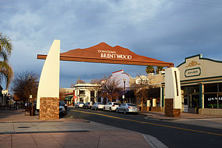
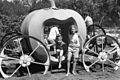
Brentwood, or “Corn Town”, is a city in Contra Costa County, California, United States. It is located in the East Bay region of the San Francisco Bay Area. The population is 66,854 as of 2022, an increase of 287% from 23,302 at the 2000 census.
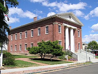
Benicia Capitol State Historic Park is a state park in Benicia, California, United States. The park is dedicated to California's third capitol building, where the California State Legislature convened from February 3, 1853 to February 24, 1854, when they voted to move the state capital to Sacramento. It is the only pre-Sacramento capitol that remains. The park includes the Fischer-Hanlon House, an early Benicia building that was moved to the property and converted into a home in 1858, after the legislature departed. Benicia Capitol State Historic Park just off the city's main street also includes a carriage house, workers' quarters and sculptured gardens.

The California State Capitol Museum consists of a museum in and grounds around the California State Capitol in Sacramento, California, United States. The building has been the home of the California State Legislature since 1869. The State Capitol Museum has been a property in the California State Parks system since 1982.
Plumas Lake is a master-planned exurb and census-designated place in Yuba County, California. It is located 30 miles (48 km) north of Sacramento and 10 miles (16 km) south of Marysville off California State Route 70. Its population was 8,126 at the 2020 census.

Druid Hill Park is a 745-acre (3.01 km2) urban park in northwest Baltimore, Maryland. Its boundaries are marked by Druid Park Drive (north), Swann Drive and Reisterstown Road, and the Jones Falls Expressway / Interstate 83 (east).
Elmhurst is a historic residential neighborhood located in the eastern part of Sacramento, California. Elmhurst is known for its large elm, ash, and oak trees that provide shady canopy for the neighborhood.

The American River Parkway is a 32-mile (51 km) parkway that runs along the American River throughout Sacramento County, California and consists of many smaller parks and boat launching points. It can be accessed by various exits off U.S. Route 50 in Sacramento County.

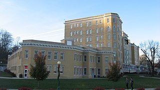
The California Governor's Mansion is the official residence of the governor of California, located in Sacramento, the capital of California. Built in 1877, the estate was purchased by the Californian government in 1903 and has served as the executive residence for 14 governors. The mansion was occupied by governors between 1903–1967 and 2015–2019. Since 1967, the mansion has been managed by California State Parks as the Governor's Mansion State Historic Park.

Emma Prusch Farm Park is a 43.5 acre park in East San Jose, California. Donated by Emma Prusch to the City of San Jose in 1962 to use to demonstrate the valley's agricultural past, it includes a 4-H barn, community gardens, a rare-fruit orchard, demonstration gardens, picnic areas, and expanses of lawn. The park is host to an annual Harvest Festival and is operated cooperatively by the San Jose Parks and Recreation Department and the non-profit Emma Prusch Farm Park Foundation.

The California Exposition and State Fair is an independent state agency established by law in the California Food and Agriculture codes. Cal Expo is governed by an appointed 11-member Board of Directors and daily operations are managed by the chief executive officer. During the annual California State Fair more than 2,000 seasonal temporary employees are hired. The California Exposition is a self-sufficient operation that receives no government funding but still has an estimated economic impact of more than $250 million on the region. The California Exposition and State Fair Police provides safety and security services to the Exposition.

Red Baron is an amusement ride that is primarily intended for small children. It's a common kiddie ride at many amusement parks, carnivals, and fairs. The rider can move the gondola up and down manually. Many ride manufacturers make this type of ride; the Zamperla's "Mini Jet" is a common model of this ride. The "Mini Jet" ride comes in various themes such as bees, dragons, elephants, airplanes, helicopters, spaceships, etc. Some of the Red Baron kiddie rides are restricted to only children under 54 inches tall, such as the ones in Cedar Point Amusement Park and in Kings Island Amusement Park, or the one in Six Flags Discovery Kingdom in Vallejo, California. In quite a few other "Red Baron" type kiddie rides, adults and parents are allowed to ride on the rides, such as "The Busy Bees" and "Amazing Flying Elephants" at Dollywood in Pigeon Forge, Tennessee, or at the Red Baron Ride at Funderland in Sacramento, California. Another place where adults can ride on a Red Baron type ride is at Disneyland and Walt Disney World, where Dumbo the Flying Elephant has been a perennial favorite of not only toddlers, preschoolers and young children, but teenagers, adults and seniors as well, for many years.
East Lawn Memorial Park is a cemetery in East Sacramento, California. It is owned by East Lawn Memorial Parks & Mortuaries, which also owns two other Sacramento area cemeteries. Founded in 1904, it is the resting place of several former Mayors of Sacramento as well as other public figures.

Randall Island is an island in the Sacramento River, in the Sacramento–San Joaquin River Delta. It is part of Sacramento County, California, and managed by Reclamation District 755. Its coordinates are 38°20′25″N121°33′03″W, and the United States Geological Survey measured its elevation as 0 ft (0 m) in 1981. It is shown, labelled "Hensley Island", on an 1850 survey map of the San Francisco Bay area made by Cadwalader Ringgold and an 1854 map of the area by Henry Lange.
New Helvetia Cemetery, initially named Sutter Fort Burying Ground, is a defunct cemetery founded in c. 1845 and closed in 1912, formerly located at northeast corner of Alhambra Boulevard and J Street in the East Sacramento neighborhood of Sacramento, California. It was the first cemetery in the city of Sacramento.

Western Hotel, was a historical hotel in Sacramento, California. The site of the former hotel is a California Historical Landmark No. 601 listed on May 22, 1957. The Western Hotel was at near the intersection of 2nd street and K Street, Sacramento and owned by William Land. The site is now a Parking lot under the Interstate 5 in California.