Williamsburg, Iowa

Last updated

Williamsburg, Iowa
Iowa County Iowa Incorporated and Unincorporated areas Williamsburg Highlighted.svg
Location of Williamsburg, Iowa
Coordinates: 41°39′51″N92°0′44″W / 41.66417°N 92.01222°W / 41.66417; -92.01222
Country Flag of the United States (23px).png  United States
State Flag of Iowa.svg  Iowa
County Iowa
Area
[1]
  Total3.38 sq mi (8.75 km2)
  Land3.37 sq mi (8.73 km2)
  Water0.01 sq mi (0.02 km2)
Elevation
823 ft (251 m)
Population
 (2020)
  Total3,346
  Density992.88/sq mi (383.32/km2)
Time zone UTC-6 (Central (CST))
  Summer (DST) UTC-5 (CDT)
ZIP code
52361
Area code 319
FIPS code 19-85845
GNIS feature ID0463064
Website williamsburgiowa.gov

Williamsburg is a city in Iowa County, Iowa, United States. The population was 3,346 at the time of the 2020 census. [2] Williamsburg is known for Holden's Foundation Seeds, a foundation seed corn company, and Kinze Manufacturing, Inc., a farm implement manufacturer. Aviation pioneer Eugene Ely was born outside Williamsburg.

Contents

History

Williamsburg was laid out in 1856 by a Welsh immigrant, Richard Williams. [3] In 1860 the town petitioned to receive a post office, and Homer Paige was declared the post master. Paige named the post office Stellalopolis, after his youngest daughter Stella. [4] This was likely in an attempt to differentiate the town from nearby Millersburg. In the 1870s there was an attempt to change the name to Chester, and deeds from that decade often list the town as “Chester, formerly Williamsburg.” [5] The name disputes were ended in 1885, when the town was incorporated as Williamsburg after the Chicago, Milwaukee and St. Paul Railroad passed through the year before and brought a population boom. [4]

Geography

Williamsburg is located at 41°39′51″N92°0′44″W / 41.66417°N 92.01222°W / 41.66417; -92.01222 (41.664281, -92.012334). [6]

According to the United States Census Bureau, the city has a total area of 3.75 square miles (9.71 km2), of which 3.74 square miles (9.69 km2) is land and 0.01 square miles (0.03 km2) is water. [7]

Climate

According to the Köppen Climate Classification system, Williamsburg has a hot-summer humid continental climate, abbreviated "Dfa" on climate maps. The hottest temperature recorded in Williamsburg was 111 °F (43.9 °C) on August 8, 1934, while the coldest temperature recorded was −31 °F (−35.0 °C) on February 4, 1996 and January 31, 2019. [8]

Climate data for Williamsburg, Iowa, 1991–2020 normals, extremes 1893–present
MonthJanFebMarAprMayJunJulAugSepOctNovDecYear
Record high °F (°C)67
(19)
77
(25)
88
(31)
93
(34)
104
(40)
108
(42)
110
(43)
111
(44)
103
(39)
97
(36)
81
(27)
74
(23)
111
(44)
Mean maximum °F (°C)50.8
(10.4)
57.5
(14.2)
71.9
(22.2)
82.0
(27.8)
88.0
(31.1)
92.7
(33.7)
94.6
(34.8)
93.3
(34.1)
90.8
(32.7)
84.4
(29.1)
69.1
(20.6)
56.7
(13.7)
95.9
(35.5)
Mean daily maximum °F (°C)28.4
(−2.0)
33.0
(0.6)
46.5
(8.1)
60.4
(15.8)
71.3
(21.8)
80.5
(26.9)
84.0
(28.9)
82.1
(27.8)
76.3
(24.6)
63.0
(17.2)
47.3
(8.5)
34.2
(1.2)
58.9
(14.9)
Daily mean °F (°C)19.4
(−7.0)
23.7
(−4.6)
36.1
(2.3)
48.4
(9.1)
60.1
(15.6)
69.9
(21.1)
73.3
(22.9)
70.9
(21.6)
63.5
(17.5)
50.8
(10.4)
37.1
(2.8)
25.3
(−3.7)
48.2
(9.0)
Mean daily minimum °F (°C)10.4
(−12.0)
14.3
(−9.8)
25.8
(−3.4)
36.4
(2.4)
48.9
(9.4)
59.4
(15.2)
62.6
(17.0)
59.7
(15.4)
50.7
(10.4)
38.6
(3.7)
26.9
(−2.8)
16.3
(−8.7)
37.5
(3.1)
Mean minimum °F (°C)−12.2
(−24.6)
−6.2
(−21.2)
4.9
(−15.1)
22.0
(−5.6)
33.6
(0.9)
46.9
(8.3)
51.3
(10.7)
49.4
(9.7)
35.5
(1.9)
22.9
(−5.1)
9.9
(−12.3)
−3.1
(−19.5)
−16.7
(−27.1)
Record low °F (°C)−31
(−35)
−31
(−35)
−25
(−32)
5
(−15)
23
(−5)
35
(2)
36
(2)
40
(4)
25
(−4)
−3
(−19)
−12
(−24)
−28
(−33)
−31
(−35)
Average precipitation inches (mm)1.16
(29)
1.46
(37)
2.19
(56)
3.92
(100)
4.85
(123)
4.80
(122)
4.32
(110)
4.47
(114)
3.80
(97)
2.83
(72)
2.20
(56)
1.69
(43)
37.69
(959)
Average snowfall inches (cm)7.6
(19)
7.7
(20)
3.6
(9.1)
0.9
(2.3)
0.1
(0.25)
0.0
(0.0)
0.0
(0.0)
0.0
(0.0)
0.0
(0.0)
0.3
(0.76)
1.6
(4.1)
6.3
(16)
28.1
(71.51)
Average precipitation days (≥ 0.01 in)6.36.17.810.211.811.38.89.17.98.27.37.2102.0
Average snowy days (≥ 0.1 in)4.43.71.90.70.00.00.00.00.00.21.04.015.9
Source 1: NOAA [9]
Source 2: National Weather Service [8]

Demographics

Historical populations
YearPop.±%
1890 635    
1900 1,100+73.2%
1910 1,060−3.6%
1920 1,251+18.0%
1930 1,219−2.6%
1940 1,308+7.3%
1950 1,183−9.6%
1960 1,342+13.4%
1970 1,544+15.1%
1980 2,033+31.7%
1990 2,174+6.9%
2000 2,622+20.6%
2010 3,068+17.0%
2020 3,346+9.1%
Source: "U.S. Census website". United States Census Bureau . Retrieved March 29, 2020. and Iowa Data Center
Source:
U.S. Decennial Census [10] [2]

2010 census

At the 2010 census there were 3,068 people, 1,309 households, and 835 families living in the city. The population density was 820.3 inhabitants per square mile (316.7/km2). There were 1,428 housing units at an average density of 381.8 per square mile (147.4/km2). The racial makeup of the city was 98.3% White, 0.2% African American, 0.3% Asian, 0.3% from other races, and 0.8% from two or more races. Hispanic or Latino of any race were 1.5%. [11]

Of the 1,309 households 32.2% had children under the age of 18 living with them, 53.2% were married couples living together, 7.3% had a female householder with no husband present, 3.4% had a male householder with no wife present, and 36.2% were non-families. 32.8% of households were one person and 16.2% were one person aged 65 or older. The average household size was 2.31 and the average family size was 2.93.

The median age was 39.1 years. 25.6% of residents were under the age of 18; 6.2% were between the ages of 18 and 24; 25.6% were from 25 to 44; 24.1% were from 45 to 64; and 18.4% were 65 or older. The gender makeup of the city was 47.0% male and 53.0% female.

2000 census

At the 2000 census there were 2,622 people, 1,072 households, and 687 families living in the city. The population density was 833.4 inhabitants per square mile (321.8/km2). There were 1,112 housing units at an average density of 353.4 per square mile (136.4/km2). The racial makeup of the city was 97.98% White, 0.11% African American, 0.04% Native American, 0.23% Asian, 0.11% Pacific Islander, 0.99% from other races, and 0.53% from two or more races. Hispanic or Latino of any race were 1.72%. [12]

Of the 1,072 households 35.4% had children under the age of 18 living with them, 53.1% were married couples living together, 8.7% had a female householder with no husband present, and 35.9% were non-families. 31.4% of households were one person and 15.7% were one person aged 65 or older. The average household size was 2.41 and the average family size was 3.10.

The age distribution was 28.9% under the age of 18, 6.7% from 18 to 24, 28.9% from 25 to 44, 19.0% from 45 to 64, and 16.5% 65 or older. The median age was 37 years. For every 100 females, there were 87.8 males. For every 100 females age 18 and over, there were 84.3 males.

The median household income was $36,528 and the median family income was $46,779. Males had a median income of $31,104 versus $24,091 for females. The per capita income for the city was $19,712. About 3.6% of families and 4.3% of the population were below the poverty line, including 3.4% of those under age 18 and 2.7% of those age 65 or over.

Education

Williamsburg is served by the Williamsburg Community School District.

Notable people

Related Research Articles

<span class="mw-page-title-main">Hazleton, Iowa</span> City in Iowa, United States

Hazleton is a city in Buchanan County, Iowa, United States. The population was 713 at the time of the 2020 census.

<span class="mw-page-title-main">Willey, Iowa</span> City in Iowa, United States

Willey is a city in Carroll County, Iowa, United States. The population was 73 at the time of the 2020 census.

<span class="mw-page-title-main">Everly, Iowa</span> City in Iowa, United States

Everly is a city in Clay County, Iowa, United States. The population was 575 in the 2020 census, a decline from 647 in 2000. The Ocheyedan River flows to the south and west of the city.

<span class="mw-page-title-main">Delaware, Iowa</span> City in Iowa, United States

Delaware is a city in Delaware County, Iowa, United States. The population was 142 at the time of the 2020 census.

<span class="mw-page-title-main">St. Lucas, Iowa</span> City in Iowa, United States

St. Lucas is a city in Fayette County, Iowa, United States. The population was 167 at the time of the 2020 census.

<span class="mw-page-title-main">Rudd, Iowa</span> City in Iowa, United States

Rudd is a city in Floyd County, Iowa, United States. The population was 358 at the time of the 2020 census, a decline of 16.9% from 431 in 2000.

<span class="mw-page-title-main">Bayard, Iowa</span> City in Iowa, United States

Bayard is a city in Guthrie County, Iowa, United States. The population was 405 in the 2020 census, a decline from 536 in 2000 census. It is part of the Des Moines–West Des Moines Metropolitan Statistical Area.

<span class="mw-page-title-main">Menlo, Iowa</span> City in Iowa, United States

Menlo is a city in Guthrie County, Iowa, United States. The population was 345 at the time of the 2020 census. It is part of the Des Moines–West Des Moines Metropolitan Statistical Area.

<span class="mw-page-title-main">Dakota City, Iowa</span> City in Iowa, United States

Dakota City is a city in and the county seat of Humboldt County, Iowa, United States. The population was 759 at the time of the 2020 census. Dakota City shares its western border with the much larger city of Humboldt. It is the least populous county seat in Iowa.

<span class="mw-page-title-main">Central City, Iowa</span> City in Iowa, United States

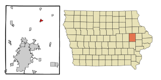
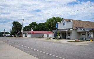
Central City is a city in Linn County, Iowa, United States. The population was 1,264 at the 2020 census. It is part of the Cedar Rapids Metropolitan Statistical Area.

<span class="mw-page-title-main">Inwood, Iowa</span> City in Iowa, United States

Inwood is a city in Lyon County, Iowa, United States. The population was 928 at the time of the 2020 census.

<span class="mw-page-title-main">Braddyville, Iowa</span> City in Iowa, United States

Braddyville is a city in Page County, Iowa, United States. The population was 147 at the 2020 census.

<span class="mw-page-title-main">Hepburn, Iowa</span> City in Iowa, United States

Hepburn is a city in Page County, Iowa, United States. The population was 26 at the time of the 2020 census.

<span class="mw-page-title-main">Lincoln, Iowa</span> City in Iowa, United States

Lincoln is a city in Tama County, Iowa, United States. The population was 121 at the time of the 2020 census. The community was known as Berlin until June 12, 1918.

<span class="mw-page-title-main">Cumming, Iowa</span> City in Iowa, United States

Cumming is a city in Warren County, Iowa, United States. The population was 436 at the time of the 2020 census. It is the hometown of former Senator Tom Harkin.

<span class="mw-page-title-main">Lawton, Iowa</span> City in Iowa, United States

Lawton is a city in Woodbury County, Iowa, Iowa, United States. It is part of the Sioux City metropolitan area. The population was 943 at the time of the 2020 census.

<span class="mw-page-title-main">Le Grand, Iowa</span> City in Iowa, United States

Le Grand is a city in Marshall and Tama counties in the U.S. state of Iowa. The population was 905 at the time of the 2020 census.

<span class="mw-page-title-main">Clearfield, Iowa</span> City in Iowa, United States

Clearfield is a city in Taylor and Ringgold counties in the U.S. state of Iowa. The population was 278 at the time of the 2020 census.

<span class="mw-page-title-main">Shannon City, Iowa</span> City in Iowa, United States

Shannon City is a city in southern Union and northern Ringgold counties in the U.S. state of Iowa. The population was 73 at the time of the 2020 census.

<span class="mw-page-title-main">Alden, Iowa</span> City in Iowa, United States

Alden is a city in Hardin County, Iowa, United States. The population was 763 at the 2020 census.

References

  1. "2020 U.S. Gazetteer Files". United States Census Bureau. Retrieved March 16, 2022.
  2. 1 2 "2020 Census State Redistricting Data". census.gov. United states Census Bureau. Retrieved August 12, 2021.
  3. The History of Iowa County, Iowa: Containing a History of the County, Its Cities, Towns, &c. Union Historical Company. 1881. pp.  611.
  4. 1 2 Hanson, Loretta. "History of Williamsburg" . Retrieved March 15, 2024.
  5. "The Naming of Williamsburg" . Retrieved March 15, 2024.
  6. "US Gazetteer files: 2010, 2000, and 1990". United States Census Bureau. February 12, 2011. Retrieved April 23, 2011.
  7. "US Gazetteer files 2010". United States Census Bureau . Retrieved May 11, 2012.
  8. 1 2 "NOAA Online Weather Data – NWS Quad Cities". National Weather Service. Retrieved November 29, 2023.
  9. "U.S. Climate Normals Quick Access – Station: Williamsburg 1E, IA". National Oceanic and Atmospheric Administration. Retrieved November 29, 2023.
  10. "Census of Population and Housing". Census.gov. Retrieved June 4, 2015.
  11. "U.S. Census website". United States Census Bureau . Retrieved May 11, 2012.
  12. "U.S. Census website". United States Census Bureau . Retrieved January 31, 2008.
  13. "U.S. Air Force". Biography of Brigadier General Harris B. Hull. Archived from the original on July 19, 2012. Retrieved December 6, 2010.