Zortman, Montana

Last updated

Zortman, Montana
Nickname: 
The cutest little town on earth
Motto: 
In the heart of the Little Rocky Mountains
USA Montana location map.svg
Red pog.svg
Zortman, Montana
Usa edcp location map.svg
Red pog.svg
Zortman, Montana
Coordinates: 47°55′00″N108°30′32″W / 47.91667°N 108.50889°W / 47.91667; -108.50889
Country United States
State Montana
County Phillips
Area
[1]
  Total3.95 sq mi (10.24 km2)
  Land3.95 sq mi (10.24 km2)
  Water0.00 sq mi (0.00 km2)
Elevation
[2]
3,993 ft (1,217 m)
Population
 (2020)
  Total82
  Density20.74/sq mi (8.01/km2)
Time zone UTC-7 (Mountain (MST))
  Summer (DST) UTC-6 (MDT)
ZIP code
59546
Area code 406
GNIS feature ID2583870 [2]

Zortman is a census-designated place and unincorporated community in Phillips County, Montana, United States. Its population was 69 as of the 2010 census. [3] Zortman has a post office with ZIP code 59546. [4] [5]

Contents

The community includes the Zortman Motel and the Buckhorn Store and Cabins. The Buckhorn Store is the only store in the community. Zortman is a popular place for hunters to have dinner and stay while on their trip.

Demographics

Historical population
CensusPop.Note
2020 82
U.S. Decennial Census [6]

History

Prospectors arrived in the Zortman area in 1868. About 2,000 men came to Zortman in 1884, when Pike Landusky and Dutch Louie discovered gold. By 1893, Pete Zortman and a partner owned the Alabama Mine. Other mines in the area were the Ruby Mine and the Little Ben Mine. [7] It is estimated that local mines had produced $125 million in gold by 1949. [8]

Climate

According to the Köppen Climate Classification system, Zortman has a semi-arid climate, abbreviated "BSk" on climate maps. [9]

Zortman has a long history of wildfires. Many of the original buildings in Zortman were lost in fires during 1929 and 1944. A forest fire in 1936 reached the edges of Zortman, killing four people and burning 23,000 acres. [7]

In July 2017, a wildfire in the Zortman area threatened the small town, and burned over 10,000 acres of forest in the Little Rocky Mountains. [10]

Pegasus and Landusky mines

Zortman was home to a mine operated by Pegasus Gold Corp., which was shut down in 1997. [11] The company went bankrupt the following year, in 1998. [12] The Zortman mine is about a mile and a half from the Landusky mine. Both are cyanide heap-leach gold mines. [13]

According to the Bureau of Land Management,

Water treatment plants for Zortman and Landusky are operated on behalf of the Montana Department of Environmental Quality in order to preserve the water quality of the Milk and Missouri Rivers, and of the Fort Belknap Indian Reservation. [15] [16]

Related Research Articles

<span class="mw-page-title-main">El Jebel, Colorado</span> Census Designated Place in Colorado, United States

El Jebel is an unincorporated community and a census-designated place (CDP) located in and governed by Eagle County, Colorado, United States. The CDP is a part of the Edwards, CO Micropolitan Statistical Area. The population of the El Jebel CDP was 4,130 at the United States Census 2020. The Carbondale Post Office serves El Jebel postal addresses.

<span class="mw-page-title-main">Battlement Mesa, Colorado</span> Ceneus-designated place in Garfield County, Colorado, United States

Battlement Mesa is a census-designated place (CDP) and post office in and governed by Garfield County, Colorado, United States. The CDP is a part of the Glenwood Springs, CO Micropolitan Statistical Area. The Battlement Mesa post office has the ZIP Codes 81635 and 81636. At the United States Census 2020, the population of the Battlement Mesa CDP was 5,438. The Battlement Mesa Metropolitan District provides services.

<span class="mw-page-title-main">Atwood, Colorado</span> Census Designated Place in Colorado, United States

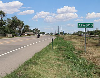
Atwood is an unincorporated town, a post office, and a census-designated place (CDP) located in and governed by Logan County, Colorado, United States. The CDP is a part of the Sterling, CO Micropolitan Statistical Area. The Atwood post office has the ZIP Code 80722. At the United States Census 2020, the population of the Atwood CDP was 138.

<span class="mw-page-title-main">Potomac, Maryland</span> Census-designated place in Maryland, United States

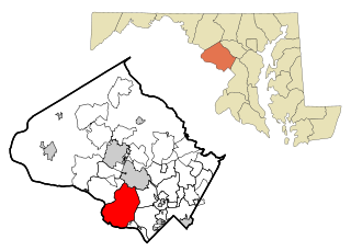
Potomac is an unincorporated community and census-designated place (CDP) in Montgomery County, Maryland. As of the 2020 census, it had a population of 47,018. It is named after the nearby Potomac River.

<span class="mw-page-title-main">Arivaca, Arizona</span> Unincorporated community in Pima County

Arivaca is an unincorporated community in Pima County, Arizona, United States. It is located 11 miles (18 km) north of the Mexican border and 35 miles (56 km) northwest of the port of entry at Nogales. The European-American history of the area dates back at least to 1695, although the community was not founded until 1878. Arivaca has the ZIP code 85601. The 85601 ZIP Code Tabulation Area had a population of 909 at the 2000 census.

<span class="mw-page-title-main">McClave, Colorado</span> Census Designated Place in Colorado, United States

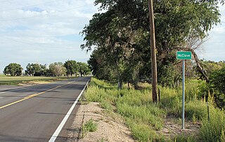
McClave is an unincorporated community in Bent County, Colorado, United States. The population was 725 at the 2020 census.

<span class="mw-page-title-main">Elfrida, Arizona</span> CDP in Cochise County, Arizona

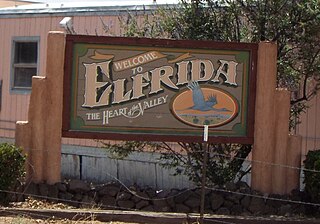
Elfrida is a census-designated place in Cochise County, Arizona, United States. As of the 2010 census it had a population of 459.

Seabrook is an unincorporated community located within Upper Deerfield Township in Cumberland County, in the U.S. state of New Jersey. The area is served as United States Postal Service ZIP code 08302. The unincorporated community and the census-designated Place Seabrook Farms within it are each named after Charles F. Seabrook, a businessman who at one point ran the largest irrigated truck farm in the world in this region.

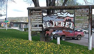
Condon is an unincorporated community and census-designated place in Missoula County, Montana, United States. Located along the Swan River and Montana Highway 83, Condon is situated between the Swan Range to the east and the Mission Mountains to the west, providing ready access to the Bob Marshall Wilderness and Mission Mountains Wilderness, respectively. Its population was 343 as of the 2010 census.

Stanley is an unincorporated community in Santa Fe County, New Mexico. The ZIP code is 87056.

<span class="mw-page-title-main">Moccasin, Montana</span> Census-designated place in Montana, United States

Moccasin is an unincorporated community in Judith Basin County, Montana, United States. The community was named for the nearby Moccasin mountain range. Moccasin has a post office with the ZIP code 59462.

Acton is an Census Designated Place in northwestern Yellowstone County, Montana, United States. It has a postal ZIP code (59002) and lies along Montana Highway 3 northwest of the city of Billings, the county seat of Yellowstone County.

Fernwood is a census-designated place and unincorporated community in Pike County, Mississippi, United States. Its ZIP code is 39635.

Springdale is a census-designated place and unincorporated community in Park County, Montana, United States. Its population was 42 at the 2010 census. The community is located near Interstate 90 and the Yellowstone River. Springdale has its own ZIP code, 59082.

Crane is a census-designated place and unincorporated community in Richland County, Montana, United States. Its population was 102 according to the 2010 census. Crane has a post office with the ZIP code 59217. Montana Highway 16 passes through Crane.

Whitewater is a census-designated place and unincorporated community in Phillips County, Montana, United States. Its population was 64 as of the 2010 census. Whitewater has a post office with ZIP code 59544.

Brady is a census-designated place and unincorporated community in Pondera County, Montana, United States. Its population was 140 as of the 2010 census. Brady has a post office with ZIP code 59416. The community is located along Interstate 15.

<span class="mw-page-title-main">Dupuyer, Montana</span> Census-designated place & Unincorporated community in Montana, United States

Dupuyer is a census-designated place and unincorporated community in Pondera County, Montana, United States. Its population was 86 as of the 2010 census. The community is located along U.S. Route 89 and Dupuyer Creek. Dupuyer has a post office with ZIP code 59432.

Stockett is a census-designated place and unincorporated community in Cascade County, Montana, United States. Its population was 169 as of the 2010 census. Stockett has a post office with ZIP code 59480.

Kila is a census-designated place and unincorporated community in Flathead County, Montana, United States. Its population was 392 as of the 2010 census. Kila has a post office with ZIP code 59920, which opened on May 27, 1901. The community is located along U.S. Route 2, 10 miles from Kalispell.

References

  1. "ArcGIS REST Services Directory". United States Census Bureau. Retrieved September 5, 2022.
  2. 1 2 U.S. Geological Survey Geographic Names Information System: Zortman
  3. "U.S. Census website". United States Census Bureau . Retrieved May 14, 2011.
  4. United States Postal Service (2012). "USPS - Look Up a ZIP Code" . Retrieved February 15, 2012.
  5. "Postmaster Finder - Post Offices by ZIP Code". United States Postal Service . Retrieved July 19, 2013.
  6. "Census of Population and Housing". Census.gov. Retrieved June 4, 2016.
  7. 1 2 Miller, Donald C (1974). Ghost Towns of Montana. Boulder, CO: Pruett Publishing Co. p. 172.
  8. "Town Site of Zortman and Landusky". Visit Montana. 2017.
  9. "Zortman, Montana Köppen Climate Classification (Weatherbase)". Weatherbase.
  10. Hoffman, Matt (July 9, 2017). "July Fire has burned more than 10,000 acres; 45 percent contained". Billings Gazette.
  11. Abel, Heather (December 22, 1997). "The rise and fall of a gold mining company". High Country News.
  12. Brown, Matthew (November 30, 2017). "Montana lets mine work proceed but warns revocation possible". Los Angeles Times . Archived from the original on November 30, 2017. Retrieved December 2, 2017.
  13. Mitchell, Larry D (2004). "Zortman & Landusky Mines. HJR 43. Water Quality Impacts" (PDF). p. 2.
  14. "Zortman & Landusky Gold Mines | AbandonedMines". www.abandonedmines.gov. Retrieved December 2, 2017.
  15. "William C. Maehl P.E., President - Senior Principal Mining Engineer" (PDF). Spectrum Engineering and Environmental LLC. 2015. p. 2. Retrieved December 2, 2017.
  16. Maehl, William C. "Zortman and Landusky with 20/20 Hindsight" (PDF).