Carlo Tiberi Romano, New and faithful report of the terrible and frightening earthquake in Matrice and its State (Rome, 1639)
The princes Orsini left the city destroyed by the earthquake,[5] whose shock lasted 15 minutes and caused about 500 deaths (although many bodies remained under the rubble). Damage was estimated between 400,000 and 1 million scudi of the time.[6]
The next 14 October there was a strong aftershock.[7]
Many inhabitants fled to the countryside, where tents were set up, while others found refuge in the church of San Domenico.[3] Among the buildings destroyed or badly damaged, there were: the princes Orsini's palace[8] (that at the time of the earthquake they were out of town), the Palazzo del Reggimento (Regiment's palace), the church of the Holy Crucifix, and other houses.[3]Rosaries and processions were organized by the people to invoke the end of earthquakes.[3] There were also heavy losses of the cattle (the main source of income at the time), which forced the population to migrate to Rome and Ascoli Piceno.[6]
The effects of the earthquake were described in detail in a report published by Carlo Tiberi in 1639, subsequently revised and updated in a second edition of the same year.
See also
Wikisource has original text related to this article:
M. Baratta (1901). I terremoti d'Italia. Saggio di storia, geografia e bibliografia sismica italiana. Torino.
M.C. Spadea; M. Vecchi; P. Gardellini; S. Del Mese. D. Postpischl (ed.). "The Amatrice earthquake of October 8, 1639 (in Atlas of Isoseismal Maps of Italian Earthquakes)". Quaderni de "La Ricerca Scientifica". CNR-PFG. 2A (114): 161.
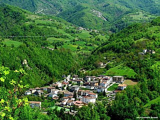
Amatrice is a town and comune in the province of Rieti, in northern Lazio, and the center of the food-agricultural area of Gran Sasso e Monti della Laga National Park. The town was devastated by a powerful earthquake on 24 August 2016.
Valle Castellana is a village and comune in the Province of Teramo, in the Abruzzo region of central Italy. It is a member of the Italian community of surrounding mountain villages, Monti della Laga. It is located in the natural park known as the Gran Sasso e Monti della Laga National Park.
Arquata del Tronto is a comune (municipality) in the Province of Ascoli Piceno in the Marche region of Italy, located about 100 kilometres (62 mi) from Ancona. It is the only European municipality located partly within two natural parks: Gran Sasso national park and Cyblings mountains natural park.
Accumoli is a comune (municipality) in the Province of Rieti in the Italian region Lazio, located about 110 kilometres (68 mi) northeast of Rome and about 45 kilometres (28 mi) northeast of Rieti. It is located in the natural park known as the "Gran Sasso e Monti della Laga National Park".
Cerreto Sannita is a comune (municipality) in the Province of Benevento in the Italian region Campania, located about 60 km northeast of Naples and about 25 km northwest of Benevento.
The 1980 Irpinia earthquake took place in Italy on November 23 with a moment magnitude of 6.9 and a maximum Mercalli intensity of X (Extreme). It left at least 2,483 people dead, at least 7,700 injured, and 250,000 homeless.
The Tronto is a 115-kilometre (71 mi) long Italian river that arises at Monti della Laga and ends in the Adriatic Sea at Porto d'Ascoli, San Benedetto del Tronto. It traverses the Lazio, Marche, and Abruzzo regions of Italy.
An earthquake, rated at VII on the Mercalli intensity scale, struck northern Italy and Germany on 3 January 1117. The epicentre of the first shock was near Verona, the city which suffered the most damage. The outer wall of the amphitheatre was partially felled, and the standing portion was damaged in a later earthquake of 1183. Many other churches, monasteries, and ancient monuments were destroyed or seriously damaged, eliminating much of Verona's early medieval architecture and providing space for a massive Romanesque rebuilding. After the first shock of 3 January, seismic activity persisted for months, striking on 12 January 4 June, 1 July 1 October, and 30 December.
On 5 February AD 62, an earthquake of an estimated magnitude of between 5 and 6 and a maximum intensity of IX or X on the Mercalli scale struck the towns of Pompeii and Herculaneum, severely damaging them. The earthquake may have been a precursor to the eruption of Mount Vesuvius in AD 79, which destroyed the same two towns. The contemporary philosopher and dramatist Seneca the Younger wrote an account of the earthquake in the sixth book of his Naturales quaestiones, entitled De Terrae Motu.
The 1920 Garfagnana earthquake occurred on September 7 in Garfagnana and Lunigiana, both agricultural areas in the Italian Tuscany region. The quake hypocenter was located 14 kilometres (8.7 mi) beneath Villa Collemandina. The maximum felt intensity was rated as X (Extreme) on the Mercalli intensity scale, and 6.6 on the Richter magnitude scale. It was one of the most destructive seismic events recorded in the Apenninic region in the twentieth century. Due to good news coverage, availability of official documents on the damage and abundance of recordings from surveillance stations throughout Europe, it was regarded as a first-rate case study to improve knowledge of tectonics and macroseismic analysis.
The 1930 Senigallia earthquake struck the city of Senigallia in central Italy on October 30. It occurred just a few months after the destructive 1930 Irpinia earthquake, which had caused over 1400 casualties in the southern part of the country.
The 1936 Cansiglio earthquake occurred on October 18 in the region between the provinces of Belluno, Treviso and Pordenone, in northern Italy. It caused 19 deaths and an unknown number of injuries.
The 1873 Alpago earthquake occurred near the Italian city of Belluno on June 29 in the geologically active Alpago Valley of the Veneto region; the zone is rated as two on a four-degree risk scale. The 6.3 magnitude quake was rated as IX–X (Violent–Extreme) on the Mercalli intensity scale. Intensities greater than VII were confined to the provinces of Belluno, Treviso and Pordenone.
An earthquake, measuring 6.2 ± 0.016 on the moment magnitude scale, hit Central Italy on 24 August 2016 at 03:36:32 CEST.
Strada statale 4 Via Salaria is an Italian state highway, linking Rome to the Adriatic sea passing through Rieti and Ascoli Piceno. Its route retraces that of the ancient Via Salaria Roman road. It is a single carriageway highway for most of its route.
A series of major earthquakes struck Central Italy between the Marche and Umbria regions in October 2016. The third quake on 30 October was the largest in Italy in 36 years, since the 1980 Irpinia earthquake.
A series of four major earthquakes struck Central Italy between Abruzzo, Lazio, the Marche and Umbria regions on 18 January 2017.
The 2017 Ischia earthquake occurred in the island of Ischia, Campania, in southern Italy. The main shock occurred at 20:57 CEST on 21 August 2017, and was rated 3.9 on the Moment magnitude scale.
The 1688 Sannio earthquake occurred in the late afternoon of June 5 in the province of Benevento of southern Italy. The moment magnitude is estimated at 7, with a Mercalli intensity of XI. It severely damaged numerous towns in a vast area, completely destroying Cerreto Sannita and Guardia Sanframondi. The exact number of victims is unknown, and is estimated at about 10,000. It is among the most destructive earthquakes in the history of Italy.
This page is based on this Wikipedia article Text is available under the CC BY-SA 4.0 license; additional terms may apply. Images, videos and audio are available under their respective licenses.