| |||||
| Decades: | |||||
|---|---|---|---|---|---|
| See also: | |||||

Events from the year 1897 in Russia .
| |||||
| Decades: | |||||
|---|---|---|---|---|---|
| See also: | |||||
Events from the year 1897 in Russia .
| | This section needs expansion. You can help by adding to it. (July 2016) |
| | This section needs expansion. You can help by adding to it. (July 2016) |
| | This section needs expansion. You can help by adding to it. (July 2016) |

The Transcaspian Oblast, or simply Transcaspia, was an oblast of the Russian Empire and early Soviet Russia to the east of the Caspian Sea during the second half of the 19th century until 1924.

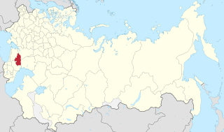
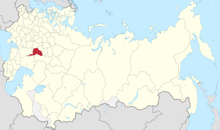
Smolensk Governorate, or the Government of Smolensk, was an administrative division of the Tsardom of Russia, the Russian Empire, and the Russian SFSR. It existed, with interruptions, between 1708 and 1929.
The first general census of the population of the Russian Empire in 1897 was the first and only nation-wide census performed in the Russian Empire. It recorded demographic data as of 28 January [O.S. 15 January] 1897. Previously, the Central Statistical Bureau issued statistical tables based on fiscal lists.

The Taurida Governorate was a historical governorate of the Russian Empire. It included the Crimean Peninsula and the mainland between the lower Dnieper River and the coasts of the Black Sea and Sea of Azov. It was formed after the Taurida Oblast was abolished in 1802 in the course of Paul I's administrative reform of the territories of the former Crimean Khanate that was annexed by the Russian Empire in 1783. The governorate's centre was the city of Simferopol. The province was named after the ancient Greek name of Crimea - Taurida.

The Kherson Governorate, known until 1803 as the Nikolaev Governorate, was a province (guberniya) of the Russian Empire, with its centеr in Kherson. The governorate encompassed 71,936 square kilometres (27,775 sq mi) in area and had a population of 2,733,612 inhabitants. At the time of the census in 1897, it bordered the Podolia Governorate to the northwest, the Kiev Governorate to the north, the Poltava Governorate to the northeast, the Yekaterinoslav Governorate to the east, the Taurida Governorate to the southeast, the Black Sea to the south, and the Bessarabia Governorate to the west. It roughly corresponds to what is now most of Mykolaiv, Kirovohrad and Odesa Oblasts and some parts of Kherson and Dnipropetrovsk Oblasts.

The Yekaterinoslav Governorate, also known by Ukrainian common name Katerynoslavshchyna, was a governorate of the Russian Empire, with its capital located in Yekaterinoslav. The governorate covered 63,392 square kilometres (24,476 sq mi) of area, and was composed of the inhabitant of 2,113,674 by the census of 1897. The Yekaterinoslav Governorate bordered the Poltava Governorate to the north, the Don Host Oblast to the east, the Sea of Azov to the southeast, the Taurida Governorate to the south, and the Kherson Governorate to the east, and covered the area of the Luhansk, Donetsk, Dnipropetrovsk, and Zaporizhzhia Oblasts of Ukraine.

The Vilna Governorate was a governorate of the Northwestern Krai of the Russian Empire. In 1897, the governorate covered the area of 41,907.9 square kilometres (16,180.7 sq mi) and a population of 1,591,207 inhabitants. The governorate was defined by the Minsk Governorate to the south, the Grodno Governorate to the southwest, the Suwałki Governorate to the west, the Kovno and Courland Governorates to the north, and the Vitebsk Governorate to the east. The administrative centre was located in the city of Vilna. The city also served as the administrative centre of the Vilna Governorate-General, which existed until 1912. The area roughly corresponded to the Vilnius Region, which was later occupied by Germany, Bolsheviks, and Poland.

The Moscow Governorate was a province (guberniya) of the Tsardom of Russia, and later the Russian Empire. The governorate bordered by the Tver Governorate to the north, the Vladimir Governorate to the northeast, the Ryazan Governorate to the southeast, the Tula Governorate to the south, the Kaluga Governorate to the southwest, and the Smolensk Governorate to the west. The Moskow Governorate consisted of an area of 33,272.84 square kilometres (12,846.72 sq mi) and a population of 2,430,581 in 1897. The administrative centre was in the cultural capital of Moscow. The province covered most of Moscow Oblast.

Kielce Governorate was an administrative unit (governorate) of Congress Poland.

Piotrków Governorate was one of the administrative divisions in the Kingdom of Poland, established in 1867 by splitting some areas of the Radom and Warsaw Governorates. Its capital was in Petrokov in modern day Piotrków Trybunalski.

Płock Governorate was an administrative unit (governorate) of Congress Poland.

Warsaw Governorate was an administrative unit (governorate) of Congress Poland.

Łomża Governorate was an administrative unit (guberniya) of Congress Poland with seat in Łomża.

The Poltava Governorate or Poltavshchyna was a gubernia in the historical Left-bank Ukraine region of the Russian Empire. It was officially created in 1802 from the disbanded Malorossiya Governorate, which was split between the Chernigov Governorate and Poltava Governorate with an administrative center of Poltava.

The Volhynian Governorate, Volhynia Governorate or Volyn Governorate was a province (guberniya) of the Southwestern Krai of the Russian Empire. It consisted of an area of 71,736 square kilometres (27,697 sq mi) and a population of 2,989,482 inhabitants. The governorate bordered the Grodno and Minsk Governorates to the north, the Kiev Governorate to the east, the Podolia Governorate to the south, the Lublin and Siedlce Governorates, and after 1912, the Kholm Governorate and Austria to the west. The administrative centre was Zhitomir, until 1804, its administrative centre was located in Novograd-Volynsky. It corresponded to most of Volyn, Rivne and Zhytomyr Oblasts of Ukraine and some parts of Brest and Gomel Regions of Belarus.
The Stavropol Governorate was a Governorate (province) of the Russian Empire. It roughly corresponded to most of present-day Stavropol Krai. It was created in 1847 out of the territories of Caucasian peoples and disbanded in Russian SFSR in 1924.

The Caucasus Viceroyalty was the Russian Empire's administrative and political authority in the Caucasus region exercised through the offices of glavnoupravlyayushchiy and namestnik ("viceroy"). These two terms are commonly, but imprecisely, translated into English as viceroy, which is frequently used interchangeably with governor general. More accurately, glavnoupravlyayushchiy is referred to as the High Commissioner of the Caucasus, and namestnik as Viceroy.
Saratov Governorate, was an administrative division of the Russian Empire and the Russian Socialist Federative Soviet Republic, which existed from 1797 to 1928. Its administrative center was in the city of Saratov.

Oryol Governorate, or the Government of Oryol, was an administrative division of the Russian Empire and the early Russian SFSR, which existed from 1796 to 1928. Its seat was in the city of Oryol.

Novorossiya is a historical name, used during the era of the Russian Empire for an administrative area that would later become the southern mainland of Ukraine: the region immediately north of the Black Sea and Crimea. The province fell largely within a slightly wider area known in Ukrainian as the Stepovyna "Steppe Land", or Nyz "Lower Land". The name Novorossiya, which means New Russia, entered official usage in 1764, after the Russian Empire conquered the Crimean Khanate, and annexed its territories, when Novorossiya Governorate was founded. Official usage of the name ceased after 1917, when the entire area was incorporated in the Ukrainian People's Republic.
![]() Media related to 1897 in Russia at Wikimedia Commons
Media related to 1897 in Russia at Wikimedia Commons
| | This Russian history–related article is a stub. You can help Wikipedia by expanding it. |