
Lansing is the capital of the U.S. state of Michigan. It is mostly in Ingham County, although portions of the city extend west into Eaton County and north into Clinton County. The 2020 census placed the city's population at 112,644, making it the sixth largest city in Michigan. The population of its metropolitan statistical area (MSA) was 541,297 at the 2020 census, the third largest in the state after metropolitan Detroit and Grand Rapids. It was named the new state capital of Michigan in 1847, ten years after Michigan became a state.

Phoenix is the state capital and most populous city of the U.S. state of Arizona, with 1,608,139 residents as of 2020. It is the fifth-most populous city in the United States and the most populous state capital in the country.

Napakiak is a city in Bethel Census Area, Alaska, United States. At the 2010 census the population was 354, up one resident from 353 since 2000.

Chandler is a city in Maricopa county, Arizona, United States, and a suburb in the Phoenix-Mesa-Chandler Metropolitan Statistical Area (MSA). It is bordered to the north and west by Tempe, to the north by Mesa, to the west by Phoenix, to the south by the Gila River Indian Community, and to the east by Gilbert. As of the 2020 census, the population of Chandler was 279,458, up from 236,123 at the 2010 census.
Glendale is a city in Maricopa County, Arizona, United States. Located about nine miles northwest of the state capital Phoenix, Glendale is known for State Farm Stadium, which is the home of the Arizona Cardinals football team. The city also contains the Arrowhead Towne Center shopping mall. As of the 2020 census, Glendale had a population of 248,325.
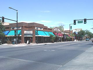
Peoria is a city in Maricopa and Yavapai counties in the U.S. state of Arizona. Most of the city is located in Maricopa County, while a portion of it in the north is in Yavapai County. It is a major suburb of Phoenix. As of the 2020 census, the population of Peoria was 190,985, up from 154,065 in 2010. It is the sixth-largest city in Arizona in land area and the ninth-largest in population. It was named after Peoria, Illinois. The word peoria is a corruption of the Miami-Illinois word for "prairie fire". It is the spring training home of the San Diego Padres and Seattle Mariners, who share the Peoria Sports Complex.

Alhambra is a city located in the western San Gabriel Valley region of Los Angeles County, California, United States, approximately eight miles from the Downtown Los Angeles civic center. It was incorporated on July 11, 1903. As of the 2020 census, the population was 82,868. The city's ZIP Codes are 91801 and 91803.
Monterey Park is a city in the western San Gabriel Valley region of Los Angeles County, California, United States, approximately seven miles (11 km) east of the Downtown Los Angeles civic center. It is bordered by Alhambra, East Los Angeles, Montebello and Rosemead. The city's motto is "Pride in the past, Faith in the future".

Rosemead is a city in Los Angeles County, California, United States. As of the 2021 census, it had a population of 50,245, currently dropping. Rosemead is part of a cluster of cities, along with Alhambra, Arcadia, Temple City, Monterey Park, San Marino, and San Gabriel, in the west San Gabriel Valley with a growing Asian-American population.

Coral Gables is a city in Miami-Dade County, Florida, United States. The city is part of the Miami metropolitan area of South Florida and is located 7 miles (11 km) southwest of Downtown Miami. As of the 2020 U.S. census, it had a population of 49,248.
Phoenix is a village in Cook County, Illinois, United States. The population was 1,708 at the 2020 census. It is located approximately 19 miles (31 km) south of the Chicago Loop in the Chicago area.

Riverside is a suburban village in Cook County, Illinois, United States. A significant portion of the village is in the Riverside Landscape Architecture District, designated a National Historic Landmark in 1970. The population of the village was 9,298 at the 2020 census, up from 8,875 at the 2010 census. It is a suburb of Chicago, located roughly 9 miles (14 km) west of downtown Chicago and 2 miles (3 km) outside city limits.

Midtown Manhattan is the central portion of the New York City borough of Manhattan and serves as the city's primary central business district. Midtown is home to some of the city's most prominent buildings, including the Empire State Building, the Chrysler Building, the Hudson Yards Redevelopment Project, the headquarters of the United Nations, Grand Central Terminal, and Rockefeller Center, as well as several prominent tourist destinations including Broadway, Times Square, and Koreatown. Penn Station in Midtown Manhattan is the busiest transportation hub in the Western Hemisphere.
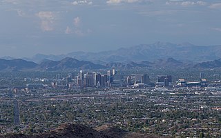
The Phoenix Metropolitan Area, also known as the Valley of the Sun, the Salt River Valley, Metro Phoenix, or The Valley, is the largest metropolitan statistical area in the Southwestern United States, with its largest principal city being the city of Phoenix. It includes much of central Arizona. The United States Office of Management and Budget designates the area as the Phoenix-Mesa-Chandler Metropolitan Statistical Area (MSA), defining it as Maricopa and Pinal counties. It anchors the Arizona Sun Corridor megaregion along with the second-most populous metropolitan area in the state, the Tucson metropolitan area. The gross domestic product of the Phoenix Metropolitan Area was $255 billion in 2018, 16th-largest amongst metro areas in the United States.

Hollywood Hills is a residential neighborhood in the central region of Los Angeles, California.
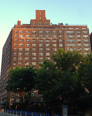
The West Village is a neighborhood in the western section of the larger Greenwich Village neighborhood of Lower Manhattan, New York City. The West Village is bounded by the Hudson River to the west and 14th Street to the north. The eastern boundary is variously cited as Greenwich Avenue, Seventh Avenue, or Sixth Avenue, while the southern boundary is either Houston Street or Christopher Street.

Maryvale is an urban village of Phoenix, Arizona.

Encanto Village is one of the 15 Urban villages that make up the City of Phoenix, in Arizona. The village includes the city's midtown and uptown districts, as well as the popular Encanto neighborhood, its namesake. In 2010, Encanto had a population of 54,614 residents.
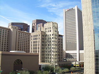
Central City Village is the urban village of Phoenix, Arizona, that includes the downtown area of the city. As of 2010, it had a population of 58,161 residents.
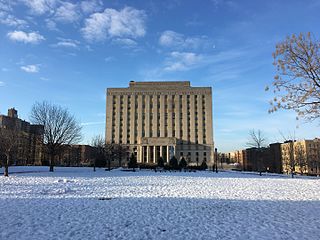
Concourse is a neighborhood in the southwestern section of the New York City borough of the Bronx which includes the Bronx County Courthouse, the Bronx Museum of the Arts, and Yankee Stadium. Its boundaries, starting from the north and moving clockwise, are East 169th Street to the north, Webster Avenue to the east, the Metro-North Railroad's Hudson Line to the south, and Jerome Avenue to the west. The neighborhood is divided into three subsections: West Concourse, East Concourse, and Concourse Village with the Grand Concourse being its main thoroughfare.


