There are four provinces of Ireland: Connacht (Connaught), Leinster, Munster, and Ulster. The Irish word for this territorial division, cúige, meaning "fifth part", suggests that there were once five, and at times Meath has been considered to be the fifth province; in the medieval period, however, there were often more than five. The number of provinces and their delimitation fluctuated until 1610, when they were permanently set by the English administration of James I. The provinces of Ireland no longer serve administrative or political purposes but function as historical and cultural entities.

Ulaid or Ulaidh was a Gaelic over-kingdom in north-eastern Ireland during the Middle Ages made up of a confederation of dynastic groups. Alternative names include Ulidia, which is the Latin form of Ulaid, and in Cóiced, Irish for "the Fifth". The king of Ulaid was called the rí Ulad or rí in Chóicid.
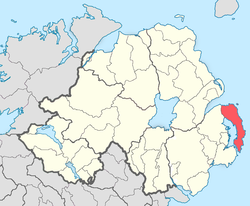
The Ards Peninsula is a peninsula in County Down, Northern Ireland, on the north-east coast of Ireland. It separates Strangford Lough from the North Channel of the Irish Sea. Towns and villages on the peninsula include Donaghadee, Millisle, Portavogie and Portaferry. The large towns of Newtownards and Bangor are at the mainland edge of the peninsula. Burr Point is the easternmost point on the island of Ireland.
Conaille Muirthemne was a Cruithin kingdom located in County Louth, Ireland, from before 688 to after 1107 approximately.

Dál nAraidi or Dál Araide, sometimes Latinised as Dalaradia or Anglicised as Dalaray, was a Cruthin kingdom, or possibly a confederation of Cruthin tribes, in north-eastern Ireland during the Middle Ages. It was part of the over-kingdom of Ulaid, and its kings often contended with the Dál Fiatach for the over-kingship of the province. At its greatest extent, the borders of Dál nAraidi roughly matched those of County Antrim, and they seemed to occupy the same area as the earlier Robogdii of Ptolemy's Geography, a region shared with Dál Riata. Their capital was Ráth Mór outside Antrim, and their eponymous ancestor is claimed as being Fiachu Araide.
Dál Fiatach was a Gaelic dynastic-grouping and the name of their territory in the north-east of Ireland during the Middle Ages. It was part of the over-kingdom of Ulaid, and they were its main ruling dynasty for most of Ulaid's history. Their territory lay in eastern County Down. Their capital was Dún Lethglaise (Downpatrick) and from the 9th century their main religious site was Bangor Abbey.

Achaidh Leithdeircc is an ancient location in Ireland reputed to be the site of a historic battle, or series of battles, around the year 331AD, in which the forces of the Three Collas along with men of Connaught eventually conquered vast tracts of territory from the tribes of the Ulaid. The prehistoric royal site of Navan Fort was burnt and plundered and ultimately this territory would re-emerge as part of the kingdom or federation of Airgíalla.
Demmán mac Cairill was a king of the Dál Fiatach, and over-king of Ulaid in Ireland. He was the son of Cairell mac Muiredaig Muinderg, a previous Ulaid king and brother of Báetán mac Cairill. He ruled the Dál Fiatach and Ulaid from 557 to 572.
Bécc Bairrche mac Blathmaic was king of Ulaid from 692 to 707 from the Dál Fiatach clan. He was the son of Blathmac mac Máel Cobha, a previous king. His byname Bairrche refers to the region of the Mourne Mountains in south County Down. Bynames like his can refer to a region or to fosterage and there may be a connection to the Uí Bairrche of Leinster in his byname.
Fergnae mac Óengusso Ibdaig was a Dal Fiatach king of Ulaid. He was the nephew of Muiredach Muinderg mac Forgo and grandson of Forga mac Dallán, previous kings.
Áed Róin mac Bécce Bairrche was the Dál Fiatach ruler of the over-kingdom of Ulaid in Ireland. He reigned from 708 to 735. He was the son of Bécc Bairrche mac Blathmaic,, a previous king of Ulaid who had abdicated in 707 to become a pilgrim.
Events from the 7th century in Ireland.
Lethlobar mac Echach was a Dál nAraide king of the Cruthin in Ulaid, an over-kingdom in Ireland. He was the son of Eochaid Iarlaithe mac Lurgain, a previous king. He belonged to the main ruling dynasty of the Dál nAraide known as the Uí Chóelbad based in Magh Line. He ruled from 708 to 709.
Fiachnae mac Áedo Róin was a Dál Fiatach ruler of the over-kingdom of Ulaid in Ireland. He reigned from 750 to 789. He was the son of Áed Róin and brother of Bressal mac Áedo Róin, previous kings. This family had their base in modern-day County Down, Northern Ireland.
Máel Bressail mac Ailello was a king of Ulaid, which is now Ulster, Ireland. He belonged to a branch of the Dal nAraide known as the Uí Echach Cobo in the west part of county Down. He ruled as King of Ulaid from 819-825.
Máel Mocheirge mac Indrechtaig was a Dál Fiatach king of Ulaid, which is now Ulster, Ireland. He belonged to a branch of the Dal Fiatach called the Leth Cathail centered in the Lecale barony of modern County Down and was the brother of Cathalán mac Indrechtaig, a previous king. He ruled from 893 to 896 as leth-rí of Ulaid.
Aitíth mac Laigni was a King of Ulaid, which is now Ulster, Ireland. He belonged to a branch of the Dal nAraide known as the Uí Echach Cobo in the west part of county Down. He ruled as King of Ulaid from 896-98.

Mourne is a barony in County Down, Northern Ireland. It lies in the south-east of the county, with the Irish Sea to its east. It is bordered by two other baronies: Iveagh Upper, Lower Half and Iveagh Upper, Upper Half to the north and west. Mourne gets its name from the Múrna, a people who hail from a territory of the same name in modern County Monaghan.

Iveagh is the name of several historical territorial divisions in what is now County Down, Northern Ireland. Originally it was a Gaelic Irish territory, ruled by the Uí Echach Cobo and part of the overkingdom of Ulaid. From the 12th century the Magennises were chiefs of Iveagh. They were based at Rathfriland and were inaugurated at Knock Iveagh. Following the Nine Years' War, the rulers of Iveagh submitted to the English Crown and the territory was divided between them. Iveagh became a barony, which was later split into Iveagh Lower and Iveagh Upper. The territory of Iveagh was also the basis of the Roman Catholic Diocese of Dromore.
Blathewyc or Blathewic is the name of several historical territorial divisions in what is now County Down, Northern Ireland. It is the anglicised name of an ancient Irish túath, ruled by the Uí Blathmaic, later becoming a barony, bailiwick, and county in the Anglo-Norman Earldom of Ulster.