Ashfield, Massachusetts

Last updated

Ashfield, Massachusetts
Ashfield Town Offices.JPG
Ashfield Town Hall (center), with the fire station on the left.
Seal of Ashfield, Massachusetts.png
Franklin County Massachusetts incorporated and unincorporated areas Ashfield highlighted.svg
Location in Franklin County in Massachusetts
Coordinates: 42°31′35″N72°47′20″W / 42.52639°N 72.78889°W / 42.52639; -72.78889
Country United States
State Massachusetts
County Franklin
Settled1743
Incorporated1765
Government
  Type Open town meeting
Area
  Total40.3 sq mi (104.3 km2)
  Land40.0 sq mi (103.6 km2)
  Water0.3 sq mi (0.7 km2)
Elevation
[1]
1,447 ft (441 m)
Population
 (2020)
  Total1,695
  Density42/sq mi (16/km2)
Time zone UTC−5 (Eastern)
  Summer (DST) UTC−4 (Eastern)
ZIP Code
01330
Area codes 413
FIPS code 25-02095
GNIS feature ID0619377 [1]
Website www.ashfield.org

Ashfield is a town in Franklin County, Massachusetts, United States. The population was 1,695 at the 2020 census. [2] It is part of the Springfield, Massachusetts Metropolitan Statistical Area.

Contents

History

Ashfield was first settled in 1743 and was officially incorporated in 1765. The town was originally called "Huntstown" for Captain Ephraim Hunt, who died in King William's War, and who had inherited the land as payment for his services. The first permanent settlement was in 1745, by Richard Ellis, an Irish immigrant from the town of Easton. The town was renamed upon reincorporation, although there is debate over its namesake; it is either for the ash trees in the area, or because Governor Bernard had friends in Ashfield, England. The town had a small peppermint industry in the nineteenth century, but for the most part the town has had a mostly agrarian economy, with some tourism around Ashfield Lake. [3]

Ashfield is the birthplace of prominent director Cecil B. DeMille (whose parents were vacationing in the town at the time), Alvan Clark, nineteenth century astronomer and telescope maker, and William S. Clark, member of the Massachusetts Senate and third president of Massachusetts Agricultural College (now UMass Amherst). [4] [5]

Geography

According to the United States Census Bureau, the town has a total area of 40.3 square miles (104.3 km2), of which 40.0 square miles (103.6 km2) is land and 0.27 square miles (0.7 km2), or 0.62%, is water. [6] Ashfield is located in the southwest corner of Franklin County, along the Hampshire County line. Ashfield is bordered by Buckland to the north, Conway to the east, Goshen to the south, Cummington to the southwest, Plainfield to the west, and Hawley to the northwest. The northern outlying section of town includes the historic neighborhoods of Beldingville and Baptist Corner. Ashfield is 15 miles (24 km) west-southwest of Greenfield, 35 miles (56 km) north-northwest of Springfield, and 105 miles (169 km) west-northwest of Boston.

Ashfield lies in the eastern foothills of The Berkshires, with several high hills, including Ridge Hill, in the northern portion of town. The town is fed by several rivers and brooks, including the South River, the "western" Swift River (the "eastern" river flows out of the Quabbin Reservoir in central Massachusetts) and several prominent brooks, most of which feed into either the Deerfield River or the Connecticut River. Near the center of town, Ashfield Lake feeds into the South River, and is a recreational site. In the southwest portion of town, a small portion of the Poland Brook Wildlife Management Area crosses into town, as does a portion of the Daughters of the American Revolution State Forest.

The town is at the junction of the north–south Route 112 and the east–west Route 116, which are combined for 1.4 miles (2.3 km) south of Ashfield Lake. The town is located approximately 12 miles (19 km) west of Interstate 91, the nearest interstate to the town. The nearest bus service is in Greenfield, with the nearest small air service being Turners Falls just east of there. The nearest Amtrak service is in Greenfield, and the nearest international air service is at Bradley International Airport in Windsor Locks, Connecticut.

Demographics

Historical population
YearPop.±%
1840 1,579    
1850 1,394−11.7%
1860 1,302−6.6%
1870 1,180−9.4%
1880 1,066−9.7%
1890 1,025−3.8%
1900 955−6.8%
1910 959+0.4%
1920 869−9.4%
1930 860−1.0%
1940 872+1.4%
1950 977+12.0%
1960 1,131+15.8%
1970 1,274+12.6%
1980 1,458+14.4%
1990 1,715+17.6%
2000 1,800+5.0%
2010 1,737−3.5%
2020 1,695−2.4%
20221,688−0.4%

Source: United States census records and Population Estimates Program data. [7] [8] [9] [10] [11] [12] [13] [14] [15] [16] [17]

As of the census [18] of 2000, there were 1,800 people, 741 households, and 500 families residing in the town. By population, Ashfield ranked thirteenth of the twenty-six towns in Franklin County, and 296th out of the 351 cities and towns in Massachusetts. The population density was 44.7 inhabitants per square mile (17.3/km2), which ranked seventeenth in the county and 314th in the Commonwealth. There were 821 housing units at an average density of 20.4 per square mile (7.9/km2). The racial makeup of the town was 97.33% White, 0.61% African American, 0.11% Native American, 0.33% Asian, 0.06% from other races, and 1.56% from two or more races. Hispanic or Latino of any race were 0.44% of the population.

There were 741 households, out of which 31.8% had children under the age of 18 living with them, 55.6% were married couples living together, and 32.4% were non-families. Of all households, 24.0% were made up of individuals, and 8.2% had someone living alone who was 65 years of age or older. The average household size was 2.43 and the average family size was 2.90.

In the town, the population was spread out, with 23.8% under the age of 18, 4.9% from 18 to 24, 26.5% from 25 to 44, 33.2% from 45 to 64, and 11.6% who were 65 years of age or older. The median age was 42 years. For every 100 females, there were 96.3 males. For every 100 females age 18 and over, there were 88.7 males.

The median income for a household in the town was $52,875, and the median income for a family was $56,739. Males had a median income of $38,818 versus $31,146 for females. The per capita income for the town was $26,483. About 5.2% of families and 7.6% of the population were below the poverty line, including 14.4% of those under age 18 and 5.1% of those age 65 or over.

Government

Ashfield employs the open town meeting form of government, and is led by a board of selectmen and a town administrator. All of the town's services are located in the town center, including the town hall, police and fire departments, as well as the Belding Memorial Library and the town's post office. The nearest hospital, Franklin Medical Center, is located in Greenfield, as are most of the nearest state offices.

On the state level, Ashfield is represented in the Massachusetts House of Representatives as part of the First Franklin district, represented by Steve Kulik, [19] which covers the towns of Ashfield, Buckland, Chester, Chesterfield, Conway, Cummington, Deerfield, Goshen, Huntington, Leverett, Middlefield, Montague, Plainfield, Shelburne, Shutesbury, Sunderland, Whately, Williamsburg, and Worthington. [20] In the Massachusetts Senate, the town is part of the Berkshire, Hampshire and Franklin district, represented by Adam Hinds, which includes all of Berkshire County as well as western portions of Franklin and Hampshire Counties. [21] The town is patrolled by the Second Barracks of Troop "B" of the Massachusetts State Police, headquartered in Shelburne Falls. [22]

On the national level, Ashfield is represented in the United States House of Representatives as part of Massachusetts's 1st congressional district, and has been represented by Richard Neal of Springfield since January 3, 2013. Massachusetts is currently represented in the United States Senate by Ed Markey, and Elizabeth Warren.

Education

Ashfield is a member of the Mohawk Trail Regional School District, along with Buckland, Charlemont, Colrain, Hawley, Heath, Plainfield, Rowe, and Shelburne. [23] The town serves 1 elementary school: Sanderson Academy, which also serves the neighboring town of Plainfield which serves K–6. High school students then attend Mohawk Trail Regional High School. There are several private, religious and charter schools located in the Greenfield area, with the most prominent being Northfield Mount Hermon School in Gill, Deerfield Academy in Deerfield, and the Academy at Charlemont in Charlemont.

The nearest community college, Greenfield Community College, is located in Greenfield. The nearest state college is Massachusetts College of Liberal Arts in North Adams, and the nearest state university is the University of Massachusetts Amherst. The nearest private colleges, including members of the Five Colleges and Seven Sisters, are located southeast in the Northampton area.

Library

Former Ashfield public library building in 1899 1899 Ashfield public library Massachusetts.png
Former Ashfield public library building in 1899

The Ashfield Library Association was formed in 1866, through the influence of Prof. Charles Eliot Norton and Hon. George William Curtis, summer residents of the town. It absorbed the books formerly belonging to the Second Social Library of Ashfield [est. 1815] ... and these volumes, with liberal donations from the gentlemen above named, formed the nucleus of the library." [24] Around 1911 "Andrew Carnegie ... offered to give $3,000 for a library building, on the usual terms, but there [was] opposition to accepting the offer." [25] The current Belding Memorial Library building was donated in 1913 by silk manufacturer M.M. Belding, a New Yorker. [26] [27] At the time, Belding's gift was considered particularly generous: "The announcement that the little town of Ashfield in Western Massachusetts—a town once famous for its summer colony of learning and culture ... is to be presented with a 30,000-dollar public library by a filially affectionate native of the place, Mr. M.M. Belding of New York, prompts the query whether a little farming community of less than a thousand inhabitants, barely making its rock-ribbed acres yield it a livelihood, will thoroughly enjoy the prospect of maintaining the splendid institutions whose marble walls, bronze doors, pedestal lamps, and other luxurious appurtenances, will present an appearance so strikingly at variance with their simple rural environment. [28]

Notable people

See also

Related Research Articles

<span class="mw-page-title-main">Franklin County, Massachusetts</span> County in Massachusetts, United States

Franklin County is a nongovernmental county located in the northwestern part of the U.S. state of Massachusetts. As of the 2020 census, the population was 71,029, which makes it the least-populous county on the Massachusetts mainland, and the third-least populous county in the state. Its traditional county seat and most populous city is Greenfield. Its largest town by area is New Salem. Franklin County comprises the Greenfield Town, MA Micropolitan Statistical Area, which is included in the Springfield-Greenfield Town, MA Combined Statistical Area.

<span class="mw-page-title-main">Florida, Massachusetts</span> Town in Massachusetts, United States

Florida is a town in Berkshire County, Massachusetts, United States. It is part of the Pittsfield, Massachusetts Metropolitan Statistical Area. It is home to the east portal of the Hoosac Tunnel, as well as Whitcomb Summit, the highest point of the Mohawk Trail. Florida contains the village of Drury. At the 2020 census the town had a total population of 694. Despite the town’s name, Florida is statistically the coldest and snowiest town in Massachusetts.

<span class="mw-page-title-main">Savoy, Massachusetts</span> Town in Massachusetts, United States

Savoy is a town in Berkshire County, Massachusetts, United States. It is part of the Pittsfield, Massachusetts Metropolitan Statistical Area. The population was 645 at the 2020 census.

<span class="mw-page-title-main">Bernardston, Massachusetts</span> Town in Massachusetts, United States

Bernardston is a town in Franklin County, Massachusetts, United States. The population was 2,102 at the 2020 census. It is part of the Springfield, Massachusetts Metropolitan Statistical Area.

<span class="mw-page-title-main">Buckland, Massachusetts</span> Town in Massachusetts, United States

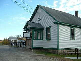
Buckland is a town in Franklin County, Massachusetts, United States. The population was 1,816 at the 2020 census. The town shares the village of Shelburne Falls with neighboring Shelburne. The town center at Shelburne Falls is the western end of the Bridge of Flowers, a local tourist attraction.

<span class="mw-page-title-main">Charlemont, Massachusetts</span> Town in Massachusetts, United States

Charlemont is a town in Franklin County, Massachusetts, United States. The population was 1,185 at the 2020 census. It is part of the Springfield, Massachusetts Metropolitan Statistical Area.

<span class="mw-page-title-main">Colrain, Massachusetts</span> Town in Massachusetts, United States

Colrain is a town in Franklin County, Massachusetts, United States. The population was 1,606 at the 2020 census. It is part of the Springfield, Massachusetts Metropolitan Statistical Area.

<span class="mw-page-title-main">Conway, Massachusetts</span> Town in Massachusetts, United States

Conway is a town in Franklin County, Massachusetts, United States. The population was 1,761 at the 2020 census. It is part of the Springfield, Massachusetts Metropolitan Statistical Area.

<span class="mw-page-title-main">Deerfield, Massachusetts</span> Town in Massachusetts, United States

Deerfield is a town in Franklin County, Massachusetts, United States. Settled near the Connecticut River in the 17th century during the colonial era, the population was 5,090 as of the 2020 census. Deerfield is part of the Springfield, Massachusetts Metropolitan Statistical Area in western Massachusetts, lying 30 miles (48 km) north of the city of Springfield.

<span class="mw-page-title-main">Hawley, Massachusetts</span> Town in Massachusetts, United States

Hawley is a town in Franklin County, Massachusetts, United States. The population was 353 at the 2020 census. It is part of the Springfield, Massachusetts Metropolitan Statistical Area.

<span class="mw-page-title-main">Heath, Massachusetts</span> Town in Massachusetts, United States

Heath is a town in Franklin County, Massachusetts, United States. The population was 723 at the 2020 census. It is part of the Springfield, Massachusetts Metropolitan Statistical Area.

<span class="mw-page-title-main">Leyden, Massachusetts</span> Town in Massachusetts, United States

Leyden is a town in Franklin County, Massachusetts, United States. The population was 734 at the 2020 census. It is part of the Springfield, Massachusetts Metropolitan Statistical Area.

<span class="mw-page-title-main">Monroe, Massachusetts</span> Town in Massachusetts, United States

Monroe is a town in Franklin County, Massachusetts, United States. The population was 118 at the 2020 census. By area, population, and population density, it is the smallest town in the county; and is the second-smallest town by population in the Commonwealth, with only Gosnold having fewer residents.

<span class="mw-page-title-main">Rowe, Massachusetts</span> Town in Massachusetts, United States

Rowe is a town in Franklin County, Massachusetts, United States. The population was 424 at the 2020 census.

<span class="mw-page-title-main">Shelburne, Massachusetts</span> Town in Massachusetts, United States

Shelburne is a town in Franklin County, Massachusetts, United States. The population was 1,884 at the 2020 census. It is part of the Springfield, Massachusetts Metropolitan Statistical Area.

<span class="mw-page-title-main">Whately, Massachusetts</span> Town in Massachusetts, United States

Whately is a town in Franklin County, Massachusetts, United States. The population was 1,607 at the 2020 census. It is part of the Springfield, Massachusetts Metropolitan Statistical Area.

<span class="mw-page-title-main">Plainfield, Massachusetts</span> Town in Massachusetts, United States

Plainfield is a town on the northwestern edge of Hampshire County, Massachusetts, United States, about 25 miles east of Pittsfield and 30 miles northwest of Northampton. The population was 633 at the 2020 census. It is part of the Springfield, Massachusetts Metropolitan Statistical Area.

<span class="mw-page-title-main">Greenfield, Massachusetts</span> City in Massachusetts, United States

Greenfield is the only city in, and the seat of, Franklin County, Massachusetts, United States. Greenfield was first settled in 1686. The population was 17,768 at the 2020 census. Greenfield is home to Greenfield Community College, the Pioneer Valley Symphony Orchestra, and the Franklin County Fair. The city has a Main Street Historic District containing fine examples of Federal, Greek Revival, and Victorian architecture.

<span class="mw-page-title-main">Mohawk Trail Regional High School</span> Public school in Buckland, Massachusetts, United States

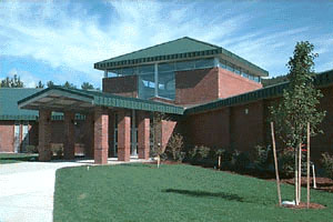
Mohawk Trail Regional School is a school located on Route 112 in Buckland, Massachusetts, United States. The public school currently serves grades 7–12 for nine towns: Ashfield, Buckland, Charlemont, Colrain, Hawley, Heath, Plainfield, Rowe and Shelburne.

<span class="mw-page-title-main">Massachusetts House of Representatives' 1st Franklin district</span> American legislative district

Massachusetts House of Representatives' 1st Franklin district in the United States is one of 160 legislative districts included in the lower house of the Massachusetts General Court. It covers parts of Franklin County and Hampshire County. Democrat Natalie Blais of Sunderland has represented the district since 2019. Blais is running unopposed for re-election in the 2020 Massachusetts general election.

References

  1. 1 2 U.S. Geological Survey Geographic Names Information System: Ashfield, Massachusetts
  2. "Census - Geography Profile: Ashfield town, Franklin County, Massachusetts". United States Census Bureau . Retrieved November 14, 2021.
  3. "History | Ashfield, MA". ashfield.org. Retrieved July 25, 2020.
  4. "Cecil B. deMille". www.goldenglobes.com. Retrieved July 25, 2020.
  5. "Clark, William Smith, 1826-1886 – Special Collections and University Archives" . Retrieved July 25, 2020.
  6. "Geographic Identifiers: 2010 Demographic Profile Data (DP-1): Ashfield town, Franklin County, Massachusetts". United States Census Bureau . Retrieved August 22, 2012.
  7. "Total Population (P1), 2010 Census Summary File 1". American FactFinder, All County Subdivisions within Massachusetts. United States Census Bureau. 2010.
  8. "Massachusetts by Place and County Subdivision - GCT-T1. Population Estimates". United States Census Bureau. Retrieved July 12, 2011.
  9. "1990 Census of Population, General Population Characteristics: Massachusetts" (PDF). US Census Bureau. December 1990. Table 76: General Characteristics of Persons, Households, and Families: 1990. 1990 CP-1-23. Retrieved July 12, 2011.
  10. "1980 Census of the Population, Number of Inhabitants: Massachusetts" (PDF). US Census Bureau. December 1981. Table 4. Populations of County Subdivisions: 1960 to 1980. PC80-1-A23. Retrieved July 12, 2011.
  11. "1950 Census of Population" (PDF). Bureau of the Census. 1952. Section 6, Pages 21-10 and 21-11, Massachusetts Table 6. Population of Counties by Minor Civil Divisions: 1930 to 1950. Retrieved July 12, 2011.
  12. "1920 Census of Population" (PDF). Bureau of the Census. Number of Inhabitants, by Counties and Minor Civil Divisions. Pages 21-5 through 21-7. Massachusetts Table 2. Population of Counties by Minor Civil Divisions: 1920, 1910, and 1920. Retrieved July 12, 2011.
  13. "1890 Census of the Population" (PDF). Department of the Interior, Census Office. Pages 179 through 182. Massachusetts Table 5. Population of States and Territories by Minor Civil Divisions: 1880 and 1890. Retrieved July 12, 2011.
  14. "1870 Census of the Population" (PDF). Department of the Interior, Census Office. 1872. Pages 217 through 220. Table IX. Population of Minor Civil Divisions, &c. Massachusetts. Retrieved July 12, 2011.
  15. "1860 Census" (PDF). Department of the Interior, Census Office. 1864. Pages 220 through 226. State of Massachusetts Table No. 3. Populations of Cities, Towns, &c. Retrieved July 12, 2011.
  16. "1850 Census" (PDF). Department of the Interior, Census Office. 1854. Pages 338 through 393. Populations of Cities, Towns, &c. Retrieved July 12, 2011.
  17. "City and Town Population Totals: 2020-2022". United States Census Bureau . Retrieved November 11, 2023.
  18. "U.S. Census website". United States Census Bureau . Retrieved January 31, 2008.
  19. Kulik, Representative Stephen. "1st Franklin, MA, District Map". Representative Stephen Kulik. Retrieved September 7, 2018.
  20. Kulik, Representative Stephen. "Representative Stephen Kulik". Representative Stephen Kulik. Retrieved September 7, 2018.
  21. List of Massachusetts Legislators by City and Town
  22. Station B-2, SP Shelburne Falls
  23. "Mohawk Schools > Central Office". Archived from the original on August 14, 2013. Retrieved August 12, 2013.
  24. Report of the Free Public Library Commission of Massachusetts. 1899.
  25. Report of the Free Public Library Commission of Massachusetts, Jan. 1911
  26. Bulletin of the American Library Association, March 1914.
  27. "Belding Brothers and Company Records". Archived from the original on June 11, 2010. Retrieved June 2, 2010.
  28. The Dial, Sept. 16, 1913
  29. Jones, James Edwin (1914). A history of Columbia County, Wisconsin: a narrative account of its historical progress, its people, and its principal interests, Volume 2. Lewis Publishing Co. p. 583.
  30. "Bement, Alon". Benezit Dictionary of Artists . Oxford University Press. October 31, 2011. doi:10.1093/benz/9780199773787.article.B00016071 . Retrieved February 23, 2021.
  31. Scott Eyman (2010). Empire of dreams. Internet Archive. Simon & Schuster. ISBN   978-0-7432-8955-9.
  32. Minnesota Legislators: Past & Present-Richard Nelson Garnder
  33. Vallette, David A. (January 26, 2009). "Vacant Ashfield farmhouse sold to songwriter Ray LaMontagne for more than $1 million". The Republican (Springfield, Massachusetts).
  34. "Henry C. Payne Dies In His Washington Home. Postmaster General Unconscious for Hours Before the End". The New York Times . October 5, 1904. Henry C. Payne, Postmaster General of the United States, died at his apartments in the annex of the Arlington Hotel at 6:10 o'clock to-night. The cause of death was officially stated to be disease of the mitral valve and dilation of the heart. Mr. Payne had been in poor health for some years, but his last illness lasted only seven days. ...