Related Research Articles

Coppicing is a traditional method of woodland management which exploits the capacity of many species of trees to put out new shoots from their stump or roots if cut down. In a coppiced wood, which is called a copse, young tree stems are repeatedly cut down to near ground level, resulting in a stool. New growth emerges, and after a number of years, the coppiced tree is harvested, and the cycle begins anew. Pollarding is a similar process carried out at a higher level on the tree in order to prevent grazing animals from eating new shoots. Daisugi, is a similar Japanese technique.

Bocage is a terrain of mixed woodland and pasture characteristic of parts of Northern France, Southern England, Ireland, the Netherlands and Northern Germany, in regions where pastoral farming is the dominant land use.

A savanna or savannah is a mixed woodland-grassland ecosystem characterised by the trees being sufficiently widely spaced so that the canopy does not close. The open canopy allows sufficient light to reach the ground to support an unbroken herbaceous layer consisting primarily of grasses. According to Britannica, there exists four savannah forms; savanna woodland where trees and shrubs form a light canopy, tree savanna with scattered trees and shrubs, shrub savanna with distributed shrubs, and grass savanna where trees and shrubs are mostly nonexistent.

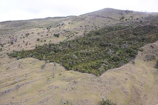
Shifting cultivation is an agricultural system in which plots of land are cultivated temporarily, then abandoned while post-disturbance fallow vegetation is allowed to freely grow while the cultivator moves on to another plot. The period of cultivation is usually terminated when the soil shows signs of exhaustion or, more commonly, when the field is overrun by weeds. The period of time during which the field is cultivated is usually shorter than the period over which the land is allowed to regenerate by lying fallow.
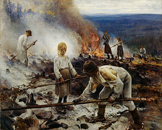
Slash-and-burn agriculture is a farming method that involves the cutting and burning of plants in a forest or woodland to create a field called a swidden. The method begins by cutting down the trees and woody plants in an area. The downed vegetation, or "slash", is then left to dry, usually right before the rainiest part of the year. Then, the biomass is burned, resulting in a nutrient-rich layer of ash which makes the soil fertile, as well as temporarily eliminating weed and pest species. After about three to five years, the plot's productivity decreases due to depletion of nutrients along with weed and pest invasion, causing the farmers to abandon the field and move over to a new area. The time it takes for a swidden to recover depends on the location and can be as little as five years to more than twenty years, after which the plot can be slashed and burned again, repeating the cycle. In Bangladesh and India, the practice is known as jhum or jhoom.

Arden is an area located mainly in Warwickshire, England, with parts in Staffordshire and Worcestershire, and is traditionally regarded as extending from the River Avon to the River Tame. It was once heavily wooded, giving rise to the name 'Forest of Arden'.

In the United Kingdom, an ancient woodland is a woodland that has existed continuously since 1600 or before in England, Wales and Northern Ireland. Planting of woodland was uncommon before those dates, so a wood present in 1600 is likely to have developed naturally.

A royal forest, occasionally known as a kingswood, is an area of land with different definitions in England, Wales, Scotland and Ireland. The term forest in the ordinary modern understanding refers to an area of wooded land; however, the original medieval sense was closer to the modern idea of a "preserve" – i.e. land legally set aside for specific purposes such as royal hunting – with less emphasis on its composition. There are also differing and contextual interpretations in Continental Europe derived from the Carolingian and Merovingian legal systems.

Savernake Forest stands on a Cretaceous chalk plateau between Marlborough and Great Bedwyn in Wiltshire, England. Its area is approximately 4,500 acres.

The clearing of woods and forests is the process by which vegetation, such as trees and bushes, together with their roots are permanently removed. The main aim of this process is to clear areas of forest, woodland or scrub in order to use the soil for another purpose, such as pasture land, arable farming, human settlement or the construction of roads or railways.

Newland is a village and civil parish in the Forest of Dean in Gloucestershire, England. situated on the east side of the River Wye, 3 miles (5 km) south-east of Monmouth. It is notable for its parish church of All Saints, known as the 'Cathedral of the Forest'. It was the centre of a large parish with complex boundaries and scattered settlements.

The woodlands of the Iberian Peninsula are distinct ecosystems on the Iberian Peninsula. Although the various regions are each characterized by distinct vegetation, the borders between these regions are not clearly defined, and there are some similarities across the peninsula.

Glympton is a village and civil parish on the River Glyme about 3 miles (5 km) north of Woodstock, Oxfordshire. The 2001 Census recorded the parish's population as 80. The village and church are owned by the Glympton Park estate.

Hatfield Broad Oak is a village and civil parish in the Uttlesford district of Essex, England. The village is approximately 5 miles (8 km) south-east of Bishop's Stortford. Near the church of St Mary the Virgin is former Benedictine priory Hatfield Regis Priory.

Shelley is a small village and civil parish in Suffolk, England. Located on the west bank of the River Brett around three miles south of Hadleigh, it is part of Babergh district. The population of the village was only minimal at the 2011 Census and is included in the civil parish of Higham.

In medieval and Early Modern England, Wales and Ireland, a deer park was an enclosed area containing deer. It was bounded by a ditch and bank with a wooden park pale on top of the bank, or by a stone or brick wall. The ditch was on the inside increasing the effective height. Some parks had deer "leaps", where there was an external ramp and the inner ditch was constructed on a grander scale, thus allowing deer to enter the park but preventing them from leaving.
Land restoration, which may include renaturalisation or rewilding, is the process of ecological restoration of a site to a natural landscape and habitat, safe for humans, wildlife, and plant communities. Ecological destruction, to which land restoration serves as an antidote, is usually the consequence of pollution, deforestation, salination or natural disasters. Land restoration is not the same as land reclamation, where existing ecosystems are altered or destroyed to give way for cultivation or construction. Land restoration can enhance the supply of valuable ecosystem services that benefit people.

The Forests of Mara and Mondrem were adjacent medieval forests in Cheshire, England, which in the 11th century extended to over 60 square miles (160 km2), stretching from the Mersey in the north almost to Nantwich in the south, and from the Gowy in the west to the Weaver in the east. Mara and Mondrem were a hunting forest of the Norman Earls of Chester, established soon after 1071 by the first earl, Hugh d'Avranches. They might earlier have been an Anglo-Saxon hunting forest. Game included wild boar, and red, fallow and roe deer.

Feckenham Forest was a royal forest, centred on the village of Feckenham, covering large parts of Worcestershire and west Warwickshire. It was not entirely wooded, nor entirely the property of the King. Rather, the King had legal rights over game, wood and grazing within the forest, and special courts imposed harsh penalties when these rights were violated. Courts and the forest gaol were located at Feckenham and executions took place at Gallows Green near Hanbury.

A woodland edge or forest edge is the transition zone (ecotone) from an area of woodland or forest to fields or other open spaces. Certain species of plants and animals are adapted to the forest edge, and these species are often more familiar to humans than species only found deeper within forests. A classic example of a forest edge species is the white-tailed deer in North America.
