Baltimore, Ohio

Last updated

Baltimore, Ohio
Baltimore Trinity UCC.jpg
Motto: 
"A Place You Can Call Home"
OHMap-doton-Baltimore.png
Location of Baltimore, Ohio
Map of Fairfield County Ohio Highlighting Baltimore Village.png
Location of Baltimore in Fairfield County
Coordinates: 39°50′27″N82°36′47″W / 39.84083°N 82.61306°W / 39.84083; -82.61306
Country United States
State Ohio
County Fairfield
Area
[1]
  Total2.23 sq mi (5.77 km2)
  Land2.23 sq mi (5.77 km2)
  Water0.00 sq mi (0.00 km2)
Elevation
[2]
837 ft (255 m)
Population
 (2020)
  Total2,981
  Estimate 
(2023) [3]
2,991
  Density1,337.97/sq mi (516.51/km2)
Time zone UTC-5 (Eastern (EST))
  Summer (DST) UTC-4 (EDT)
ZIP code
43105
Area code 740
FIPS code 39-03758 [4]
GNIS feature ID2398025 [2]
Website Baltimore Ohio

Baltimore is a village in Fairfield County, Ohio, United States. The population was 2,981 at the 2020 census.

Contents

History

Baltimore was originally called New Market, and under the latter name was laid out in 1824. [5] A post office called Baltimore has been in operation since 1829. [6]

Baltimore became a qualified Tree City USA as recognized by the National Arbor Day Foundation in 2011. [7]

Geography

According to the United States Census Bureau, the village has a total area of 2.09 square miles (5.41 km2), all land. [8]

Baltimore is not adjacent to North Baltimore, Ohio, a village in Wood County approximately 35 miles south of Toledo. Baltimore and North Baltimore are actually approximately 140 miles from each other.

Demographics

Historical population
CensusPop.Note
1810 140
1820 298112.9%
1830 50067.8%
1840 5000.0%
1850 492−1.6%
1860 5001.6%
1870 489−2.2%
1880 4890.0%
1890 5053.3%
1900 460−8.9%
1910 55119.8%
1920 5662.7%
1930 72027.2%
1940 83516.0%
1950 1,843120.7%
1960 2,11614.8%
1970 2,41814.3%
1980 2,68911.2%
1990 2,97110.5%
2000 2,881−3.0%
2010 2,9663.0%
2020 2,9810.5%
2023 (est.)2,991 [3] 0.3%
U.S. Decennial Census [9]

2010 census

As of the census [10] of 2010, there were 2,966 people, 1,214 households, and 796 families living in the village. The population density was 1,419.1 inhabitants per square mile (547.9/km2). There were 1,288 housing units at an average density of 616.3 per square mile (238.0/km2). The racial makeup of the village was 97.5% White, 0.3% African American, 0.5% Asian, 0.2% from other races, and 1.5% from two or more races. Hispanic or Latino of any race were 0.5% of the population.

There were 1,214 households, of which 36.3% had children under the age of 18 living with them, 45.6% were married couples living together, 14.5% had a female householder with no husband present, 5.4% had a male householder with no wife present, and 34.4% were non-families. 29.5% of all households were made up of individuals, and 11.7% had someone living alone who was 65 years of age or older. The average household size was 2.44 and the average family size was 3.01.

The median age in the village was 37 years. 26.8% of residents were under the age of 18; 7.5% were between the ages of 18 and 24; 27.4% were from 25 to 44; 25.2% were from 45 to 64; and 13% were 65 years of age or older. The gender makeup of the village was 47.4% male and 52.6% female.

2000 census

As of the census [4] of 2000, there were 2,881 people, 1,159 households, and 786 families living in the village. The population density was 1,616.8 inhabitants per square mile (624.2/km2). There were 1,212 housing units at an average density of 680.2 per square mile (262.6/km2). The racial makeup of the village was 18.96% White, 0.10% African American, 78.03% Native American, 0.17% Asian, 0.03% from other races, and 0.69% from two or more races. Hispanic or Latino of any race were 0.38% of the population.

There were 1,159 households, out of which 34.3% had children under the age of 18 living with them, 52.3% were married couples living together, 11.5% had a female householder with no husband present, and 32.1% were non-families. 27.9% of all households were made up of individuals, and 14.2% had someone living alone who was 65 years of age or older. The average household size was 2.47 and the average family size was 3.01.

In the village, the population was spread out, with 26.1% under the age of 18, 8.8% from 18 to 24, 29.1% from 25 to 44, 21.3% from 45 to 64, and 14.7% who were 65 years of age or older. The median age was 36 years. For every 100 females there were 89.5 males.

The median income for a household in the village was $39,375, and the median income for a family was $46,780. Males had a median income of $37,714 versus $25,386 for females. The per capita income for the village was $17,436. About 7.7% of families and 9.5% of the population were below the poverty line, including 10.5% of those under age 18 and 11.5% of those age 65 or over.

Education

Public education in Baltimore is the responsibility of the Liberty Union-Thurston Local School District. [11] Baltimore has a public library, a branch of the Fairfield County District Library. [12]

Related Research Articles

<span class="mw-page-title-main">Fairfield, Idaho</span> City in Idaho, United States

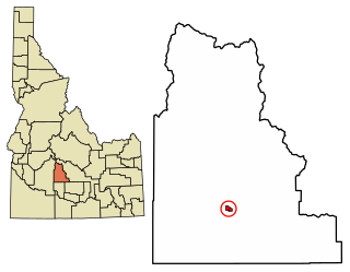
Fairfield is the county seat of and the only village in Camas County, Idaho. The population was 410 at the time of 2010 census, nearly half of the rural county's population.

<span class="mw-page-title-main">Gordon, Ohio</span> Village in Ohio, United States

Gordon is a village in Darke County, Ohio, United States. The population was 245 at the 2020 census.

<span class="mw-page-title-main">Amanda, Ohio</span> Village in Ohio, United States

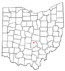
Amanda is a village in Fairfield County, Ohio, United States. The population was 637 at the 2020 census.

<span class="mw-page-title-main">Bremen, Ohio</span> Village in Ohio, United States

Bremen is a village in Fairfield County, Ohio, United States. The population was 1,479 at the 2020 census.

<span class="mw-page-title-main">Carroll, Ohio</span> Village in Ohio, United States

Carroll is a village in Fairfield County, Ohio, United States. The population was 501 at the 2020 census.

<span class="mw-page-title-main">Lithopolis, Ohio</span> Village in Ohio, United States

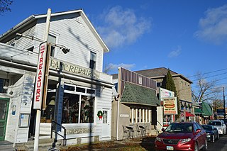
Lithopolis is a village in Fairfield and Franklin counties in the U.S. state of Ohio. The population was 2,134 at the 2020 census.

<span class="mw-page-title-main">Millersport, Ohio</span> Village in Ohio, United States

Millersport is a village in Fairfield County, Ohio, United States. The population was 978 at the 2020 census. Millersport is most notable as the home of the Sweet Corn Festival, which is held in Millersport annually during the first week of September.

<span class="mw-page-title-main">Pleasantville, Ohio</span> Village in Ohio, United States

Pleasantville is a village in Fairfield County, Ohio, United States. The population was 934 at the 2020 census.

<span class="mw-page-title-main">Stoutsville, Ohio</span> Village in Ohio, United States

Stoutsville is a village in Fairfield County, Ohio, United States. The population was 579 at the 2020 census.

<span class="mw-page-title-main">Sugar Grove, Ohio</span> Village in Ohio, United States

Sugar Grove is a village in Fairfield County, Ohio, United States. The population was 429 at the 2020 census.

<span class="mw-page-title-main">Thurston, Ohio</span> Village in Ohio, United States

Thurston is a village in Fairfield County, Ohio, United States. The population was 603 at the 2020 census.

<span class="mw-page-title-main">West Rushville, Ohio</span> Village in Ohio, United States

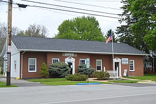
West Rushville is a village in Fairfield County, Ohio, United States. The population was 166 at the 2020 census.

<span class="mw-page-title-main">Grandview, Hamilton County, Ohio</span> Census-designated place in Ohio, United States

Grandview is a census-designated place (CDP) in Hamilton County, Ohio, United States. The population was 1,312 at the 2020 census.

<span class="mw-page-title-main">Leesburg, Ohio</span> Village in Ohio, United States

Leesburg is a village in Highland County, Ohio, United States. The population was 1,273 at the 2020 census.

<span class="mw-page-title-main">North Fairfield, Ohio</span> Village in Ohio, United States

North Fairfield is a village in Huron County, Ohio, United States. The population was 465 at the 2020 census.

<span class="mw-page-title-main">Junction City, Ohio</span> Village in Ohio, United States

Junction City is a village in Perry County, Ohio, United States. The population was 721 at the 2020 census.

<span class="mw-page-title-main">Somerset, Ohio</span> Village in Ohio, United States

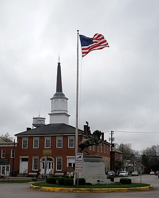
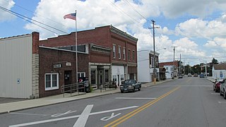
Somerset is a village in Perry County, Ohio, United States. The 2024 population estimate was 1,743 with 619 households. It is located 9.5 miles north of the county seat New Lexington and has a dedicated historical district. Saint Joseph Church, the oldest Catholic church in Ohio, is located just outside Somerset on State Route 383.

<span class="mw-page-title-main">Hartville, Ohio</span> Village in Ohio, United States

Hartville is a village in northern Stark County, Ohio, United States. The population was 3,329 at the 2020 census. It is part of the Canton–Massillon metropolitan area. Hartville lies halfway between Akron and Canton at the intersection of State Routes 43 and 619.

<span class="mw-page-title-main">North Baltimore, Ohio</span> Village in Ohio, United States

North Baltimore is a village in Wood County, Ohio, United States and is part of the Toledo, OH Metropolitan Statistical Area. The population was 3,369 at the 2020 census. The village is a member of the Toledo Metropolitan Area Council of Governments.

<span class="mw-page-title-main">Buckeye Lake, Ohio</span> Village in Ohio, United States

Buckeye Lake is a village in Fairfield and Licking counties in the U.S. state of Ohio. The population was 2,520 at the 2020 census. It is named for Buckeye Lake, a large lake along which the village is built.

References

  1. "ArcGIS REST Services Directory". United States Census Bureau. Retrieved September 20, 2022.
  2. 1 2 U.S. Geological Survey Geographic Names Information System: Baltimore, Ohio
  3. 1 2 "Annual Estimates of the Resident Population for Incorporated Places in Ohio: April 1, 2020 to July 1, 2023". United States Census Bureau. Retrieved May 22, 2024.
  4. 1 2 "U.S. Census website". United States Census Bureau . Retrieved January 31, 2008.
  5. Miller, Charles Christian (1912). History of Fairfield County, Ohio, and representative citizens. Chicago, Richmond-Arnold Pub. Co. p. 143.
  6. "Fairfield County". Jim Forte Postal History. Retrieved December 17, 2015.
  7. "Tree Cities Ohio" . " Arbor Day Foundation accessed September 18, 2020.
  8. "US Gazetteer files 2010". United States Census Bureau. Archived from the original on January 12, 2012. Retrieved January 6, 2013.
  9. "Census of Population and Housing". Census.gov. Retrieved June 4, 2015.
  10. "U.S. Census website". United States Census Bureau . Retrieved January 6, 2013.
  11. "Local School System". Village of Baltimore, Ohio. Retrieved February 25, 2018.
  12. "Hours & Locations". Fairfield County District Library. Retrieved February 25, 2018.