
Colorado Springs is a home rule municipality in and the county seat of El Paso County, Colorado, United States. It is the largest city in El Paso County, with a population of 478,961 at the 2020 United States Census, a 15.02% increase since 2010. Colorado Springs is the second-most populous city and the most extensive city in the state of Colorado, and the 40th-most populous city in the United States. It is the principal city of the Colorado Springs metropolitan area and the second-most prominent city of the Front Range Urban Corridor. It is located in east-central Colorado, on Fountain Creek, 70 miles (113 km) south of Denver.

Fort Collins is a home rule municipality that is the county seat and the most populous municipality of Larimer County, Colorado, United States. The city population was 169,810 at the 2020 census, an increase of 17.94% since 2010. Fort Collins is the principal city of the Fort Collins, CO Metropolitan Statistical Area and is a major city of the Front Range Urban Corridor. The city is the fourth most populous city in Colorado. Situated on the Cache La Poudre River along the Colorado Front Range, Fort Collins is located 56 mi (90 km) north of the Colorado State Capitol in Denver. Fort Collins is a midsize college town, home to Colorado State University and Front Range Community College's Larimer college.
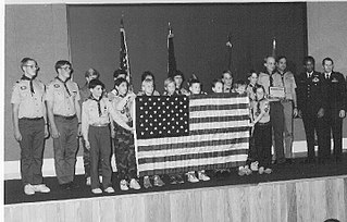
Scouting in Colorado has a long history, from the 1910s to the present day.

Goodyear is a city in Maricopa County, Arizona, United States. It is a suburb of Phoenix and at the 2020 census had a population of 95,294, up from 65,275 in 2010 and 18,911 in 2000. It was the third-fastest-growing city in Arizona between 1990 and 2000.

The City of Westminster is a home rule municipality located in Adams and Jefferson counties, Colorado, United States. The city population was 116,317 at the 2020 United States Census with 71,240 residing in Adams County and 45,077 residing in Jefferson County. Westminster is the eighth most populous city in Colorado. The city is a part of the Denver–Aurora–Lakewood, CO Metropolitan Statistical Area and the Front Range Urban Corridor. The Westminster Municipal Center is located 9 miles (14 km) north-northwest of the Colorado State Capitol in Denver.
Highlands Ranch is an unincorporated community and a census-designated place (CDP) located in and governed by Douglas County, Colorado, United States. The CDP is a part of the Denver–Aurora–Lakewood, CO Metropolitan Statistical Area. The population of the Highlands Ranch CDP was 105,631 at the United States Census 2020, making it the most populous unincorporated community in the State of Colorado. The Highlands Ranch Metropolitan District provides services to the community, which lies in ZIP Codes 80126, 80129, 80130, and 80163.
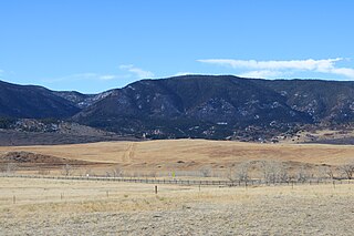
Perry Park is an unincorporated community and a census-designated place (CDP) located in Douglas County, Colorado, United States. The CDP is a part of the Denver–Aurora–Lakewood, CO Metropolitan Statistical Area. The population of the Perry Park CDP was 1,932 at the United States Census 2020. The Perry Park Metropolitan District and the Perry Park Water & Sanitation District provide services. The Larkspur post office serves the area.

The City of Fountain is a home rule municipality located in El Paso County, Colorado, United States. The city population was 29,802 at the 2020 United States Census, a +15.31% increase since the 2010 United States Census. Fountain is a part of the Colorado Springs, CO Metropolitan Statistical Area and the Front Range Urban Corridor.

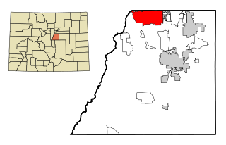
Monument is a home rule town situated at the base of the Rampart Range in El Paso County, Colorado, United States. Monument is one of the three communities that make up the Tri-Lakes area, along with Palmer Lake and Woodmoor. The town is part of the Colorado Springs metropolitan area, which had an estimated population of 700,000 in 2019. Monument is bordered by Pike National Forest on the west, Colorado Springs and the United States Air Force Academy to the south, Bald Mountain, True Mountain, and Spruce Mountain to the north, and Black Forest and rolling plains to the east. Monument was first settled as a stop along the Rio Grande Railroad in 1872, and the area was incorporated as a town called Henry's Station in 1879, but the name was later changed to Monument. The town population was 10,399 at the 2020 United States Census, an increase from the population of 5,530 in 2010 and 1,971 in 2000. On April 1, 2019, the town declared itself to be a Second Amendment sanctuary.

Woodland Park is a home rule municipality in Teller County, Colorado, United States. Woodland Park is part of the Colorado Springs, CO Metropolitan Statistical Area. Many residents in this bedroom community commute to Colorado Springs. Woodland Park is surrounded by the 1,000,000-acre (400,000 ha) Pike National Forest. The population was 7,920 as of the 2020 Census.

Cinco Ranch is a census-designated place and master-planned community located in the extraterritorial jurisdiction of the city of Houston within Fort Bend and Harris counties in the U.S. state of Texas. The population was 16,899 at the 2020 census. It lies about 25 miles (40 km) west of the Harris County seat of Houston and 10 miles (16 km) north of the Fort Bend County seat of Richmond. Cinco Ranch is considered to be part of the Greater Katy area and is roughly 10 miles southeast of the city of Katy.

The Coachella Valley is an arid rift valley in the Colorado Desert of Southern California in Riverside County. The valley may also be referred to as Greater Palm Springs and the Palm Springs Area due to the prominence of the city of Palm Springs and disagreement over the name Coachella. The valley extends approximately 45 mi (72 km) southeast from the San Gorgonio Pass to the northern shore of the Salton Sea and the neighboring Imperial Valley, and is approximately 15 mi (24 km) wide along most of its length. It is bounded on the northeast by the San Bernardino and Little San Bernardino Mountains, and on the southwest by the San Jacinto and Santa Rosa Mountains.

Before it was founded, the site of modern-day Colorado Springs, Colorado, was part of the American frontier. Old Colorado City, built in 1859 during the Pike's Peak Gold Rush was the Colorado Territory capital. The town of Colorado Springs was founded by General William Jackson Palmer as a resort town. Old Colorado City was annexed into Colorado Springs. Railroads brought tourists and visitors to the area from other parts of the United States and abroad. The city was noted for junctions for seven railways: Denver and Rio Grande (1870), Denver and New Orleans Manitou Branch (1882), Colorado Midland (1886-1918), Colorado Springs and Interurban, Atchison, Topeka, and Santa Fe (1889), Rock Island (1889), and Colorado Springs and Cripple Creek Railways. It was also known for mining exchanges and brokers for the Cripple Creek Gold Rush.

Palmer Ridge High School is a public high school in Monument, Colorado, United States, serving students in grades 9–12. It is one of two high schools in the Lewis-Palmer School District, with admission based primarily on the locations of students' homes.

The Holden/Marolt Mining and Ranching Museum is located on the former Holden Lixiviation Works facility on the western edge of the city of Aspen, Colorado, United States. It consists of two remaining buildings from the facility, as well as the relocated McMurchy/Zupancis domestic buildings. In 1990 the property was recognized as a historic district and listed on the National Register of Historic Places, the only district in the city to be so recognized.
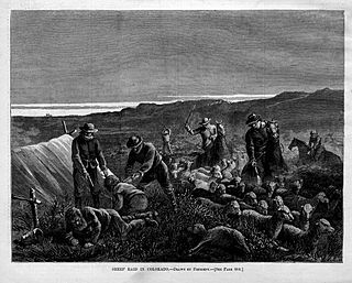
The sheep wars, or the sheep and cattle wars, were a series of armed conflicts in the Western United States fought between sheepmen and cattlemen over grazing rights. Sheep wars occurred in many western states, though they were most common in Texas, Arizona, and the border region of Wyoming and Colorado. Generally, the cattlemen saw the sheepherders as invaders who destroyed the public grazing lands, which they had to share on a first-come, first-served basis. Between 1870 and 1920, approximately 120 engagements occurred in eight states or territories. At least 54 men were killed and some 50,000 to over 100,000 sheep were slaughtered.

The Waldo Canyon fire was a forest fire that started approximately 4 miles (6.4 km) northwest of Colorado Springs, Colorado on June 23, 2012, and was declared 100 percent contained on July 10, 2012, after no smoke plumes were visible on a small portion of the containment line on Blodgett Peak. The fire was active in the Pike National Forest and adjoining areas, covering a total of 18,247 acres. The fire had caused the evacuation of over 32,000 residents of Colorado Springs, Manitou Springs and Woodland Park, several small mountain communities along the southwestern side of U.S. Highway 24, and partial evacuation of the United States Air Force Academy. There were 346 homes destroyed by the fire. U.S. Highway 24, a major east–west road, was closed in both directions. The Waldo Canyon Fire resulted in insurance claims totaling more than US $453.7 million. It was the most destructive fire in Colorado state history, as measured by the number of homes destroyed, until the Black Forest Fire surpassed it almost a year later when it consumed 486 homes and damaged 28 others.

Cheyenne Mountain is a triple-peaked mountain in El Paso County, Colorado, southwest of downtown Colorado Springs. The mountain serves as a host for military, communications, recreational, and residential functions. The underground operations center for the North American Aerospace Defense Command (NORAD) was built during the Cold War to monitor North American airspace for missile launches and Soviet military aircraft. Built deep within granite, it was designed to withstand the impact and fallout from a nuclear bomb. Its function broadened with the end of the Cold War, and then many of its functions were transferred to Peterson Air Force Base in 2006.
Banning Lewis Academy are the two schools consisting of Banning Lewis Ranch Academy and Banning Lewis Preparatory Academy which are tuition free public charter schools serving approximately 1500 students in Colorado Springs, Colorado. The upper school campus opened in August 2017. BLPA now includes grades 6-8 for Middle School and grades 9-12 for High School. The schools are located in the Banning Lewis Ranch neighborhood, which was built years later after the original school opened. For enrolling in the school, admission is usually done by lottery. The school's mascot is a stallion.

Edgerton is an extinct town at the confluence of Monument Creek and West Monument Creek eight miles north of present-day Colorado Springs in El Paso County, Colorado, United States. and. It was across from Black Forest. The Edgerton post office operated from June 16, 1870, until August 28, 1902.

