Blaine County, Idaho

Last updated

Blaine County
Blaine County Courthouse, Hailey ID1.jpg
Blaine County Courthouse
Blaine County ID Seal.PNG
Map of Idaho highlighting Blaine County.svg
Location within the U.S. state of Idaho
Idaho in United States.svg
Idaho's location within the U.S.
Coordinates: 43°23′N113°59′W / 43.39°N 113.98°W / 43.39; -113.98
CountryFlag of the United States.svg United States
StateFlag of Idaho.svg  Idaho
FoundedMarch 5, 1895
Named for James G. Blaine
Seat Hailey
Largest cityHailey
Area
  Total2,661 sq mi (6,890 km2)
  Land2,644 sq mi (6,850 km2)
  Water17 sq mi (40 km2)  0.6%
Population
 (2020)
  Total24,272 Increase2.svg
  Density9.1/sq mi (3.5/km2)
Time zone UTC−7 (Mountain)
  Summer (DST) UTC−6 (MDT)
Congressional district 2nd
Website www.co.blaine.id.us

Blaine County is a county in the U.S. state of Idaho. As of the 2020 United States Census, the population was 24,272. [1] The county seat and largest city is Hailey. [2] [3] It is also home to the Sun Valley ski resort, adjacent to Ketchum.

Contents

Blaine County was created by the territorial legislature on March 5, 1895, by combining Alturas and Logan counties; it was named for former congressman and 1884 Republican presidential nominee James G. Blaine. [2] [4] Its present boundaries were set on February 8, 1917, when a western portion was partitioned off to form Camas County. [5]

Blaine County is part of the Hailey, ID Micropolitan Statistical Area.

History

Sun Valley's Bald Mountain in 2006 Baldmountainid.jpg
Sun Valley's Bald Mountain in 2006

The Wood River Valley in present-day Blaine County was organized as part of Alturas County by the Idaho Territorial Legislature in 1864. [6] By the 1880s the valley supported a thriving mining commerce; in 1882 the county seat of Alturas County was moved from Rocky Bar in present-day Elmore County to Hailey, in response to a population shift from Rocky Bar – which would eventually become a ghost town – to the Wood River Valley. [7]

The Blaine County boundaries described in its 1895 creation ordinance contained lands that soon were partitioned off to form other counties. Only thirteen days after the official formation date of Blaine, Lincoln County was formed from the county. Lincoln itself was later partitioned to create Gooding (1913), Minidoka (1913), and Jerome (1919) counties. Blaine County was further reduced in 1917 when Camas County was formed. [2]

The strong mining economy of the 1880s had substantially declined by 1890, when Idaho Territory became a state. The county began to recast itself as a tourism destination in 1936 with the opening of the Sun Valley resort, originally owned by the Union Pacific Railroad. The area soon attracted celebrity visitors, and later residents, most notably Ernest Hemingway, who is buried in the Ketchum Cemetery. [8] Celebrities who have lived in Blaine County include Adam West, [9] Demi Moore, [10] and John Kerry. [11]

County profile

Most Blaine County residents live in the Wood River Valley along State Highway 75 in the western half of the county. This area includes all of the county's incorporated cities and towns except Carey, which is located in the south-central part of the county at the junction of US 20 with US 26/93. The county's gerrymandered southeastern panhandle, known locally as the Yale area, is sparsely populated. [12]

As the home of a major ski resort, Blaine County has a higher cost of living than surrounding areas; the median value of its owner-occupied housing units is more than double the state average. [13] As a result, many who work in Blaine County live in outlying areas, particularly in the city of Shoshone in neighboring Lincoln County. It is estimated that 2,540 people from outside the county commute to work in Blaine County. [14]

A portion of Blaine County, the "Yale" area, forms a political peninsula. Douglas S. Jones of the Mini-Cassia News Service wrote that access to a Union Pacific railroad line, and therefore getting tax money from it, is likely why the county wanted that strip of land. [15]

Government and politics

Since 1992, Blaine County has gained a reputation as a Democratic Party enclave in strongly Republican Idaho. [16] The Democratic presidential candidate has won the county in every election since; that year, incumbent George H. W. Bush finished third behind Bill Clinton and Ross Perot. [17] In  2000 and 2004, Blaine was the only Idaho county carried by Al Gore and John Kerry, respectively. [18] [19] [20] [21] Barack Obama carried the county in 2008 by a 33.2% margin over John McCain, while McCain won statewide by a 25.3% margin. [22] It was one of three counties (Latah, Teton) in Idaho won by Obama in 2008, and by far the highest margin. [23] In  2020, Joe Biden defeated incumbent Donald Trump in the county by 36.8 percentage points, with his 67.1% vote share being the highest for any Democrat since 1900.

Obama also carried Blaine County in 2012 with 58.8 percent of the vote, compared to Mitt Romney's 38.7 percent. Blaine County was the only Idaho county in which Obama received over 50 percent of the vote, although he also carried Latah County with 49.6 percent of the vote. From 1968 through 1988, a less populated Blaine County was won by the Republican candidate in all six presidential elections, as was the state of Idaho, although even then the county voted more Democratic than Idaho as a whole in every election going back to 1924. [24]

Similar to other Idaho counties, an elected three-member county commission heads the county government. Other elected officials include clerk, treasurer, sheriff, assessor, and prosecutor. [25]

In 2006, Blaine County voted 66.3% against HJR 2, which amended the Idaho Constitution to outlaw same-sex marriage in Idaho; the measure passed with 63.4% of the statewide vote. Latah County, (Moscow, home of the University of Idaho), was the only other county where the measure failed. [26]

Until the 2021 redistricting cycle, Blaine County at the state level was located in Legislative District 25, [27] with an all-Democratic delegation in the Idaho Legislature. [28] Michelle Stennett, a former minority leader of the Idaho Senate, and Wendy Jaquet, a member of the Idaho House of Representatives and a former minority leader of that body, both live in Ketchum.

United States presidential election results for Blaine County, Idaho [29]
Year Republican Democratic Third party
No.%No.%No.%
2020 4,03230.34%8,91967.12%3382.54%
2016 3,34031.15%6,41659.83%9689.03%
2012 3,93938.64%5,99258.78%2632.58%
2008 3,43932.53%6,94765.71%1871.77%
2004 4,03439.76%5,99259.05%1211.19%
2000 3,52844.44%3,74847.22%6628.34%
1996 3,00336.55%3,84046.73%1,37416.72%
1992 2,24328.25%2,86536.09%2,83135.66%
1988 3,13054.39%2,49843.41%1272.21%
1984 3,60363.69%1,97134.84%831.47%
1980 2,71649.12%1,84033.28%97317.60%
1976 2,17656.13%1,60441.37%972.50%
1972 2,11360.98%1,24035.79%1123.23%
1968 1,33753.82%81532.81%33213.37%
1964 1,16147.31%1,29352.69%00.00%
1960 1,21649.27%1,25250.73%00.00%
1956 1,38458.59%97841.41%00.00%
1952 1,60960.90%1,03339.10%00.00%
1948 94543.71%1,18254.67%351.62%
1944 87445.62%1,03754.12%50.26%
1940 1,12441.83%1,55958.02%40.15%
1936 73534.88%1,36164.59%110.52%
1932 69337.60%1,13361.48%170.92%
1928 84951.96%78047.74%50.31%
1924 73241.59%54330.85%48527.56%
1920 1,16967.57%56132.43%00.00%
1916 1,23137.88%1,83056.31%1895.82%
1912 98835.95%99636.24%76427.80%
1908 1,19746.04%1,24848.00%1555.96%
1904 1,22556.37%77535.66%1737.96%
1900 63432.04%1,34567.96%00.00%
1896 594.57%1,22895.19%30.23%

Geography

According to the U.S. Census Bureau, the county has a total area of 2,661 square miles (6,890 km2), of which 2,644 square miles (6,850 km2) is land and 17 square miles (44 km2) (0.6%) is water. [30]

Adjacent counties

Major highways

National protected areas

Demographics

Historical population
CensusPop.Note
1900 4,900
1910 8,38771.2%
1920 4,473−46.7%
1930 3,768−15.8%
1940 5,29540.5%
1950 5,3841.7%
1960 4,598−14.6%
1970 5,74925.0%
1980 9,84171.2%
1990 13,55237.7%
2000 18,99140.1%
2010 21,37612.6%
2020 24,27213.5%
2023 (est.)25,041 [31] 3.2%
US Decennial Census [32]
1790–1960 [33] 1900–1990 [34]
1990–2000 [35] 2010–2020 [36] 2020 [1]

2000 census

As of the 2000 United States Census, [37] there were 18,991 people, 7,780 households, and 4,839 families in the county. The population density was 7 people per square mile (2.7 people/km2). There were 12,186 housing units at an average density of 5 units per square mile (1.9 units/km2). The racial makeup of the county was 90.73% White, 0.13% Black or African American, 0.33% Native American, 0.73% Asian, 0.07% Pacific Islander, 6.43% from other races, and 1.57% from two or more races. 10.69% of the population were Hispanic or Latino of any race. 17.0% were of English, 14.6% German, 10.8% Irish and 6.2% American ancestry.

There were 7,780 households, out of which 31.90% had children under the age of 18 living with them, 51.20% were married couples living together, 7.20% had a female householder with no husband present, and 37.80% were non-families. 27.30% of all households were made up of individuals, and 5.50% had someone living alone who was 65 years of age or older. The average household size was 2.40 and the average family size was 2.96.

The county population contained 24.00% under the age of 18, 7.70% from 18 to 24, 32.60% from 25 to 44, 27.90% from 45 to 64, and 7.80% who were 65 years of age or older. The median age was 37 years. For every 100 females there were 107.90 males. For every 100 females age 18 and over, there were 106.80 males.

The median income for a household in the county was $50,496, and the median income for a family was $60,037. Males had a median income of $35,949 versus $27,487 for females. The per capita income for the county was $31,346. About 4.90% of families and 7.80% of the population were below the poverty line, including 7.80% of those under age 18 and 5.30% of those age 65 or over.

2010 census

As of the 2010 United States Census, there were 21,376 people, 8,823 households, and 5,575 families in the county. [38] The population density was 8.1 inhabitants per square mile (3.1/km2). There were 15,050 housing units at an average density of 5.7 units per square mile (2.2 units/km2). [39] The racial makeup of the county was 84.9% white, 0.9% Asian, 0.6% American Indian, 0.2% black or African American, 0.1% Pacific islander, 11.8% from other races, and 1.5% from two or more races. Those of Hispanic or Latino origin made up 20.0% of the population. [38] In terms of ancestry, 24.1% were German, 18.8% were English, 11.4% were Irish, and 7.9% were American. [40]

Of the 8,823 households, 32.1% had children under the age of 18 living with them, 51.8% were married couples living together, 7.3% had a female householder with no husband present, 36.8% were non-families, and 28.7% of all households were made up of individuals. The average household size was 2.39 and the average family size was 2.99. The median age was 40.4 years. [38]

The median income for a household in the county was $61,854 and the median income for a family was $73,929. Males had a median income of $48,036 versus $37,603 for females. The per capita income for the county was $32,656. About 4.9% of families and 9.3% of the population were below the poverty line, including 10.9% of those under age 18 and 8.2% of those age 65 or over. [41]

Education

All but one public school in the county is administered by the Blaine County School District 61. [42] The school district covers the entire county. [43] There are three district-operated public schools in the county that have high school divisions: Wood River High School in Hailey, Carey School in Carey, and Silver Creek High School in Hailey. Syringa Mountain School is the first charter school to be approved in Blaine County; it opened in 2014. [44]

Students living in the rural Yale area in the county's southeastern panhandle are sent to schools in neighboring Minidoka County, operated by the Minidoka County School District. [45] The Blaine district pays money to the Minidoka district to send the Yale students to Minidoka schools. [46]

Private schools include Community School in Sun Valley and The Sage School in Hailey.

The College of Southern Idaho, a community college based in Twin Falls, operates an off-campus outreach center in Hailey. [47] The county is in the catchment area, but not the taxation zone, for College of Southern Idaho. [48]

Politics

In 1993 it was common for residents of the rural Yale area to oppose levying additional countywide taxes, partly due to a lack of proximity to county facilities and therefore less of a desire to fund them. [46]

Communities

Cities

Census-designated place

Unincorporated communities

Ghost towns

Media

In 1993, it was not common for residents of the rural Yale area to read newspapers that are published in the county, and as a consequence many of them were not informed about changes in taxation that affected them. [46]

Festivals

Blaine County hosts Wagon Days, Trailing of the Sheep Festival, Sun Valley Harvest Festival, and the Sun Valley for the Arts Wine Auction, among other events.

The Blaine County Fair is an annual summer event. [56]

See also

Related Research Articles

<span class="mw-page-title-main">Adams County, Idaho</span> County in Idaho, United States

Adams County is a rural county in the state of Idaho. As of the 2020 census, the county had a population of 4,379, making it the sixth-least populous county in Idaho. The county seat and largest city is Council. Established in 1911, the county was named for second U.S. President John Adams.

<span class="mw-page-title-main">Twin Falls County, Idaho</span> County in Idaho, United States

Twin Falls County is a county in the south central part of the U.S. state of Idaho. As of the 2020 census, the population was 90,046, making it the fifth-most populous county in Idaho. The county seat and largest city is Twin Falls. Twin Falls County is part of the Twin Falls, ID Twin Falls Metropolitan Statistical Area.

<span class="mw-page-title-main">Teton County, Idaho</span> County in Idaho, United States

Teton County is a county located in the U.S. state of Idaho. As of the 2020 census, the population was 11,630. The county seat is Driggs, and the largest city is Victor. The county was established in 1915 and was named after the Teton Mountains to the east.

<span class="mw-page-title-main">Power County, Idaho</span> County in Idaho, United States

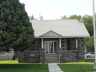
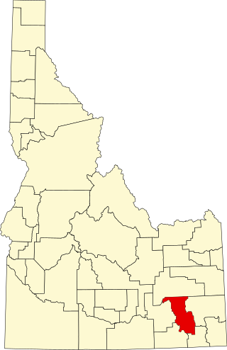
Power County is a county located in the U.S. state of Idaho. As of the 2020 Census, the county had a population of 7,878. The county seat and largest city is American Falls. The county was created by the Idaho Legislature on January 30, 1913, by a partition of Cassia County. It is named for an early hydroelectric power plant (1902) at the American Falls.

<span class="mw-page-title-main">Minidoka County, Idaho</span> County in Idaho, United States

Minidoka County is a county located in the U.S. state of Idaho. As of the 2020 census, the population was 21,613. The county seat and largest city is Rupert.

<span class="mw-page-title-main">Lincoln County, Idaho</span> County in Idaho, United States

Lincoln County is a county located in the U.S. state of Idaho. As of the 2020 census, the population was 5,127. The county seat and largest city is Shoshone. The county is named after President Abraham Lincoln. The Idaho Territory was created in 1863, during the Lincoln Administration of 1861–65.

<span class="mw-page-title-main">Jerome County, Idaho</span> County in Idaho, United States

Jerome County is a county in the U.S. state of Idaho. As of the 2020 Census the county had a population of 24,237. The county seat and largest city is Jerome. The county was created by the Idaho Legislature on February 8, 1919, by a partition of Lincoln County. It was named after either Jerome Hill, a developer of the North Side Irrigation Project, his son-in-law Jerome Kuhn, or his grandson Jerome Kuhn, Jr.

<span class="mw-page-title-main">Gooding County, Idaho</span> County in Idaho, United States

Gooding County is a county located in the U.S. state of Idaho. As of the 2020 census, the population was 15,598. Its county seat is Gooding. The county was created by the Idaho Legislature on January 28, 1913, by a partition of Lincoln County. It is named for Frank R. Gooding, the 7th governor and a United States Senator from Idaho.

<span class="mw-page-title-main">Elmore County, Idaho</span> County in Idaho, United States

Elmore County is a county in the U.S. state of Idaho. As of the 2020 census, the population was 28,666. The largest city and county seat is Mountain Home.

<span class="mw-page-title-main">Custer County, Idaho</span> County in Idaho, United States

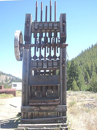
Custer County is a rural mountain county in the center of the U.S. state of Idaho. As of the 2020 census, the population was 4,275, making it the fifth-least populous county in Idaho. The county seat is Challis. Established in 1881, the county was named for the General Custer Mine, where gold was discovered five years earlier. Custer County relies on ranching, mining, and tourism as its main resources.

<span class="mw-page-title-main">Cassia County, Idaho</span> County in Idaho, United States

Cassia County is a county in the U.S. state of Idaho. As of the 2020 Census the county had a population of 24,655. The county seat and largest city is Burley. Cassia County is included in the Burley, ID Micropolitan Statistical Area.

<span class="mw-page-title-main">Camas County, Idaho</span> County in Idaho, United States

Camas County is a county in the southern portion of the U.S. state of Idaho. The county seat and largest city is Fairfield. The county was established 107 years ago in 1917 by the Idaho Legislature with a partition of Blaine County on February 6. It is named for the camas root, or Camassia, a lily-like plant with an edible bulb found in the region, that Native Americans and settlers used as a food source. As of the 2020 census, the population was 1,077, making it the second-least populous county in the state, after Clark County.

<span class="mw-page-title-main">Butte County, Idaho</span> County in Idaho, United States

Butte County is a rural county located in the U.S. state of Idaho. As of the 2020 census, the population was 2,574, making it the third-least populous county in Idaho. Its county seat and largest city is Arco. The county was established in 1917 from parts of Bingham, Blaine, and Jefferson counties. The county gained territory in the Clyde area from Custer County in 1937 to reach its present boundary.

<span class="mw-page-title-main">Boise County, Idaho</span> County in Idaho, United States

Boise County is a rural mountain county in the U.S. state of Idaho. As of the 2020 United States Census, the population was 7,610. The county seat is historic Idaho City, which is connected through a series of paved and unpaved roads to Lowman, Centerville, Placerville, Pioneerville, Star Ranch, Crouch, Garden Valley, and Horseshoe Bend.

<span class="mw-page-title-main">Bingham County, Idaho</span> County in Idaho, United States

Bingham County is a county in the U.S. state of Idaho. As of the 2020 census, the population was 47,992. The county seat and largest city is Blackfoot.

<span class="mw-page-title-main">Bannock County, Idaho</span> County in Idaho, United States

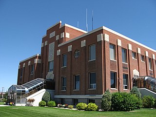
Bannock County is a county in the southeastern part of Idaho. As of the 2020 census, the population was 87,018, making it the sixth-most populous county in Idaho. The county seat and largest city is Pocatello. The county was established in 1893 and named after the local Bannock tribe. It is one of the counties with territories included in the Fort Hall Indian Reservation of the federally recognized Shoshone-Bannock Tribes.

<span class="mw-page-title-main">Ada County, Idaho</span> County in Idaho, United States

Ada County is located in the southwestern part of Idaho, United States. As of the 2020 census, the county had a population of 494,967, which by 2022 was estimated to have risen to 518,907. Ada County is by far the state's most populous county; it is home to 26.8% of the state's population. The county seat and largest city is Boise, which is also the state capital. Ada County is included in the Boise metropolitan area. The Ada County Highway District has jurisdiction over all the local county and city streets, except for private roads and state roads. In the interior Pacific Northwest east of the Cascade Range, Ada County ranks second in population, behind Spokane County, Washington.

<span class="mw-page-title-main">Bellevue, Idaho</span> City in Idaho, United States

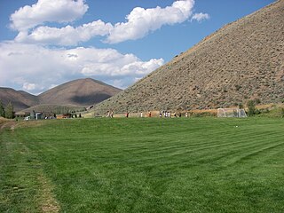
Bellevue is a city in Blaine County in the central part of the U.S. state of Idaho. The population was 2,287 at the 2010 census, up from 1,876 in 2000.

<span class="mw-page-title-main">Hailey, Idaho</span> City in and county seat of Blaine County, Idaho, United States

Hailey is a city in and the county seat of Blaine County, in the Wood River Valley of the central part of the U.S. state of Idaho. The population was 7,960 at the 2010 census, up from 6,200 in 2000. Hailey is the site of Friedman Memorial Airport (SUN), the airport for the resort area of Sun Valley/Ketchum, 12 miles (19 km) north. The town of Bellevue is a few miles south. From 1882 to 1895, Hailey was the county seat of now-defunct Alturas County.

<span class="mw-page-title-main">Ketchum, Idaho</span> City in Idaho, United States

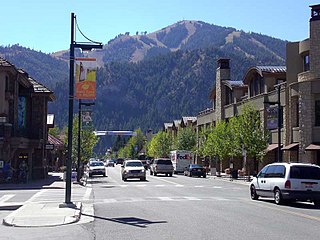
Ketchum is a city in Blaine County, Idaho, United States. Located in the central part of the state, the population was 3,555 at the 2020 census, up from 2,689 in 2010. Located in the Wood River Valley, Ketchum is adjacent to Sun Valley and the communities share many resources: both sit in the same valley beneath Bald Mountain, with its skiing. The city also draws tourists to its fishing, hiking, trail riding, tennis, shopping, art galleries, and more. The airport for Ketchum, Friedman Memorial Airport, is approximately 15 miles (24 km) south in Hailey.

References

  1. 1 2 "2020 Census Data". data.census.gov.
  2. 1 2 3 Nisson, Evelyn (May 24, 1962). "County seat was a juicy plum". Lewiston Morning Tribune. (Idaho). p. 9, section 2.
  3. "Find a County". National Association of Counties. Archived from the original on May 31, 2011. Retrieved June 7, 2011.
  4. "Blaine County". Idaho.gov. Archived from the original on November 4, 2011. Retrieved November 13, 2011.
  5. "Camas County". Idaho.gov. February 6, 1917. Archived from the original on November 20, 2011. Retrieved November 13, 2011.
  6. "Alturas County, Idaho Genealogy and History". Idahogenealogy.com. Retrieved November 13, 2011.
  7. "Blaine County Courthouse" (PDF). Idahohistory.net. July 7, 2010. Archived (PDF) from the original on December 11, 2007. Retrieved November 13, 2011.
  8. "Hemingway Haunts". Svguide.com. Retrieved November 13, 2011.
  9. Simons, Greg. "Adam West: Behind the Mask". Boiseweekly.com. Archived from the original on July 22, 2012. Retrieved November 13, 2011.
  10. "Demi Moore Biography". The Biography Channel. Archived from the original on April 11, 2008. Retrieved November 13, 2011.
  11. "Login".
  12. "Populated north, rural south: Blaine County's two worlds". Mtexpress.com. January 25, 2000. Archived from the original on January 29, 2013. Retrieved November 13, 2011.
  13. "Blaine County QuickFacts from the US Census Bureau". Quickfacts.census.gov. Archived from the original on January 2, 2016. Retrieved November 13, 2011.
  14. Blaine County estimate (PDF) [ dead link ]
  15. Jones, Douglas S. (July 7, 1993). "Railroad taxes led to shape". Times-News . Twin Falls, Idaho. p.  A-2 via Newspapers.com. - Attached map
  16. Simons, Greg. "Real Western: Pondering the Democratic map of the Intermountain West". Boiseweekly.com. Archived from the original on September 26, 2008. Retrieved November 13, 2011.
  17. "Dave Leip's Atlas of US Presidential Elections". Uselectionatlas.org. Retrieved November 13, 2011.
  18. "1992 Presidential General Election Results – Idaho". Uselectionatlas.org. November 3, 1992. Retrieved November 13, 2011.
  19. "1996 Presidential General Election Results – Idaho". Uselectionatlas.org. November 5, 1996. Retrieved November 13, 2011.
  20. "2000 Presidential General Election Results – Idaho". Uselectionatlas.org. November 7, 2000. Retrieved November 13, 2011.
  21. "2004 Presidential General Election Results – Idaho". Uselectionatlas.org. November 19, 2004. Retrieved November 13, 2011.
  22. David Leip. "US Election Atlas". US Election Atlas. Retrieved November 13, 2011.
  23. 2008 – General Election Blaine Archived November 27, 2008, at the Wayback Machine
  24. "Blaine County, Idaho". PoliticalGraveyard.com. Retrieved May 16, 2012.
  25. "Blaine County Idaho Elected Officials". Co.blaine.id.us. Archived from the original on December 5, 2011. Retrieved November 13, 2011.
  26. "Idaho HJR 2 Results by County". Uselectionatlas.org. Retrieved November 13, 2011.
  27. "Idaho Legislative District Map" (PDF). Archived from the original (PDF) on November 17, 2011. Retrieved November 13, 2011.
  28. "Idaho Legislative Districts". Legislature.idaho.gov. July 29, 2004. Archived from the original on November 10, 2008. Retrieved November 13, 2011.
  29. Leip, David. "Atlas of US Presidential Elections". uselectionatlas.org. Retrieved April 4, 2018.
  30. "US Gazetteer files: 2010, 2000, and 1990". US Census Bureau. February 12, 2011. Retrieved April 23, 2011.
  31. "Annual Estimates of the Resident Population for Counties: April 1, 2020 to July 1, 2023". United States Census Bureau. Retrieved March 31, 2024.
  32. "US Decennial Census". US Census Bureau. Retrieved June 28, 2014.
  33. "Historical Census Browser". University of Virginia Library. Retrieved June 28, 2014.
  34. "Population of Counties by Decennial Census: 1900 to 1990". US Census Bureau. Retrieved June 28, 2014.
  35. "Census 2000 PHC-T-4. Ranking Tables for Counties: 1990 and 2000" (PDF). US Census Bureau. Archived (PDF) from the original on March 27, 2010. Retrieved June 28, 2014.
  36. "State & County QuickFacts". US Census Bureau. Archived from the original on January 2, 2016. Retrieved June 28, 2014.
  37. "U.S. Census website". US Census Bureau. Retrieved January 31, 2008.
  38. 1 2 3 "Profile of General Population and Housing Characteristics: 2010 Demographic Profile Data". US Census Bureau. Archived from the original on February 13, 2020. Retrieved January 4, 2016.
  39. "Population, Housing Units, Area, and Density: 2010 – County". US Census Bureau. Archived from the original on February 13, 2020. Retrieved January 4, 2016.
  40. "Selected Social Characteristics in the US – 2006–2010 American Community Survey 5-Year Estimates". US Census Bureau. Archived from the original on February 13, 2020. Retrieved January 4, 2016.
  41. "Selected Economic Characteristics – 2006–2010 American Community Survey 5-Year Estimates". US Census Bureau. Archived from the original on February 13, 2020. Retrieved January 4, 2016.
  42. "Blaine County School District". Blaineschools.org. Retrieved November 13, 2011.
  43. "2020 CENSUS - SCHOOL DISTRICT REFERENCE MAP: Blaine County, ID" (PDF). U.S. Census Bureau . Retrieved March 12, 2024. - Text list
  44. "Only Idaho Public Waldorf School Opens in Hailey". magicvalley.com. September 5, 2014. Retrieved September 21, 2014.
  45. "Blaine County School District : Neighborhood School Boundaries". Blaineschools.org. Archived from the original on September 29, 2011. Retrieved November 13, 2011. Students in the Yale/Minidoka Area are excluded. Students in this area attend school in Minidoka County School District.
  46. 1 2 3 Jones, Douglas S. (July 7, 1993). "Out on a limb Boundary quirk puts Yale area residents there". Times-News . Vol. 88, no. 188. Twin Falls, Idaho. pp.  A1, A2 via Newspapers.com.
  47. Edit Szanto; Chika Daggett; RD Van Noy. "CSI Off-Campus Centers | Blaine County Center". Offcampus.csi.edu. Retrieved November 13, 2011.
  48. "Community Colleges" (PDF). Legislative Budget Book. Idaho Legislature. 2016. p. 1-81 (PDF p. 3/9). - See area 1 in: "TITLE 33 EDUCATION CHAPTER 21 JUNIOR COLLEGES". Idaho Legislature . Retrieved March 12, 2024.
  49. Cathedral Pines ID Google Maps (accessed January 18, 2019)
  50. Doniphan ID Google Maps (accessed January 17, 2019)
  51. Sawtooth City ID Google Maps (accessed January 18, 2019)
  52. Stanton Crossing ID Google Maps (accessed January 18, 2019)
  53. Tikura ID Google Maps (accessed January 18, 2019)
  54. Bounder ID Google Maps (accessed January 18, 2019)
  55. Vienna Mine Google Maps (accessed January 18, 2019)
  56. "Idaho Mountain Express: Dozens of 4-H kids take awards at county fair – August 31, 2011". Mtexpress.com. August 31, 2011. Archived from the original on September 4, 2012. Retrieved November 13, 2011.

43°23′N113°59′W / 43.39°N 113.98°W / 43.39; -113.98