Blean is a village and civil parish in the Canterbury district of Kent, England. The civil parish is large and is mostly woodland, much of which is ancient woodland. The developed village within the parish is scattered along the road between Canterbury and Whitstable, in the middle of the Forest of Blean. The parish of St. Cosmus and St. Damian in the Blean was renamed "Blean" on 1 April 2019.
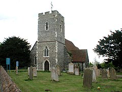
Bapchild is a village and civil parish in the Swale district of Kent, England, about two miles inside of Sittingbourne. It lies on the old Roman road now the A2, and according to the 2001 census, the parish had a population of 1,068, including Tonge, increasing to 1,141 at the 2011 Census.

Iwade is a village and civil parish 2 miles (3.2 km) north of the town of Sittingbourne in the English county of Kent.

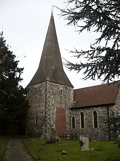
Lower Halstow is a village and civil parish in the Swale district of Kent, England. The village is northwest of Sittingbourne on the banks of the Medway Estuary. It lies north of Newington on the A2 Roman road.

Newington is a village and civil parish in the borough of Swale in Kent, England. The parish is located beside the A2 road between Rainham to the west and Sittingbourne to the east. The population of the parish in 2011 was 2,551.

Milton Regis is a village in the district of Swale in Kent, England. Former names include Milton-next-Sittingbourne, Milton Royal, Middleton, Midletun and Middletune. It has a population of about 5,000. Today it is a suburb of Sittingbourne, although this has not always been the case, with Milton Regis having an older and richer history. Until around 1800, Sittingbourne was a smaller hamlet and under the control of the Manor of Milton Regis.
Goodnestone is a village and civil parish in the Swale district of Kent, England. The civil parish is called Graveney with Goodnestone. The village is mainly on the road 'Head Hill Road' towards Graveney.

Bredgar is a village and civil parish in the borough of Swale in Kent, England.
Elmley is the local name for the Isle of Elmley, part of the Isle of Sheppey in Kent, England. It was also the name of a very late 19th century industrial village on the isle. Edward Hasted describes, in 1798, the isle as two-eighths of the Isle of Sheppey estimated as 11 miles by 8 miles. Its present national nature reserve covers more than the easily traceable area of the former isle by extending to the east, over Windmill Creek, one of two Sheppey inlets, former internal tidal channels.
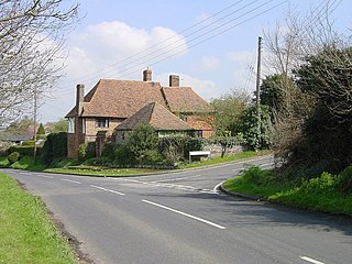
Heart's Delight is a settlement located to the south of Sittingbourne in Kent, England. Heart's Delight Road, leading to it, has the postal address of Tunstall. At the 2011 Census the population of the settlement was included in the civil parish of Borden.
Milstead is a village and civil parish in the borough of Swale in Kent, England. It is surrounded by the villages of Frinsted, Wichling, Doddington and Lynsted in Kent, England. It is the southernmost parish in the Sittingbourne area, it is approximately 3 miles (4.8 km) from Sittingbourne town centre. Just past the M2 motorway.
Murston is a suburb of Sittingbourne in Kent, England. It is about 1 mile north-east of central Sittingbourne, on the east bank of the Milton Creek.
Tunstall is a linear village and civil parish in Swale in Kent, England. It is about 2 km to the south-west of the centre of Sittingbourne, on a road towards Bredgar.
Kemsley is a suburb of Sittingbourne in Kent, England.

Stockbury is a village and civil parish in the Maidstone district of Kent, England. The population of the civil parish at the Census 2011 was 691.
Highsted is a village near Sittingbourne in Kent, England. It is in the civil parish of Rodmersham.

Tonge is a village near Sittingbourne in Kent, England. The hamlet is north of Bapchild, close to Murston Marshes beside the Swale.
Sir Thomas Browne was a Member of Parliament and Chancellor of the Exchequer. Browne's tenure as Chancellor occurred during the Great Bullion Famine and the Great Slump in England. He was executed for treason on 20 July 1460.
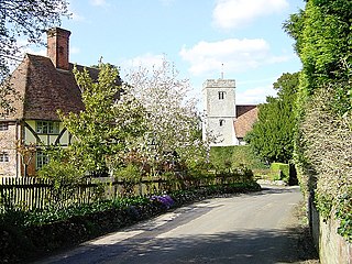
Rodmersham is a village and civil parish in the Borough of Swale in the north of the English county of Kent. It is just under 1 mile (1.6 km) south of Bapchild on the A2 road and 1.5 miles (2.4 km) south-east of the town of Sittingbourne. Rodmersham Green, which forms the bulk of the modern village, is 0.5 miles (0.80 km) to the south-west of the village church towards the Highsted Valley and Tunstall.

Norton, Buckland and Stone is a small rural civil parish 1 mile (1.6 km) east of Teynham and 3 miles (4.8 km) west of the centre of Faversham in the borough of Swale, Kent, England. It is bypassed by the M2 to the south and traverses the historic A2, on the route of the Roman road of Watling Street.