Boganangone | |
|---|---|
| Country | |
| Government | |
| • Sub-prefect | Angèle Semkomana [1] |
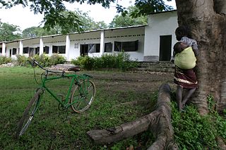
Boganangone is a sub-prefecture of Lobaye in the Central African Republic. [2] [3]
Boganangone | |
|---|---|
| Country | |
| Government | |
| • Sub-prefect | Angèle Semkomana [1] |
Boganangone is a sub-prefecture of Lobaye in the Central African Republic. [2] [3]
Boganangone is located 145 km north of Mbaïki. In 2003, the sub-prefecture has 24,322 inhabitants. [4]
The administrative post of Boganangone becomes the 5th sub-prefecture of the prefecture of Lobaye from May 2, 2002.[ citation needed ]
Boganangone is the only commune of the sub-prefecture.

Since 10 December 2020, The Central African Republic is administratively divided into 20 prefectures and the capital city of Bangui, which is an autonomous commune.

Lobaye is one of the 20 prefectures of the Central African Republic. Its capital is Mbaïki. Emperor Duy Tân of Vietnam died here on December 26, 1945 in a plane crash. David Dacko, the first and third president of the Central African Republic from 1960–1965 and 1979–1981, was from Lobaye.

Sangha-Mbaéré is one of the 20 prefectures of the Central African Republic. Its capital is Nola.
Mbaïki is the capital of Lobaye, one of the 14 prefectures of the Central African Republic. It is situated in the southwest of the country, 107 km from the capital Bangui. Lobaye people and Pygmy people live in the area. There is also a waterfall near the town.

Boda is a town located in the Central African Republic prefecture of Lobaye.
Bouca is a town located in the Central African Republic prefecture of Ouham-Fafa. It is not far east of Bossangoa at the Fafa river.
Mongoumba is a town located in the Lobaye Prefecture, Central African Republic. From 1905–1933, Mongoumba was part of Moyen-Congo.
Paoua is a town located in the Central African Republic prefecture of Lim-Pendé.The town is the birthplace of the former president of the Central African Republic, Ange-Félix Patassé and mathematician, Gaston Nguérékata.

Bambio is a sub-prefecture and town in the Sangha-Mbaéré Prefecture of the south-west Central African Republic.
Satema is a sub-prefecture of Basse-Kotto in the Central African Republic.
Zangba is a sub-prefecture of Basse-Kotto in the Central African Republic.
Ndjoukou is a sub-prefecture of Kémo in the Central African Republic.
Amada-Gaza is a sub-prefecture of Mambéré in the Central African Republic.
Dédé-Makouba is a sub-prefecture in the Central African Republic.

Gadzi is a sub-prefecture in the Central African Republic.
Sosso-Nakombo is a sub-prefecture in the Central African Republic.
Bogangolo is a sub-prefecture of Ombella-M'Poko in the Central African Republic.
Ngaoundaye is a sub-prefecture of Lim-Pendé in the Central African Republic.
Bossemptélé is a sub-prefecture of Ouham-Pendé in the Central African Republic.
Senkpa-Mbaéré is a sub-prefecture in the Central African Republic. It extends south of the town of Carnot, and takes its name from the Mbaéré river, a tributary of the Lobaye.
| Equateur Region |
|  | ||||||||
|---|---|---|---|---|---|---|---|---|---|---|
| Fertit Region |
| |||||||||
| Haut-Oubangui Region |
| |||||||||
| Kagas Region |
| |||||||||
| Plateaux Region |
| |||||||||
| Yade Region |
| |||||||||