Mobaye is a settlement with a population of 7,176 in the Basse-Kotto prefecture of Central African Republic. It lies on the Ubangi River.

Bria is the capital of Haute-Kotto, one of the 14 prefectures of the Central African Republic. As of the 2003 census the town had a population of 35,204.
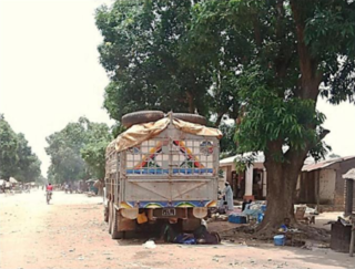
Sibut, formerly Fort Sibut is the capital of Kémo, one of the 16 prefectures of the Central African Republic. An important transport hub, it is situated 188 km (117 mi) north of the capital Bangui and is known for its market.

Bambari is a town in the Central African Republic, lying on the Ouaka River. It has a population of 41,356 and is the capital of Ouaka prefecture. Bambari is an important market town and is home to Bambari Airport, and the Roman Catholic Diocese of Bambari.
Bossembélé is a small town in Yaloke-Bossembele, in the Ombella-M'Poko Prefecture of the Central African Republic, lying 157 miles north west of Bangui on the main road to Cameroon. It is known for its market and its nightlife and is home to a cinema and an airstrip. The Lambi Falls lie near the town.
N'Délé or Ndele is a market town and sub prefecture in the north eastern Central African Republic, lying east of the Bamingui-Bangoran National Park. Ndélé is the capital of Bamingui-Bangoran, one of the 16 prefectures of the Central African Republic. N'Délé had a population of 10,850 as of the 2003 census; and a calculated 2013 population of 13,704.
Batangafo is a town located in the Central African Republic prefecture of Ouham-Fafa at the confluence of Ouham River and its affluent Fafa.

Baoro is a town located in the Central African Republic prefecture of Nana-Mambéré.

Boali is a town located in the Central African Republic prefecture of Ombella-M'Poko.

Boda is a town located in the Central African Republic prefecture of Lobaye.
Bouca is a town located in the Central African Republic prefecture of Ouham-Fafa. It is not far east of Bossangoa at the Fafa river.
Ouadda is a town located in the Central African Republic prefecture of Haute-Kotto.
Ippy is a town located in the Central African Republic prefecture of Ouaka, and is located near the geographic center of the country. It is 364 kilometers from the city of Bangui directly. Driving distance, however, is 496 kilometers.
Kouango is a town located in the Central African Republic prefecture of Ouaka.
Paoua is a town located in the Central African Republic prefecture of Lim-Pendé.The town is the birthplace of the former president of the Central African Republic, Ange-Félix Patassé and mathematician, Gaston Nguérékata.
Bamingui is a town and sub-prefecture in the Bamingui-Bangoran Prefecture in the northern Central African Republic. It lies on the south bank of the Chari River along National Route 8, 529 kilometres (329 mi) by road northeast of the capital of Bangui. As of 2003 it had a population of 6230 people.

Markounda, formerly Fort-Brusseaux, is a sub-prefecture and town in the Ouham Prefecture of the north-western Central African Republic. The sub-prefecture borders with Chad.
Ndjoukou is a sub-prefecture of Kémo in the Central African Republic.
Bossemptélé is a sub-prefecture of Ouham-Pendé in the Central African Republic.
Moyenne-Sido is a locality in the prefecture of Ouham, in the Central African Republic.


