Browntown, Wisconsin

Last updated

Browntown, Wisconsin
Trailside Inn, Browntown, WI.jpg
The Trailside Inn in Browntown
Green County Wisconsin Incorporated and Unincorporated areas Browntown Highlighted.svg
Location of Browntown in Green County, Wisconsin.
Coordinates: 42°34′38″N89°47′35″W / 42.57722°N 89.79306°W / 42.57722; -89.79306
Country Flag of the United States.svg  United States
State Flag of Wisconsin.svg  Wisconsin
County Green
Area
[1]
  Total1.05 sq mi (2.73 km2)
  Land1.05 sq mi (2.73 km2)
  Water0.00 sq mi (0.00 km2)
Elevation
[2]
837 ft (255 m)
Population
 (2010) [3]
  Total280
  Estimate 
(2019) [4]
276
  Density261.86/sq mi (101.15/km2)
Time zone UTC-6 (Central (CST))
  Summer (DST) UTC-5 (CDT)
Area code 608
FIPS code 55-10475 [5]
GNIS feature ID1562278 [2]

Browntown is a village in Green County, Wisconsin, United States. The population was 280 at the 2010 census.

Contents

Geography

Browntown is located at 42°34′38″N89°47′35″W / 42.57722°N 89.79306°W / 42.57722; -89.79306 (42.577268, -89.793134). [6]

According to the United States Census Bureau, the village has a total area of 1.06 square miles (2.75 km2), all of it land. [7]

Demographics

Historical population
CensusPop.Note
1900 246
1910 222−9.8%
1920 24510.4%
1930 29118.8%
1940 271−6.9%
1950 2793.0%
1960 263−5.7%
1970 253−3.8%
1980 28412.3%
1990 256−9.9%
2000 252−1.6%
2010 28011.1%
2019 (est.)276 [4] −1.4%
U.S. Decennial Census [8]

2010 census

As of the census [3] of 2010, there were 280 people, 109 households, and 83 families living in the village. The population density was 264.2 inhabitants per square mile (102.0/km2). There were 116 housing units at an average density of 109.4 per square mile (42.2/km2). The racial makeup of the village was 95.7% White, 0.7% African American, 0.4% Native American, 1.1% from other races, and 2.1% from two or more races. Hispanic or Latino of any race were 1.8% of the population.

There were 109 households, of which 37.6% had children under the age of 18 living with them, 57.8% were married couples living together, 11.0% had a female householder with no husband present, 7.3% had a male householder with no wife present, and 23.9% were non-families. 22.0% of all households were made up of individuals, and 4.6% had someone living alone who was 65 years of age or older. The average household size was 2.57 and the average family size was 2.94.

The median age in the village was 36.4 years. 27.1% of residents were under the age of 18; 7.5% were between the ages of 18 and 24; 23.6% were from 25 to 44; 30% were from 45 to 64; and 11.8% were 65 years of age or older. The gender makeup of the village was 49.6% male and 50.4% female.

2000 census

As of the census [5] of 2000, there were 252 people, 100 households, and 77 families living in the village. The population density was 238.9 people per square mile (92.7/km2). There were 104 housing units at an average density of 98.6 per square mile (38.2/km2). The racial makeup of the village was 100.00% White. Hispanic or Latino of any race were 2.38% of the population.

There were 100 households, out of which 32.0% had children under the age of 18 living with them, 63.0% were married couples living together, 9.0% had a female householder with no husband present, and 23.0% were non-families. 18.0% of all households were made up of individuals, and 7.0% had someone living alone who was 65 years of age or older. The average household size was 2.52 and the average family size was 2.82.

In the village, the population was spread out, with 25.0% under the age of 18, 3.6% from 18 to 24, 26.6% from 25 to 44, 27.0% from 45 to 64, and 17.9% who were 65 years of age or older. The median age was 41 years. For every 100 females, there were 96.9 males. For every 100 females age 18 and over, there were 92.9 males.

The median income for a household in the village was $36,500, and the median income for a family was $41,563. Males had a median income of $27,083 versus $21,667 for females. The per capita income for the village was $14,876. About 4.9% of families and 5.6% of the population were below the poverty line, including 8.1% of those under the age of eighteen and 8.3% of those 65 or over.

Recreation

The community is located near Browntown-Cadiz Springs State Recreation Area. The Cheese Country Trail passes through the northern edge of the village.

Related Research Articles

<span class="mw-page-title-main">Covelo, California</span> Census-designated place in California, United States

Covelo is a census-designated place (CDP) in Mendocino County, California, United States. Covelo is located 14 miles (23 km) east-northeast of Laytonville, at an elevation of 1,398 feet (426 m). The population was 1,394 at the 2020 census, up from 1,255 at the 2010 census. 405 acres (1.64 km2) of Covelo is part of the Round Valley Indian Reservation.

<span class="mw-page-title-main">Palo, Iowa</span> City in Iowa, United States

Palo is a city in Linn County, Iowa, United States. The population was 1,407 at the time of the 2020 census. It is part of the Cedar Rapids Metropolitan Statistical Area.

<span class="mw-page-title-main">Oak Park Heights, Minnesota</span> City in Minnesota, United States

Oak Park Heights is a city in Washington County, Minnesota, United States. The population was 4,849 at the 2020 census.

<span class="mw-page-title-main">Vandiver, Missouri</span> Village in Missouri, United States

Vandiver is a village in Audrain County, Missouri, United States. As of the 2010 census, the village population was 77.

<span class="mw-page-title-main">Leslie, Missouri</span> Village in Missouri, United States

Leslie is a village in west central Franklin County, Missouri, United States. The population was 136 at the 2020 census.

<span class="mw-page-title-main">Newark, Missouri</span> Village in Missouri, United States

Newark is a village in southeast Knox County, Missouri, United States, along the South Fabius River. As of the 2020 census, its population was 54.

<span class="mw-page-title-main">Cliff Village, Missouri</span> Village in Missouri, United States

Cliff Village is a village in Newton County, Missouri, United States. The population was 40 at the 2010 census. It is part of the Joplin, Missouri Metropolitan Statistical Area.

<span class="mw-page-title-main">Worthington, Missouri</span> Village in Missouri, United States

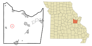
Worthington is a village in southeast Putnam County, Missouri, United States. The population was 47 at the 2020 census.

<span class="mw-page-title-main">Santee, Nebraska</span> Village in Nebraska, United States

Santee is the principal village of the Santee Sioux Reservation in Knox County, Nebraska, United States. The population was 346 at the 2010 census.

<span class="mw-page-title-main">Washington, Nebraska</span> Village in Washington County, Nebraska, United States

Washington is a village in Washington County, Nebraska, United States. The population was 150 at the 2010 census.

<span class="mw-page-title-main">Roaming Shores, Ohio</span> Village in Ohio, United States

Roaming Shores is a village in Ashtabula County, Ohio, United States. The population was 1,586 at the 2020 census.

<span class="mw-page-title-main">Richmond, Ohio</span> Village in Ohio, United States

Richmond is a village in central Jefferson County, Ohio, United States. The population was 412 at the 2020 census. It is part of the Weirton–Steubenville metropolitan area.

<span class="mw-page-title-main">Broughton, Ohio</span> Village in Ohio, United States

Broughton is a village in Paulding County, Ohio, United States. The population was 116 at the 2020 census.

<span class="mw-page-title-main">Macksburg, Ohio</span> Village in Ohio, United States

Macksburg is a village in Washington County, Ohio, United States, along the West Fork of Duck Creek. The population was 120 at the 2020 census. The village is about 28 miles (45 km) south of Cambridge, Ohio.

Garland is a town in Tipton County, Tennessee. The population was 310 at the 2010 census.

<span class="mw-page-title-main">Kekoskee, Wisconsin</span> Village in Wisconsin, United States

Kekoskee is a village in Dodge County, Wisconsin, United States. The population was 161 at the 2010 census.

<span class="mw-page-title-main">Ridgeland, Wisconsin</span> Village in Wisconsin, United States

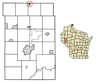
Ridgeland is a village in Dunn County, Wisconsin, United States. The population was 258 at the 2021 census.

<span class="mw-page-title-main">Silver Lake, Wisconsin</span> Former village in Wisconsin, United States

Silver Lake is a former village and now a neighborhood within the village of Salem Lakes in Kenosha County, Wisconsin, United States. The population was 2,411 at the 2010 census, when the community was still an independent village. On February 14, 2017, the village merged with the town of Salem to create the village of Salem Lakes.

<span class="mw-page-title-main">Grover, Wyoming</span> Census-designated place in Wyoming, United States

Grover is a census-designated place (CDP) in Lincoln County, Wyoming, United States. The population was 481 at the 2020 census.

<span class="mw-page-title-main">Prairie Farm, Wisconsin</span> Village in Wisconsin, United States

Prairie Farm is a village in Barron County in the U.S. state of Wisconsin. The population was 473 at the 2010 census. The village is located within the Town of Prairie Farm, on eastern shore of the Prairie Farm Flowage, a reservoir on the Hay River.

References

  1. "2019 U.S. Gazetteer Files". United States Census Bureau. Retrieved August 7, 2020.
  2. 1 2 "US Board on Geographic Names". United States Geological Survey. October 25, 2007. Retrieved January 31, 2008.
  3. 1 2 "U.S. Census website". United States Census Bureau . Retrieved November 18, 2012.
  4. 1 2 "Population and Housing Unit Estimates". United States Census Bureau. May 24, 2020. Retrieved May 27, 2020.
  5. 1 2 "U.S. Census website". United States Census Bureau . Retrieved January 31, 2008.
  6. "US Gazetteer files: 2010, 2000, and 1990". United States Census Bureau. February 12, 2011. Retrieved April 23, 2011.
  7. "US Gazetteer files 2010". United States Census Bureau. Archived from the original on July 2, 2012. Retrieved November 18, 2012.
  8. "Census of Population and Housing". Census.gov. Retrieved June 4, 2015.