Canaan, New York

Last updated

Canaan, New York
Lace House, Canaan, NY.jpg
The Lace House in Canaan
Columbia County New York incorporated areas Canaan highlighted.svg
Location of Canaan, New York
Coordinates: 42°24′7″N73°26′47″W / 42.40194°N 73.44639°W / 42.40194; -73.44639
CountryUnited States
State New York
County Columbia
Government
  Type Town council
   Town supervisor Brenda Adams (D)
   Town board
List
Area
[1]
  Total36.93 sq mi (95.65 km2)
  Land36.65 sq mi (94.93 km2)
  Water0.28 sq mi (0.72 km2)
Elevation
981 ft (299 m)
Population
 (2020) [2]
  Total1,570
Time zone UTC-5 (Eastern (EST))
  Summer (DST) UTC-4 (EDT)
ZIP code
12029
Area code 518
FIPS code 36-021-12056
GNIS feature ID0978781
Website canaannewyork.org

Canaan is a town in Columbia County, New York, United States. The population was 1,570 at the 2020 census, [3] down from 1,710 at the 2010 census. [4] The town is in the northeastern part of the county.

Contents

History

The first settlers arrived around 1759. The town was founded in 1772 as "Kings District". The name was changed to "Canaan" in 1788. One of the oldest sections of Canaan is Frisbie Street, settled in 1770 by Gideon Frisbie, an immigrant from Canaan, Connecticut. [5] Frisbie Street fronts what was once the Albany-Boston stagecoach route.

At approximately 1 p.m. (EDT) on August 28, 1973, an F4 tornado touched down in Canaan and moved in a south-southeast direction across the Massachusetts state line into the town of West Stockbridge, Massachusetts. It caused significant damage to the Berkshire Farm for Boys in Canaan then “obliterated” nearly every house in its path in West Stockbridge. Finally, it leveled the Berkshire Truck Stop on Massachusetts Route 102 near the Massachusetts Turnpike, overturning and throwing trucks and cars and ripping gas pumps out of their stands. When it was over, four people had been killed (including three at the truck stop), 36 were injured, and approximately $25 million ($148 million, 2021 USD) in damage had been done.

The Lace House was listed on the National Register of Historic Places in 1985. [6]

Geography

According to the United States Census Bureau, the town has a total area of 36.9 square miles (95.7 km2), of which 36.7 square miles (95.0 km2) is land and 0.27 square miles (0.7 km2), or 0.76%, is water. [4] The majority of the town drains westward or northward via tributaries of Kinderhook Creek to the Hudson River, notably Queechy Lake Brook and Buttercup Creek, both of which flow into the Stony Kill. The southeastern corner of the town drains via Flat Brook into the Williams River in Massachusetts and thence to the Housatonic River, which flows south into Connecticut.

The eastern town line is the border of Massachusetts.

Interstate 90 passes through the town, connecting the Massachusetts Turnpike to the east with the New York State Thruway to the west. I-90 has one interchange in the town, with New York State Route 22.

The Taconic Mountains rise in the northeastern corner of the town.

The Taconic Mountain area countryside on NY-22 near Edwards Park Road, Canaan, New York. Taconic countryside on NY-22 near Edwards Park Road, Canaan, New York.jpg
The Taconic Mountain area countryside on NY-22 near Edwards Park Road, Canaan, New York.

Demographics

Historical population
CensusPop.Note
1820 2,079
1830 2,064−0.7%
1840 1,957−5.2%
1850 1,941−0.8%
1860 2,19713.2%
1870 1,877−14.6%
1880 1,654−11.9%
1890 1,561−5.6%
1900 1,307−16.3%
1910 1,167−10.7%
1920 1,085−7.0%
1930 979−9.8%
1940 1,0426.4%
1950 1,28423.2%
1960 1,272−0.9%
1970 1,47215.7%
1980 1,65412.4%
1990 1,7737.2%
2000 1,8202.7%
2010 1,710−6.0%
2020 1,570−8.2%
U.S. Decennial Census [7] 2020 [8]

As of the census [9] of 2000, there were 1,820 people, 643 households, and 414 families residing in the town. The population density was 49.6 inhabitants per square mile (19.2/km2). There were 970 housing units at an average density of 26.4 per square mile (10.2/km2). The racial makeup of the town was 87.80% White, 8.63% African American, 0.33% Native American, 0.66% Asian, 1.21% from other races, and 1.37% from two or more races. Hispanic or Latino of any race were 2.25% of the population.

There were 643 households, out of which 27.1% had children under the age of 18 living with them, 55.5% were married couples living together, 5.4% had a female householder with no husband present, and 35.5% were non-families. 28.6% of all households were made up of individuals, and 11.7% had someone living alone who was 65 years of age or older. The average household size was 2.34 and the average family size was 2.88.

In the town, the population was spread out, with 34.2% under the age of 18, 4.3% from 18 to 24, 20.9% from 25 to 44, 26.5% from 45 to 64, and 14.0% who were 65 years of age or older. The median age was 38 years. For every 100 females, there were 137.3 males. For every 100 females age 18 and over, there were 103.2 males.

The median income for a household in the town was $51,607, and the median income for a family was $62,656. Males had a median income of $44,063 versus $37,083 for females. The per capita income for the town was $28,209. About 2.7% of families and 5.1% of the population were below the poverty line, including 4.1% of those under age 18 and 5.4% of those age 65 or over.

Communities and locations in Canaan

Notable people

Related Research Articles

<span class="mw-page-title-main">North Canaan, Connecticut</span> Town in Connecticut, United States

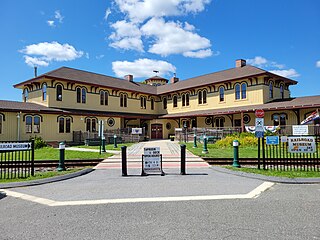
North Canaan is a town in Litchfield County, Connecticut, United States. The population was 3,211 at the 2020 census. The town is part of the Northwest Hills Planning Region. The town center is still called "Canaan", being the main town center of the old town of Canaan prior to North Canaan splitting off as its own town.

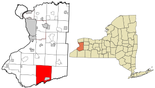
Farmersville is a town located in the eastern border of Cattaraugus County, New York, United States. The population was 1,081 at the 2020 census.

<span class="mw-page-title-main">Kiantone, New York</span> Town in New York, United States

Kiantone is a town in Chautauqua County, New York, United States. As of the 2020 census, the town had a population of 1,388. The town is immediately south of Jamestown and is at the south border of the county.

<span class="mw-page-title-main">Ancram, New York</span> Town in New York, United States

Ancram is a town in Columbia County, New York, United States. The population was 1,440 at the 2020 census, down from 1,573 at the 2010 census. The town was named after Ancram, Scotland.

<span class="mw-page-title-main">Austerlitz, New York</span> Town in New York, United States

Austerlitz is a town in Columbia County, New York, United States. The population was 1,625 at the 2020 census. The town was named after the Battle of Austerlitz.

<span class="mw-page-title-main">Copake, New York</span> Town in New York, United States

Copake is a town in Columbia County, New York, United States. The population was 3,346 at the 2020 US census, down from 3,615 at the 2010 census. The town derives its name from a lake, which was known to the natives as Cook-pake, or Ack-kook-peek, meaning "Snake Pond".

<span class="mw-page-title-main">Hillsdale, New York</span> Town in New York, United States

Hillsdale is a town in Columbia County, New York, near Hudson, New York and Great Barrington, Massachusetts. State routes 22 and 23 intersect near the town center, which is listed on the National Register of Historic Places. The town has several restaurants and a general store, among other businesses. Hillsdale is known for its hilly landscape and is near Bash Bish Falls, Taconic State Park, and the Catamount Ski Area. The Harlem Valley Rail Trail, a 26-mile bike path in two sections, is located not far from the intersection of routes 22 and 23.

<span class="mw-page-title-main">New Lebanon, New York</span> Town in New York, United States

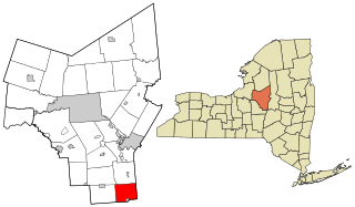
New Lebanon is a town in Columbia County, New York, United States, 24 miles (39 km) southeast of Albany. The population was 2,514 at the 2020 census.

<span class="mw-page-title-main">Stuyvesant, New York</span> Town in New York, United States

Stuyvesant is a town in Columbia County, New York, United States. The population was 1,931 at the 2020 census, down from 2,027 at the 2010 census. The town is in the northwest corner of Columbia County. U.S. Route 9 crosses the southeastern corner of the town.

<span class="mw-page-title-main">North East, New York</span> Town in New York, United States

North East is a town in Dutchess County, New York, United States. The population was 3,031 at the 2020 census. The town is in the northeastern corner of the county. U.S. Route 44 crosses the town.

<span class="mw-page-title-main">Concord, New York</span> Town in New York, United States

Concord is a town in Erie County, New York, United States. The population was 8,494 at the 2010 census. The town is believed to be named after Concord, Massachusetts, by early settlers from New England.

<span class="mw-page-title-main">New Baltimore, New York</span> Town in New York, United States

New Baltimore is a town in the northeastern part of Greene County, New York, United States. The population was 3,226 at the 2020 United States census, down from 3,370 in the 2010 census.

<span class="mw-page-title-main">Salisbury, Herkimer County, New York</span> Town in New York, United States

Salisbury is a town in Herkimer County, New York, United States. The population was 1,958 at the 2010 census. The town is on the eastern edge of the county, north of the city of Little Falls. The northern part of the town is in the Adirondack Park.

<span class="mw-page-title-main">Schodack, New York</span> Town in New York, United States

Schodack is a town in Rensselaer County, New York, United States. The population was 12,965 at the 2020 census. The town name is derived from the Mahican word, Escotak. The town is in the southwestern part of the county. Schodack is southeast of Albany, New York.

Berkshire is a town in Tioga County, New York, United States. As of the 2020 census, it had a population of 1,485. The town is named after Berkshire County, Massachusetts.

<span class="mw-page-title-main">Chatham, New York</span> Town in New York, United States

Chatham is a town in Columbia County, New York, United States. The population was 4,104 at the 2020 census, down from the 2010 census.

<span class="mw-page-title-main">Ghent, New York</span> Town in New York, United States

Ghent is a town in Columbia County, New York, United States, with a ZIP code of 12075. The population was 5,303 at the 2020 census, down from the 2010 census population of 5,402. Ghent is centrally located in the county and is northeast of the city of Hudson.

<span class="mw-page-title-main">Greenville, Greene County, New York</span> Town in New York, United States

Greenville is a town on the northern border of Greene County, New York, United States. The population was 3,741 at the 2020 census. The town contains a hamlet also named Greenville.

<span class="mw-page-title-main">Bridgewater, New York</span> Town in New York, United States

Bridgewater is a town in Oneida County, New York, United States. The population was 1,522 at the 2010 census.

<span class="mw-page-title-main">Canaan, Connecticut</span> Town in Connecticut, United States

Canaan is a town in Litchfield County, Connecticut, United States. The population was 1,080 at the 2020 census, down from 1,234 at the 2010 census. The town is part of the Northwest Hills Planning Region. The town of Canaan is often referred to locally by the name of its principal settlement, Falls Village.

References

  1. "2016 U.S. Gazetteer Files". United States Census Bureau. Retrieved July 4, 2017.
  2. US Census Bureau, 2020 census, Canaan town, Columbia County, New York
  3. US Census Bureau, 2020 census, Canaan town, Columbia County, New York
  4. 1 2 "Geographic Identifiers: 2010 Demographic Profile Data (G001): Canaan town, Columbia County, New York". U.S. Census Bureau, American Factfinder. Archived from the original on February 12, 2020. Retrieved December 9, 2014.
  5. Pg. 1 – "Most Likely To Succeed" – Alan Gelb 1990 ISBN   0-312-92566-2
  6. "National Register Information System". National Register of Historic Places . National Park Service. July 9, 2010.
  7. "Census of Population and Housing". Census.gov. Retrieved June 4, 2015.
  8. US Census Bureau, 2020 census, Canaan town, Columbia County, New York
  9. "U.S. Census website". United States Census Bureau . Retrieved January 31, 2008.
  10. Who Was Who in America, Historical Volume, 1607–1896. Chicago: Marquis Who's Who. 1963.
  11. 'The Rev Eleazar Root Dead,' New York Times, August 5, 1887

42°24′43″N73°26′49″W / 42.41194°N 73.44694°W / 42.41194; -73.44694