Related Research Articles
Pimlico Race Course is a thoroughbred horse racetrack in Baltimore, Maryland, most famous for hosting the Preakness Stakes. Its name is derived from the 1660s when English settlers named the area where the facility currently stands in honor of Olde Ben Pimlico's Tavern in London. The racetrack is nicknamed "Old Hilltop" after a small rise in the infield that became a favorite gathering place for thoroughbred trainers and race enthusiasts. It is currently owned by the Stronach Group.

Mount Vernon is a neighborhood of Baltimore, Maryland, located immediately north of the city's downtown district. Designated a National Historic Landmark District and a city Cultural District, it is one of the city's oldest neighborhoods and originally was home to the city's wealthiest and most fashionable families. The name derives from the Mount Vernon home of George Washington; the original Washington Monument, a massive pillar commenced in 1815 to commemorate the first president of the United States, is the defining feature of the neighborhood.

Druid Hill Park is a 745-acre (3.01 km2) urban park in northwest Baltimore, Maryland. Its boundaries are marked by Druid Park Drive (north), Swann Drive and Reisterstown Road, and the Jones Falls Expressway / Interstate 83 (east).

Doughoregan Manor is a plantation house and estate located on Manor Lane west of Ellicott City, Maryland, United States. Established in the early 18th century as the seat of Maryland's prominent Carroll family, it was home to Charles Carroll, a signer of the United States Declaration of Independence, during the late 18th century. A portion of the estate, including the main house, was designated a National Historic Landmark on November 11, 1971. It remains in the Carroll family and is not open to the public.

The Phoenix Shot Tower, also known as the Old Baltimore Shot Tower, is a red brick shot tower, 234.25 feet (71.40 m) tall, located near the downtown, Jonestown, and Little Italy communities of East Baltimore, in Maryland. When it was completed in 1828 it was the tallest structure in the United States.

"Pigtown", also known as "Washington Village" is a neighborhood in the southwest area of Baltimore, bordered by Martin Luther King Jr. Boulevard to the east, Monroe Street to the west, Russell Street to the south, and West Pratt Street to the north. The neighborhood acquired its name during the second half of the 19th century, when the area was the site of butcher shops and meat packing plants to process pigs transported from the Midwest on the B&O Railroad; they were herded across Ostend and Cross Streets to be slaughtered and processed.

Mount Washington is an area of northwest Baltimore, Maryland. It is a designated city historic district and divided into two sections: South Road/Sulgrave to the southeast and Dixon's Hill to the north. The Mount Washington Historic District was listed on the National Register of Historic Places in 1990 with a boundary increase in 2001, with five contributing buildings and four contributing structures.

St. Charles College was a minor seminary in Catonsville, Maryland, originally located in Ellicott City, Maryland.

Union Square is a neighborhood located in the Sowebo area of Baltimore. It dates to the 1830s and includes a historic district of houses and commerce buildings.
Glen is a neighborhood in Baltimore, Maryland. It was developed in the early 1920s and 1930s, with the remaining development coming in the 1940s through the 1960s. Glen is one of the largest communities of Northern Park Heights in Baltimore. Glen is a neighborhood of mixed housing types that include Tudor, French Norman and brick ranch houses, along with garden apartments, condominiums and semi-detached single family homes.
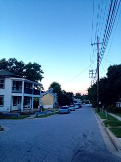
Cheswolde is residential community in northwest Baltimore, Maryland. It is located along the Western Run. The main roads running through the area are Greenspring Avenue, Cross Country Boulevard, and Taney Road.
Northern Parkway is a major road that runs west–east across the northern part of the city Baltimore. For most of the way, it is at least six lanes wide, and it is used by motorists for crosstown travel. It is designated E. Northern Pkwy and W. Northern Pkwy with Charles Street being the dividing line. It was constructed in the 1950s through several neighborhoods and several homes were razed in the process from right-of-way. The section of E. Northern Pkwy from Harford Road to Fleetwood Ave was originally called German Lane.

Woodberry is a neighborhood located in the north-central area of Baltimore, Maryland, USA. A largely residential, middle-class area, Woodberry is a historic community bordered on the north by Cold Spring Lane, on the south by Druid Hill Park, on the west by Greenspring Avenue, and on the east by the Jones Falls Expressway and the Jones Falls. Woodberry is located within Postal Zip code 21211.

Mount Clare, also known as Mount Clare Mansion and generally known today as the Mount Clare Museum House, is the oldest Colonial-era structure in the City of Baltimore, Maryland, U.S.A. The Georgian style of architecture plantation house exhibits a somewhat altered five-part plan. It was built on a Carroll family plantation beginning in 1763 by barrister Charles Carroll the Barrister, (1723–1783), a descendant of the last Gaelic Lords of Éile in Ireland and a distant relative of the much better-known Charles Carroll of Carrollton, (1737–1832), longest living signer of the Declaration of Independence and the richest man in America in his later years, also the layer of the First Stone of the new Baltimore and Ohio Railroad, just a short distance away in 1828.
Lakeland is a neighborhood in south Baltimore, Maryland. Its borders are Annapolis Road on the east, the Baltimore city/county line to the south, a CSX/MARC Railroad line to the west, and the same railroad line to the north.
Remington is a neighborhood in northern Baltimore bordered to the north by Hampden, Wyman Park, and Johns Hopkins University and to the east by Charles Village. The southernmost boundary is North Avenue and the long southwestern boundary is formed by Falls Road in the I-83 corridor. The neighborhood is split between two Baltimore City Council Districts.
Baltimore Heritage is an American nonprofit historic-preservation organization headquartered in Baltimore, Maryland.

The Hockley Forge and Mill are a collection of colonial-era industrial buildings along the Patapsco River near modern Elkridge, Maryland. Located at the river's head of navigation, the site is a flat section of land along the Patapsco River valley with steep embankments on either side. At its 19th-century peak, the site held more than 30 industrial buildings.
Elkridge Landing was a Patapsco River seaport in Maryland, and is now part of Elkridge, Maryland. The historic Elkridge Furnace Inn site resides within the Patapsco Valley State Park.

Baltimore City Landmark is a historic property designation made by the city of Baltimore, Maryland. Nominations are reviewed by the city's Commission for Historical & Architectural Preservation (CHAP) and planning board, and are passed by Baltimore City Council. The landmarks program was created in 1971.
References
- ↑ "Baltimore City Commission on Historical and Architectural Preservation" (PDF). chap.baltimorecity.gov/about-chap.
- ↑ "Landmarks". Historical and Architectural Preservation. City of Baltimore. Archived from the original on 2016-05-17.
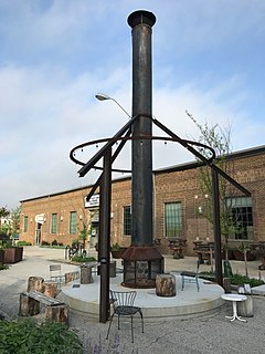
- ↑ "Wikimedia Commons - Pimlico Tobacco Works". commons.wikimedia.org.
- ↑ "About Us - Cheswolde Neighborhood Association". cheswoldena.com.
Coordinates: 39°21′53.9″N76°40′27.7″W / 39.364972°N 76.674361°W
| | This article about a building or structure in Maryland is a stub. You can help Wikipedia by expanding it. |