Castione Andevenno

Last updated
Castione Andevenno
Comune
Comune di Castione Andevenno
Italy provincial location map 2015.svg
Red pog.svg
Castione Andevenno
Location of Castione Andevenno in Italy
Coordinates: 46°10′N9°48′E / 46.167°N 9.800°E / 46.167; 9.800 Coordinates: 46°10′N9°48′E / 46.167°N 9.800°E / 46.167; 9.800
Country Italy
Region Lombardy
Province Province of Sondrio (SO)
Area
  Total 17.1 km2 (6.6 sq mi)
Population (Dec. 2004)
  Total 1,545
  Density 90/km2 (230/sq mi)
Time zone CET (UTC+1)
  Summer (DST) CEST (UTC+2)
Postal code23012
Dialing code 0342
Website Official website
view of the town Castione Andevenno centro.JPG
view of the town

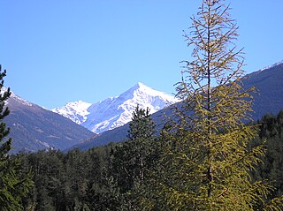
Castione Andevenno is a comune (municipality) in the Province of Sondrio in the Italian region Lombardy, located about 90 kilometres (56 mi) northeast of Milan and about 5 kilometres (3 mi) west of Sondrio. As of 31 December 2004, it had a population of 1,545 and an area of 17.1 square kilometres (6.6 sq mi). [1]

<i>Comune</i> third-level administrative divisions of the Italian Republic

The comune is a basic administrative division in Italy, roughly equivalent to a township or municipality.

Province of Sondrio Province of Italy

The Province of Sondrio is in the Lombardy region of northern Italy. Its provincial capital is the town Sondrio. As of 2017, it has a population of 181,403.

Italy republic in Southern Europe

Italy, officially the Italian Republic, is a country in Southern and Western Europe. Located in the middle of the Mediterranean Sea, Italy shares open land borders with France, Switzerland, Austria, Slovenia and the enclaved microstates San Marino and Vatican City. Italy covers an area of 301,340 km2 (116,350 sq mi) and has a largely temperate seasonal and Mediterranean climate. With around 61 million inhabitants, it is the fourth-most populous EU member state and the most populous country in Southern Europe.

Contents

Castione Andevenno borders the following municipalities: Albosaggia, Caiolo, Postalesio, Sondrio, Torre di Santa Maria.

Albosaggia Comune in Lombardy, Italy

Albosaggia is a comune (municipality) in the Province of Sondrio in the Italian region Lombardy, located about 90 kilometres (56 mi) northeast of Milan and about 2 kilometres (1 mi) southwest of Sondrio. As of 31 December 2004, it had a population of 3,135 and an area of 34.3 square kilometres (13.2 sq mi).

Caiolo Comune in Lombardy, Italy

Caiolo is a comune (municipality) in the Province of Sondrio in the Italian region Lombardy, located about 90 kilometres (56 mi) northeast of Milan and about 5 kilometres (3 mi) southwest of Sondrio. As of 31 December 2004, it had a population of 994 and an area of 33.3 square kilometres (12.9 sq mi).

Postalesio Comune in Lombardy, Italy

Postalesio is a comune (municipality) in the Province of Sondrio in the Italian region Lombardy, located about 90 kilometres (56 mi) northeast of Milan and about 6 kilometres (4 mi) west of Sondrio. As of 31 December 2004, it had a population of 618 and an area of 10.6 square kilometres (4.1 sq mi).

The 18th-century church of San Martino is found in the territory.

San Martino is a Neoclassical-style, Roman Catholic church located on in the town of Castione Andevenno in the province of Sondrio, region of Lombardy, Italy.

Demographic evolution

Castione Andevenno

Related Research Articles

Berbenno di Valtellina Comune in Lombardy, Italy

Berbenno di Valtellina is a comune (municipality) in the Province of Sondrio in the Italian region Lombardy, located about 90 kilometres (56 mi) northeast of Milan and about 9 kilometres (6 mi) west of Sondrio. As of 31 December 2004, it had a population of 4,226 and an area of 35.7 square kilometres (13.8 sq mi).

Bianzone Comune in Lombardy, Italy

Bianzone is a comune (municipality) in the Province of Sondrio in the Italian region Lombardy, located about 110 kilometres (68 mi) northeast of Milan and about 20 kilometres (12 mi) east of Sondrio, on the border with Switzerland. As of 31 December 2004, it had a population of 1,250 and an area of 17.3 square kilometres (6.7 sq mi).

Chiuro Comune in Lombardy, Italy

Chiuro is a comune (municipality) in the Province of Sondrio in the Italian region Lombardy, located about 100 kilometres (62 mi) northeast of Milan and about 9 kilometres (6 mi) east of Sondrio, on the border with Switzerland. As of 31 December 2004, it had a population of 2,499 and an area of 51.8 square kilometres (20.0 sq mi).

Colorina Comune in Lombardy, Italy

Colorina is a comune (municipality) in the Province of Sondrio in the Italian region Lombardy, located about 90 kilometres (56 mi) northeast of Milan and about 10 kilometres (6 mi) west of Sondrio. As of 31 December 2004, it had a population of 1,468 and an area of 18.0 square kilometres (6.9 sq mi).

Dazio Comune in Lombardy, Italy

Dazio is a comune (municipality) in the Province of Sondrio in the Italian region Lombardy, located about 80 kilometres (50 mi) northeast of Milan and about 20 kilometres (12 mi) west of Sondrio. As of 31 December 2004, it had a population of 380 and an area of 3.7 square kilometres (1.4 sq mi).

Montagna in Valtellina Comune in Lombardy, Italy

Montagna in Valtellina is a comune (municipality) in the Province of Sondrio in the Italian region Lombardy, located about 100 kilometres (62 mi) northeast of Milan and about 3 kilometres (2 mi) northeast of Sondrio.

Novate Mezzola Comune in Lombardy, Italy

Novate Mezzola is a comune (municipality) in the Province of Sondrio in the Italian region Lombardy, located about 90 kilometres (56 mi) north of Milan and about 35 kilometres (22 mi) west of Sondrio, on the border with Switzerland. As of 31 December 2004, it had a population of 1,713 and an area of 99.7 square kilometres (38.5 sq mi).

Ponte in Valtellina Comune in Lombardy, Italy

Ponte in Valtellina is a comune (municipality) in the Province of Sondrio in the Italian region Lombardy, located about 100 kilometres (62 mi) northeast of Milan and about 9 kilometres (6 mi) east of Sondrio. As of 31 December 2004, it had a population of 2,222 and an area of 69.5 square kilometres (26.8 sq mi).

Rogolo Comune in Lombardy, Italy

Rogolo is a comune (municipality) in the Province of Sondrio in the Italian region Lombardy, located about 80 kilometres (50 mi) northeast of Milan and about 30 kilometres (19 mi) west of Sondrio. As of 31 December 2004, it had a population of 568 and an area of 13.0 square kilometres (5.0 sq mi). Rogolo borders the following municipalities: Andalo Valtellino, Cosio Valtellino, Delebio, Mantello, Pedesina, Premana, Rasura

Spriana Comune in Lombardy, Italy

Spriana is a comune (municipality) in the Province of Sondrio in the Italian region Lombardy, located about 100 kilometres (62 mi) northeast of Milan and about 6 kilometres (4 mi) north of Sondrio. As of 31 December 2004, it had a population of 101 and an area of 8.2 square kilometres (3.2 sq mi).

Tartano Comune in Lombardy, Italy

Tartano is a comune (municipality) in the Province of Sondrio in the Italian region Lombardy, located about 80 kilometres (50 mi) northeast of Milan and about 15 kilometres (9 mi) southwest of Sondrio. As of 31 December 2004, it had a population of 236 and an area of 47.6 square kilometres (18.4 sq mi).

Torre di Santa Maria Comune in Lombardy, Italy

Torre di Santa Maria is a comune (municipality) in the Province of Sondrio in the Italian region Lombardy, located about 100 kilometres (62 mi) northeast of Milan and about 8 kilometres (5 mi) north of Sondrio. As of 31 December 2004, it had a population of 884 and an area of 45.5 square kilometres (17.6 sq mi).

Tresivio Comune in Lombardy, Italy

Tresivio is a comune (municipality) in the Province of Sondrio in the Italian region Lombardy, located about 100 kilometres (62 mi) northeast of Milan and about 6 kilometres (4 mi) east of Sondrio. As of 31 December 2004, it had a population of 2,000 and an area of 15.0 square kilometres (5.8 sq mi).

Valfurva Comune in Lombardy, Italy

Valfurva is a comune (municipality) in the Province of Sondrio in the Italian region Lombardy, located about 150 kilometres (93 mi) northeast of Milan and about 50 kilometres (31 mi) northeast of Sondrio, in the Alps. As of 31 December 2004, it had a population of 2,725 and an area of 215.9 square kilometres (83.4 sq mi).

Villa di Tirano Comune in Lombardy, Italy

Villa di Tirano is a comune (municipality) in the Province of Sondrio in the Italian region Lombardy, located about 110 kilometres (68 mi) northeast of Milan and about 20 kilometres (12 mi) east of Sondrio, on the border with Switzerland. As of 31 December 2004, it had a population of 2,997 and an area of 24.6 square kilometres (9.5 sq mi).

Castione della Presolana Comune in Lombardy, Italy

Castione della Presolana is a comune (municipality) in the Province of Bergamo in the Italian region of Lombardy, located about 80 kilometres (50 mi) northeast of Milan and about 35 kilometres (22 mi) northeast of Bergamo. As of 31 December 2004, it had a population of 3,379 and an area of 42.6 square kilometres (16.4 sq mi).

Loria, Veneto Comune in Veneto, Italy

Loria is a comune (municipality) in the Province of Treviso in the Italian region Veneto, located about 50 kilometres (31 mi) northwest of Venice and about 30 kilometres (19 mi) west of Treviso. As of 31 December 2007, it had a population of 8,749 and an area of 23.2 square kilometres (9.0 sq mi).

References

  1. All demographics and other statistics: Italian statistical institute Istat.