Cedar Crest Boulevard

Last updated

Cedar Crest Boulevard

Route information
Maintained by PennDOT
Length9.471 mi [1]  (15.242 km)
Existed1920s–present
Component
highways
PA-29.svg PA 29 from Emmaus to Dorneyville
SR 1019 from Dorneyville to North Whitehall Township
Major junctions
South endPA-29.svg PA 29 in Emmaus
Major intersectionsI-78.svgPA-309.svg I-78  / PA 309 near Dorneyville
PA-222.svg PA 222 near Dorneyville
Tilghman Street in Allentown
US 22.svg US 22 in South Whitehall Township
Walbert Avenue in South Whitehall Township
North endMauch Chunk Road in North Whitehall Township
Location
Country United States
State Pennsylvania
Counties Lehigh
Highway system
PA-228.svg PA 228 PA 229PA-230.svg PA 230

Cedar Crest Boulevard, colloquially known as Cedar Crest and The Boulevard, is a major north-south highway in Lehigh County, Pennsylvania in the Lehigh Valley region of eastern Pennsylvania. South of Interstate 78 (I-78), the road is part of Pennsylvania Route 29 (PA 29). North of it, the road becomes State Route 1019 (SR 1019).

Contents

The boulevard is 9.5 miles in length and passes through Allentown, the third-most populous city in Pennsylvania and county seat of Lehigh County. Its southern terminus is in Emmaus at Chestnut Street and its northern terminus is in North Whitehall Township at Mauch Chunk Road. It also is a junction onto I-78, a major east-west highway between Lebanon County in the west and the Holland Tunnel and Lower Manhattan in the east.

Cedar Crest Boulevard is home to many Lehigh Valley attractions, including two large rival high schools, Emmaus High School and Parkland High School, and the main campuses of Lehigh Valley Hospital–Cedar Crest and Cedar Crest College, Dorney Park & Wildwater Kingdom, Lake Muhlenberg, Lehigh Country Club, Lehigh Parkway, Muhlenberg College, and Trexler Park all border the boulevard. The boulevard is a prominent road for Allentown-area commerce, including numerous strip malls, restaurants, and commercial establishments.

Route description

Lehigh Valley Hospital-Cedar Crest at 1200 South Cedar Crest Boulevard in Allentown in August 2005 Unatte.jpg
Lehigh Valley Hospital–Cedar Crest at 1200 South Cedar Crest Boulevard in Allentown in August 2005

Cedar Crest Boulevard begins at an intersection with PA 29 (Chestnut Street) in Emmaus in Lehigh County, heading northwest as a two-lane undivided road that passes through residential areas to the southwest of Emmaus High School and then through a section of Upper Milford Township. It then crosses the border between Emmaus to the east and Lower Macungie Township to the west and curves north as it enters Lower Macungie Township, where it crosses Little Lehigh Creek and then a mix of fields, woods, and homes and passes to the west of Lehigh Country Club.

PA 29 then crosses into Salisbury Township and widens into a four-lane road that passes between Lehigh Valley Hospital–Cedar Crest to the west and an office park to the east. Cedar Crest Boulevard becomes a divided highway and comes to an interchange with I-78/PA 309, where PA 29 ends and the road becomes SR 1019. [2] [3]

Past the interchange, SR 1019 becomes a two-lane undivided road, passing through several suburban residential neighborhoods before entering South Whitehall Township. Cedar Crest Boulevard comes to an intersection with a one-way pair carrying PA 222 in a business area in Dorneyville just east of Dorney Park & Wildwater Kingdom. The Da Vinci Science Center is located at the northeast corner of PA 222 southbound and Cedar Crest Boulevard. Following this, the road serves as the border between South Whitehall Township to the west and the Allentown border to the east and west of Cedar Crest College. Cedar Crest Boulevard continues near homes and businesses in the western part of Allentown as a three-lane road with a center left-turn lane, crossing Lehigh Parkway, and then forming the eastern border of Trexler Park.

SR 1019 then crosses SR 1002 (Tilghman Street) in a commercial section of Allentown and then continues through residential areas as a two-lane road and entering South Whitehall Township. The road comes to an interchange with the US 22 freeway and then enters business areas. After crossing SR 1006 (Walbert Avenue) in Wennersville, Cedar Crest Boulevard passes through a mix of farmland and woodland with some development. The road crosses Jordan Creek and then under Norfolk Southern's C&F Secondary before passing Parkland High School to its east. SR 1019 then continues through rural areas and enters North Whitehall Township, where it comes to its northern terminus at an intersection with SR 1017, which is also known as Mauch Chunk Road. [2] [3]

History

PA-229 (1926).svg

Pennsylvania Route 229

Location Emmaus Wennersville
Existed1928–1940s

In 1928, the section of Cedar Crest Boulevard from Walbert Avenue (US 309/PA 29) in Wennersville to Chestnut Street (PA 29) in Emmaus was designated as Pennsylvania Route 229. [4] [5] PA 229 was paved by 1930. [6] By 1950, however, the PA 29 route number was removed, and it was renamed Cedar Crest Boulevard. [7] PA 29 was designated onto a portion of Cedar Crest Boulevard south of US 309 (now I-78/PA 309) in the 1950s. [8]

Battle of Cedar Crest Boulevard

Two of eastern Pennsylvania's largest public high schools, Emmaus High School in Emmaus and Parkland High School in Allentown, are each located off Cedar Crest Boulevard roughly 9 miles (14 km) apart. In high school football, the two rival schools play each other in a game known as the Battle of Cedar Crest Boulevard. The winner of the game each year is awarded the Battle of Cedar Crest Boulevard trophy. [9]

Major intersections

The entire route is in Lehigh County.

Locationmi [1] kmDestinationsNotes
Emmaus 40.39865.014South plate.svg
PA-29.svg
PA 29 south (Chestnut Street) Boyertown
Southern terminus; south end of PA 29 overlap
Salisbury Township 43.454
0.000
69.932
0.000
I-78.svgPA-309.svg I-78  / PA 309  Harrisburg, Tamaqua, Bethlehem, Quakertown
End plate.svg
PA-29.svg
PA 29 ends
Exit 55 (I-78/PA 309); northern terminus of southern section of PA 29; south end of SR 1019
Allentown 0.853–
1.090
1.373–
1.754
PA-222.svg PA 222 (Hamilton Boulevard) Reading, Allentown
2.1153.404SR 1002 (Tilghman Street) Kuhnsville, Allentown
South Whitehall Township 2.9584.760US 22.svg US 22 (Lehigh Valley Thruway) Harrisburg, Bethlehem Interchange
3.3935.461SR 1006 (Walbert Avenue) Slatington, Allentown
North Whitehall Township 6.41510.324SR 1017 (Mauch Chunk Road) Balliettsville, Allentown Northern terminus
1.000 mi = 1.609 km; 1.000 km = 0.621 mi

See also

Related Research Articles

<span class="mw-page-title-main">Lehigh County, Pennsylvania</span> County in Pennsylvania, United States

Lehigh County is a county in the Commonwealth of Pennsylvania. As of the 2020 census, the county's population was 374,557. Its county seat is Allentown, the state's third-largest city after Philadelphia and Pittsburgh.

<span class="mw-page-title-main">Emmaus, Pennsylvania</span> Borough in Pennsylvania, United States

Emmaus is a borough in Lehigh County, Pennsylvania. As of the 2020 U.S. census, it had a population of 11,652. Emmaus is located in the Lehigh Valley, the third-largest metropolitan area in Pennsylvania and 68th-largest metropolitan area in the nation.

<span class="mw-page-title-main">Lower Macungie Township, Pennsylvania</span> Township in Pennsylvania, United States

Lower Macungie Township is a township in Lehigh County, Pennsylvania. The township's population was 31,964 as of the 2020 census, making it the second-largest population center in Lehigh County after Allentown and the third-largest population center in the Lehigh Valley metropolitan area after Allentown and Bethlehem.

<span class="mw-page-title-main">North Whitehall Township, Pennsylvania</span> Township in Pennsylvania, United States

North Whitehall Township is a township in Lehigh County, Pennsylvania. The population of North Whitehall Township was 15,655 at the 2020 census. It is a suburb of Allentown in the Lehigh Valley, which had a population of 861,899 and was the 68th-most populous metropolitan area in the U.S. as of the 2020 census.

<span class="mw-page-title-main">Salisbury Township, Lehigh County, Pennsylvania</span> Township in Pennsylvania, United States

Salisbury Township is a township in Lehigh County, Pennsylvania. The township's population was 13,505 at the 2010 census. The township borders Allentown, Pennsylvania's third-largest city, Bethlehem, and Emmaus, in the Lehigh Valley, which had a population of 861,899 and was the 68th-most populous metropolitan area in the U.S. as of the 2020 census.

<span class="mw-page-title-main">South Whitehall Township, Pennsylvania</span> Township in Pennsylvania, United States

South Whitehall Township is a township in Lehigh County, Pennsylvania. The township's population was 19,180 at the 2010 census. It is a suburb of Allentown and is part of the Lehigh Valley, which had a population of 861,899 and was the 68th-most populous metropolitan area in the U.S. as of the 2020 census.

<span class="mw-page-title-main">Upper Macungie Township, Pennsylvania</span> Township in Pennsylvania, United States

Upper Macungie Township is a township in Lehigh County, Pennsylvania. The population of Upper Macungie Township was 26,377 as of the 2020 U.S. census, making it the fourth-fastest growing municipality of any category in Pennsylvania in terms of total population growth between 2010 and 2020.

<span class="mw-page-title-main">U.S. Route 222</span> Highway in Maryland and Pennsylvania

U.S. Route 222 is a U.S. Highway that is a spur of US 22 in the states of Maryland and Pennsylvania. It runs for 95 miles (153 km) from US 1 in Conowingo, Maryland, north to the junction of Interstate 78 (I-78) and Pennsylvania Route 309 in Dorneyville, Pennsylvania. US 222 is almost entirely in Pennsylvania, and serves as the state's principal artery between the Lancaster and Reading areas in the west and the Lehigh Valley in the east.

<span class="mw-page-title-main">Lehigh Valley</span> Metropolitan Statistical Area in the United States

<span class="mw-page-title-main">Dorneyville, Pennsylvania</span> Census-designated place in Pennsylvania, United States

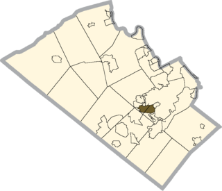
Dorneyville is a census-designated place in Lehigh County, Pennsylvania. As of the 2020 census the population was 4,850. Dorneyville is located just west of Allentown in South Whitehall Township and Salisbury Township.

<span class="mw-page-title-main">Pennsylvania Route 309</span> State highway in Pennsylvania, United States

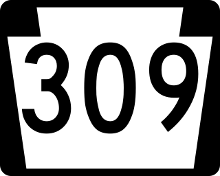
Pennsylvania Route 309 is a state highway that runs for 134 miles (216 km) through eastern Pennsylvania. The route runs from an interchange between PA 611 and Cheltenham Avenue on the border of Philadelphia and Cheltenham Township north to an intersection with PA 29 in Bowman Creek, a village in Monroe Township in Wyoming County. The highway connects Philadelphia and its northern suburbs to Allentown and the Lehigh Valley, and Hazleton and Wilkes-Barre in Wyoming Valley.

<span class="mw-page-title-main">Pennsylvania Route 145</span> State highway in Pennsylvania, US

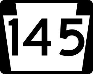
Pennsylvania Route 145 is a 20.89 mi (33.62 km) long north–south state highway in the Lehigh Valley area of eastern Pennsylvania. It connects Interstate 78 (I-78) and PA 309 in Lanark, Lehigh County, north to PA 248 in Lehigh Gap, Northampton County.

<span class="mw-page-title-main">Pennsylvania Route 329</span> State highway in Pennsylvania, US

Pennsylvania Route 329 is a Pennsylvania state highway that runs for 12.9 miles (20.8 km) through Lehigh and Northampton counties in the Lehigh Valley region of the state. It runs from PA 873 in the North Whitehall Township village of Neffs east to PA 248 and PA 987 in Bath. The route is a two-lane undivided road that runs through a mix of rural and developed areas to the north of the cities of Allentown and Bethlehem, serving the communities of Balliettsville, Egypt, Cementon, and Northampton. PA 329 intersects PA 145 near Egypt and runs concurrent with PA 987 between East Allen Township and the eastern terminus in Bath.

<span class="mw-page-title-main">Pennsylvania Route 29</span> State highway in Pennsylvania, US

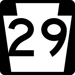
Pennsylvania Route 29 is a 118-mile-long (190 km) north–south state highway that runs through most of eastern Pennsylvania.

<span class="mw-page-title-main">Pennsylvania Route 222</span> Highway in Pennsylvania

Pennsylvania Route 222 is a 4.482 mi (7.213 km)-long state highway located in Allentown and its immediate suburbs in the Lehigh Valley region in eastern Pennsylvania.

<span class="mw-page-title-main">Wescosville, Pennsylvania</span> Census-designated place in Pennsylvania, United States

Wescosville is a census-designated place located in Lehigh County, Pennsylvania. It is located between Allentown and Trexlertown in Lower Macungie Township. It is part of the Lehigh Valley, which had a population of 861,899 and was the 68th-most populous metropolitan area in the U.S. as of the 2020 census.

<span class="mw-page-title-main">State Route 1002 (Lehigh County, Pennsylvania)</span> Highway in Pennsylvania

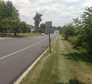
State Route 1002(SR 1002), locally known as Tilghman Street and Union Boulevard, is a major 13.8 mi (22.2 km) long east–west road in the Lehigh Valley area of the U.S. state of Pennsylvania. The majority of the roadway is the former alignment of U.S. Route 22, maintained by the Pennsylvania Department of Transportation as a Quadrant Route, and is not signed except on small white segment markers.

Lehigh Street is a major road that connects Emmaus, Pennsylvania in the west to Allentown, Pennsylvania in the east in the Lehigh Valley region of eastern Pennsylvania. The road is one of six roads that enter and depart Allentown, the third-largest city in Pennsylvania.

<span class="mw-page-title-main">Cetronia, Pennsylvania</span> Census-designated place in Pennsylvania, United States

Cetronia is a census-designated place (CDP) in South Whitehall Township in Lehigh County, Pennsylvania, located near Allentown. As of the 2020 census, its population was 2,421.

<span class="mw-page-title-main">Interstate 78 in Pennsylvania</span> Highway in Pennsylvania, US

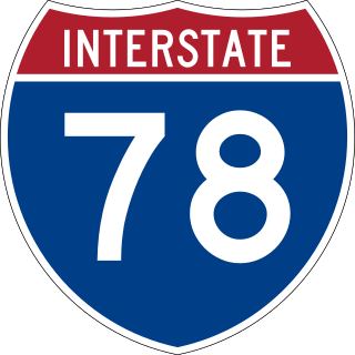
Interstate 78 (I-78) is a major east–west Interstate Highway stretching from Union Township, Lebanon County, Pennsylvania, in the west to the Holland Tunnel and New York City in the east. In Pennsylvania, I-78 runs for about 78 miles (126 km) from the western terminus at I-81 in Union Township east to the New Jersey state line near Easton in Northampton County.

References

  1. 1 2 Bureau of Maintenance and Operations (January 2015). Roadway Management System Straight Line Diagrams (Report) (2015 ed.). Pennsylvania Department of Transportation. Retrieved June 30, 2015.
  2. 1 2 Google (August 23, 2015). "Cedar Crest Boulevard" (Map). Google Maps . Google. Retrieved August 23, 2015.
  3. 1 2 Lehigh County, Pennsylvania Highway Map (PDF) (Map). PennDOT. 2014. Retrieved January 5, 2015.[ permanent dead link ]
  4. Map of Pennsylvania (Map). Pennsylvania Department of Highways. 1928. Retrieved May 7, 2015.
  5. "1941 Lehigh County Map" (PDF). Pennsylvania Department of Highways . Retrieved 2007-07-25.[ permanent dead link ]
  6. Tourist Map of Pennsylvania (PDF) (Map). Pennsylvania Department of Highways. 1930. Retrieved June 24, 2010.[ permanent dead link ]
  7. Official Road Map of Pennsylvania (PDF) (Map). Pennsylvania Department of Highways. 1950. Retrieved January 1, 2014.[ permanent dead link ]
  8. "1960 Lehigh County Map" (PDF). Pennsylvania Department of Highways. Retrieved 2007-07-25.[ permanent dead link ]
  9. https://www.mcall.com/sports/varsity/football/mc-spt-parkland-emmaus-football-20221029-bcvvfh424jhrljgzuwea7qn6f4-story.html "Emmaus football gives its fans plenty of treats in 40-15 win over Parkland in the Battle of Cedar Crest Boulevard"], The Morning Call, October 29, 2022, retrieved January 22, 2023