Chaddesley Corbett

Last updated

Chaddesley Corbett
Chaddesley Corbett Church View.JPG
Church View, Chaddesley Corbett
Worcestershire UK location map.svg
Red pog.svg
Chaddesley Corbett
Location within Worcestershire
Civil parish
  • Chaddesley Corbett
District
Shire county
Region
Country England
Sovereign state United Kingdom
Post town Kidderminster
Postcode district DY10
List of places
UK
England
Worcestershire
52°21′39″N2°09′35″W / 52.360725°N 2.159672°W / 52.360725; -2.159672
Arms of Corbet of Chaddesley Corbet: Or a raven proper within a bordure engrailed gules. A cadet branch of the ancient family of Corbet of Caus Castle was seated at the manor of Chaddesley. ArmsOfCorbetOfChadesleyCorbet.JPG
Arms of Corbet of Chaddesley Corbet: Or a raven proper within a bordure engrailed gules. A cadet branch of the ancient family of Corbet of Caus Castle was seated at the manor of Chaddesley.

Chaddesley Corbett is a village and civil parish in the Wyre Forest District of Worcestershire, England. The Anglican and secular versions of the parish include other named neighbourhoods, once farmsteads or milling places: Bluntington, Brockencote, Mustow Green, Cakebole, Outwood, Harvington, and Drayton.

Contents

History

The village was named Chad Lea, or the place of Chad, in Saxon times, [2] and is recorded in the Domesday Book of 1086 as Cedeslai, when it was held by a woman, Eadgifu, who also held it in the time of King Edward before the Norman Conquest of 1066. [3] It consisted of eight berewicks and 25 hides of which 10 were free of geld and had the value of £12. [3] The area was subject to forest law for around a century to 1301, as part of Feckenham Forest. [4]

Geography

Chaddesley Corbett is centred on the north side of the A448 approximately midway between the north Worcestershire towns of Bromsgrove and Kidderminster.

In 1913 the parish was stated to have just under 5% woodland, namely 242+34 acres (98.2 ha). [5] Of this the main feature is Chaddesley Woods , which is recognised as a national nature reserve [6] and lies to the east of the village. It is thought to be a remnant of the medieval Feckenham Forest. It is under the care of the Worcestershire Wildlife Trust, founded in 1968 to conserve, protect and restore the county's wildlife. The main section of the woods has a network of public footpaths to facilitate access. [7]

Demography

Chaddesley Corbett covers a relatively large 6,079 acres, that is 24.6 square kilometres (9.5 sq mi) and had a population of 1343 persons and 280 houses in 1821. [5] [8]

The same area had a population of 1,440 persons across 607 households in 2001. [9]

Governance & religion

Chaddesley Corbett civil parish falls under the Wyre Forest District Council ward of Wyre Forest Rural, the Worcestershire County Council division of Chaddesley, and the parliamentary constituency of Wyre Forest, whose MP since 2010 is Mark Garnier of the Conservative Party.

It is within the Church of England province of Canterbury, the Diocese of Worcester, the Archdeaconry of Dudley, and the deanery of Kidderminster.

Landmarks

St Cassian's Church

St Cassian's Church from the lych gate. Chaddesley Corbett 02.jpg
St Cassian's Church from the lych gate.

Within the village urban area is the Church of England church of St Cassian. The Domesday Book implies that there was a church at Chaddesley Corbett before 1086, although the present nave dates from the 12th century with later additions. [10] St Nicholas Chapel was added in the 13th century, the chancel and north and south aisles in the 14th century, and the vestry probably added in the 16th century when the south aisle and St Nicholas Chapel were also altered. The tower and spire were added in the 18th century and the north aisle widened and vestry altered in the 19th century. [11] The pipe organ, currently 3 manuals plus pedals, was first built in 1817 and relocated from a west gallery during major restoration and alterations in 1863–4. More recent additions include a roll of honour, housed in the tower, that lists those who served in World War I, and two windows commemorating soldiers killed during World War II. [12]

The monuments include former owners of Harvington Hall as well as members of the Corbett family, local lords of the manor and benefactors of the church. Sir Thomas Holte, 1st Baronet in 1647 erected a memorial to his daughter Elizabeth. The fittings include a Norman stone font, which is thought to be the work of the Herefordshire School of sculptors, active c.1125–1150, which drew on Romanesque models from southern Europe. It features a main motif of interlaced dragons—symbolising, perhaps, the evil of original sin which is washed away in baptism—with other interlacing patterns along the rim and base. The dragons resemble Romanesque north Italian models, especially the pulpit of San Giulio abbey in Piedmont, but their interlacing is a motif of indigenous Anglo-Irish origin. [13]

The churchyard contains the war graves of 4 British Army soldiers of World War I and 2 Royal Air Force officers of World War II. [14]

Harvington Hall

Harvington Hall near Chaddesley Corbett Harvington Hall at Harvington Chaddesley Corbett Worcestershire 01.jpg
Harvington Hall near Chaddesley Corbett

Harvington Hall, located in the hamlet of Harvington in the civil parish of Chaddesley Corbett, is a moated medieval and Elizabethan manor house. Harvington Hall is particularly notable for its vestment-hide and seven priest-holes, four of which are built around the main staircase and are thought to be the work of Nicholas Owen. [15] [16] [17] [18]

Chapels

There is also a Methodist Chapel in Bluntington and a Catholic chapel associated with Harvington Hall.

Amenities

The three village pubs, The Talbot, The Swan and The Fox were named in the 2007 Good Beer Guide. [19]

There is also a post office and general store, a butcher, hairdresser and beauty salon, a flower shop, delicatessen and a GP surgery.

Education

There are two schools in the village: Chaddesley Corbett Primary School and the independent Winterfold House School. The primary school caters for Reception to Year 6 and replaced the previous Chaddesley Corbett Endowed First School under the Wyre Forest education review. Each school has an associated pre-school nursery.

Sport

Chaddesley Corbett Sports Club is located in Fox Lane and has rugby, football and cricket sections, all of which play in one or more local leagues. The cricket club is one of the oldest cricket clubs in Worcestershire having been established in 1862. The football team also known as Chaddesley Ravens have two adult teams, as well as a junior section. The club was established in 1906.

The village is the location for the Lady Dudley Cup, a point to point race that was first run in 1897. [20]

Notable people

Related Research Articles

<span class="mw-page-title-main">Kidderminster</span> Human settlement in England

Kidderminster is a market and historic minster town and civil parish in Worcestershire, England, 20 miles (32 km) south-west of Birmingham and 12 miles (19 km) north of Worcester. Located north of the River Stour and east of the River Severn, in the 2021 census, it had a population of 57,400. The town is twinned with Husum, Germany.

<span class="mw-page-title-main">Frankley</span> Village in Worcestershire, England

Frankley is a village and civil parish in Worcestershire. The modern Frankley estate is part of the New Frankley civil parish in Birmingham, and has been part of the city since 1995. The parish has a population of 122.

<span class="mw-page-title-main">History of Worcestershire</span>

The area now known as Worcestershire has had human presence for over half a million years. Interrupted by two ice ages, Worcestershire has had continuous settlement since roughly 10,000 years ago. In the Iron Age, the area was dominated by a series of hill forts, and the beginnings of industrial activity including pottery and salt mining can be found. It seems to have been relatively unimportant during the Roman era, with the exception of the salt workings.

<span class="mw-page-title-main">Blakedown</span> Human settlement in England

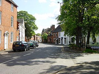
Blakedown is a village in the Wyre Forest District lying along the A456 in the north of the county of Worcestershire, England. Following enclosures and the arrival of the railway, it developed both agriculturally and industrially during the 19th century. Due to its transport links, it now serves mainly as a dormitory for the neighbouring town of Kidderminster and for the cities of Birmingham and Worcester.

<span class="mw-page-title-main">Feckenham</span> Human settlement in England

Feckenham is a village and civil parish in the Borough of Redditch in Worcestershire, England. It lies some 4 miles (6 km) south-west of the town of Redditch and some 11 miles (18 km) east of the city of Worcester. It had a population of 670 in the 2001 census and its immediate area is the location of notable royal manors that cover over 1,000 years of English history documented in many royal charters and Acts of Parliament. At its greatest, the historic Forest of Feckenham stretched to the River Avon in the south and to Worcester in the west. In 1389 Geoffrey Chaucer was as Clerk of Works and Keeper of the Lodge.

<span class="mw-page-title-main">Hanbury, Worcestershire</span> Human settlement in England

Hanbury is a rural village in Worcestershire, England near Droitwich Spa and the M5 motorway. The population of Hanbury has remained around 1,000 since the early 19th century, and apart from farming and the popular Jinney Ring Craft Centre there is little economic activity, as the parish is lived in mainly by those who commute to the nearby towns of Bromsgrove, Redditch, Droitwich and Worcester, and the slightly more distant areas of Birmingham and the Black Country.

<span class="mw-page-title-main">Broome, Worcestershire</span> Human settlement in England

Broome is a village and civil parish in the Wyre Forest District of Worcestershire, England. According to the 2001 census it had a population of 338. The village is situated on the lower slopes of the Clent Hills and lies to one side of Broome Lane, a minor road that runs westwards from the outskirts of Clent to the outskirts of Hagley.

<span class="mw-page-title-main">Wyre Forest District</span> Non-metropolitan district in England

Wyre Forest is a local government district in Worcestershire, England. It is named after the ancient woodland of Wyre Forest. The largest town is Kidderminster, where the council is based. The district also includes the towns of Stourport-on-Severn and Bewdley, along with several villages and surrounding rural areas.

<span class="mw-page-title-main">Inkberrow</span> Human settlement in England

Inkberrow is a village in Worcestershire, England, often thought to be the model for Ambridge, the setting of BBC Radio 4's long-running series The Archers. In particular, The Bull, the fictional Ambridge pub, is supposed to be based on The Old Bull in Inkberrow.

<span class="mw-page-title-main">Brailsford</span> Human settlement in England

Brailsford is a small red-brick village and civil parish in Derbyshire on the A52 midway between Derby and Ashbourne. The parish also includes Brailsford Green. The civil parish population at the 2011 Census was 1,118. The village has a pub, a golf club, a post office and a school. There are many fine houses in the district including two 20th-century country houses: Brailsford Hall built in 1905 in Jacobean style, and Culland Hall.

<span class="mw-page-title-main">Wolverley</span> Human settlement in England

Wolverley is a village; with nearby Cookley, it forms a civil parish in the Wyre Forest District of Worcestershire, England. It is 2 miles north of Kidderminster and lies on the River Stour and the Staffordshire and Worcestershire Canal. At the time of the 2001 census, it had a population of 2,096.

The Worcestershire County Cricket League (WCL) is an English club cricket league, and consists of club teams primarily from Worcestershire, as well as several other clubs from bordering counties Herefordshire, Shropshire, Staffordshire and Warwickshire.

<span class="mw-page-title-main">Dodford, Worcestershire</span> Human settlement in England

Dodford is a village in the Bromsgrove district of Worcestershire, England, approximately 3 miles (4.8 km) west of Bromsgrove, officially founded on 2 July 1849 by members of the Chartist movement. It was one of five settlements created in the land scheme and retains a characteristic grid street plan, along with narrow lanes and many plum and pear trees from its market gardening past. The civil parish of Dodford with Grafton has a population of 731.

<span class="mw-page-title-main">Upton Warren</span> Human settlement in England

Upton Warren is a village and civil parish in the Wychavon district, in Worcestershire, England. The village is situated just off the A38 road between Bromsgrove and Droitwich Spa, and on the River Salwarpe. In the 2001 census, the parish, which also contains the small hamlet of Cooksey Green, had a population of 291.

<span class="mw-page-title-main">Stone, Worcestershire</span> Human settlement in England

Stone is a village and civil parish in the Wyre Forest District of Worcestershire, England. Of Anglo-Saxon origin, it lies two miles south-east of Kidderminster on the A448 road to Bromsgrove.

<span class="mw-page-title-main">Harvington Hall</span> Stately home in Worcestershire, England

Harvington Hall is a moated medieval and Elizabethan manor house in the hamlet of Harvington in the civil parish of Chaddesley Corbett, southeast of Kidderminster in the English county of Worcestershire.

<span class="mw-page-title-main">Feckenham Forest</span>

Feckenham Forest was a royal forest, centred on the village of Feckenham, covering large parts of Worcestershire and west Warwickshire. It was not entirely wooded, nor entirely the property of the King. Rather, the King had legal rights over game, wood and grazing within the forest, and special courts imposed harsh penalties when these rights were violated. Courts and the forest gaol were located at Feckenham and executions took place at Gallows Green near Hanbury.

Halfshire was one of the hundreds in the English county of Worcestershire. As three of the five hundreds in the county were jurisdictions exempt from the authority of the sheriff, the hundred was considered to be half what was subject to his jurisdiction, whence the name.

References

  1. Burke's General Armory, 1884
  2. Noake, John (1868). J Noake's Guide to Worcestershire. London: Longman. p. 82. ISBN   978-0-14-143994-5.
  3. 1 2 Williams, Ann; G H Martin (2002). Domesday Book: A Complete Translation. London: Penguin. pp. 492, 1326. ISBN   978-0-14-143994-5.
  4. Humphreys FSA, John. "Forest of Feckenham". Transactions and Proceedings. Birmingham and Warwickshire Archaeology Society. 44–45: 115–132. (page 120)
  5. 1 2 Parishes: Chaddesley Corbett - A History of the County of Worcester. Vol. 3. London. 191. pp. 35–43. Retrieved 25 May 2018 via British History Online.
  6. "Worcestershire's National Nature Reserves". UK Government. Retrieved 14 July 2020.
  7. Surveyed in August 2008 for OpenStreetMap, Chaddesley Wood Archived 8 June 2011 at the Wayback Machine .
  8. Tymm, Samuel (1834). The Family Topographer: Being a Compendious Account of the Antient and Present State of the Counties of England. London: J.B. Nichols and Son. p. 280. Retrieved 18 May 2008.
  9. United Kingdom Census 2001. "Chaddesley Corbett CP (Parish)". Office for National Statistics. Archived from the original on 12 June 2011. Retrieved 26 January 2008.{{cite web}}: CS1 maint: numeric names: authors list (link)
  10. Roper, John S., A History of St Cassian's Church Chaddesley Corbett,2006, The Friends of St Cassian's Church (May 2009), p.3
  11. Roper, op. cit., p.36
  12. Roper, op. cit., pp. 19, 31
  13. G. Zarnecki, "Germanic Animal Motifs in Romanesque Sculpture", Artibus et historiae 22 (1990), pp. 189–203
  14. "CWGC Cemetery record, breakdown obtained from casualty record".
  15. Home > Corporate Hospitality > West Midlands Archived 28 June 2008 at the Wayback Machine , Hudson's Archived 17 February 2010 at the Wayback Machine . Retrieved 19 July 2009. "Roman Catholic Archdiocese of Birmingham"
  16. Julian Yates, Error, misuse, failure: object lessons from the English Renaissance, U of Minnesota Press, 2002, ISBN   0-8166-3961-2, ISBN   978-0-8166-3961-8. p. 187
  17. The Priest Holes Archived 21 October 2010 at the Wayback Machine Harvington Hall, official website. Retrieved 19 July 2009.
  18. Harvington Hall- Inside the roof hide. Tudorstuff blog, Retrieved 19 July 2009.
  19. Smith, Adam (26 September 2006). "Village is hailed for its great ale". Birmingham Mail. Archived from the original on 16 May 2011. Retrieved 7 January 2008.
  20. Connaughton, Mick (1 April 2006). "Horse Racing: Cannon Bridge to extend winning run in Cup". The Independent. Retrieved 7 January 2008.[ dead link ]
  21. "Wisden: The Independent Voice of Cricket - Scores, News, Opinion, Fixtures". www.wisden.com.

Commons-logo.svg Media related to Chaddesley Corbett at Wikimedia Commons