
Abel Iturralde is one of the twenty provinces of the Bolivian La Paz Department. It is situated in its northern part. Its name honors Abel Iturralde Palacios, a Bolivian politician. Madidi National Park is partially in this province.

Aroma is one of the twenty provinces of the Bolivian La Paz Department. It is situated in the southern parts of the department. Its seat is Sica Sica.

Bautista Saavedra is one of the twenty provinces of the Bolivian La Paz Department situated in the northwestern parts of the department. It was created on November 17, 1948 in honor of Bautista Saavedra Mallea (1870-1939) who was Bolivia's president from 1920 to 1925. The capital of the province is Charazani.

Los Andes is one of the twenty provinces in the central parts of the Bolivian La Paz Department. The province was legally founded on November 24, 1917, during the presidency of José Gutiérrez Guerra. The Spanish name of the province means "The Andes", referring to its position within the Cordillera Real which is part of the Bolivian Andes mountain range. The capital of the province is Pucarani, which has a population of 918 as of the 2001 census. Pucarani is situated in the Altiplano west of the Cordillera Real offering a view of some of its highest mountains such as Ch'iyar Juqhu, Chachakumani, Kunturiri, Wayna Potosí and Chacaltaya.

Tomás Frías is a province in the northern parts of the Bolivian Potosí Department. Its capital is Potosí which is also the capital of the department. The province is named after the former president Tomás Frías Ametller.
Cornelio Saavedra is a province in the north-eastern parts of the Bolivian Potosí Department. The capital of the province is Betanzos with 4,168 inhabitants in the year 2001.

José María Linares is a province in the eastern parts of the Bolivian department of Potosí. Its capital is Puna.

Cercado is a province in the northeastern parts of the Bolivian department of Oruro. Its capital is Oruro. The hamlet of Paria, established in 1535, was the first Spanish settlement in Bolivia and previously had been a regional capital of the Inca Empire. Paria is located in Soracachi municipality.

Chayanta is a province in the northern parts of the Bolivian Potosí Department. Its capital is Colquechaca.
Kallawaya, also Callahuaya or Callawalla, is an endangered, secret, mixed language in Bolivia; another name sometimes used for the language is Pohena. It is spoken by the Kallawaya people, a group of traditional itinerant healers in the Andes in their medicinal healing practice living in Charazani, the highlands north of Lake Titicaca, and Tipuani.

The Kallawaya are an indigenous group living in the Andes of Bolivia. They live in the Bautista Saavedra Province and Muñecas Province of the La Paz Department but are best known for being an itinerant group of traditional healers that travel on foot to reach their patients. According to the UNESCO Safeguarding Project, the Kallawaya can be traced to the pre-Inca period as direct descendants of the Tiwanaku and Mollo cultures, meaning their existence has lasted approximately 1,000 years. They are known to have performed complex procedures like brain surgery alongside their continuous use of medicinal plants as early as 700 AD. Most famously, they are known to have helped to save thousands of lives during the construction of the Panama Canal, in which they used traditional plant remedies to treat the malaria epidemic. Some historical sources even cite the Kallawayas as the first to use quinine to prevent and control malaria. In 2012, there were 11,662 Kallawaya throughout Bolivia.

Apolobamba(Cordillera Apolobamba) is a mountain range in the South American Andes.
The Mollo culture existed in Bolivia's altiplano area after the collapse of the Tiwanaku culture during the period of AD 1000 to 1500; it predated the Inca civilization. While the Mollo showed a continuity with Late Tiwanaku culture in both domestic and village architecture, they left no pyramids. Mollo worshiped the jaguar.

Manuripi is one of the five provinces of Pando Department in Bolivia and is situated in the northwest of the department. Its name is derived from the Manuripi River, which passes through the province from west to east.
Entre Ríos is a small town in the Cochabamba Department of the South American Republic of Bolivia.
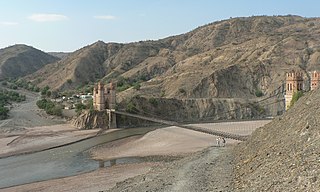
General Juan José Pérez Municipality or Charazani Municipality is the first municipal section of the Bautista Saavedra Province in the La Paz Department, Bolivia. Its seat is Charazani.
Cañaviri is a small town in Bolivia. In 2010 it had an estimated population of 992.

Escoma Municipality is the fifth municipal section of the Eliodoro Camacho Province in the La Paz Department in Bolivia. It was created on February 6, 2009. Until then this area was part of the Viacha Municipality. Its seat is Escoma with 576 inhabitants in the year 2001.
Ch'aki Mayu, also Kachi Mayu, is a Bolivian river in the Potosí Department. It flows towards the Pillku Mayu.
Jatun Sallica is a mountain in the Vilcanota mountain range Andes of Peru, about 5,200 metres (17,060 ft) high. It is located in the Cusco Region, Canchis Province, San Pablo District, and in the Puno Region, Melgar Province, Nuñoa District. Jatun Sallica is situated south-west of the mountains Pomanota and Jatuncucho, south of the mountain Cochacucho and north-east of the mountain Hueco.


